

Surf Forecasts:

Playa Manzanilla surf forecast from 14 Jul 2026:
- Best quality surf: Monday 20 Jul, 3AM (local time) - 3.5ft (1.1m), 16s period, SW swell with offshore winds.
- Most powerful swell: Monday 20 Jul, 6PM (local time) - 4ft (1.2m), 16s period, SW swell with 710 kJ wave energy.
- Next surfable swell (1★+): Tuesday 14 Jul, 9AM (local time) - 3ft (0.9m), 13s period with SSW swell.
Best Forecast Surf Conditions for Playa Manzanilla this week:
The surf forecast for Playa Manzanilla over the next 16 days: The first swell (rated 1 star or higher) is forecast to arrive on Tuesday (Jul 14) at 9AM. The primary swell is predicted to be 0.9m and 13s period with a secondary swell of 0.6m and 7s. The wind is predicted to be glassy as the swell arrives.
The most powerful waves expected at Playa Manzanilla in the next 16 days are 1.2m 16s and forecast to arrive on Monday (Jul 20) at 6PM. Winds are predicted to be cross-shore at the time the swell arrives. The largest open ocean swell (not directed at the beach) is 1.3m 6s period and expected on Tuesday (Jul 14) at 6PM.
| Wave Type | Time (CST) & Date | Wave Height & Period |
|---|---|---|
| Next good surf (1 star+) | 9AM (Tue 14th Jul) | 3ft (0.9m) 13s |
| Best Surf | 3AM (Mon 20th Jul) | 3.5ft (1.1m) 16s |
| Most Powerful | 6PM (Mon 20th Jul) | 4ft (1.2m) 16s |
Table - best surf conditions forecast for Playa Manzanilla over the next 16 days.
The Lowdown
Alright folks, Rusty here. Let’s have a look at what’s cooking for Playa Manzanilla over the next couple of weeks. This is a point break that’s exposed to the SSW swell and it’s consistent, so there’s always a chance of a wave.
We’ve got a bit of a slow start, but the first real standout is shaping up, and the water is sitting at 87°, which is a touch warmer than normal for this time of year. That’s a nice bonus.
The best window for clean, glassy waves kicks off on Tuesday morning, 14 July. We’re looking at a 3 ft SSW swell with a 13-second period, and the wind is dead glass from the SE at only 3 mph. The wave energy is moderate (489), and the conditions are going to be super clean. This is a great morning for a longboard or a funboard.
Wednesday morning, 15 July, is another glassy gem. The wind is calm, the swell is 3 ft from the SSW with a 14-second period, and the energy is moderate (307). It’ll be a bit smaller, but the quality will be there.
Now, the real standout for the first week is Monday morning, 20 July. The swell bumps up to 4 ft from the SW, with a 16-second period (groundswell), and the energy is strong (887). The wind is light from the E at 3 mph, making it glassy. This is going to be a long-period, clean swell that will really wrap into the point. It’s not too big, so intermediate surfers will be in heaven.
The following week, we start to see some bigger energy. Saturday morning, 25 July is a serious alert. The swell is 3 ft from the SSW, but the period is a very long 21 seconds, and the energy is pumping (1066). The wind is glassy from the SW at 3 mph. This is a long-period groundswell that will be best on the point, but it might be a bit straight for the beach. It’s a standout for experienced surfers who want power.
The absolute best session in the entire 16-day window, though, is Sunday morning, 26 July. The swell is 4 ft from the SW, with a 19-second period, and the energy is strong (1287). The wind is a perfect calm, glassy 0 mph from the SE. This is as good as it gets for a point break: clean, long lines, and plenty of push. It’s a bit more size, but still manageable for strong intermediates.
Monday morning, 27 July is also excellent, with a 4 ft SW swell, 18-second period, and strong energy (1337). The wind is light from the E at 3 mph, making for glassy conditions. This is another top-tier morning.
The last big call is Wednesday morning, 29 July. The swell is 4 ft from the SW with a 16-second period, and the energy is very strong (1341). The wind is glassy from the S at 3 mph. This is another excellent session for experienced surfers.
Crowds are listed as "sometimes" at Playa Manzanilla, so on these standout mornings, especially the weekends, expect a few locals out. But with a point break this consistent, there’s plenty of wave to go around.
Rusty.
Short Range ForecastLight rain (total 8mm), mostly falling on Wed afternoon. Warm (max 32°C on Tue afternoon, min 25°C on Wed night). Wind will be generally light. | Days 4-6 Weather SummarySome drizzle, heaviest during Fri night. Warm (max 31°C on Fri afternoon, min 26°C on Fri night). Wind will be generally light. | ||||||||||||||||||||
Tuesday 14 | Wednesday 15 | Thursday 16 | Friday 17 | Saturday 18 | Sunday 19 | Monday 20 | |||||||||||||||
AM | PM | Night | AM | PM | Night | AM | PM | Night | AM | PM | Night | AM | PM | Night | AM | PM | Night | AM | PM | Night | |
Swell Height Map |  |  |  | 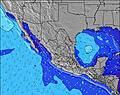 | 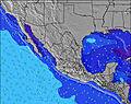 | 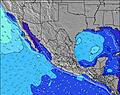 | 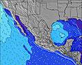 | ||||||||||||||
Wave Height (m) Direction Period (s) | SSW 13 | SSW 13 | SSW 14 | SSW 14 | SSW 13 | SSW 13 | SSW 13 | SSW 13 | SSW 12 | SSW 14 | S 14 | SSW 13 | SW 18 | SW 19 | SSW 12 | SW 17 | SW 17 | SW 17 | SW 16 | SW 16 | SW 15 |
Wave Graph | |||||||||||||||||||||
265 | 321 | 232 | 290 | 253 | 264 | 235 | 326 | 111 | 276 | 136 | 286 | 249 | 290 | 147 | 505 | 499 | 587 | 661 | 644 | 589 | |
Wind (km/h) | |||||||||||||||||||||
Wind State on-shore cross-onshore cross-shore cross-offshore off-shore glassy | glassy | cross-on | off | glassy | cross-on | off | cross | cross-on | off | glassy | cross-on | off | glassy | cross-on | cross-off | cross | cross-on | cross-off | glassy | cross-on | cross-off |
High Tide | 2:10PM1.32m | 2:33AM0.97m | 3:07PM1.32m | 3:36AM1.05m | 4:02PM1.30m | 4:35AM1.12m | 4:54PM1.25m | 5:31AM1.18m | 5:44PM1.19m | 6:24AM1.21m | 6:32PM1.12m | 7:15AM1.21m | 7:20PM1.03m | ||||||||
Low Tide | 8:45PM0.09m | 8:36AM0.02m | 9:38PM0.04m | 9:39AM0.03m | 10:28PM0.01m | 10:39AM0.06m | 11:16PM-0.01m | 11:37AM0.10m | 00:03AM-0.01m | 12:33PM0.14m | 00:47AM0.02m | 1:27PM0.19m | 1:31AM0.06m | ||||||||
6:01 | — | — | 6:01 | — | — | 6:01 | — | — | 6:01 | — | — | 6:01 | — | — | 6:01 | — | — | 6:03 | — | — | |
— | 7:00 | — | — | 7:00 | — | — | 6:59 | — | — | 6:59 | — | — | 6:59 | — | — | 6:59 | — | — | 6:59 | — | |
mm | — | — | — | — | 1 | 4 | — | 2 | 1 | — | — | 1 | — | — | — | — | — | — | — | — | — |
Temp °C | 31 | 32 | 28 | 31 | 31 | 27 | 31 | 31 | 27 | 30 | 31 | 28 | 30 | 30 | 28 | 31 | 31 | 28 | 31 | 31 | 28 |
Feels °C | 33 | 34 | 32 | 33 | 33 | 30 | 33 | 33 | 31 | 33 | 33 | 32 | 33 | 32 | 31 | 33 | 32 | 31 | 33 | 33 | 32 |
Swell 1 Height (m) Direction Period (s) | SSW 13 | SSW 13 | SSW 14 | SSW 14 | SSW 13 | SSW 13 | SSW 13 | SSW 13 | E 5 | SSW 14 | SSW 12 | SSW 13 | S 13 | SSW 12 | SSW 12 | SW 17 | SW 17 | SW 17 | SW 16 | SW 16 | SW 15 |
265 | 321 | 232 | 290 | 253 | 246 | 235 | 326 | 37 | 276 | 107 | 286 | 163 | 244 | 147 | 505 | 499 | 587 | 661 | 644 | 589 | |
Swell 2 Height (m) Direction Period (s) | SSE 7 | SW 18 | ENE 6 | ENE 6 | SW 16 | SE 7 | SE 7 | SE 9 | SE 8 | E 6 | E 6 | SE 8 | SW 18 | SW 19 | SE 8 | S 13 | S 11 | S 12 | S 12 | S 13 | S 13 |
43 | 252 | 25 | 11 | 208 | 79 | 25 | 74 | 73 | 28 | 29 | 61 | 249 | 290 | 50 | 156 | 116 | 174 | 190 | 277 | 281 | |
Swell 3 Height (m) Direction Period (s) | SSW 16 | E 7 | S 15 | SSE 7 | SE 8 | SW 16 | SW 16 | S 16 | SSW 12 | SE 7 | S 14 | E 6 | SW 13 | SE 9 | S 15 | SSW 9 | S 13 | S 14 | ESE 7 | WSW 11 | W 10 |
181 | 22 | 155 | 17 | 39 | 264 | 91 | 42 | 111 | 33 | 136 | 27 | 87 | 61 | 104 | 44 | 87 | 146 | 36 | 119 | 96 | |
Wind waves Height (m) Direction Period (s) | — | — | NW 3 | ENE 6 | ENE 6 | WSW 6 | ENE 6 | E 6 | ENE 5 | ENE 6 | — | — | — | SSW 3 | WNW 3 | — | — | — | — | — | — |
— | — | 2 | 60 | 65 | 4 | 7 | 36 | 39 | 111 | — | — | — | 3 | 3 | — | — | — | — | — | — | |
Nearest Offshore or Glassy | |||||||||||||||||||||
Distance (km) | 0 | 917 | 0 | 0 | 916 | 0 | 8 | 996 | 0 | 0 | 1013 | 0 | 0 | 912 | 0 | 32 | 95 | 0 | 0 | 95 | 0 |
Best forecast wave conditions in Oaxaca | |||||||||||||||||||||
Best forecast wave conditions in Mexico | |||||||||||||||||||||
Header Global | |||||||||||||||||||||
- Map Icons:
 Break
Break Live Wave Height (m)
 Live Wind Speed (km/h)
 Surf Rating (10 Max)
 Ocean Swells (m)
- Wind Speed (km/h)


FREE! Surf-Forecast.com widget for your website
The surf report / weather widget below is available to embed on third party websites free of charge and provides a summary of our Playa Manzanilla surf forecast. Simply grab the html code snippet that we provide and paste it into your own site. You can choose your preferred language and metric/imperial units for the surf forecast feed to suit users of your site. Click here to get the code.
Information about the Playa Manzanilla Surf forecast
The above surf forecast table for Playa Manzanilla provides essential information for determining whether the surfing conditions will be good over the next 16 days. A general guide to surfing at Playa Manzanilla can be found by selecting the local surf guide option on the grey menu. Our Playa Manzanilla surf forecast is unique since it includes wave energy (power) that defines the real feel of the surf rather than just the height or the period. If you surf the same spot (Playa Manzanilla) regularly then make a mental note of the wave energy from the surf forecast table each time you go. Very soon you may start to choose your surf days based on the wave energy alone combined with our forecast of favourable offshore wind conditions. Our star ratings will help here and of course you will also find the usual wave height and period predictions on our surf forecasts as well as a full break down of the swell components under our advanced users option (to reveal that, click the little Einstein character under the tide times).
Further information to help with frequently asked questions about our surf forecast for Playa Manzanilla may be found under the help tab on the top menu and also by moving your mouse over the question marks on the surf forecast table itself. Please always bear in mind that the forecast is for near-shore open water and local factors at each surf break influence the actual breaking wave height, such as the beach / reef profile, water depths offshore and shelter.
Are you planning a holiday in Oaxaca? If you are looking for accommodation near Playa Manzanilla, camping, hotels and holiday cottages in Oaxaca, consider staying in Miahuatlan de Porfirio Diaz which is 83 km (52 miles) away. Alternatively, find information about places to stay and car hire in Puerto Escondido which is 92 km (57 miles) away
 Nearest