

Surf Forecasts:

Bahia Santa Cruz surf forecast from 3 Aug 2026:
- Best quality surf: Thursday 6 Aug, 9PM (local time) - 2.5ft (0.7m), 18s period, SSW swell with glassy winds.
- Most powerful swell: Saturday 8 Aug, 12PM (local time) - 4.5ft (1.3m), 16s period, SSW swell with 740 kJ wave energy.
- Next surfable swell (1★+): Monday 3 Aug, 3AM (local time) - 2.5ft (0.8m), 14s period with SSW swell.
Best Forecast Surf Conditions for Bahia Santa Cruz this week:
The surf forecast for Bahia Santa Cruz over the next 16 days: The first swell (rated 1 star or higher) is forecast to arrive on Monday (Aug 03) at 3AM. The primary swell is predicted to be 0.8m and 14s period with a secondary swell of 0.6m and 7s. Another secondary swell of 0.3m and 3s is also forecast. The wind is predicted to be cross-offshore as the swell arrives.
The most powerful waves expected at Bahia Santa Cruz in the next 16 days are 1.3m 16s and forecast to arrive on Saturday (Aug 08) at 12PM. Winds are predicted to be onshore at the time the swell arrives. The largest open ocean swell (not directed at the beach) is 0.7m 5s period and expected on Sunday (Aug 09) at 6PM.
| Wave Type | Time (CST) & Date | Wave Height & Period |
|---|---|---|
| Next good surf (1 star+) | 3AM (Mon 3rd Aug) | 2.5ft (0.8m) 14s |
| Best Surf | 9PM (Thu 6th Aug) | 2.5ft (0.7m) 18s |
| Most Powerful | 12PM (Sat 8th Aug) | 4.5ft (1.3m) 16s |
Table - best surf conditions forecast for Bahia Santa Cruz over the next 16 days.
The Lowdown
Alright, Rusty here. Let’s talk surf.
First up, the water at Bahia Santa Cruz is sitting at 87°F, which is a touch warmer than normal for this time of year. That’s nice, but don’t let the warm water fool you – we’ve got a bit of a slow start. There’s nothing worth paddling out for right now. The first real window of opportunity doesn’t open up until Monday morning, August 3rd.
That Monday morning, August 3rd, is shaping up to be a gem. We’re looking at a clean, glassy 3ft swell from the SSW with a solid 15-second period. The combined energy is moderate (465), and with the wind dead calm, it’s going to be smooth as butter. This is the standout for the first week. The break is fairly consistent, and the SSW direction is right on the money for this spot.
Tuesday morning, August 4th, is glassy again but the swell drops to 2ft. It’s surfable but very ordinary. Wednesday morning, August 5th, is similar – small, glassy, and clean, but nothing exciting. Thursday morning, August 6th, stays small at 2ft.
Now, keep your eyes on Friday morning, August 7th. We’ve got a bigger jump: 3ft from the SSW, but the period stretches to a very long 18 seconds. That’s proper groundswell. The combined energy jumps to a strong 677. The wind is glassy. This is another top pick – long-period SSW swell on a fairly consistent break, with clean conditions. Just a heads-up, with a period that long, the waves could be a bit straight at a beach break, but Bahia Santa Cruz handles it.
Saturday, August 8th, sees the swell building to 4ft in the morning and 4ft in the afternoon, still from the SSW, but the cross-shore wind messes with the quality. It’s marginal.
Sunday morning, August 9th, is back to glassy with a 4ft SSW swell (14 seconds). Very good conditions. Monday morning, August 10th, is also glassy with 3ft. Tuesday morning, August 11th, is another glassy morning with 3ft – very good.
The second week starts to look interesting. Wednesday, August 12th, has a clean morning with a cross-offshore breeze and a 2ft SW swell (16 seconds). Nice.
But the real standout for the tail end of the forecast is Friday morning, August 14th. We’ve got 4ft from the SW with an 18-second period. The combined energy is very strong at 909. The wind is glassy. That’s a serious, clean groundswell. It’s not quite too big for beginners (over 5ft), but with that long period, the power is real. This is the best bet for the second week.
Saturday morning, August 15th, is another glassy morning with 4ft SW swell (16 seconds) and energy at 930. Another top-tier session. Sunday morning, August 16th, is glassy with 3ft. Monday morning, August 17th, is glassy with 3ft.
There’s a gap between the start and the first good session on Monday the 3rd. From there, the consistency is good, with plenty of glassy mornings. Crowds can be a factor here sometimes, so get out early for the best of it.
Stay safe, keep your eyes on that Friday the 14th, and I’ll see you in the water.
Rusty
Short Range ForecastLight rain (total 7mm), mostly falling on Sun night. Warm (max 32°C on Sun afternoon, min 26°C on Sun night). Wind will be generally light. | Days 5-7 Weather SummaryModerate rain (total 16mm), heaviest on Thu night. Warm (max 32°C on Fri afternoon, min 25°C on Thu night). Wind will be generally light. | |||||||||||||||||||
Sun 2 | Monday 3 | Tuesday 4 | Wednesday 5 | Thursday 6 | Friday 7 | Saturday 8 | ||||||||||||||
PM | Night | AM | PM | Night | AM | PM | Night | AM | PM | Night | AM | PM | Night | AM | PM | Night | AM | PM | Night | |
Swell Height Map |  |  |  |  | 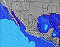 | 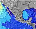 | 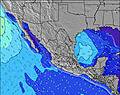 | |||||||||||||
Wave Height (m) Direction Period (s) | SW 14 | SW 13 | SSW 15 | SW 13 | SSW 13 | SSW 13 | SW 15 | S 9 | SW 15 | SW 14 | SW 14 | SW 13 | SW 13 | SSW 18 | SSW 18 | SSW 17 | SSW 16 | SSW 16 | SSW 15 | SSW 14 |
Wave Graph | ||||||||||||||||||||
123 | 113 | 358 | 164 | 98 | 98 | 112 | 99 | 104 | 103 | 164 | 113 | 212 | 214 | 395 | 493 | 532 | 612 | 674 | 515 | |
Wind (km/h) | ||||||||||||||||||||
Wind State on-shore cross-onshore cross-shore cross-offshore off-shore glassy | cross-on | cross-off | glassy | on | cross-off | glassy | on | off | glassy | on | off | glassy | cross-on | cross-off | glassy | cross-on | cross-off | cross | cross-on | cross-off |
High Tide | 5:19PM1.06m | 5:54AM1.11m | 5:57PM1.02m | 6:34AM1.17m | 6:35PM0.98m | 7:15AM1.21m | 7:16PM0.94m | 8:01AM1.23m | 8:01PM0.90m | 8:52AM1.25m | 8:52PM0.87m | 9:48AM1.25m | 9:51PM0.85m | |||||||
Low Tide | 11:32PM0.13m | 12:00PM0.23m | 00:05AM0.12m | 12:46PM0.23m | 00:41AM0.10m | 1:33PM0.23m | 1:21AM0.08m | 2:24PM0.24m | 2:05AM0.06m | 3:19PM0.25m | 2:57AM0.06m | 4:19PM0.25m | ||||||||
— | — | 6:05 | — | — | 6:07 | — | — | 6:07 | — | — | 6:07 | — | — | 6:07 | — | — | 6:07 | — | — | |
6:54 | — | — | 6:53 | — | — | 6:53 | — | — | 6:52 | — | — | 6:52 | — | — | 6:52 | — | — | 6:52 | — | |
mm | 1 | 3 | — | — | 1 | — | — | 2 | — | 3 | 3 | — | 3 | 6 | — | — | 1 | — | — | — |
Temp °C | 32 | 28 | 31 | 32 | 28 | 32 | 32 | 28 | 31 | 30 | 28 | 31 | 31 | 28 | 31 | 32 | 28 | 31 | 31 | 28 |
Feels °C | 34 | 32 | 33 | 34 | 32 | 34 | 34 | 32 | 33 | 34 | 33 | 33 | 33 | 33 | 34 | 34 | 31 | 33 | 33 | 32 |
Swell 1 Height (m) Direction Period (s) | SSW 12 | SE 8 | SSW 15 | SW 13 | S 7 | S 8 | S 8 | S 9 | S 9 | S 8 | S 8 | SW 13 | SW 13 | SW 13 | SW 13 | SSW 17 | SSW 16 | SSW 16 | SSW 15 | SSW 14 |
123 | 46 | 358 | 164 | 38 | 45 | 44 | 99 | 74 | 69 | 66 | 113 | 212 | 175 | 238 | 493 | 532 | 612 | 674 | 515 | |
Swell 2 Height (m) Direction Period (s) | ESE 9 | SW 13 | SW 13 | SSW 13 | SSW 13 | SSW 13 | SW 15 | SSW 12 | SW 15 | SW 14 | SW 14 | S 8 | SSE 8 | SSW 18 | SSW 18 | SW 12 | S 8 | S 8 | SE 9 | S 8 |
54 | 113 | 83 | 58 | 98 | 98 | 112 | 58 | 104 | 103 | 164 | 28 | 36 | 214 | 395 | 184 | 78 | 54 | 59 | 42 | |
Swell 3 Height (m) Direction Period (s) | SW 14 | SSW 12 | SE 7 | SSE 7 | SW 12 | SW 12 | SW 12 | SW 15 | SW 12 | SW 12 | SW 20 | SE 9 | S 9 | SSE 8 | SSE 8 | S 8 | SW 12 | SW 12 | S 7 | SW 11 |
119 | 79 | 24 | 18 | 54 | 51 | 51 | 76 | 36 | 35 | 97 | 19 | 40 | 45 | 44 | 41 | 116 | 114 | 35 | 58 | |
Wind waves Height (m) Direction Period (s) | WSW 3 | W 3 | — | — | W 7 | — | — | WNW 8 | — | — | WSW 3 | WNW 3 | — | — | — | — | — | — | — | — |
6 | 3 | — | — | 10 | — | — | 13 | — | — | 1 | 1 | — | — | — | — | — | — | — | — | |
Nearest Offshore or Glassy | ||||||||||||||||||||
Distance (km) | 1098 | 0 | 0 | 1139 | 0 | 0 | 518 | 0 | 0 | 87 | 0 | 0 | 87 | 0 | 0 | 87 | 0 | 8 | 87 | 0 |
Best forecast wave conditions in Oaxaca | ||||||||||||||||||||
Best forecast wave conditions in Mexico | ||||||||||||||||||||
Header Global | ||||||||||||||||||||
- Map Icons:
 Break
Break Live Wave Height (m)
 Live Wind Speed (km/h)
 Surf Rating (10 Max)
 Ocean Swells (m)
- Wind Speed (km/h)
Latest Updates


FREE! Surf-Forecast.com widget for your website
The surf report / weather widget below is available to embed on third party websites free of charge and provides a summary of our Bahia Santa Cruz surf forecast. Simply grab the html code snippet that we provide and paste it into your own site. You can choose your preferred language and metric/imperial units for the surf forecast feed to suit users of your site. Click here to get the code.
Information about the Bahia Santa Cruz Surf forecast
The above surf forecast table for Bahia Santa Cruz provides essential information for determining whether the surfing conditions will be good over the next 16 days. A general guide to surfing at Bahia Santa Cruz can be found by selecting the local surf guide option on the grey menu. Our Bahia Santa Cruz surf forecast is unique since it includes wave energy (power) that defines the real feel of the surf rather than just the height or the period. If you surf the same spot (Bahia Santa Cruz) regularly then make a mental note of the wave energy from the surf forecast table each time you go. Very soon you may start to choose your surf days based on the wave energy alone combined with our forecast of favourable offshore wind conditions. Our star ratings will help here and of course you will also find the usual wave height and period predictions on our surf forecasts as well as a full break down of the swell components under our advanced users option (to reveal that, click the little Einstein character under the tide times).
Further information to help with frequently asked questions about our surf forecast for Bahia Santa Cruz may be found under the help tab on the top menu and also by moving your mouse over the question marks on the surf forecast table itself. Please always bear in mind that the forecast is for near-shore open water and local factors at each surf break influence the actual breaking wave height, such as the beach / reef profile, water depths offshore and shelter.
Are you planning a holiday in Oaxaca? If you are looking for accommodation near Bahia Santa Cruz, camping, hotels and holiday cottages in Oaxaca, consider staying in Miahuatlan de Porfirio Diaz which is 84 km (52 miles) away. Alternatively, find information about places to stay and car hire in Puerto Escondido which is 99 km (61 miles) away
 Nearest