

Surf Forecasts:

Hemorrhoids surf forecast from 3 Aug 2026:
- Best quality surf: Monday 3 Aug, 12PM (local time) - 2.5ft (0.8m), 13s period, SW swell with glassy winds.
- Most powerful swell: Saturday 8 Aug, 6AM (local time) - 3ft (0.9m), 16s period, SW swell with 371 kJ wave energy.
- Next surfable swell (1★+): Monday 3 Aug, 12PM (local time) - 2.5ft (0.8m), 13s period with SW swell.
Best Forecast Surf Conditions for Hemorrhoids this week:
The surf forecast for Hemorrhoids over the next 16 days: The first swell (rated 1 star or higher) is forecast to arrive on Monday (Aug 03) at 12PM. The primary swell is predicted to be 0.8m and 13s period with a secondary swell of 0.5m and 7s. The wind is predicted to be glassy as the swell arrives.
The most powerful waves expected at Hemorrhoids in the next 16 days are 0.9m 16s and forecast to arrive on Saturday (Aug 08) at 6AM. Winds are predicted to be cross-offshore at the time the swell arrives. The largest open ocean swell (not directed at the beach) is 0.9m 4s period and expected on Saturday (Aug 08) at 6AM.
| Wave Type | Time (CST) & Date | Wave Height & Period |
|---|---|---|
| Next good surf (1 star+) | 12PM (Mon 3rd Aug) | 2.5ft (0.8m) 13s |
| Best Surf | 12PM (Mon 3rd Aug) | 2.5ft (0.8m) 13s |
| Most Powerful | 6AM (Sat 8th Aug) | 3ft (0.9m) 16s |
Table - best surf conditions forecast for Hemorrhoids over the next 16 days.
The Lowdown
Alright folks, Rusty here. Let’s talk about the outlook for Hemorrhoids.
First up, the water is sitting at 85°, which is about 2° warmer than usual for this time of year. Nothing crazy, just a little above average.
We’ve got a bit of a slow start, but there’s a small window of surfable waves early on. Monday morning the 3rd of August is looking like the best bet early on. We’ve got a clean 3ft swell rolling in from the SW with a period of 14 seconds, and the wind is light from the NE. The combined energy is moderate (320), and it’s shaping up for some clean, fun little waves. This is a reef setup, so it’ll handle that long period groundswell well.
Tuesday morning the 4th of August is also worth a look. The swell drops to 2ft from the SW, but the wind goes offshore from the ENE at 12 mph, making for clean conditions. It’s small, but it’ll be tidy.
Now, after that, things get a bit ordinary for a stretch. From Wednesday the 5th right through to the end of the first week, we’ve got a mix of cross-offshore winds and moderate breezes, with the swell staying small. The energy is weak to moderate (118 to 188), and the quality just isn’t there for a proper recommendation. You’d be fighting for a marginal wave.
The second week opens up a little more interesting. Saturday the 15th of August shows a spike in swell energy. The morning has a 4ft SW swell with a period of 17 seconds, and the combined energy jumps to a strong 1064. The wind is cross-offshore from the ENE, so it won’t be glassy, but there’s a lot of water moving. The period is long, so the reef will be the place to be. It’s a standout for size, but it’s likely to be a bit raw with the wind. That’s one to keep an eye on.
Through the rest of the second week, the swell hangs around 2ft to 3ft, with the wind mostly blowing offshore or cross-offshore. The energy stays moderate (225 to 639), but the conditions are never quite clean enough to call it a classic. Friday the 14th of August afternoon has a 3ft SW swell with a 18-second period and fresh offshore wind, so it’s worth a paddle if you’re desperate, but it’s not a standout.
The best session on offer? I’d put my money on that Monday morning the 3rd of August for the cleanest, most user-friendly waves, and Saturday the 15th of August morning for the biggest push of swell, even if it’s a bit wind-affected.
Rusty.
Short Range ForecastSome drizzle, heaviest during Mon night. Warm (max 35°C on Tue morning, min 27°C on Mon night). Winds increasing (calm on Mon morning, fresh winds from the E by Wed afternoon). | Days 4-6 Weather SummaryLight rain (total 4mm), mostly falling on Thu afternoon. Warm (max 34°C on Thu morning, min 26°C on Thu night). Mainly fresh winds. | ||||||||||||||||||||
Monday 3 | Tuesday 4 | Wednesday 5 | Thursday 6 | Friday 7 | Saturday 8 | Sunday 9 | |||||||||||||||
AM | PM | Night | AM | PM | Night | AM | PM | Night | AM | PM | Night | AM | PM | Night | AM | PM | Night | AM | PM | Night | |
Swell Height Map |  |  |  | 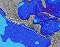 | 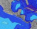 |  | 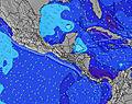 | ||||||||||||||
Wave Height (m) Direction Period (s) | SW 14 | SSW 13 | SW 13 | SW 13 | SW 12 | SW 12 | SW 12 | SW 12 | SW 15 | SW 14 | SW 14 | SW 18 | SW 18 | SW 18 | SW 16 | SW 16 | SW 16 | SW 15 | SW 14 | SW 14 | SW 13 |
Wave Graph | |||||||||||||||||||||
264 | 304 | 138 | 104 | 73 | 72 | 50 | 49 | 54 | 97 | 119 | 162 | 154 | 246 | 268 | 371 | 291 | 255 | 346 | 293 | 249 | |
Wind (km/h) | |||||||||||||||||||||
Wind State on-shore cross-onshore cross-shore cross-offshore off-shore glassy | cross-off | cross-on | off | off | off | off | cross-off | off | cross-off | cross-off | off | off | off | off | cross-off | cross-off | off | off | off | off | off |
High Tide | 5:52PM2.18m | 6:18AM2.37m | 6:33PM2.11m | 6:59AM2.35m | 7:19PM2.02m | 7:47AM2.32m | 8:13PM1.94m | 8:43AM2.28m | 9:16PM1.88m | 9:48AM2.25m | 10:29PM1.88m | 10:59AM2.26m | 11:44PM1.95m | ||||||||
Low Tide | 11:50AM0.41m | 11:57PM0.33m | 12:32PM0.42m | 00:36AM0.38m | 1:18PM0.45m | 1:21AM0.44m | 2:11PM0.49m | 2:14AM0.50m | 3:13PM0.51m | 3:17AM0.55m | 4:23PM0.50m | 4:30AM0.56m | 5:34PM0.44m | ||||||||
5:33 | — | — | 5:33 | — | — | 5:33 | — | — | 5:33 | — | — | 5:33 | — | — | 5:33 | — | — | 5:33 | — | — | |
— | 6:10 | — | — | 6:10 | — | — | 6:09 | — | — | 6:09 | — | — | 6:09 | — | — | 6:08 | — | — | 6:08 | — | |
mm | — | — | 1 | — | — | — | — | — | — | — | 3 | 1 | — | — | — | — | — | — | — | — | — |
Temp °C | 33 | 32 | 29 | 35 | 34 | 30 | 35 | 35 | 29 | 34 | 31 | 27 | 30 | 32 | 27 | 29 | 30 | 26 | 30 | 31 | 29 |
Feels °C | 37 | 35 | 29 | 36 | 37 | 29 | 35 | 35 | 29 | 32 | 29 | 27 | 29 | 30 | 26 | 28 | 28 | 25 | 28 | 29 | 28 |
Swell 1 Height (m) Direction Period (s) | SW 14 | SSW 13 | S 8 | SSW 10 | SSW 9 | SSW 9 | S 8 | S 8 | S 8 | S 8 | SW 14 | SW 13 | SW 13 | SW 13 | SSW 12 | SW 16 | SW 16 | SW 15 | SW 14 | SW 14 | SW 13 |
264 | 304 | 80 | 71 | 59 | 58 | 50 | 49 | 49 | 45 | 119 | 144 | 140 | 170 | 187 | 371 | 291 | 255 | 346 | 293 | 249 | |
Swell 2 Height (m) Direction Period (s) | SW 18 | SW 16 | SW 13 | SW 13 | SW 12 | SW 12 | SW 12 | SW 12 | SW 15 | SW 14 | S 8 | S 8 | SSW 8 | SW 18 | SW 16 | SSW 12 | SW 12 | SW 11 | S 8 | S 8 | S 8 |
49 | 67 | 138 | 104 | 73 | 72 | 50 | 36 | 54 | 97 | 31 | 30 | 32 | 246 | 268 | 127 | 90 | 43 | 12 | 12 | 11 | |
Swell 3 Height (m) Direction Period (s) | W 9 | ESE 4 | SW 16 | SW 16 | WSW 16 | SSW 16 | SW 15 | SW 15 | SW 11 | SW 11 | SSW 20 | SW 18 | SW 18 | SW 7 | S 9 | S 8 | SSW 8 | S 8 | S 11 | SSW 18 | SSW 22 |
7 | 2 | 41 | 40 | 25 | 24 | 33 | 33 | 19 | 19 | 38 | 162 | 154 | 7 | 56 | 35 | 23 | 21 | 2 | 31 | 46 | |
Wind waves Height (m) Direction Period (s) | E 4 | E 4 | E 4 | E 3 | E 4 | E 3 | ENE 3 | E 3 | E 3 | ENE 3 | E 4 | E 3 | ENE 3 | E 4 | E 3 | E 3 | E 4 | E 3 | E 4 | E 4 | E 3 |
1 | 7 | 15 | 2 | 9 | 2 | 3 | 8 | 5 | 2 | 16 | 5 | 3 | 13 | 8 | 5 | 12 | 8 | 12 | 14 | 5 | |
Nearest Offshore or Glassy | |||||||||||||||||||||
Distance (km) | 0 | 19 | 0 | 0 | 0 | 0 | 1 | 0 | 1 | 34 | 146 | 0 | 110 | 132 | 1 | 1 | 132 | 110 | 110 | 149 | 110 |
Best forecast wave conditions in Leon Province | |||||||||||||||||||||
Best forecast wave conditions in Nicaragua | |||||||||||||||||||||
Header Global | |||||||||||||||||||||
- Map Icons:
 Break
Break Live Wave Height (m)
 Live Wind Speed (km/h)
 Surf Rating (10 Max)
 Ocean Swells (m)
- Wind Speed (km/h)
Latest Updates


FREE! Surf-Forecast.com widget for your website
The surf report / weather widget below is available to embed on third party websites free of charge and provides a summary of our Hemorrhoids surf forecast. Simply grab the html code snippet that we provide and paste it into your own site. You can choose your preferred language and metric/imperial units for the surf forecast feed to suit users of your site. Click here to get the code.
Information about the Hemorrhoids Surf forecast
The above surf forecast table for Hemorrhoids provides essential information for determining whether the surfing conditions will be good over the next 16 days. A general guide to surfing at Hemorrhoids can be found by selecting the local surf guide option on the grey menu. Our Hemorrhoids surf forecast is unique since it includes wave energy (power) that defines the real feel of the surf rather than just the height or the period. If you surf the same spot (Hemorrhoids) regularly then make a mental note of the wave energy from the surf forecast table each time you go. Very soon you may start to choose your surf days based on the wave energy alone combined with our forecast of favourable offshore wind conditions. Our star ratings will help here and of course you will also find the usual wave height and period predictions on our surf forecasts as well as a full break down of the swell components under our advanced users option (to reveal that, click the little Einstein character under the tide times).
Further information to help with frequently asked questions about our surf forecast for Hemorrhoids may be found under the help tab on the top menu and also by moving your mouse over the question marks on the surf forecast table itself. Please always bear in mind that the forecast is for near-shore open water and local factors at each surf break influence the actual breaking wave height, such as the beach / reef profile, water depths offshore and shelter.
 Nearest