

Surf Forecasts:

Puerto Escondido surf forecast from 1 Aug 2026:
- Best quality surf: Friday 7 Aug, 6AM (local time) - 2.5ft (0.7m), 18s period, SSW swell with offshore winds.
- Most powerful swell: Saturday 8 Aug, 12PM (local time) - 4.5ft (1.3m), 15s period, SSW swell with 730 kJ wave energy.
- Next surfable swell (1★+): Sunday 2 Aug, 12AM (local time) - 2.5ft (0.8m), 12s period with SSW swell.
Best Forecast Surf Conditions for Puerto Escondido this week:
The surf forecast for Puerto Escondido over the next 16 days: The first swell (rated 1 star or higher) is forecast to arrive on Sunday (Aug 02) at 12AM. The primary swell is predicted to be 0.8m and 12s period with a secondary swell of 0.6m and 15s. The wind is predicted to be cross-offshore as the swell arrives.
The most powerful waves expected at Puerto Escondido in the next 16 days are 1.3m 15s and forecast to arrive on Saturday (Aug 08) at 12PM. Winds are predicted to be cross-onshore at the time the swell arrives. The largest open ocean swell (not directed at the beach) is 0.3m 6s period and expected on Thursday (Aug 06) at 6AM.
| Wave Type | Time (CST) & Date | Wave Height & Period |
|---|---|---|
| Next good surf (1 star+) | 12AM (Sun 2nd Aug) | 2.5ft (0.8m) 12s |
| Best Surf | 6AM (Fri 7th Aug) | 2.5ft (0.7m) 18s |
| Most Powerful | 12PM (Sat 8th Aug) | 4.5ft (1.3m) 15s |
Table - best surf conditions forecast for Puerto Escondido over the next 16 days.
The Lowdown
Alright, Rusty here. Let’s have a look at what’s on the cards.
We’ve got a solid run of surf coming up at Puerto Escondido, Mexico. The water’s sitting at 87°F and it’s a touch warmer than normal for this time of year, so you won’t need a thick suit.
Things kick off right from Saturday, August 1st, with a clean 3ft SSW groundswell, period a fun 13 seconds, and glassy conditions in the morning. The energy is moderate (376) and that early window is the pick of the day. Afternoons get a bit cross-onshore and messy, so get out early. Sunday and Monday follow a similar pattern: small but clean mornings with glassy wind and 3ft to 3ft SSW swell – perfect for getting some practice in before the wind turns onshore later.
The first real standout comes on Friday, August 7th. The morning delivers 3ft of SSW groundswell but the period jumps to a very long 18 seconds. The energy is strong (749), and with glassy conditions, the wave quality will be next level. This is groundswell, so at a beach and point setup like Puerto, the sets will be more powerful and lined up, with longer lulls between them – it’ll be worth the paddle out.
Saturday, August 8th morning is another beauty, with the swell bumping up to 4ft from the SSW, still a long 16-second period, glassy wind, and strong energy (772). For a surfer who knows what they’re doing, this is prime territory.
The standout of the entire forecast, though, is Friday, August 14th morning. We’ve got 4ft of SW groundswell, an 18-second period, glassy conditions, and combined energy hitting a strong 959. This is big, clean, and powerful – expert-level waves. Crowds are possible here sometimes, but if you’re in the right spot, you won’t care.
The following mornings keep delivering right through to Sunday, August 16th, with 3ft to 4ft SSW/SW groundswell, long periods, and clean glass. Afternoons generally get a bit onshore, so early sessions are the go.
There are no gaps – surf is on offer every single morning of this 16-day run. No kite talk here, just pure paddle surfing.
Rusty.
Short Range ForecastModerate rain (total 14mm), heaviest on Sat night. Warm (max 31°C on Sat morning, min 27°C on Sat night). Wind will be generally light. | Days 4-6 Weather SummaryModerate rain (total 18mm), heaviest on Tue night. Warm (max 31°C on Tue morning, min 25°C on Tue night). Wind will be generally light. | ||||||||||||||||||||
Saturday 1 | Sunday 2 | Monday 3 | Tuesday 4 | Wednesday 5 | Thursday 6 | Friday 7 | |||||||||||||||
AM | PM | Night | AM | PM | Night | AM | PM | Night | AM | PM | Night | AM | PM | Night | AM | PM | Night | AM | PM | Night | |
Swell Height Map |  |  |  | 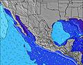 | 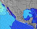 | 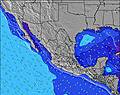 | 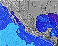 | ||||||||||||||
Wave Height (m) Direction Period (s) | SSW 13 | SSW 13 | SSW 12 | SSW 12 | SW 14 | SW 13 | SSW 15 | SW 13 | SSW 13 | SSW 13 | SSW 12 | S 9 | SW 15 | SW 14 | SW 14 | SW 13 | SW 13 | SSW 18 | SSW 18 | SSW 17 | SSW 16 |
Wave Graph | |||||||||||||||||||||
257 | 253 | 180 | 158 | 123 | 113 | 372 | 164 | 98 | 111 | 98 | 76 | 104 | 103 | 164 | 111 | 212 | 214 | 395 | 481 | 532 | |
Wind (km/h) | |||||||||||||||||||||
Wind State on-shore cross-onshore cross-shore cross-offshore off-shore glassy | glassy | cross-on | cross-off | glassy | cross-on | cross-off | glassy | cross-on | cross-off | glassy | on | off | cross-off | cross-on | off | glassy | cross-on | off | glassy | on | cross-off |
High Tide | 4:44PM0.95m | 5:20AM0.90m | 5:22PM0.92m | 6:00AM0.97m | 5:59PM0.89m | 6:40AM1.02m | 6:36PM0.85m | 7:21AM1.07m | 7:15PM0.82m | 8:06AM1.11m | 7:58PM0.79m | 8:54AM1.13m | 8:45PM0.76m | ||||||||
Low Tide | 10:29AM0.24m | 11:04PM0.17m | 11:18AM0.24m | 11:36PM0.14m | 12:04PM0.23m | 00:09AM0.11m | 12:51PM0.23m | 00:43AM0.08m | 1:38PM0.23m | 1:21AM0.05m | 2:27PM0.23m | 2:04AM0.03m | 3:19PM0.24m | 2:52AM0.01m | |||||||
6:09 | — | — | 6:09 | — | — | 6:09 | — | — | 6:09 | — | — | 6:09 | — | — | 6:09 | — | — | 6:11 | — | — | |
— | 6:59 | — | — | 6:58 | — | — | 6:58 | — | — | 6:58 | — | — | 6:57 | — | — | 6:57 | — | — | 6:55 | — | |
mm | — | — | 5 | — | 3 | 4 | — | 1 | 1 | — | — | 12 | — | 3 | — | — | 1 | 2 | — | — | 3 |
Temp °C | 31 | 31 | 29 | 30 | 30 | 28 | 31 | 30 | 29 | 31 | 31 | 29 | 31 | 31 | 27 | 31 | 30 | 27 | 30 | 30 | 28 |
Feels °C | 34 | 34 | 34 | 33 | 33 | 33 | 35 | 34 | 34 | 34 | 34 | 34 | 34 | 34 | 31 | 33 | 32 | 31 | 32 | 33 | 32 |
Swell 1 Height (m) Direction Period (s) | SSW 13 | SSW 13 | SSW 12 | SSW 12 | SSW 12 | SSW 12 | SSW 15 | SW 13 | SSW 13 | SSW 13 | S 8 | S 9 | S 9 | S 9 | S 8 | S 8 | SW 13 | SW 13 | SSW 18 | SSW 17 | SSW 16 |
257 | 253 | 180 | 158 | 123 | 109 | 372 | 164 | 98 | 111 | 63 | 74 | 76 | 71 | 47 | 49 | 212 | 175 | 395 | 481 | 532 | |
Swell 2 Height (m) Direction Period (s) | SW 16 | SW 15 | SW 15 | SW 14 | SW 14 | SW 13 | SW 13 | S 8 | SW 12 | S 8 | SSW 12 | SSW 12 | SW 15 | SW 14 | SW 14 | SW 13 | S 8 | SSW 18 | SW 13 | SW 12 | SW 12 |
89 | 113 | 136 | 125 | 118 | 113 | 83 | 22 | 53 | 43 | 98 | 58 | 104 | 103 | 164 | 111 | 45 | 214 | 238 | 184 | 114 | |
Swell 3 Height (m) Direction Period (s) | W 10 | S 7 | S 7 | SW 18 | SSE 8 | SW 18 | W 8 | SW 16 | SW 16 | SW 12 | SW 12 | SW 15 | SW 12 | SW 12 | SW 20 | SW 20 | SW 18 | S 8 | S 11 | S 8 | S 8 |
30 | 17 | 17 | 82 | 12 | 79 | 11 | 67 | 90 | 50 | 23 | 76 | 36 | 34 | 97 | 61 | 159 | 32 | 116 | 61 | 49 | |
Wind waves Height (m) Direction Period (s) | — | — | — | W 4 | WSW 4 | W 8 | — | WSW 8 | — | — | SW 3 | — | — | W 6 | WNW 6 | — | — | — | — | — | — |
— | — | — | 7 | 5 | 33 | — | 19 | — | — | 1 | — | — | 3 | 3 | — | — | — | — | — | — | |
Nearest Offshore or Glassy | |||||||||||||||||||||
Distance (km) | 0 | 193 | 0 | 0 | 480 | 0 | 0 | 624 | 0 | 0 | 1050 | 0 | 0 | 178 | 0 | 0 | 178 | 0 | 0 | 852 | 0 |
Best forecast wave conditions in Oaxaca | |||||||||||||||||||||
Best forecast wave conditions in Mexico | |||||||||||||||||||||
Header Global | |||||||||||||||||||||
- Map Icons:
 Break
Break Live Wave Height (m)
 Live Wind Speed (km/h)
 Surf Rating (10 Max)
 Ocean Swells (m)
- Wind Speed (km/h)
Latest Updates


FREE! Surf-Forecast.com widget for your website
The surf report / weather widget below is available to embed on third party websites free of charge and provides a summary of our Puerto Escondido surf forecast. Simply grab the html code snippet that we provide and paste it into your own site. You can choose your preferred language and metric/imperial units for the surf forecast feed to suit users of your site. Click here to get the code.
Information about the Puerto Escondido Surf forecast
The above surf forecast table for Puerto Escondido provides essential information for determining whether the surfing conditions will be good over the next 16 days. A general guide to surfing at Puerto Escondido can be found by selecting the local surf guide option on the grey menu. Our Puerto Escondido surf forecast is unique since it includes wave energy (power) that defines the real feel of the surf rather than just the height or the period. If you surf the same spot (Puerto Escondido) regularly then make a mental note of the wave energy from the surf forecast table each time you go. Very soon you may start to choose your surf days based on the wave energy alone combined with our forecast of favourable offshore wind conditions. Our star ratings will help here and of course you will also find the usual wave height and period predictions on our surf forecasts as well as a full break down of the swell components under our advanced users option (to reveal that, click the little Einstein character under the tide times).
Further information to help with frequently asked questions about our surf forecast for Puerto Escondido may be found under the help tab on the top menu and also by moving your mouse over the question marks on the surf forecast table itself. Please always bear in mind that the forecast is for near-shore open water and local factors at each surf break influence the actual breaking wave height, such as the beach / reef profile, water depths offshore and shelter.
Are you planning a holiday in Oaxaca? If you are looking for accommodation near Puerto Escondido, camping, hotels and holiday cottages in Oaxaca, consider staying in Puerto Escondido which is 1 km (1 miles) away. Other places in and around Oaxaca where you can find information about places to rent, and car hire include Nopala which is 29 km (18 miles) away and Miahuatlan de Porfirio Diaz, 72 km (45 miles) away.
 Nearest