

Surf Forecasts:

Islas de Todos Santos surf forecast from 15 Jul 2026:
- Best quality surf: Sunday 19 Jul, 5AM (local time) - 4.5ft (1.4m), 12s period, S swell with glassy winds.
- Most powerful swell: Tuesday 21 Jul, 2PM (local time) - 4ft (1.2m), 15s period, SSW swell with 661 kJ wave energy.
- Next surfable swell (1★+): Wednesday 15 Jul, 8PM (local time) - 2ft (0.6m), 16s period with SW swell.
Best Forecast Surf Conditions for Islas de Todos Santos this week:
The surf forecast for Islas de Todos Santos over the next 16 days: The first swell (rated 1 star or higher) is forecast to arrive on Wednesday (Jul 15) at 8PM. The primary swell is predicted to be 0.6m and 16s period with a secondary swell of 0.5m and 6s. The wind is predicted to be glassy as the swell arrives.
The most powerful waves expected at Islas de Todos Santos in the next 16 days are 1.2m 15s and forecast to arrive on Tuesday (Jul 21) at 2PM. Winds are predicted to be cross-onshore at the time the swell arrives.
| Wave Type | Time (PDT) & Date | Wave Height & Period |
|---|---|---|
| Next good surf (1 star+) | 8PM (Wed 15th Jul) | 2ft (0.6m) 16s |
| Best Surf | 5AM (Sun 19th Jul) | 4.5ft (1.4m) 12s |
| Most Powerful | 2PM (Tue 21st Jul) | 4ft (1.2m) 15s |
Table - best surf conditions forecast for Islas de Todos Santos over the next 16 days.
The Lowdown
Alright folks, Rusty here. Let's have a look at what's coming down the pipe for the next couple of weeks.
Alright, to be straight with you, the next week and a half is looking pretty average. There's a lot of cross-onshore wind messing up what could be half-decent waves. The swell is there, but it's not clean. We're looking at a long stretch of marginal to poor conditions from now until around the 23rd of July. The water temp is sitting at about 69°, which is pretty much normal for this time of year, so no surprises there.
The standout window is definitely the 23rd of July, Thursday afternoon. That's the one to circle. The wind is forecast to go glassy, and we've got a solid 6ft S swell, with a period of 14 seconds. That's proper groundswell energy, and the combined energy figure is a hearty 1307, so it's got some push. This is a reef break, and that long-period S swell is going to wrap in beautifully. It's an advanced wave, so this isn't for the groms, but for the crew who know what they're doing, it's going to be firing. The wind is light and from the S, so it'll be offshore and clean. Just keep in mind, crowds are sometimes a thing here, so get in early.
The following day, Friday the 24th of July, sees the swell building even more. We're looking at 6ft in the morning, jumping to 8ft by the afternoon, still from the S. The period holds at 14-16 seconds, so it's got serious power. The combined energy hits 2646 in the morning and a massive 3993 in the afternoon. That's a lot of water moving. However, the wind swings back to a cross-onshore from the WNW, which will chop it up. At 8ft, this is strictly for the experts. It's a shame about the wind, because the swell is there.
The rest of the period is a bit of a write-off. There's a small window on the 19th of July, Sunday morning, with a 3ft SW swell and an onshore wind, giving it a marginal call, but it's nothing to write home about. The 27th and 28th of July have some 4ft to 4ft SSW swell with light winds, but the period is a bit shorter and the energy is moderate, so it's more of a fun-size option than a standout.
So, to sum it up: the first week is a wash. The real action is on Thursday the 23rd of July afternoon. That's the day. The 24th has the size but the wind is a problem. The tail end of the period has some small, clean options, but nothing that'll get your heart racing like that Thursday session.
Stay salty,
Rusty
Short Range ForecastMostly dry. Warm (max 24°C on Wed morning, min 19°C on Thu night). Wind will be generally light. | Days 5-7 Weather SummaryMostly dry. Warm (max 23°C on Mon morning, min 19°C on Fri night). Wind will be generally light. | ||||||||||||||||||||
Tue 14 | Wednesday 15 | Thursday 16 | Friday 17 | Saturday 18 | Sunday 19 | Monday 20 | |||||||||||||||
PM | Night | AM | PM | Night | AM | PM | Night | AM | PM | Night | AM | PM | Night | AM | PM | Night | AM | PM | Night | AM | |
Swell Height Map |  |  |  | 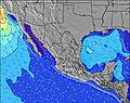 | 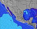 | 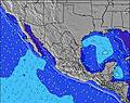 | 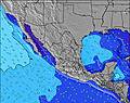 | 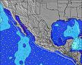 | |||||||||||||
Wave Height (m) Direction Period (s) | SW 18 | SW 18 | SW 17 | SW 16 | SW 16 | WNW 8 | WNW 9 | SW 19 | SW 19 | SW 14 | WNW 17 | SW 18 | SW 18 | S 12 | S 12 | SW 17 | SW 16 | SSW 16 | SW 16 | SW 16 | SSW 15 |
Wave Graph | |||||||||||||||||||||
197 | 249 | 148 | 165 | 251 | 146 | 199 | 227 | 231 | 137 | 166 | 510 | 375 | 266 | 487 | 573 | 358 | 430 | 580 | 595 | 493 | |
Wind (km/h) | |||||||||||||||||||||
Wind State on-shore cross-onshore cross-shore cross-offshore off-shore glassy | cross-on | cross | cross-on | on | glassy | cross-on | cross-on | cross | cross-on | cross-on | glassy | cross-on | cross-on | glassy | on | cross-on | cross-on | cross-on | cross-on | cross | cross-on |
High Tide | 9:29PM2.48m | 11:11AM1.65m | 10:17PM2.37m | 11:52AM1.69m | 11:04PM2.19m | 12:34PM1.73m | 11:52PM1.95m | 1:16PM1.77m | 00:43AM1.68m | 1:59PM1.78m | 1:46AM1.43m | 2:47PM1.79m | 3:18AM1.23m | ||||||||
Low Tide | 3:12PM0.92m | 4:42AM-0.12m | 4:05PM0.89m | 5:23AM-0.02m | 4:59PM0.88m | 6:01AM0.14m | 5:57PM0.89m | 6:38AM0.34m | 7:02PM0.91m | 7:13AM0.55m | 8:19PM0.91m | 7:47AM0.76m | 9:51PM0.86m | 8:24AM0.94m | |||||||
— | — | 5:50 | — | — | 5:52 | — | — | 5:52 | — | — | 5:52 | — | — | 5:54 | — | — | 5:54 | — | — | 5:54 | |
7:53 | — | — | 7:53 | — | — | 7:52 | — | — | 7:52 | — | — | 7:52 | — | — | 7:52 | — | — | 7:51 | — | 7:51 | |
mm | — | — | — | — | — | — | — | — | — | — | — | — | — | — | — | — | — | — | — | — | — |
Temp °C | 22 | 21 | 24 | 23 | 21 | 21 | 21 | 20 | 21 | 21 | 20 | 22 | 21 | 21 | 22 | 22 | 21 | 23 | 23 | 21 | 23 |
Feels °C | 22 | 23 | 25 | 23 | 23 | 22 | 21 | 21 | 20 | 22 | 22 | 22 | 22 | 23 | 22 | 22 | 22 | 22 | 23 | 22 | 23 |
Swell 1 Height (m) Direction Period (s) | SSW 13 | SW 18 | SSW 12 | SW 16 | WNW 7 | WNW 8 | WNW 9 | WNW 9 | WNW 9 | WNW 8 | WNW 8 | SW 18 | S 12 | S 12 | S 12 | S 11 | S 11 | S 10 | SW 16 | SW 16 | SSW 15 |
170 | 249 | 119 | 165 | 57 | 146 | 199 | 208 | 168 | 137 | 78 | 510 | 228 | 266 | 456 | 344 | 357 | 218 | 580 | 595 | 493 | |
Swell 2 Height (m) Direction Period (s) | SW 18 | SSW 13 | SW 17 | WNW 5 | SW 16 | SW 16 | SW 16 | SW 15 | SW 19 | SW 14 | SW 14 | S 12 | SW 18 | SSW 14 | SW 17 | SW 17 | SW 16 | SSW 16 | S 10 | S 9 | WNW 14 |
197 | 98 | 148 | 16 | 251 | 122 | 119 | 136 | 231 | 132 | 130 | 180 | 375 | 189 | 487 | 573 | 358 | 430 | 122 | 81 | 80 | |
Swell 3 Height (m) Direction Period (s) | WNW 15 | NW 9 | WNW 14 | S 12 | S 12 | SSW 12 | SSW 12 | SW 19 | SW 14 | WNW 18 | WNW 17 | WNW 8 | WNW 16 | WNW 16 | WNW 16 | WNW 16 | WNW 15 | WNW 15 | WNW 14 | WNW 6 | S 8 |
44 | 20 | 41 | 75 | 73 | 47 | 46 | 227 | 102 | 126 | 166 | 51 | 206 | 201 | 196 | 188 | 184 | 125 | 118 | 17 | 21 | |
Wind waves Height (m) Direction Period (s) | WNW 4 | WNW 4 | WNW 4 | — | — | — | — | — | S 3 | S 3 | S 3 | — | — | — | — | — | — | WNW 5 | WNW 6 | — | WNW 5 |
13 | 10 | 12 | — | — | — | — | — | 3 | 2 | 2 | — | — | — | — | — | — | 8 | 25 | — | 16 | |
Nearest Offshore or Glassy | |||||||||||||||||||||
Distance (km) | 96 | 10 | 46 | 319 | 0 | 229 | 229 | 17 | 261 | 43 | 0 | 229 | 260 | 0 | 46 | 46 | 7 | 95 | 96 | 10 | 95 |
Best forecast wave conditions in Baja Norte | |||||||||||||||||||||
Best forecast wave conditions in Mexico | |||||||||||||||||||||
Header Global | |||||||||||||||||||||
- Map Icons:
 Break
Break Live Wave Height (m)
 Live Wind Speed (km/h)
 Surf Rating (10 Max)
 Ocean Swells (m)
- Wind Speed (km/h)


FREE! Surf-Forecast.com widget for your website
The surf report / weather widget below is available to embed on third party websites free of charge and provides a summary of our Islas de Todos Santos surf forecast. Simply grab the html code snippet that we provide and paste it into your own site. You can choose your preferred language and metric/imperial units for the surf forecast feed to suit users of your site. Click here to get the code.
Information about the Islas de Todos Santos Surf forecast
The above surf forecast table for Islas de Todos Santos provides essential information for determining whether the surfing conditions will be good over the next 16 days. A general guide to surfing at Islas de Todos Santos can be found by selecting the local surf guide option on the grey menu. Our Islas de Todos Santos surf forecast is unique since it includes wave energy (power) that defines the real feel of the surf rather than just the height or the period. If you surf the same spot (Islas de Todos Santos) regularly then make a mental note of the wave energy from the surf forecast table each time you go. Very soon you may start to choose your surf days based on the wave energy alone combined with our forecast of favourable offshore wind conditions. Our star ratings will help here and of course you will also find the usual wave height and period predictions on our surf forecasts as well as a full break down of the swell components under our advanced users option (to reveal that, click the little Einstein character under the tide times).
Further information to help with frequently asked questions about our surf forecast for Islas de Todos Santos may be found under the help tab on the top menu and also by moving your mouse over the question marks on the surf forecast table itself. Please always bear in mind that the forecast is for near-shore open water and local factors at each surf break influence the actual breaking wave height, such as the beach / reef profile, water depths offshore and shelter.
Islas de Todos Santos is 14 km (9 miles) from Ensenada. If you plan a holiday in Baja Norte, look for hotels and other accommodation in Ensenada. Ensenada has rooms for a wide range of budgets as well as car hire and transport links.
 Nearest