

Surf Forecasts:

Bahia Chileno surf forecast from 1 Aug 2026:
- Best quality surf: Thursday 6 Aug, 11PM (local time) - 2.5ft (0.7m), 18s period, SSW swell with cross-offshore winds.
- Most powerful swell: Saturday 8 Aug, 5AM (local time) - 3.5ft (1.1m), 16s period, SSW swell with 582 kJ wave energy.
- Next surfable swell (1★+): Saturday 1 Aug, 8PM (local time) - 2ft (0.6m), 14s period with SW swell.
Best Forecast Surf Conditions for Bahia Chileno this week:
The surf forecast for Bahia Chileno over the next 16 days: The first swell (rated 1 star or higher) is forecast to arrive on Saturday (Aug 01) at 8PM. The primary swell is predicted to be 0.6m and 14s period with a secondary swell of 0.6m and 12s. The wind is predicted to be offshore as the swell arrives.
The most powerful waves expected at Bahia Chileno in the next 16 days are 1.1m 16s and forecast to arrive on Saturday (Aug 08) at 5AM. Winds are predicted to be offshore at the time the swell arrives. The largest open ocean swell (not directed at the beach) is 1.1m 5s period and expected on Sunday (Aug 02) at 8AM.
| Wave Type | Time (MST) & Date | Wave Height & Period |
|---|---|---|
| Next good surf (1 star+) | 8PM (Sat 1st Aug) | 2ft (0.6m) 14s |
| Best Surf | 11PM (Thu 6th Aug) | 2.5ft (0.7m) 18s |
| Most Powerful | 5AM (Sat 8th Aug) | 3.5ft (1.1m) 16s |
Table - best surf conditions forecast for Bahia Chileno over the next 16 days.
The Lowdown
Alright folks, Rusty here, and I’ve been staring at the charts for the next couple of weeks. Let’s get into it.
The overall pattern is a slow build. It’s not going to be flat, but the first week is pretty small and ordinary. Saturday the 1st kicks off with a small 2ft SSW swell at Bahia Chileno. The morning is clean with a light cross-offshore breeze but the energy is weak (276). The water is a balmy 86°, which is *much* warmer than normal for this time of year – that’s a real treat. The swell has a solid 12-second period, so there’s some shape to it, but it’s inconsistent here. The afternoon gets blown out with a risk of thunderstorms and a moderate breeze, so the morning is your only window that day.
Sunday the 2nd is the standout of the early period. The swell drops slightly to 3ft from the SSW, but the wind goes glassy offshore from the SSE in the morning. That’s prime. The energy is still moderate (217), but those clean, glassy conditions will have it looking its best. It’s only small, so it’s fun for a longboard or a fish. The afternoon gets chewed up by a strong WNW wind, so get on it early.
Monday the 3rd through to Thursday the 6th is a bit of a lull. Swell stays around 2ft to 2ft, and the winds are mostly cross-offshore or light. It’s surfable but ordinary. You’ll get a few, but it’s not going to set the world on fire. The energy is very low, dipping into the 130s and 160s.
Now, things start to get interesting from Thursday the 6th afternoon. The new swell arrives, pushing 2ft from the SSW, but it’s the period that jumps – up to 18 seconds. That’s a proper groundswell. The energy ramps up to 482, and it’s clean with a gentle cross-offshore breeze. This is the start of the good stuff.
Friday the 7th is a solid option. The swell is 3ft from the SSW, with a 17-second period, and the energy is strong (652). The morning is dead calm with a light offshore wind. It’s the best of the first week, for sure. The water is still much warmer than normal, so you’ll be comfortable.
Saturday the 8th is the best of the entire run. We’ve got a 4ft SSW swell, long 16-second period, and glassy conditions in the morning. The energy is pumping at 630. This is the one to circle. It’s small enough for a fun session but clean and full of energy. The crowds are listed as “sometimes” here, so you might have some company, but it’s worth it.
The second week sees a lot of swell in the water, but the wind gets tricky. Sunday the 9th is still good with 3ft SSW swell and clean conditions, but the energy dips. Monday the 10th and Tuesday the 11th have bigger energy readings (446, 760) but cross-onshore winds will mess with the surface. Tuesday afternoon the 11th cleans up, with 2ft SW swell, 18-second period, and a cross-offshore breeze. That’s a worthy backup.
The 12th of August is clean again with glassy wind and a solid 3ft SW swell. Good energy (407). The 13th has a lot of energy (775 to 1056) but the wind is cross-shore, so it won’t be perfect.
The 14th of August is the biggest swell of the run – 5ft from the SW with a 17-second period, energy hitting 1410. That’s a lot of power. But the wind is a strong cross-onshore, making it choppy and messy. This setup looks more interesting for kite surfing than paddle surfing. It’s a shame because the swell has real grunt. The 15th is still big but the wind is lighter, so it might clean up a little, but it’s still marginal.
The last day, Sunday the 16th, is a nice little finisher. 3ft SSW swell, glassy in the morning, and good energy (451). A solid end to the run.
Overall, the standout is without a doubt Saturday the 8th at Bahia Chileno. The glassy wind, the 4ft SSW swell, and the long 16-second period make for a very clean, fun session. The water is much warmer than normal, so it’s going to be a real pleasure. Get in the water.
- Rusty
Short Range ForecastModerate rain (total 14mm), heaviest on Sat night. Warm (max 31°C on Sat morning, min 26°C on Mon night). Wind will be generally light. | Days 4-6 Weather SummaryLight rain (total 5mm), mostly falling on Tue afternoon. Warm (max 29°C on Tue morning, min 26°C on Tue night). Wind will be generally light. | ||||||||||||||||||||
Saturday 1 | Sunday 2 | Monday 3 | Tuesday 4 | Wednesday 5 | Thursday 6 | Friday 7 | |||||||||||||||
AM | PM | Night | AM | PM | Night | AM | PM | Night | AM | PM | Night | AM | PM | Night | AM | PM | Night | AM | PM | Night | |
Swell Height Map | 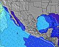 |  | 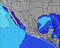 | 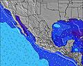 | 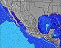 | 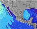 | 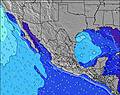 | ||||||||||||||
Wave Height (m) Direction Period (s) | SSW 12 | SW 14 | S 12 | SSW 13 | SW 13 | SW 13 | SW 13 | SW 12 | SW 16 | SW 15 | SW 15 | SW 14 | SW 14 | SW 14 | SW 20 | SW 13 | SSW 18 | SSW 18 | SSW 17 | SSW 17 | SSW 16 |
Wave Graph | |||||||||||||||||||||
155 | 152 | 103 | 195 | 140 | 83 | 79 | 73 | 90 | 69 | 54 | 132 | 99 | 102 | 144 | 140 | 286 | 216 | 475 | 448 | 487 | |
Wind (km/h) | |||||||||||||||||||||
Wind State on-shore cross-onshore cross-shore cross-offshore off-shore glassy | cross-off | cross-off | off | glassy | cross-off | off | cross-off | cross-off | off | cross-off | cross-off | cross-off | cross | cross-off | cross-off | cross | cross-off | cross-off | cross-off | cross-off | off |
High Tide | 10:05AM1.04m | 9:39PM1.20m | 10:29AM1.08m | 10:13PM1.07m | 10:58AM1.10m | 10:52PM0.90m | 11:32AM1.12m | 11:44PM0.71m | 12:18PM1.11m | 1:31AM0.52m | 1:31PM1.09m | 3:20PM1.12m | |||||||||
Low Tide | 3:40PM0.24m | 4:09AM-0.05m | 4:20PM0.23m | 4:31AM0.05m | 5:07PM0.24m | 4:54AM0.17m | 6:11PM0.28m | 5:15AM0.30m | 7:56PM0.29m | 5:26AM0.44m | 10:24PM0.18m | 11:47PM-0.01m | |||||||||
5:50 | — | — | 5:50 | — | — | 5:50 | — | — | 5:50 | — | — | 5:50 | — | — | 5:52 | — | — | 5:52 | — | — | |
— | 7:00 | — | — | 7:00 | — | — | 6:59 | — | — | 6:59 | — | — | 6:58 | — | — | 6:58 | — | — | 6:57 | — | |
mm | — | 1 | 5 | — | — | 1 | 1 | 2 | 4 | — | 1 | 2 | — | — | 2 | — | — | — | — | — | 2 |
Temp °C | 31 | 30 | 28 | 31 | 30 | 28 | 30 | 29 | 28 | 29 | 29 | 27 | 29 | 29 | 27 | 29 | 29 | 27 | 30 | 29 | 28 |
Feels °C | 35 | 31 | 28 | 35 | 32 | 29 | 32 | 32 | 29 | 31 | 30 | 28 | 32 | 31 | 29 | 32 | 31 | 29 | 33 | 31 | 30 |
Swell 1 Height (m) Direction Period (s) | SSW 12 | SSW 12 | S 12 | SSW 13 | SW 13 | SW 13 | SW 13 | SW 12 | SW 12 | SW 12 | SW 12 | SW 14 | SW 14 | S 8 | SW 13 | SW 13 | SSW 18 | SW 13 | SSW 17 | SSW 17 | SSW 16 |
155 | 152 | 103 | 195 | 140 | 83 | 79 | 73 | 51 | 69 | 50 | 132 | 99 | 36 | 144 | 140 | 286 | 172 | 475 | 448 | 487 | |
Swell 2 Height (m) Direction Period (s) | SW 14 | SW 14 | SW 14 | WNW 5 | S 11 | S 11 | S 9 | S 11 | SSE 9 | SW 15 | SW 15 | S 11 | S 8 | SW 14 | S 9 | S 9 | SW 13 | SSE 8 | SW 12 | S 8 | SW 12 |
102 | 127 | 92 | 23 | 64 | 57 | 24 | 58 | 25 | 57 | 54 | 59 | 37 | 102 | 56 | 55 | 138 | 57 | 126 | 50 | 114 | |
Swell 3 Height (m) Direction Period (s) | WSW 8 | SSE 8 | W 8 | WSW 8 | WSW 18 | SSW 18 | SSW 14 | SSW 13 | SW 16 | SSW 13 | SSW 13 | SW 11 | SW 11 | SW 11 | SW 20 | SSW 18 | SSE 9 | SSW 18 | S 8 | SW 12 | SSE 8 |
19 | 6 | 35 | 22 | 31 | 30 | 37 | 35 | 90 | 33 | 32 | 31 | 31 | 32 | 97 | 127 | 58 | 216 | 51 | 87 | 40 | |
Wind waves Height (m) Direction Period (s) | WNW 3 | W 9 | WNW 4 | WNW 5 | W 8 | W 4 | W 4 | W 4 | W 4 | W 3 | W 4 | W 3 | W 3 | WSW 3 | W 2 | NW 9 | WSW 3 | WNW 3 | NW 4 | WNW 3 | WNW 4 |
2 | 102 | 23 | 48 | 44 | 15 | 16 | 28 | 13 | 6 | 9 | 3 | 2 | 3 | 1 | 21 | 3 | 5 | 3 | 6 | 11 | |
Nearest Offshore or Glassy | |||||||||||||||||||||
Distance (km) | 0 | 457 | 0 | 0 | 319 | 0 | 0 | 0 | 0 | 0 | 457 | 3 | 3 | 457 | 0 | 3 | 83 | 0 | 0 | 457 | 0 |
Best forecast wave conditions in Baja Sur | |||||||||||||||||||||
Best forecast wave conditions in Mexico | |||||||||||||||||||||
Header Global | |||||||||||||||||||||
- Map Icons:
 Break
Break Live Wave Height (m)
 Live Wind Speed (km/h)
 Surf Rating (10 Max)
 Ocean Swells (m)
- Wind Speed (km/h)
Latest Updates


FREE! Surf-Forecast.com widget for your website
The surf report / weather widget below is available to embed on third party websites free of charge and provides a summary of our Bahia Chileno surf forecast. Simply grab the html code snippet that we provide and paste it into your own site. You can choose your preferred language and metric/imperial units for the surf forecast feed to suit users of your site. Click here to get the code.
Information about the Bahia Chileno Surf forecast
The above surf forecast table for Bahia Chileno provides essential information for determining whether the surfing conditions will be good over the next 16 days. A general guide to surfing at Bahia Chileno can be found by selecting the local surf guide option on the grey menu. Our Bahia Chileno surf forecast is unique since it includes wave energy (power) that defines the real feel of the surf rather than just the height or the period. If you surf the same spot (Bahia Chileno) regularly then make a mental note of the wave energy from the surf forecast table each time you go. Very soon you may start to choose your surf days based on the wave energy alone combined with our forecast of favourable offshore wind conditions. Our star ratings will help here and of course you will also find the usual wave height and period predictions on our surf forecasts as well as a full break down of the swell components under our advanced users option (to reveal that, click the little Einstein character under the tide times).
Further information to help with frequently asked questions about our surf forecast for Bahia Chileno may be found under the help tab on the top menu and also by moving your mouse over the question marks on the surf forecast table itself. Please always bear in mind that the forecast is for near-shore open water and local factors at each surf break influence the actual breaking wave height, such as the beach / reef profile, water depths offshore and shelter.
Bahia Chileno is 7 km (4 miles) from Cabo San Lucas. If you plan a holiday in Baja Sur, look for hotels and other accommodation in Cabo San Lucas. Cabo San Lucas has rooms for a wide range of budgets as well as car hire and transport links.
 Nearest