

Surf Forecasts:

Baler - Lindy's Point surf forecast from 2 Aug 2026:
- Best quality surf: Thursday 6 Aug, 8PM (local time) - 7ft (2.2m), 18s period, ENE swell with offshore winds.
- Most powerful swell: Thursday 6 Aug, 8PM (local time) - 7ft (2.2m), 18s period, ENE swell with 3,280 kJ wave energy.
- Next surfable swell (1★+): Monday 3 Aug, 2AM (local time) - 1.5ft (0.5m), 17s period with E swell.
Best Forecast Surf Conditions for Baler - Lindy's Point this week:
The surf forecast for Baler - Lindy's Point over the next 16 days: The first swell (rated 1 star or higher) is forecast to arrive on Monday (Aug 03) at 2AM. The primary swell is predicted to be 0.5m and 17s period with a secondary swell of 0.3m and 9s. The wind is predicted to be offshore as the swell arrives.
The most powerful waves expected at Baler - Lindy's Point in the next 16 days are 2.2m 18s and forecast to arrive on Thursday (Aug 06) at 8PM. Winds are predicted to be offshore at the time the swell arrives. The largest open ocean swell (not directed at the beach) is 1.1m 5s period and expected on Thursday (Aug 06) at 8PM.
| Wave Type | Time (PST) & Date | Wave Height & Period |
|---|---|---|
| Next good surf (1 star+) | 2AM (Mon 3rd Aug) | 1.5ft (0.5m) 17s |
| Best Surf | 8PM (Thu 6th Aug) | 7ft (2.2m) 18s |
| Most Powerful | 8PM (Thu 6th Aug) | 7ft (2.2m) 18s |
Table - best surf conditions forecast for Baler - Lindy's Point over the next 16 days.
The Lowdown
Alright folks, Rusty here. Let’s have a look at what’s coming down the pipe for the next couple of weeks.
We’ve got a solid run of surf kicking off right now and building through the week. The first few days are a bit on the smaller side, but it’s clean and the swell is building. The standout period is from Wednesday the 5th of August through to Friday the 7th of August, when things get properly chunky.
The main break is Baler - Lindy's Point. This is a river-mouth setup, exposed to the swell and kicking off from Monday morning the 3rd of August. The water temp is about average for this time of year, so nothing unusual there.
Monday the 3rd sees a small but clean swell. Morning has light rain and a light offshore breeze, with waves around 2ft from the east. The period is a very long 15 seconds, so it’s a proper groundswell. Combined energy is moderate (268). It’s only small, but it’s clean. By afternoon, the swell nudges up to 3ft, still from the east, with a 17-second period and a gentle offshore. Energy jumps to moderate (374). Nice, clean lines but not much push.
Tuesday the 4th is better. Morning brings 4ft from the east, 16-second period, with a gentle offshore wind. The combined energy is strong (735). The wave comment says “very good” – and it feels that way. Afternoon sits at 4ft, still east, still clean, energy climbing to strong (974). This is the start of the real fun.
Now, Wednesday the 5th of August is where it gets serious for the experienced crew. Morning swell hits 5ft from the east-northeast, with a 17-second period and a moderate offshore breeze. The combined energy is strong (1433), and the comment says “excellent” for experienced surfers. This is a solid, powerful groundswell. The afternoon holds at 5ft, same direction, with a gentle offshore. Energy is still strong (1376). This is one of the best days on offer.
Thursday the 6th of August is the biggest day. Swell peaks at 7ft from the east-northeast, with an 18-second period – that’s a very long period groundswell. The wind is light offshore in the morning, and the combined energy is very strong (2605). This is big, powerful, and only for experienced surfers. The afternoon holds at 7ft, energy even higher at 2827. This is the standout of the whole forecast. The wind is offshore and clean, but the size and power mean it’s not for the faint-hearted.
Friday the 7th of August is still excellent, but the swell backs off a touch. Morning is 6ft from the northeast, 17-second period, with a moderate offshore. Energy is strong (1927). Afternoon drops to 5ft, still northeast, still clean. Still a great day for experienced surfers.
After Friday, the swell drops away quickly. Saturday the 8th is smaller, around 3ft, and by Sunday the 9th it’s down to 0.7ft. From there, through to the 18th of August, the swell stays tiny – mostly 0.7ft to 1ft, with very low energy (under 100). The winds are mostly offshore, but there’s just no swell to work with. The 16th of August has a moment of glassy conditions, but with only 1.0ft on offer, it’s not worth paddling out for.
So, the call is clear: aim for Wednesday the 5th through Friday the 7th of August at Baler - Lindy's Point. Thursday the 6th is the absolute peak, with 7ft, very long period, clean offshore wind, and a very strong energy reading (2826). It’s a proper groundswell at a river mouth, so expect long, powerful lines and longer gaps between sets. Crowds are possible here, so get in early. This is a true standout in the window.
Rusty.
Short Range ForecastHeavy rain (total 28mm), heaviest during Sun night. Warm (max 30°C on Wed afternoon, min 24°C on Mon night). Wind will be generally light. | Days 5-7 Weather SummaryHeavy rain (total 21mm), heaviest during Thu night. Warm (max 29°C on Fri morning, min 25°C on Thu night). Wind will be generally light. | ||||||||||||||||||
Monday 3 | Tuesday 4 | Wednesday 5 | Thursday 6 | Friday 7 | Saturday 8 | ||||||||||||||
Night | AM | PM | Night | AM | PM | Night | AM | PM | Night | AM | PM | Night | AM | PM | Night | AM | PM | Night | |
Swell Height Map | 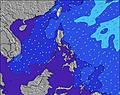 | 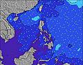 | 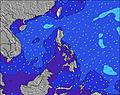 | 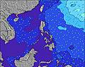 | 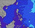 | 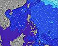 | 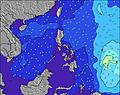 | ||||||||||||
Wave Height (m) Direction Period (s) | E 17 | E 15 | E 17 | E 16 | E 16 | E 16 | ENE 18 | ENE 17 | ENE 16 | ENE 18 | ENE 18 | ENE 18 | NE 18 | NE 17 | NE 17 | NE 16 | NE 16 | NE 16 | NE 16 |
Wave Graph | |||||||||||||||||||
147 | 224 | 355 | 522 | 724 | 589 | 1464 | 1433 | 1376 | 2343 | 2605 | 2827 | 2630 | 1927 | 1502 | 955 | 376 | 198 | 62 | |
Wind (km/h) | |||||||||||||||||||
Wind State on-shore cross-onshore cross-shore cross-offshore off-shore glassy | off | off | off | off | off | off | off | off | off | off | off | off | off | off | off | off | off | off | off |
High Tide | 8:09PM1.68m | 8:13AM1.66m | 8:40PM1.68m | 8:55AM1.56m | 9:14PM1.65m | 9:46AM1.43m | 9:54PM1.61m | 10:53AM1.30m | 10:47PM1.56m | 12:30PM1.22m | 00:00AM1.53m | 2:22PM1.24m | 1:30AM1.55m | ||||||
Low Tide | 2:08AM0.44m | 2:23PM0.36m | 2:49AM0.44m | 2:57PM0.47m | 3:37AM0.45m | 3:35PM0.61m | 4:36AM0.47m | 4:24PM0.75m | 5:53AM0.47m | 5:36PM0.87m | 7:25AM0.42m | 7:16PM0.92m | |||||||
— | 5:35 | — | — | 5:35 | — | — | 5:35 | — | — | 5:35 | — | — | 5:35 | — | — | 5:35 | — | — | |
6:23 | — | 6:23 | — | — | 6:22 | — | — | 6:22 | — | — | 6:22 | — | — | 6:22 | — | — | 6:21 | — | |
mm | 12 | 2 | 1 | 1 | — | — | 11 | 1 | — | — | 1 | 3 | 13 | — | — | 2 | — | 2 | 15 |
Temp °C | 25 | 25 | 25 | 25 | 28 | 27 | 26 | 28 | 30 | 26 | 28 | 27 | 26 | 29 | 29 | 27 | 29 | 29 | 27 |
Feels °C | 28 | 29 | 28 | 27 | 30 | 30 | 29 | 30 | 33 | 28 | 32 | 31 | 28 | 31 | 31 | 28 | 32 | 32 | 32 |
Swell 1 Height (m) Direction Period (s) | E 17 | E 15 | E 17 | E 16 | E 16 | E 16 | ENE 18 | ENE 17 | ENE 16 | ENE 18 | ENE 18 | ENE 18 | NE 18 | NE 17 | NE 17 | NE 16 | NE 16 | NE 16 | NE 16 |
147 | 224 | 355 | 522 | 724 | 589 | 1464 | 1433 | 1376 | 2343 | 2605 | 2827 | 2630 | 1927 | 1502 | 955 | 376 | 198 | 62 | |
Swell 2 Height (m) Direction Period (s) | E 9 | ENE 6 | ENE 6 | ENE 6 | NE 6 | ENE 19 | — | — | — | — | — | — | — | — | — | — | E 16 | SSW 6 | NE 16 |
14 | 14 | 13 | 6 | 5 | 383 | — | — | — | — | — | — | — | — | — | — | 5 | 4 | 10 | |
Swell 3 Height (m) Direction Period (s) | NE 6 | E 20 | E 9 | E 11 | ENE 8 | E 10 | — | — | — | — | — | — | — | — | — | — | — | NE 16 | E 10 |
5 | 30 | 6 | 2 | 6 | 2 | — | — | — | — | — | — | — | — | — | — | — | 10 | 2 | |
Wind waves Height (m) Direction Period (s) | NW 3 | SW 3 | S 9 | WSW 3 | SW 8 | SW 3 | SW 4 | — | SW 4 | WSW 4 | SSW 5 | SW 4 | WSW 5 | WSW 4 | SW 5 | S 18 | SW 5 | SW 5 | SW 4 |
1 | 3 | 6 | 3 | 33 | 5 | 17 | — | 12 | 29 | 23 | 35 | 44 | 12 | 53 | 24 | 20 | 25 | 17 | |
Nearest Offshore or Glassy | |||||||||||||||||||
Distance (km) | 0 | 0 | 0 | 0 | 0 | 0 | 0 | 0 | 0 | 0 | 0 | 0 | 0 | 0 | 0 | 0 | 0 | 0 | 0 |
Best forecast wave conditions in West Luzon | |||||||||||||||||||
Best forecast wave conditions in Philippines | |||||||||||||||||||
Header Global | |||||||||||||||||||
- Map Icons:
 Break
Break Live Wave Height (m)
 Live Wind Speed (km/h)
 Surf Rating (10 Max)
 Ocean Swells (m)
- Wind Speed (km/h)
Latest Updates


FREE! Surf-Forecast.com widget for your website
The surf report / weather widget below is available to embed on third party websites free of charge and provides a summary of our Baler - Lindy's Point surf forecast. Simply grab the html code snippet that we provide and paste it into your own site. You can choose your preferred language and metric/imperial units for the surf forecast feed to suit users of your site. Click here to get the code.
Information about the Baler - Lindy's Point Surf forecast
The above surf forecast table for Baler - Lindy's Point provides essential information for determining whether the surfing conditions will be good over the next 16 days. A general guide to surfing at Baler - Lindy's Point can be found by selecting the local surf guide option on the grey menu. Our Baler - Lindy's Point surf forecast is unique since it includes wave energy (power) that defines the real feel of the surf rather than just the height or the period. If you surf the same spot (Baler - Lindy's Point) regularly then make a mental note of the wave energy from the surf forecast table each time you go. Very soon you may start to choose your surf days based on the wave energy alone combined with our forecast of favourable offshore wind conditions. Our star ratings will help here and of course you will also find the usual wave height and period predictions on our surf forecasts as well as a full break down of the swell components under our advanced users option (to reveal that, click the little Einstein character under the tide times).
Further information to help with frequently asked questions about our surf forecast for Baler - Lindy's Point may be found under the help tab on the top menu and also by moving your mouse over the question marks on the surf forecast table itself. Please always bear in mind that the forecast is for near-shore open water and local factors at each surf break influence the actual breaking wave height, such as the beach / reef profile, water depths offshore and shelter.
Baler - Lindy's Point is 46 km (29 miles) from Laur. If you plan a holiday in West Luzon, look for hotels and other accommodation in Laur. Laur has rooms for a wide range of budgets as well as car hire and transport links.
 Nearest