

Surf Forecasts:

Urbiztondo Beach surf forecast from 3 Aug 2026:
- Best quality surf: Friday 7 Aug, 8PM (local time) - 6ft (1.8m), 8s period, W swell with cross-offshore winds.
- Most powerful swell: Monday 10 Aug, 11AM (local time) - 10ft (3.0m), 10s period, W swell with 1,742 kJ wave energy.
- Next surfable swell (1★+): Tuesday 4 Aug, 5AM (local time) - 2.5ft (0.8m), 6s period with W swell.
Best Forecast Surf Conditions for Urbiztondo Beach this week:
The surf forecast for Urbiztondo Beach over the next 16 days: The first swell (rated 1 star or higher) is forecast to arrive on Tuesday (Aug 04) at 5AM. The primary swell is predicted to be 0.8m and 6s period with a secondary swell of 0.7m and 6s. The wind is predicted to be cross-offshore as the swell arrives.
The most powerful waves expected at Urbiztondo Beach in the next 16 days are 3.0m 10s and forecast to arrive on Monday (Aug 10) at 11AM. Winds are predicted to be cross-onshore at the time the swell arrives. The largest open ocean swell (not directed at the beach) is 3.5m 10s period and expected on Monday (Aug 10) at 5PM.
| Wave Type | Time (PST) & Date | Wave Height & Period |
|---|---|---|
| Next good surf (1 star+) | 5AM (Tue 4th Aug) | 2.5ft (0.8m) 6s |
| Best Surf | 8PM (Fri 7th Aug) | 6ft (1.8m) 8s |
| Most Powerful | 11AM (Mon 10th Aug) | 10ft (3.0m) 10s |
Table - best surf conditions forecast for Urbiztondo Beach over the next 16 days.
The Lowdown
Alright folks, Rusty here. We’ve got a 16-day window for Urbiztondo Beach, but I’ll be straight with you – it’s a tough watch. The first few days are a write-off, so don’t bother paddling out until things start to look a little more interesting around the start of the second week.
The first solid recommendation doesn’t arrive until Friday the 8th of August. That morning, we’ve got a 7ft swell rolling in from the West with a period of 9 seconds. The combined energy is up there at 814 (moderate), but the wind is cross-shore, keeping it a bit messy. This is for the more experienced crew only, as that size is pushing into expert territory. The water temp is about average for this time of year, so nothing wild there.
The real standout, if you can call it that, is Saturday the 15th of August. It’s a long way off, so keep your expectations in check, but the forecast is showing a promising 5ft West swell with a 9-second period, and the wind turns cross-offshore from the SSE. The combined energy is 380 (moderate), and the surf is described as clean. This is your best bet for a decent, manageable session that won’t beat you up. It’s a real ray of hope after a long flat spell.
Outside of that, the rest of the period is mostly poor surf conditions. There’s a big pulse of swell from the 8th to the 10th of August, with waves hitting 10ft on the 10th, but the wind is howling cross-onshore at 30-35 km/h (18-22 mph), making it a choppy, lumpy mess. That’s more of a kite day than a paddle day, if you ask me. The crowds at Urbiztondo can pop up sometimes, but with this kind of forecast, you’ll likely have the place to yourself.
The long gap between the first real surf and the 15th of August is a bummer, but that’s how it goes sometimes. Forecasts can change, so keep an eye on it.
Rusty.
Short Range ForecastHeavy rain (total 275mm), heaviest during Wed morning. Warm (max 29°C on Thu afternoon, min 25°C on Mon night). Winds decreasing (fresh winds from the S on Tue night, calm by Wed night). | Days 5-7 Weather SummaryHeavy rain (total 160mm), heaviest during Fri night. Warm (max 28°C on Fri morning, min 27°C on Thu night). Winds increasing (light winds from the W on Thu night, fresh winds from the SW by Sun afternoon). | ||||||||||||||||||
Tuesday 4 | Wednesday 5 | Thursday 6 | Friday 7 | Saturday 8 | Sunday 9 | ||||||||||||||
Night | AM | PM | Night | AM | PM | Night | AM | PM | Night | AM | PM | Night | AM | PM | Night | AM | PM | Night | |
Swell Height Map | 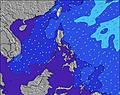 | 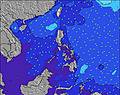 | 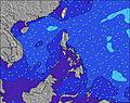 | 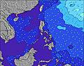 | 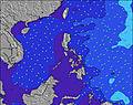 | 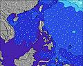 | 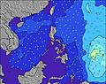 | ||||||||||||
Wave Height (m) Direction Period (s) | NNW 6 | N 5 | NNW 6 | W 6 | N 5 | NNW 5 | NNW 5 | W 5 | N 6 | W 5 | WNW 8 | W 8 | N 6 | W 9 | W 9 | NW 7 | W 9 | W 10 | W 10 |
Wave Graph | |||||||||||||||||||
51 | 14 | 10 | 51 | 8 | 28 | 12 | 2 | 1 | 9 | 51 | 280 | 1 | 763 | 919 | 89 | 1104 | 1559 | 1614 | |
Wind (km/h) | |||||||||||||||||||
Wind State on-shore cross-onshore cross-shore cross-offshore off-shore glassy | cross-off | off | cross-off | cross-off | off | cross-off | glassy | cross | cross | cross-on | cross-on | cross | cross-on | cross | cross-on | cross-on | cross-on | cross-on | cross-on |
High Tide | 1:52AM0.51m | 11:44AM0.63m | 2:00AM0.62m | 12:12PM0.49m | 2:30AM0.75m | 3:13AM0.87m | 4:05AM0.98m | 5:03AM1.06m | |||||||||||
Low Tide | 5:16AM0.48m | 6:53PM0.37m | 8:53AM0.47m | 6:13PM0.38m | 4:00PM0.33m | 2:19PM0.20m | 3:00PM0.09m | 3:47PM0.01m | |||||||||||
— | 5:39 | — | — | 5:39 | — | — | 5:39 | — | — | 5:39 | — | — | 5:39 | — | — | 5:39 | — | — | |
6:30 | — | 6:29 | — | — | 6:29 | — | — | 6:29 | — | — | 6:28 | — | — | 6:28 | — | — | 6:27 | — | |
mm | 9 | 8 | 24 | 42 | 89 | 82 | 19 | 2 | — | 10 | 12 | 12 | 26 | 13 | 18 | 34 | 19 | 16 | 27 |
Temp °C | 26 | 26 | 26 | 26 | 25 | 25 | 26 | 28 | 29 | 27 | 28 | 28 | 28 | 28 | 28 | 28 | 28 | 28 | 28 |
Feels °C | 27 | 30 | 30 | 28 | 24 | 27 | 30 | 31 | 33 | 31 | 32 | 32 | 30 | 31 | 30 | 30 | 29 | 29 | 29 |
Swell 1 Height (m) Direction Period (s) | NNW 6 | N 5 | W 6 | W 6 | W 7 | WSW 7 | WSW 8 | WSW 8 | WSW 8 | WSW 9 | W 8 | W 8 | N 6 | W 9 | — | NW 7 | NNE 14 | W 10 | NNE 14 |
51 | 14 | 86 | 51 | 109 | 73 | 81 | 150 | 160 | 295 | 309 | 280 | 1 | 763 | — | 89 | 20 | 1559 | 41 | |
Swell 2 Height (m) Direction Period (s) | W 6 | N 8 | NNW 6 | N 6 | N 5 | — | NNW 5 | NNW 4 | N 6 | N 5 | — | WNW 8 | — | N 6 | — | N 14 | — | NNE 14 | N 14 |
36 | 1 | 10 | 15 | 8 | — | 12 | 2 | 1 | 1 | — | 14 | — | 1 | — | 4 | — | 20 | 16 | |
Swell 3 Height (m) Direction Period (s) | — | — | — | — | — | — | — | N 6 | — | — | — | — | — | — | — | — | — | — | — |
— | — | — | — | — | — | — | 1 | — | — | — | — | — | — | — | — | — | — | — | |
Wind waves Height (m) Direction Period (s) | S 4 | WSW 6 | S 3 | S 3 | NW 5 | NNW 5 | — | W 5 | — | W 5 | WNW 8 | WSW 3 | WSW 9 | WNW 7 | W 9 | WSW 10 | W 9 | W 10 | W 10 |
7 | 104 | 6 | 6 | 6 | 28 | — | 2 | — | 9 | 51 | 1 | 1038 | 50 | 919 | 920 | 1104 | 216 | 1614 | |
Nearest Offshore or Glassy | |||||||||||||||||||
Distance (km) | 158 | 158 | 141 | 80 | 139 | 80 | 80 | 158 | 158 | 158 | 158 | 1 | 166 | 1 | 166 | 166 | 401 | 401 | 401 |
Best forecast wave conditions in West Luzon | |||||||||||||||||||
Best forecast wave conditions in Philippines | |||||||||||||||||||
Header Global | |||||||||||||||||||
- Map Icons:
 Break
Break Live Wave Height (m)
 Live Wind Speed (km/h)
 Surf Rating (10 Max)
 Ocean Swells (m)
- Wind Speed (km/h)
Latest Updates


FREE! Surf-Forecast.com widget for your website
The surf report / weather widget below is available to embed on third party websites free of charge and provides a summary of our Urbiztondo Beach surf forecast. Simply grab the html code snippet that we provide and paste it into your own site. You can choose your preferred language and metric/imperial units for the surf forecast feed to suit users of your site. Click here to get the code.
Information about the Urbiztondo Beach Surf forecast
The above surf forecast table for Urbiztondo Beach provides essential information for determining whether the surfing conditions will be good over the next 16 days. A general guide to surfing at Urbiztondo Beach can be found by selecting the local surf guide option on the grey menu. Our Urbiztondo Beach surf forecast is unique since it includes wave energy (power) that defines the real feel of the surf rather than just the height or the period. If you surf the same spot (Urbiztondo Beach) regularly then make a mental note of the wave energy from the surf forecast table each time you go. Very soon you may start to choose your surf days based on the wave energy alone combined with our forecast of favourable offshore wind conditions. Our star ratings will help here and of course you will also find the usual wave height and period predictions on our surf forecasts as well as a full break down of the swell components under our advanced users option (to reveal that, click the little Einstein character under the tide times).
Further information to help with frequently asked questions about our surf forecast for Urbiztondo Beach may be found under the help tab on the top menu and also by moving your mouse over the question marks on the surf forecast table itself. Please always bear in mind that the forecast is for near-shore open water and local factors at each surf break influence the actual breaking wave height, such as the beach / reef profile, water depths offshore and shelter.
Urbiztondo Beach is 5 km (3 miles) from San Fernando. If you plan a holiday in West Luzon, look for hotels and other accommodation in San Fernando. San Fernando has rooms for a wide range of budgets as well as car hire and transport links.
 Nearest