

Surf Forecasts:

Playa Azul surf forecast from 9 Jul 2026:
- Best quality surf: Thursday 9 Jul, 3AM (local time) - 4.5ft (1.4m), 16s period, SSW swell with offshore winds.
- Most powerful swell: Thursday 9 Jul, 3AM (local time) - 4.5ft (1.4m), 16s period, SSW swell with 1,003 kJ wave energy.
- Next surfable swell (1★+): Thursday 9 Jul, 3AM (local time) - 4.5ft (1.4m), 16s period with SSW swell.
Best Forecast Surf Conditions for Playa Azul this week:
The surf forecast for Playa Azul over the next 16 days: The first swell (rated 1 star or higher) is forecast to arrive on Thursday (Jul 09) at 3AM. The primary swell is predicted to be 1.4m and 16s period with a secondary swell of 0.4m and 9s. The wind is predicted to be offshore as the swell arrives.
The most powerful waves expected at Playa Azul in the next 16 days are 1.4m 16s and forecast to arrive on Thursday (Jul 09) at 3AM. Winds are predicted to be offshore at the time the swell arrives. The largest open ocean swell (not directed at the beach) is 0.3m 3s period and expected on Monday (Jul 13) at 6AM.
| Wave Type | Time (CST) & Date | Wave Height & Period |
|---|---|---|
| Next good surf (1 star+) | 3AM (Thu 9th Jul) | 4.5ft (1.4m) 16s |
| Best Surf | 3AM (Thu 9th Jul) | 4.5ft (1.4m) 16s |
| Most Powerful | 3AM (Thu 9th Jul) | 4.5ft (1.4m) 16s |
Table - best surf conditions forecast for Playa Azul over the next 16 days.
Alright, let’s get into it. This is Rusty, and I’m looking at the only game in town for the next couple of weeks: Playa Azul.
Right off the bat, the water is sitting at 88°F – that’s more than 3°F warmer than normal for this time of year. Feels like a bath out there, so a thin wetsuit or just boardshorts is the call.
We’ve got a solid run of waves coming through, but the quality is going to be a real mixed bag because of the wind. The first few days are the kicker. Don’t even bother paddling out this afternoon (Wednesday, July 8th) – the 5ft SSW swell is getting chopped up by a 9 mph cross-onshore wind. The energy is pumping (1087), but it’s a mess.
The real standout, and the best bet on offer, is Thursday morning, July 9th. We’ve got glassy conditions with a light N wind at 3 mph, and that 4ft groundswell from the SSW (period of 15 seconds) will be reeling off clean. The energy is still strong (871), and with the water flat, it’s going to be a session to remember. Get out there early, because the afternoon turns into a crumbly, choppy cross-on mess again.
The same pattern repeats for Friday, July 10th – a glassy morning with 0 mph wind and 4ft of clean SSW swell. It’s a bit smaller but still a great window for a longboard or a funboard. The afternoons are a write-off.
Look, for the first week, it’s all about the early bird. The mornings from the 9th through the 13th are consistently clean with light offshore or cross-offshore winds and swell holding between 3ft and 4ft (SSW). The energy stays in the moderate to strong range (500-900). The crowds are listed as "sometimes," so you might see a few others out, but nothing crazy.
Saturday, July 11th morning is a good call with clean conditions and a 4ft SSW swell. But the afternoon brings a risk of thunderstorms and a cross-on wind, so keep an eye on the sky.
Now, into the second week, things get interesting again. Wednesday, July 15th has a small window of clean 4ft swell from the SSE in the morning, but the period drops to 9 seconds – short period, more of a wind swell vibe. The setup is okay, but not as good as the previous week.
Thursday, July 16th is a major highlight. Both morning and afternoon are looking solid with 5ft to 5ft of S/SSW swell, clean cross-offshore winds, and moderate energy (768-840). This is the best swell size of the run, and with the right wind, it’s a solid intermediate to advanced wave. Because it’s a long-period groundswell (12 seconds), it’s going to be a bigger, more powerful wave at the point.
Friday, July 17th is another winner. 5ft to 5ft of clean SSW swell, with glassy conditions in the afternoon. That afternoon session is a gem.
After that, the swell drops off significantly. Saturday, July 18th has a tiny 1ft wave in the morning – glassy, but barely enough to ride. The rest of the run from the 19th to the 23rd is small, with 2ft to 4ft of swell. There are some clean windows in the mornings, especially Monday, July 20th afternoon (clean 4ft SW), and Tuesday, July 21st morning (clean 4ft SW), but the energy is dropping. It’s still surfable for a log or a funboard, but the punch is gone.
Overall, this is a solid run for Playa Azul. The window is wide open. The absolute best is Thursday, July 9th and Friday, July 10th mornings for the glass and the long-period groundswell. For a bit more size, Thursday, July 16th and Friday, July 17th are the standouts in the second week. Don’t sleep on those early sessions.
Rusty.
Short Range ForecastLight rain (total 2mm), mostly falling on Wed night. Warm (max 32°C on Thu afternoon, min 26°C on Wed night). Wind will be generally light. | Days 5-7 Weather SummaryHeavy rain (total 28mm), heaviest during Sun night. Warm (max 31°C on Sun morning, min 26°C on Mon night). Wind will be generally light. | ||||||||||||||||||||
Wed 8 | Thursday 9 | Friday 10 | Saturday 11 | Sunday 12 | Monday 13 | Tuesday 14 | |||||||||||||||
PM | Night | AM | PM | Night | AM | PM | Night | AM | PM | Night | AM | PM | Night | AM | PM | Night | AM | PM | Night | AM | |
Swell Height Map |  |  |  | 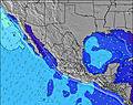 | 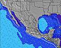 | 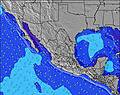 | 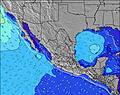 | 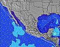 | |||||||||||||
Wave Height (m) Direction Period (s) | SSW 16 | SSW 16 | SSW 15 | SSW 15 | SSW 15 | SSW 15 | SSW 15 | SSW 15 | SSW 14 | SSW 16 | SSW 15 | SSW 14 | SSW 14 | SSW 14 | SSW 13 | SSW 13 | SSW 13 | SSW 13 | SW 18 | SSE 10 | SSE 9 |
Wave Graph | |||||||||||||||||||||
1029 | 1003 | 826 | 784 | 610 | 619 | 636 | 544 | 515 | 796 | 679 | 557 | 472 | 384 | 342 | 336 | 273 | 246 | 319 | 426 | 218 | |
Wind (km/h) | |||||||||||||||||||||
Wind State on-shore cross-onshore cross-shore cross-offshore off-shore glassy | cross-on | off | glassy | cross-on | cross-off | glassy | cross-on | cross-off | cross-off | cross-on | off | cross-off | on | cross-off | cross-off | on | off | off | cross-on | glassy | off |
High Tide | 5:05PM0.55m | 9:45AM0.68m | 5:47PM0.59m | 10:01AM0.73m | 6:31PM0.63m | 10:29AM0.75m | 7:15PM0.67m | 11:03AM0.76m | 7:57PM0.70m | 11:41AM0.73m | 8:38PM0.72m | 12:22PM0.70m | 9:15PM0.70m | ||||||||
Low Tide | 1:35AM0.18m | 2:50PM0.56m | 1:58AM0.07m | 3:05PM0.57m | 2:31AM-0.02m | 3:24PM0.58m | 3:08AM-0.08m | 3:47PM0.58m | 3:48AM-0.09m | 4:14PM0.58m | 4:29AM-0.06m | 4:44PM0.57m | 5:09AM0.02m | ||||||||
— | — | 6:20 | — | — | 6:20 | — | — | 6:20 | — | — | 6:20 | — | — | 6:20 | — | — | 6:22 | — | — | 6:22 | |
7:29 | — | — | 7:29 | — | — | 7:29 | — | — | 7:29 | — | — | 7:29 | — | — | 7:29 | — | — | 7:29 | — | 7:29 | |
mm | — | 2 | — | — | — | — | — | — | — | 2 | 1 | 2 | 1 | 7 | 6 | — | 7 | 2 | — | — | — |
Temp °C | 31 | 29 | 31 | 32 | 29 | 30 | 32 | 29 | 32 | 30 | 29 | 31 | 31 | 29 | 29 | 31 | 28 | 30 | 31 | 28 | 31 |
Feels °C | 33 | 34 | 33 | 33 | 32 | 32 | 33 | 32 | 35 | 34 | 34 | 35 | 35 | 35 | 34 | 34 | 32 | 33 | 33 | 32 | 33 |
Swell 1 Height (m) Direction Period (s) | SSW 16 | SSW 16 | SSW 15 | SSW 15 | SSW 15 | SSW 15 | SSW 15 | SSW 15 | SSW 14 | SSW 16 | SSW 15 | SSW 14 | SSW 14 | SSW 14 | SSW 13 | SSW 13 | SSW 13 | SSW 13 | SSE 11 | SSE 10 | SSE 9 |
1029 | 1003 | 826 | 784 | 610 | 619 | 636 | 544 | 515 | 796 | 679 | 557 | 472 | 384 | 342 | 336 | 273 | 246 | 281 | 426 | 218 | |
Swell 2 Height (m) Direction Period (s) | S 14 | SSE 9 | SSE 8 | SSE 8 | W 4 | S 10 | S 10 | WSW 5 | SSE 10 | S 10 | W 5 | S 9 | S 9 | S 9 | SSE 9 | SSE 8 | SSE 8 | SSE 8 | SSW 13 | SSW 14 | S 12 |
4 | 25 | 28 | 51 | 7 | 74 | 72 | 24 | 54 | 70 | 19 | 60 | 55 | 39 | 43 | 38 | 40 | 43 | 189 | 180 | 184 | |
Swell 3 Height (m) Direction Period (s) | S 14 | SSE 14 | SSE 13 | SSE 13 | S 12 | SSW 20 | SSW 20 | S 18 | W 5 | S 22 | S 10 | W 6 | WSW 6 | SSW 21 | SSW 19 | SSW 19 | SSW 19 | SSW 18 | SW 18 | SSW 18 | SW 16 |
16 | 20 | 17 | 33 | 69 | 75 | 37 | 227 | 14 | 9 | 67 | 16 | 12 | 89 | 146 | 251 | 148 | 209 | 319 | 209 | 129 | |
Wind waves Height (m) Direction Period (s) | S 9 | — | — | S 13 | WNW 4 | — | W 4 | W 5 | — | WSW 3 | — | — | — | — | — | SW 6 | — | — | — | — | — |
38 | — | — | 163 | 17 | — | 4 | 82 | — | 7 | — | — | — | — | — | 6 | — | — | — | — | — | |
Nearest Offshore or Glassy | |||||||||||||||||||||
Distance (km) | 414 | 0 | 0 | 414 | 0 | 0 | 440 | 0 | 0 | 443 | 0 | 0 | 443 | 0 | 0 | 84 | 0 | 0 | 440 | 0 | 0 |
Best forecast wave conditions in Michoacan | |||||||||||||||||||||
Best forecast wave conditions in Mexico | |||||||||||||||||||||
Header Global | |||||||||||||||||||||
- Map Icons:
 Break
Break Live Wave Height (m)
 Live Wind Speed (km/h)
 Surf Rating (10 Max)
 Ocean Swells (m)
- Wind Speed (km/h)


FREE! Surf-Forecast.com widget for your website
The surf report / weather widget below is available to embed on third party websites free of charge and provides a summary of our Playa Azul surf forecast. Simply grab the html code snippet that we provide and paste it into your own site. You can choose your preferred language and metric/imperial units for the surf forecast feed to suit users of your site. Click here to get the code.
Information about the Playa Azul Surf forecast
The above surf forecast table for Playa Azul provides essential information for determining whether the surfing conditions will be good over the next 16 days. A general guide to surfing at Playa Azul can be found by selecting the local surf guide option on the grey menu. Our Playa Azul surf forecast is unique since it includes wave energy (power) that defines the real feel of the surf rather than just the height or the period. If you surf the same spot (Playa Azul) regularly then make a mental note of the wave energy from the surf forecast table each time you go. Very soon you may start to choose your surf days based on the wave energy alone combined with our forecast of favourable offshore wind conditions. Our star ratings will help here and of course you will also find the usual wave height and period predictions on our surf forecasts as well as a full break down of the swell components under our advanced users option (to reveal that, click the little Einstein character under the tide times).
Further information to help with frequently asked questions about our surf forecast for Playa Azul may be found under the help tab on the top menu and also by moving your mouse over the question marks on the surf forecast table itself. Please always bear in mind that the forecast is for near-shore open water and local factors at each surf break influence the actual breaking wave height, such as the beach / reef profile, water depths offshore and shelter.
Playa Azul is 26 km (16 miles) from La Orilla. If you plan a holiday in Michoacan, look for hotels and other accommodation in La Orilla. La Orilla has rooms for a wide range of budgets as well as car hire and transport links.
 Nearest