

Surf Forecasts:

Tybee Pier surf forecast from 3 Aug 2026:
- Best quality surf: Monday 3 Aug, 11PM (local time) - 3.5ft (1.0m), 6s period, S swell with cross-offshore winds.
- Most powerful swell: Monday 3 Aug, 8PM (local time) - 5.5ft (1.7m), 6s period, S swell with 218 kJ wave energy.
- Next surfable swell (1★+): Monday 3 Aug, 11PM (local time) - 3.5ft (1.0m), 6s period with S swell.
Best Forecast Surf Conditions for Tybee Pier this week:
The surf forecast for Tybee Pier over the next 16 days: The first swell (rated 1 star or higher) is forecast to arrive on Monday (Aug 03) at 11PM. The primary swell is predicted to be 1.0m and 6s period with a secondary swell of 0.4m and 7s. The wind is predicted to be cross-offshore as the swell arrives.
The most powerful waves expected at Tybee Pier in the next 16 days are 1.7m 6s and forecast to arrive on Monday (Aug 03) at 8PM. Winds are predicted to be cross-offshore at the time the swell arrives. The largest open ocean swell (not directed at the beach) is 0.8m 5s period and expected on Monday (Aug 03) at 2AM.
| Wave Type | Time (EDT) & Date | Wave Height & Period |
|---|---|---|
| Next good surf (1 star+) | 11PM (Mon 3rd Aug) | 3.5ft (1.0m) 6s |
| Best Surf | 11PM (Mon 3rd Aug) | 3.5ft (1.0m) 6s |
| Most Powerful | 8PM (Mon 3rd Aug) | 5.5ft (1.7m) 6s |
Table - best surf conditions forecast for Tybee Pier over the next 16 days.
The Lowdown
Alright, this is Rusty. Let's be straight with you. I've had a good look at the charts for the next couple of weeks, and honestly, for Tybee Pier, it's looking like a real bust. The whole 16-day window is a graveyard of flat, wind-battered, or just plain messy conditions. There's nothing on offer that a surfer would get excited about.
We're starting off Monday the 3rd of August and running through a solid stretch of poor surf. The energy is weak, barely registering (combined energy of all swells directed here is 41) with a tiny 3ft swell from the SSW and a short, choppy 4-second period. The wind is a fresh cross-offshore, which is about the only positive, but the waves themselves are just a mess. This pattern of tiny, weak swell and average to poor wind holds through the entire first week and into the second.
There is a substantial gap here. The first glimmer of anything that isn't "poor" doesn't show up until Sunday the 16th of August. The morning of the 16th finally gives us a "surfable" rating, but it's very ordinary. You're looking at a 2ft SSE swell (60 combined energy) with a clean, gentle offshore wind from the NW. That's the best of the bunch, but it's barely a knee-high dribbler. The waves are likely to be weak and slow.
The next day, Monday the 17th, shows a little more energy (129 combined energy) with a 3ft SE swell, but the wind swings onshore, killing any chance of it being decent. The period is still short at 6 seconds, so it's just a messy, blown-out shorebreak.
The water temperature at Tybee Pier is about average for this time of year, so no strange anomalies to report there. Look, I hate to be the bearer of bad news, but this is one of those times where the ocean just isn't cooperating. There's nothing here for a paddle surfer. The whole setup is more interesting for a kite surfer with the consistent onshore winds, but for a wave count, you're better off waiting for the next system.
Rusty.
Short Range ForecastHeavy rain (total 25mm), heaviest during Sun night. Warm (max 30°C on Sun night, min 25°C on Sun night). Mainly fresh winds. | Days 5-7 Weather SummaryModerate rain (total 19mm), heaviest on Thu morning. Warm (max 30°C on Thu afternoon, min 27°C on Fri night). Wind will be generally light. | ||||||||||||||||||
Monday 3 | Tuesday 4 | Wednesday 5 | Thursday 6 | Friday 7 | Saturday 8 | ||||||||||||||
Night | AM | PM | Night | AM | PM | Night | AM | PM | Night | AM | PM | Night | AM | PM | Night | AM | PM | Night | |
Swell Height Map |  | 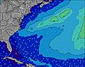 | 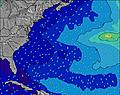 | 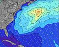 | 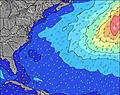 | 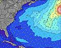 | 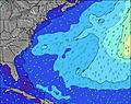 | ||||||||||||
Wave Height (m) Direction Period (s) | SE 7 | SSW 4 | S 6 | S 6 | S 5 | SSE 4 | SE 6 | ESE 6 | SE 7 | SE 7 | SE 5 | SE 5 | SE 7 | SE 6 | SE 7 | SE 7 | SE 8 | ESE 8 | SE 8 |
Wave Graph | |||||||||||||||||||
29 | 29 | 88 | 58 | 19 | 36 | 27 | 22 | 47 | 12 | 18 | 16 | 43 | 51 | 67 | 49 | 62 | 112 | 62 | |
Wind (km/h) | |||||||||||||||||||
Wind State on-shore cross-onshore cross-shore cross-offshore off-shore glassy | cross-off | cross-off | cross-off | cross | cross-off | cross-on | cross | cross | cross-on | cross | cross-on | cross-on | cross-on | on | on | cross-on | cross-on | on | cross-on |
High Tide | 11:16PM2.10m | 11:44AM2.10m | 00:02AM2.05m | 12:35PM2.15m | 00:54AM1.99m | 1:31PM2.21m | 1:52AM1.94m | 2:30PM2.26m | 2:54AM1.91m | 3:33PM2.31m | 3:59AM1.90m | 4:39PM2.37m | |||||||
Low Tide | 6:03AM0.03m | 6:23PM0.23m | 6:47AM0.04m | 7:16PM0.28m | 7:36AM0.05m | 8:16PM0.33m | 8:33AM0.06m | 9:23PM0.34m | 9:35AM0.05m | 10:32PM0.31m | 10:41AM0.02m | 11:38PM0.24m | |||||||
— | 6:39 | — | — | 6:39 | — | — | 6:41 | — | — | 6:41 | — | — | 6:41 | — | — | 6:43 | — | — | |
8:19 | — | 8:19 | — | — | 8:17 | — | — | 8:16 | — | — | 8:15 | — | — | 8:15 | — | — | 8:14 | — | |
mm | 5 | 5 | 2 | 4 | 1 | 2 | 6 | — | — | 5 | 6 | — | 5 | 1 | 2 | — | — | — | — |
Temp °C | 30 | 27 | 25 | 27 | 28 | 30 | 29 | 28 | 29 | 29 | 29 | 30 | 29 | 28 | 29 | 28 | 28 | 29 | 28 |
Feels °C | 29 | 26 | 24 | 29 | 30 | 31 | 30 | 30 | 30 | 30 | 32 | 32 | 31 | 31 | 31 | 30 | 31 | 30 | 32 |
Swell 1 Height (m) Direction Period (s) | SE 7 | SE 7 | ESE 7 | ESE 8 | ESE 6 | ESE 6 | SE 6 | ESE 6 | — | SE 5 | SE 5 | SE 7 | — | SE 6 | SE 7 | — | SE 8 | ESE 8 | — |
29 | 12 | 21 | 6 | 17 | 26 | 27 | 22 | — | 7 | 18 | 12 | — | 51 | 67 | — | 62 | 112 | — | |
Swell 2 Height (m) Direction Period (s) | S 6 | — | — | — | — | — | — | — | — | SE 7 | SE 7 | — | — | E 11 | E 11 | — | — | — | — |
19 | — | — | — | — | — | — | — | — | 12 | 12 | — | — | 2 | 2 | — | — | — | — | |
Swell 3 Height (m) Direction Period (s) | — | — | — | — | — | — | — | — | — | — | ESE 7 | — | — | — | — | — | — | — | — |
— | — | — | — | — | — | — | — | — | — | 5 | — | — | — | — | — | — | — | — | |
Wind waves Height (m) Direction Period (s) | SSW 5 | SSW 4 | S 6 | S 6 | S 5 | SSE 4 | S 5 | SSW 5 | SE 7 | SSW 4 | — | SE 5 | SE 7 | SE 6 | SE 7 | SE 7 | — | SE 8 | SE 8 |
24 | 29 | 88 | 58 | 19 | 36 | 12 | 7 | 47 | 12 | — | 16 | 43 | 27 | 36 | 49 | — | 67 | 62 | |
Nearest Offshore or Glassy | |||||||||||||||||||
Distance (km) | 181 | 239 | 1112 | 696 | 216 | 335 | 198 | 257 | 357 | 234 | 343 | 1316 | 1124 | 824 | 824 | 824 | 219 | 917 | 194 |
Best forecast wave conditions in Georgia | |||||||||||||||||||
Best forecast wave conditions in United States | |||||||||||||||||||
Header Global | |||||||||||||||||||
- Map Icons:
 Break
Break Live Wave Height (m)
 Live Wind Speed (km/h)
 Surf Rating (10 Max)
 Ocean Swells (m)
- Wind Speed (km/h)
Latest Updates


FREE! Surf-Forecast.com widget for your website
The surf report / weather widget below is available to embed on third party websites free of charge and provides a summary of our Tybee Pier surf forecast. Simply grab the html code snippet that we provide and paste it into your own site. You can choose your preferred language and metric/imperial units for the surf forecast feed to suit users of your site. Click here to get the code.
Information about the Tybee Pier Surf forecast
The above surf forecast table for Tybee Pier provides essential information for determining whether the surfing conditions will be good over the next 16 days. A general guide to surfing at Tybee Pier can be found by selecting the local surf guide option on the grey menu. Our Tybee Pier surf forecast is unique since it includes wave energy (power) that defines the real feel of the surf rather than just the height or the period. If you surf the same spot (Tybee Pier) regularly then make a mental note of the wave energy from the surf forecast table each time you go. Very soon you may start to choose your surf days based on the wave energy alone combined with our forecast of favourable offshore wind conditions. Our star ratings will help here and of course you will also find the usual wave height and period predictions on our surf forecasts as well as a full break down of the swell components under our advanced users option (to reveal that, click the little Einstein character under the tide times).
Further information to help with frequently asked questions about our surf forecast for Tybee Pier may be found under the help tab on the top menu and also by moving your mouse over the question marks on the surf forecast table itself. Please always bear in mind that the forecast is for near-shore open water and local factors at each surf break influence the actual breaking wave height, such as the beach / reef profile, water depths offshore and shelter.
Are you planning a vacation in Georgia? If you are looking for accommodation near Tybee Pier, camping, hotels and condos and appartments in Georgia, consider staying in Wilmington Island which is 12 km (7 miles) away. Other places in and around Georgia where you can find information about places to rent, and car hire include Point Comfort which is 20 km (12 miles) away, Savannah, Hilton Head Island and Port Royal.
 Nearest