

Surf Forecasts:

21st Street (Miami) surf forecast from 3 Aug 2026:
- Most powerful swell: Friday 7 Aug, 2PM (local time) - 5ft (1.5m), 6s period, E swell with 144 kJ wave energy.
Best Forecast Surf Conditions for 21st Street (Miami) this week:
The most powerful waves expected at 21st Street (Miami) in the next 16 days are 1.5m 6s and forecast to arrive on Friday (Aug 07) at 2PM. Winds are predicted to be onshore at the time the swell arrives. The largest open ocean swell (not directed at the beach) is 0.5m 5s period and expected on Saturday (Aug 08) at 8PM.
| Wave Type | Time (EDT) & Date | Wave Height & Period |
|---|---|---|
| Next good surf (1 star+) | - | - |
| Best Surf | - | - |
| Most Powerful | 2PM (Fri 7th Aug) | 5ft (1.5m) 6s |
Table - best surf conditions forecast for 21st Street (Miami) over the next 16 days.
The Lowdown
Alright, this is Rusty. Let’s be real with you: the outlook for the next couple of weeks here is pretty grim. I’ve been looking at the numbers, and there’s just nothing to get excited about for a proper paddle session. We’re looking at a long stretch of weak, short-period windswell and onshore or cross-onshore winds that will keep things messy. The first day with any surf recommendation isn’t until Monday the 3rd of August, and honestly, it’s a letdown straight away.
Monday morning the 3rd of August, 21st Street (Miami) is showing a tiny 0.7 ft swell from the east, with a period of just 8 seconds and a combined energy of only 12. That’s feeble. There’s a light cross breeze, but the water is only about average for the time of year, and the whole setup is just poor surf conditions. It’s not worth paddling out for. That afternoon the wind picks up and the period drops to 3 seconds, making it even worse.
The whole of the first week is a washout. We get a few small pulses, but the swell stays under 3 ft for most of it, with periods between 3 and 8 seconds. The wind is almost always onshore or cross-onshore, from the ESE or E, and the combined energy barely cracks 100, hitting 115 on Friday morning the 7th of August when the swell bumps to 5 ft. That’s the only three-digit energy reading, but with a 5-second period and strong onshore wind, it’s just a choppy, blown-out mess. That’s more of a kite surfer’s setup than a paddle surfer’s.
The second week doesn’t offer any redemption. From Monday the 10th of August right through to Tuesday the 18th of August, it’s the same story: tiny swell, mostly under 3 ft, with periods between 4 and 6 seconds. The combined energy hangs around in the teens, twenties, and low seventies, and the wind is consistently onshore or cross-onshore. There’s no standout day, no window of clean, rideable surf. The best we see is a few mornings with a light cross breeze, like on the 17th of August, but the swell is still only 4 ft with a 6-second period and a combined energy of 70 – not enough to make it worthwhile.
For this area, a blank run like this is more normal than unusual. It’s a tough stretch, but forecasts can change. Keep your eyes on the horizon, but for now, I’d leave the board in the car.
Rusty.
Short Range ForecastHeavy rain (total 23mm), heaviest during Mon night. Warm (max 30°C on Mon morning, min 27°C on Sun night). Wind will be generally light. | Days 5-7 Weather SummaryHeavy rain (total 23mm), heaviest during Wed night. Warm (max 29°C on Wed night, min 28°C on Fri night). Mainly fresh winds. | ||||||||||||||||||
Monday 3 | Tuesday 4 | Wednesday 5 | Thursday 6 | Friday 7 | Saturday 8 | ||||||||||||||
Night | AM | PM | Night | AM | PM | Night | AM | PM | Night | AM | PM | Night | AM | PM | Night | AM | PM | Night | |
Swell Height Map |  |  |  |  | 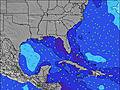 | 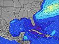 | 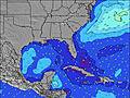 | ||||||||||||
Wave Height (m) Direction Period (s) | E 8 | E 8 | ESE 3 | E 8 | E 8 | E 8 | E 8 | SE 4 | SE 4 | E 4 | E 5 | E 5 | E 5 | E 5 | E 6 | E 5 | E 5 | ESE 5 | E 5 |
Wave Graph | |||||||||||||||||||
5 | 5 | 7 | 10 | 10 | 10 | 10 | 9 | 14 | 22 | 45 | 36 | 57 | 113 | 98 | 55 | 54 | 38 | 42 | |
Wind (km/h) | |||||||||||||||||||
Wind State on-shore cross-onshore cross-shore cross-offshore off-shore glassy | on | cross | cross | on | cross | on | on | cross-on | on | on | on | on | on | on | cross-on | on | cross-on | cross-on | cross-on |
High Tide | 11:41PM0.79m | 12:11PM0.78m | 00:21AM0.77m | 1:01PM0.77m | 1:07AM0.76m | 1:58PM0.76m | 2:01AM0.74m | 3:02PM0.75m | 3:04AM0.73m | 4:11PM0.77m | 4:13AM0.74m | 5:20PM0.79m | |||||||
Low Tide | 5:56AM0.00m | 6:16PM0.08m | 6:40AM-0.00m | 7:05PM0.11m | 7:31AM-0.00m | 8:01PM0.15m | 8:30AM-0.00m | 9:05PM0.17m | 9:35AM-0.00m | 10:15PM0.17m | 10:44AM-0.02m | 11:25PM0.14m | |||||||
— | 6:47 | — | — | 6:48 | — | — | 6:48 | — | — | 6:48 | — | — | 6:48 | — | — | 6:50 | — | — | |
8:06 | — | 8:05 | — | — | 8:04 | — | — | 8:04 | — | — | 8:02 | — | — | 8:01 | — | — | 8:01 | — | |
mm | 4 | — | 2 | 12 | — | — | 4 | — | 1 | 4 | 1 | 4 | 6 | 3 | 1 | — | 3 | 1 | 1 |
Temp °C | 29 | 30 | 30 | 28 | 29 | 30 | 29 | 29 | 30 | 29 | 29 | 29 | 29 | 29 | 29 | 29 | 29 | 29 | 29 |
Feels °C | 30 | 34 | 32 | 30 | 32 | 33 | 31 | 30 | 32 | 30 | 30 | 30 | 30 | 29 | 29 | 30 | 31 | 31 | 31 |
Swell 1 Height (m) Direction Period (s) | E 8 | E 8 | NE 8 | E 8 | E 8 | E 8 | E 8 | E 7 | E 7 | SSE 5 | SSE 4 | SSE 4 | S 6 | N 11 | SSE 5 | NE 8 | NE 9 | E 8 | NE 9 |
5 | 5 | 2 | 10 | 10 | 10 | 10 | 4 | 4 | 5 | 2 | 6 | 2 | 2 | 9 | 11 | 19 | 11 | 12 | |
Swell 2 Height (m) Direction Period (s) | E 5 | E 5 | E 8 | SSE 3 | NE 8 | NE 8 | NE 8 | NE 8 | NE 8 | — | N 8 | — | N 10 | — | — | NE 9 | NE 9 | NE 9 | NNE 9 |
2 | 2 | 5 | 1 | 2 | 2 | 2 | 2 | 2 | — | 1 | — | 2 | — | — | 12 | 12 | 12 | 8 | |
Swell 3 Height (m) Direction Period (s) | NE 8 | NE 8 | NE 8 | — | — | — | — | — | E 7 | — | — | — | — | — | — | — | — | NE 5 | — |
3 | 3 | 2 | — | — | — | — | — | 4 | — | — | — | — | — | — | — | — | 4 | — | |
Wind waves Height (m) Direction Period (s) | SE 3 | SSE 3 | ESE 3 | — | SSE 3 | SE 3 | SSE 4 | SE 4 | SE 4 | E 4 | E 5 | E 5 | E 5 | E 5 | E 6 | E 5 | E 5 | ESE 5 | E 5 |
2 | 2 | 7 | — | 1 | 2 | 2 | 9 | 14 | 22 | 45 | 36 | 57 | 113 | 98 | 55 | 54 | 38 | 42 | |
Nearest Offshore or Glassy | |||||||||||||||||||
Distance (km) | 234 | 448 | 1634 | 1167 | 448 | 234 | 234 | 448 | 941 | 448 | 915 | 1634 | 1149 | 338 | 338 | 338 | 338 | 1518 | 272 |
Best forecast wave conditions in South Florida | |||||||||||||||||||
Best forecast wave conditions in United States | |||||||||||||||||||
Header Global | |||||||||||||||||||
- Map Icons:
 Break
Break Live Wave Height (m)
 Live Wind Speed (km/h)
 Surf Rating (10 Max)
 Ocean Swells (m)
- Wind Speed (km/h)
Latest Updates


FREE! Surf-Forecast.com widget for your website
The surf report / weather widget below is available to embed on third party websites free of charge and provides a summary of our 21st Street (Miami) surf forecast. Simply grab the html code snippet that we provide and paste it into your own site. You can choose your preferred language and metric/imperial units for the surf forecast feed to suit users of your site. Click here to get the code.
Information about the 21st Street (Miami) Surf forecast
The above surf forecast table for 21st Street (Miami) provides essential information for determining whether the surfing conditions will be good over the next 16 days. A general guide to surfing at 21st Street (Miami) can be found by selecting the local surf guide option on the grey menu. Our 21st Street (Miami) surf forecast is unique since it includes wave energy (power) that defines the real feel of the surf rather than just the height or the period. If you surf the same spot (21st Street (Miami)) regularly then make a mental note of the wave energy from the surf forecast table each time you go. Very soon you may start to choose your surf days based on the wave energy alone combined with our forecast of favourable offshore wind conditions. Our star ratings will help here and of course you will also find the usual wave height and period predictions on our surf forecasts as well as a full break down of the swell components under our advanced users option (to reveal that, click the little Einstein character under the tide times).
Further information to help with frequently asked questions about our surf forecast for 21st Street (Miami) may be found under the help tab on the top menu and also by moving your mouse over the question marks on the surf forecast table itself. Please always bear in mind that the forecast is for near-shore open water and local factors at each surf break influence the actual breaking wave height, such as the beach / reef profile, water depths offshore and shelter.
21st Street (Miami) is 1 km (1 miles) from the city of Miami Beach. If you plan a vacation in South Florida, look for hotels and other accommodation in Miami Beach. Miami Beach has rooms for a wide range of budgets as well as car hire and transport links.
 Nearest