

Surf Forecasts:

Sharps Beach surf forecast from 10 Jul 2026:
- Best quality surf: Saturday 11 Jul, 4AM (local time) - 5.5ft (1.7m), 10s period, SSE swell with cross-offshore winds.
- Most powerful swell: Thursday 16 Jul, 1AM (local time) - 10ft (3.0m), 10s period, SSE swell with 1,778 kJ wave energy.
- Next surfable swell (1★+): Saturday 11 Jul, 4AM (local time) - 5.5ft (1.7m), 10s period with SSE swell.
Best Forecast Surf Conditions for Sharps Beach this week:
The surf forecast for Sharps Beach over the next 16 days: The first swell (rated 1 star or higher) is forecast to arrive on Saturday (Jul 11) at 4AM. The primary swell is predicted to be 1.7m and 10s period with a secondary swell of 0.3m and 14s. The wind is predicted to be cross-offshore as the swell arrives.
The most powerful waves expected at Sharps Beach in the next 16 days are 3.0m 10s and forecast to arrive on Thursday (Jul 16) at 1AM. Winds are predicted to be cross-onshore at the time the swell arrives. The largest open ocean swell (not directed at the beach) is 0.6m 3s period and expected on Monday (Jul 13) at 1AM.
| Wave Type | Time (AEST) & Date | Wave Height & Period |
|---|---|---|
| Next good surf (1 star+) | 4AM (Sat 11th Jul) | 5.5ft (1.7m) 10s |
| Best Surf | 4AM (Sat 11th Jul) | 5.5ft (1.7m) 10s |
| Most Powerful | 1AM (Thu 16th Jul) | 10ft (3.0m) 10s |
Table - best surf conditions forecast for Sharps Beach over the next 16 days.
Alright folks, Rusty here. Let’s have a look at what’s cooking at Sharps Beach over the next couple of weeks.
We’ve got a bit of a mixed bag on the cards. The first few days are actually worth paddling out for, with some decent size and clean conditions, but then a long, ugly stretch of wind and messy swell hits us. The real standout is going to be waiting for us in the second week.
Saturday morning, July 11th is your best early call. The water temp is about average for this time of year. We’re looking at a clean 2 ft swell from the SSE, with a light cross-offshore breeze. The wave energy is moderate (681), and the 10-second period means there’s some decent shape. It’s a fairly consistent beach and reef setup, but crowds are possible here, so get in early. The morning is the pick, as the afternoon goes a bit cross-on and smaller.
Sunday morning, July 12th still has some fun waves. A clean 4 ft swell from the SE with a proper offshore breeze from the WNW. The energy drops to moderate (287), but it’ll be clean and glassy. Not a standout, but a solid session.
Then we hit a wall. From Monday, July 13th through to Sunday, July 19th, the surf is pretty ordinary. The swell drops to almost nothing, or when it does pick up, the wind ruins it. The larger swells that arrive mid-week (over 10 ft) are accompanied by strong cross-onshore winds, making it a total mess. That’s a solid seven days of poor conditions. Honestly, for a beach and reef setup in those winds, it’s looking more interesting for kite surfing than paddle surfing.
Now, hang in there for Monday, July 20th. The morning brings a clean 6 ft swell from the ESE with a light cross-off breeze. The energy is moderate (630), and the setup is clean. It’s a very good session.
But the real highlight is Tuesday morning, July 21st. This is the one. We’ve got a 8 ft swell from the ESE with a 12-second period, which is a proper groundswell. The energy is strong (1538), and with a light cross-offshore wind, it’s going to be clean and powerful. This is excellent surf, but at 8 ft, it’s definitely for experienced surfers only. The afternoon gets blown out, so make that morning session count.
After that, the swell drops back down. Thursday morning, July 23rd offers a last gasp of clean, 4 ft surf from the S with light winds, but the energy is moderate (742). It’s a good finisher.
The very end of the run, from Friday, July 24th onwards, goes flat and small again. A long gap of poor to marginal surf takes us out to the end of the forecast.
So, to wrap it up: Saturday morning, July 11th is a great, clean opener, but the absolute standout is Tuesday morning, July 21st. That’s the one to circle on the calendar for a proper session, just make sure you’ve got the skill for it.
Rusty.
Short Range ForecastMostly dry. Warm (max 21°C on Sun afternoon, min 12°C on Fri night). Wind will be generally light. | Days 5-7 Weather SummaryLight rain (total 8mm), mostly falling on Wed afternoon. Very mild (max 18°C on Thu morning, min 11°C on Mon night). Winds increasing (light winds from the E on Tue afternoon, strong winds from the SSE by Thu morning). | ||||||||||||||||||||
Saturday 11 | Sunday 12 | Monday 13 | Tuesday 14 | Wednesday 15 | Thursday 16 | Fri 17 | |||||||||||||||
Night | AM | PM | Night | AM | PM | Night | AM | PM | Night | AM | PM | Night | AM | PM | Night | AM | PM | Night | AM | PM | |
Swell Height Map |  |  |  |  |  |  |  | 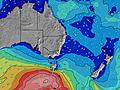 | |||||||||||||
Wave Height (m) Direction Period (s) | SE 11 | SSE 10 | ESE 12 | ESE 11 | SE 10 | ESE 10 | SE 9 | SE 9 | S 8 | S 8 | S 8 | ESE 10 | S 8 | S 5 | S 8 | SSE 10 | SSE 9 | SSE 8 | SSE 8 | SE 8 | SE 10 |
Wave Graph | |||||||||||||||||||||
777 | 439 | 429 | 396 | 248 | 175 | 71 | 39 | 34 | 34 | 22 | 10 | 43 | 42 | 880 | 1778 | 1678 | 1315 | 1176 | 1105 | 1631 | |
Wind (km/h) | |||||||||||||||||||||
Wind State on-shore cross-onshore cross-shore cross-offshore off-shore glassy | cross-off | cross-off | cross-on | cross-off | off | cross-off | cross-off | cross-off | cross-on | off | cross-off | cross-on | cross-off | cross | cross | cross-on | cross-on | cross-on | cross-on | cross-on | cross-on |
High Tide | 4:58AM1.00m | 5:57PM1.61m | 6:09AM1.02m | 6:52PM1.74m | 7:09AM1.06m | 7:43PM1.83m | 8:02AM1.09m | 8:31PM1.86m | 8:52AM1.12m | 9:17PM1.84m | 9:40AM1.14m | 10:01PM1.75m | 10:26AM1.14m | ||||||||
Low Tide | 11:33PM0.45m | 10:50AM0.24m | 00:42AM0.37m | 11:51AM0.21m | 1:39AM0.28m | 12:49PM0.17m | 2:30AM0.20m | 1:43PM0.13m | 3:16AM0.15m | 2:35PM0.11m | 4:00AM0.12m | 3:25PM0.12m | 4:42AM0.12m | 4:14PM0.16m | |||||||
— | 6:37 | — | — | 6:37 | — | — | 6:37 | — | — | 6:37 | — | — | 6:37 | — | — | 6:37 | — | — | 6:37 | — | |
— | — | 5:02 | — | — | 5:02 | — | — | 5:04 | — | — | 5:04 | — | — | 5:05 | — | — | 5:05 | — | — | 5:06 | |
mm | — | — | — | — | — | — | — | — | — | — | — | — | — | — | 2 | 4 | 2 | — | — | 2 | — |
Temp °C | 15 | 16 | 17 | 16 | 20 | 21 | 16 | 17 | 17 | 16 | 16 | 16 | 16 | 16 | 16 | 17 | 18 | 18 | 18 | 18 | 18 |
Feels °C | 14 | 16 | 15 | 13 | 16 | 18 | 11 | 16 | 15 | 12 | 13 | 13 | 14 | 9 | 8 | 9 | 9 | 10 | 11 | 11 | 12 |
Swell 1 Height (m) Direction Period (s) | SE 11 | SSE 10 | ESE 12 | ESE 11 | SE 10 | ESE 10 | SE 9 | SE 9 | S 8 | S 8 | S 8 | ESE 10 | S 8 | S 10 | — | — | NE 10 | NE 9 | NE 9 | ESE 11 | S 13 |
777 | 439 | 429 | 396 | 248 | 175 | 71 | 39 | 34 | 34 | 22 | 10 | 43 | 8 | — | — | 4 | 3 | 3 | 170 | 28 | |
Swell 2 Height (m) Direction Period (s) | ESE 15 | ESE 13 | SSE 10 | SSE 9 | S 9 | SSE 9 | SSE 8 | SSE 8 | SE 9 | SE 8 | ESE 10 | S 10 | ESE 10 | ESE 9 | — | — | — | — | S 15 | NE 9 | — |
21 | 235 | 214 | 84 | 39 | 25 | 22 | 22 | 27 | 10 | 10 | 9 | 9 | 9 | — | — | — | — | 4 | 3 | — | |
Swell 3 Height (m) Direction Period (s) | S 21 | S 19 | S 17 | S 16 | — | E 11 | ESE 11 | ESE 10 | ESE 10 | ESE 10 | ESE 7 | S 8 | SE 7 | N 10 | — | — | — | — | — | NE 9 | — |
8 | 7 | 6 | 5 | — | 2 | 22 | 21 | 20 | 20 | 5 | 5 | 2 | 2 | — | — | — | — | — | 3 | — | |
Wind waves Height (m) Direction Period (s) | — | — | — | NNW 3 | NW 3 | NW 4 | WSW 3 | SSW 2 | — | — | SSW 3 | S 4 | — | S 5 | S 8 | SSE 10 | SSE 9 | SSE 8 | SSE 8 | SE 8 | SE 10 |
— | — | — | 1 | 3 | 7 | 9 | 1 | — | — | 4 | 3 | — | 42 | 880 | 1778 | 1678 | 1315 | 1176 | 1105 | 1631 | |
Nearest Offshore or Glassy | |||||||||||||||||||||
Distance (km) | 0 | 0 | 22 | 0 | 0 | 0 | 1 | 0 | 75 | 0 | 261 | 252 | 1 | 194 | 34 | 530 | 495 | 366 | 320 | 320 | 320 |
Best forecast wave conditions in North Coast - New South Wales | |||||||||||||||||||||
Best forecast wave conditions in Australia | |||||||||||||||||||||
Header Global | |||||||||||||||||||||
- Map Icons:
 Break
Break Live Wave Height (m)
 Live Wind Speed (km/h)
 Surf Rating (10 Max)
 Ocean Swells (m)
- Wind Speed (km/h)


FREE! Surf-Forecast.com widget for your website
The surf report / weather widget below is available to embed on third party websites free of charge and provides a summary of our Sharps Beach surf forecast. Simply grab the html code snippet that we provide and paste it into your own site. You can choose your preferred language and metric/imperial units for the surf forecast feed to suit users of your site. Click here to get the code.
Information about the Sharps Beach Surf forecast
The above surf forecast table for Sharps Beach provides essential information for determining whether the surfing conditions will be good over the next 16 days. A general guide to surfing at Sharps Beach can be found by selecting the local surf guide option on the grey menu. Our Sharps Beach surf forecast is unique since it includes wave energy (power) that defines the real feel of the surf rather than just the height or the period. If you surf the same spot (Sharps Beach) regularly then make a mental note of the wave energy from the surf forecast table each time you go. Very soon you may start to choose your surf days based on the wave energy alone combined with our forecast of favourable offshore wind conditions. Our star ratings will help here and of course you will also find the usual wave height and period predictions on our surf forecasts as well as a full break down of the swell components under our advanced users option (to reveal that, click the little Einstein character under the tide times).
Further information to help with frequently asked questions about our surf forecast for Sharps Beach may be found under the help tab on the top menu and also by moving your mouse over the question marks on the surf forecast table itself. Please always bear in mind that the forecast is for near-shore open water and local factors at each surf break influence the actual breaking wave height, such as the beach / reef profile, water depths offshore and shelter.
 Nearest