

Surf Forecasts:

Playa do Orzan surf forecast from 22 Jul 2026:
- Best quality surf: Monday 27 Jul, 11PM (local time) - 4ft (1.2m), 9s period, NNW swell with cross-offshore winds.
- Most powerful swell: Monday 27 Jul, 5AM (local time) - 5ft (1.5m), 10s period, NNW swell with 442 kJ wave energy.
- Next surfable swell (1★+): Wednesday 22 Jul, 11AM (local time) - 3.5ft (1.0m), 7s period with NNE swell.
Best Forecast Surf Conditions for Playa do Orzan this week:
The surf forecast for Playa do Orzan over the next 16 days: The first swell (rated 1 star or higher) is forecast to arrive on Wednesday (Jul 22) at 11AM. The primary swell is predicted to be 1.0m and 7s period with a secondary swell of 0.3m and 10s. The wind is predicted to be glassy as the swell arrives.
The most powerful waves expected at Playa do Orzan in the next 16 days are 1.5m 10s and forecast to arrive on Monday (Jul 27) at 5AM. Winds are predicted to be cross-offshore at the time the swell arrives. The largest open ocean swell (not directed at the beach) is 1.0m 5s period and expected on Monday (Jul 27) at 5PM.
| Wave Type | Time (CEST) & Date | Wave Height & Period |
|---|---|---|
| Next good surf (1 star+) | 11AM (Wed 22nd Jul) | 3.5ft (1.0m) 7s |
| Best Surf | 11PM (Mon 27th Jul) | 4ft (1.2m) 9s |
| Most Powerful | 5AM (Mon 27th Jul) | 5ft (1.5m) 10s |
Table - best surf conditions forecast for Playa do Orzan over the next 16 days.
The Lowdown
Alright folks, Rusty here. Let’s have a look at what’s on offer for Playa do Orzan over the next couple of weeks.
Honestly, we’ve got a bit of a slow start. The first few days are pretty ordinary, with small, weak swell and a lot of wait-and-see conditions. The water temp is sitting at about 66°, which is pretty much spot on average for this time of year, so no dramas there.
The first real glimmer of hope comes on Monday morning, the 27th of July. We’ve got a clean 5ft swell from the NNW with a period of 10 seconds, and the wind is a clean offshore from the NE at 12 mph. The combined energy is moderate (377), and the waves should be holding some shape. That’s the pick of the first week – a solid window for a few clean lines early.
Then things get a bit more interesting heading into the second week. Wednesday morning, the 29th of July, sees a 4ft NW swell with a long 11 second period, and again the wind is light and cross-shore from the NNE. The energy is moderate (339), and even though the wind isn’t dead offshore, it’s light enough to keep things tidy. This is a good option for a point break style wave as the longer period will help the swell wrap in.
The standout, though, is the first weekend of August. On Saturday morning, the 1st of August, we’ve got a solid 6ft swell from the WNW, the optimum direction for this spot, with a 10 second period and a very light cross-onshore breeze. The energy jumps to a strong 598, and the conditions are still workable. This is the biggest and most powerful swell of the forecast, and it’s got the right direction. It’s a bit much for beginners, but for the experienced crew, this is the one to circle. The following Sunday morning, the 2nd of August, also has a decent 4ft WNW swell with light cross-shore winds, so there’s a little window of fun there too.
The long-range stuff after that gets a bit wind-affected and lumpy, with strong cross-shore winds and a drop in quality. The swell sticks around but the wind makes it a scrap.
All in all, the best bet is Saturday morning, the 1st of August, for the biggest cleanest swell, but keep an eye on Monday the 27th of July for a sneakily good session.
Rusty.
Short Range ForecastMostly dry. Warm (max 24°C on Wed afternoon, min 16°C on Wed morning). Wind will be generally light. | Days 4-6 Weather SummaryMostly dry. Warm (max 27°C on Mon afternoon, min 16°C on Sat morning). Wind will be generally light. | ||||||||||||||||||||
Wednesday 22 | Thursday 23 | Friday 24 | Saturday 25 | Sunday 26 | Monday 27 | Tuesday 28 | |||||||||||||||
AM | PM | Night | AM | PM | Night | AM | PM | Night | AM | PM | Night | AM | PM | Night | AM | PM | Night | AM | PM | Night | |
Swell Height Map |  |  |  | 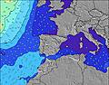 | 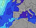 | 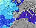 | 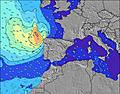 | ||||||||||||||
Wave Height (m) Direction Period (s) | NNE 7 | NNE 7 | NNE 6 | NNW 7 | N 6 | N 7 | N 6 | N 6 | NNW 6 | NW 7 | NNW 7 | NNW 6 | NNW 6 | NNW 6 | NNW 11 | NNW 10 | NNW 9 | NW 9 | NNW 9 | NW 9 | NW 10 |
Wave Graph | |||||||||||||||||||||
111 | 105 | 72 | 37 | 53 | 69 | 38 | 29 | 13 | 104 | 185 | 113 | 58 | 50 | 427 | 351 | 226 | 194 | 194 | 107 | 204 | |
Wind (km/h) | |||||||||||||||||||||
Wind State on-shore cross-onshore cross-shore cross-offshore off-shore glassy | glassy | cross | glassy | glassy | cross-on | cross-off | cross | on | cross-off | on | cross-on | cross-on | glassy | cross-on | cross-off | cross-off | cross | off | cross | cross | cross |
High Tide | 11:17AM2.52m | 11:45PM2.45m | 12:25PM2.45m | 00:59AM2.36m | 1:36PM2.47m | 2:11AM2.38m | 2:39PM2.58m | 3:09AM2.49m | 3:30PM2.73m | 3:55AM2.63m | 4:12PM2.90m | 4:34AM2.76m | 4:49PM3.06m | ||||||||
Low Tide | 5:26PM1.06m | 5:58AM1.08m | 6:40PM1.14m | 7:08AM1.14m | 7:53PM1.12m | 8:13AM1.09m | 8:54PM1.01m | 9:08AM0.98m | 9:43PM0.85m | 9:53AM0.82m | 10:24PM0.69m | 10:31AM0.67m | 11:01PM0.54m | ||||||||
7:11 | — | — | 7:13 | — | — | 7:13 | — | — | 7:15 | — | — | 7:16 | — | — | 7:16 | — | — | 7:18 | — | — | |
— | — | 10:06 | — | — | 10:05 | — | — | 10:05 | — | — | 10:04 | — | — | 10:02 | — | — | 10:01 | — | — | 10:00 | |
mm | — | — | — | — | — | — | — | — | — | — | — | — | — | — | — | — | — | — | — | — | — |
Temp °C | 21 | 24 | 22 | 20 | 22 | 20 | 21 | 23 | 22 | 19 | 21 | 20 | 18 | 20 | 20 | 22 | 27 | 26 | 24 | 25 | 21 |
Feels °C | 22 | 24 | 24 | 21 | 21 | 21 | 21 | 23 | 20 | 20 | 21 | 19 | 19 | 21 | 20 | 21 | 25 | 26 | 25 | 25 | 22 |
Swell 1 Height (m) Direction Period (s) | NNE 7 | NNE 7 | NNE 6 | NNW 7 | N 6 | N 7 | N 6 | N 6 | NNW 6 | NW 7 | WNW 10 | NNW 6 | NNW 6 | NNW 6 | NNW 11 | NNW 10 | NNW 9 | NW 9 | NNW 9 | NW 9 | NW 10 |
111 | 105 | 72 | 37 | 53 | 69 | 38 | 29 | 13 | 104 | 10 | 113 | 58 | 50 | 427 | 351 | 226 | 194 | 194 | 107 | 204 | |
Swell 2 Height (m) Direction Period (s) | WNW 10 | WNW 10 | NNW 7 | NNE 6 | W 9 | W 9 | W 8 | W 8 | NNE 6 | WSW 6 | — | WNW 9 | WNW 9 | WNW 9 | WNW 9 | WNW 9 | WNW 9 | NNE 6 | WNW 8 | NNW 11 | WNW 11 |
19 | 18 | 5 | 12 | 6 | 6 | 5 | 5 | 7 | 6 | — | 9 | 28 | 27 | 25 | 26 | 26 | 29 | 14 | 51 | 12 | |
Swell 3 Height (m) Direction Period (s) | N 9 | — | WNW 9 | NE 6 | — | — | — | NE 6 | W 8 | NE 6 | — | W 8 | NE 6 | NW 12 | — | — | — | WNW 8 | — | W 8 | — |
14 | — | 16 | 6 | — | — | — | 1 | 5 | 1 | — | 5 | 6 | 34 | — | — | — | 14 | — | 5 | — | |
Wind waves Height (m) Direction Period (s) | — | — | — | — | — | — | — | — | SW 2 | — | NNW 7 | — | — | — | — | — | NNE 5 | — | — | NNE 5 | N 5 |
— | — | — | — | — | — | — | — | 1 | — | 185 | — | — | — | — | — | 58 | — | — | 26 | 31 | |
Nearest Offshore or Glassy | |||||||||||||||||||||
Distance (km) | 0 | 15 | 0 | 0 | 34 | 0 | 13 | 983 | 83 | 22 | 178 | 83 | 0 | 208 | 83 | 81 | 90 | 0 | 15 | 83 | 5 |
Best forecast wave conditions in Galicia | |||||||||||||||||||||
Best forecast wave conditions in Spain (Europe) | |||||||||||||||||||||
Header Global | |||||||||||||||||||||
- Map Icons:
 Break
Break Live Wave Height (m)
 Live Wind Speed (km/h)
 Surf Rating (10 Max)
 Ocean Swells (m)
- Wind Speed (km/h)


FREE! Surf-Forecast.com widget for your website
The surf report / weather widget below is available to embed on third party websites free of charge and provides a summary of our Playa do Orzan surf forecast. Simply grab the html code snippet that we provide and paste it into your own site. You can choose your preferred language and metric/imperial units for the surf forecast feed to suit users of your site. Click here to get the code.
Information about the Playa do Orzan Surf forecast
The above surf forecast table for Playa do Orzan provides essential information for determining whether the surfing conditions will be good over the next 16 days. A general guide to surfing at Playa do Orzan can be found by selecting the local surf guide option on the grey menu. Our Playa do Orzan surf forecast is unique since it includes wave energy (power) that defines the real feel of the surf rather than just the height or the period. If you surf the same spot (Playa do Orzan) regularly then make a mental note of the wave energy from the surf forecast table each time you go. Very soon you may start to choose your surf days based on the wave energy alone combined with our forecast of favourable offshore wind conditions. Our star ratings will help here and of course you will also find the usual wave height and period predictions on our surf forecasts as well as a full break down of the swell components under our advanced users option (to reveal that, click the little Einstein character under the tide times).
Further information to help with frequently asked questions about our surf forecast for Playa do Orzan may be found under the help tab on the top menu and also by moving your mouse over the question marks on the surf forecast table itself. Please always bear in mind that the forecast is for near-shore open water and local factors at each surf break influence the actual breaking wave height, such as the beach / reef profile, water depths offshore and shelter.
Playa de Orzan is 5 km (3 miles) from La Coruna. If you plan a holiday in Galicia, look for hotels and other accommodation in La Coruna. La Coruna has rooms for a wide range of budgets as well as car hire and transport links.
 Nearest