

Surf Forecasts:

Playa de la Concha surf forecast from 20 Jul 2026:
- Best quality surf: Monday 20 Jul, 8AM (local time) - 3.5ft (1.0m), 6s period, NNE swell with offshore winds.
- Most powerful swell: Monday 27 Jul, 8AM (local time) - 3.5ft (1.1m), 10s period, NNW swell with 270 kJ wave energy.
- Next surfable swell (1★+): Monday 20 Jul, 8AM (local time) - 3.5ft (1.0m), 6s period with NNE swell.
Best Forecast Surf Conditions for Playa de la Concha this week:
The surf forecast for Playa de la Concha over the next 16 days: The first swell (rated 1 star or higher) is forecast to arrive on Monday (Jul 20) at 8AM. The primary swell is predicted to be 1.0m and 6s period with a secondary swell of 0.4m and 8s. The wind is predicted to be offshore as the swell arrives.
The most powerful waves expected at Playa de la Concha in the next 16 days are 1.1m 10s and forecast to arrive on Monday (Jul 27) at 8AM. Winds are predicted to be cross-offshore at the time the swell arrives.
| Wave Type | Time (CEST) & Date | Wave Height & Period |
|---|---|---|
| Next good surf (1 star+) | 8AM (Mon 20th Jul) | 3.5ft (1.0m) 6s |
| Best Surf | 8AM (Mon 20th Jul) | 3.5ft (1.0m) 6s |
| Most Powerful | 8AM (Mon 27th Jul) | 3.5ft (1.1m) 10s |
Table - best surf conditions forecast for Playa de la Concha over the next 16 days.
The Lowdown
Alright folks, Rusty here. Let’s have a proper look at what’s coming up for Playa de la Concha. It’s a bit of a mixed bag over the next couple of weeks, so let’s break it down.
First up, the water temp is sitting at 72°F which is much warmer than normal for this time of year. You’ll be comfortable in a spring suit or even just boardies if you’re tough enough.
The first week is pretty grim, I’m not gonna lie. We’ve got a long stretch of weak, short-period windswell (6-7 seconds) and onshore winds. Monday the 20th and Tuesday the 21st are write-offs. There’s a brief glimmer on Tuesday morning the 21st with glassy conditions and 4ft from the NNE (combined energy 172), but it’s not worth getting excited about. Wednesday and Thursday are even smaller and choppier. Friday the 24th through Sunday the 26th is just a mess of stormy cross-offshore winds and tiny waves, with energy levels dropping below 65. That’s a solid four-day gap of nothing really rideable.
Now, things start to get interesting around the 27th of July. Monday morning the 27th sees a jump in size to 4ft from the NNW, with a period of 10 seconds and a clean cross-offshore breeze. The combined energy jumps to 450 – that’s moderate energy for sure. It’s still a bit marginal due to tides, but it’s the first real sign of life. The northwesterly swell direction is the optimum for this spot, and the wind is good. It’s not a standout, but it’s a head-turner after the flat spell.
The real standout, the one you want to circle on the calendar, is Thursday morning the 30th of July. We’ve got 5ft from the NNW with a light cross-offshore breeze from the WNW. The conditions are clean, the energy is solid at 306, and the swell direction is in the sweet spot. This is the best session on offer across the whole 16-day window. The swell period is a bit short at 7 seconds, so it’ll be a bit punchy, but with that wind, it’ll be fun. It’s a river break, so it’s fairly exposed, and crowds are sometimes an issue, but it’s worth the paddle.
After that, the 31st of July and 1st of August are okay – 4ft to 3ft from the NW – but the wind turns onshore or cross-onshore, so it’s not as clean. The 4th of August, Tuesday morning, brings another promising window with 4ft from the NW, a 10-second period, clean cross-offshore wind, and combined energy of 278. That’s a long-range call, so don’t bank on it, but keep an eye on it.
In short, the first week is a write-off. Thursday the 30th is your best bet for clean, fun waves. The 4th of August is a promising long-range possibility. Hang tight, and don’t leave your board at home.
Rusty.
Short Range ForecastMostly dry. Warm (max 24°C on Wed afternoon, min 19°C on Mon night). Wind will be generally light. | Days 4-6 Weather SummaryLight rain (total 9mm), mostly falling on Sat afternoon. Warm (max 24°C on Thu afternoon, min 19°C on Fri morning). Wind will be generally light. | ||||||||||||||||||||
Monday 20 | Tuesday 21 | Wednesday 22 | Thursday 23 | Friday 24 | Saturday 25 | Sunday 26 | |||||||||||||||
AM | PM | Night | AM | PM | Night | AM | PM | Night | AM | PM | Night | AM | PM | Night | AM | PM | Night | AM | PM | Night | |
Swell Height Map |  |  |  | 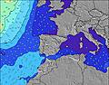 | 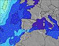 | 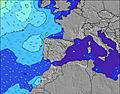 | 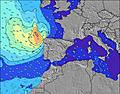 | ||||||||||||||
Wave Height (m) Direction Period (s) | NNE 6 | NNE 7 | NNE 7 | NNE 7 | NNE 7 | NNE 7 | N 6 | NNE 6 | NNE 6 | NE 6 | N 6 | N 6 | NNW 6 | N 6 | NNW 6 | NNW 6 | N 5 | N 6 | NW 13 | NW 12 | NW 11 |
Wave Graph | |||||||||||||||||||||
129 | 225 | 198 | 161 | 261 | 141 | 78 | 127 | 62 | 35 | 59 | 76 | 30 | 18 | 12 | 11 | 21 | 22 | 40 | 137 | 119 | |
Wind (km/h) | |||||||||||||||||||||
Wind State on-shore cross-onshore cross-shore cross-offshore off-shore glassy | on | on | off | glassy | on | cross-off | on | on | cross-off | glassy | on | off | cross-off | cross-off | cross-off | cross-off | cross-off | cross-off | cross-off | cross-off | cross-off |
High Tide | 9:42AM3.13m | 10:01PM3.21m | 10:31AM2.94m | 10:54PM2.93m | 11:27AM2.78m | 11:56PM2.71m | 12:34PM2.69m | 1:11AM2.61m | 1:47PM2.70m | 2:24AM2.64m | 2:51PM2.81m | 3:22AM2.75m | 3:42PM2.97m | 4:08AM2.90m | |||||||
Low Tide | 3:40PM0.70m | 4:13AM0.76m | 4:33PM0.93m | 5:05AM1.00m | 5:34PM1.12m | 6:06AM1.17m | 6:45PM1.22m | 7:14AM1.24m | 7:57PM1.21m | 8:20AM1.20m | 8:59PM1.09m | 9:16AM1.08m | 9:49PM0.93m | ||||||||
6:52 | — | — | 6:54 | — | — | 6:54 | — | — | 6:56 | — | — | 6:56 | — | — | 6:56 | — | — | 6:58 | — | — | |
— | — | 9:51 | — | — | 9:50 | — | — | 9:49 | — | — | 9:47 | — | — | 9:46 | — | — | 9:45 | — | — | 9:45 | |
mm | — | — | — | — | — | — | — | — | — | — | — | — | — | — | — | 2 | 6 | 1 | — | — | 1 |
Temp °C | 22 | 23 | 23 | 22 | 23 | 23 | 22 | 24 | 23 | 23 | 24 | 24 | 22 | 22 | 22 | 21 | 22 | 20 | 21 | 22 | 21 |
Feels °C | 23 | 21 | 23 | 23 | 21 | 22 | 21 | 22 | 23 | 23 | 24 | 25 | 21 | 20 | 21 | 18 | 20 | 17 | 17 | 18 | 18 |
Swell 1 Height (m) Direction Period (s) | NNE 6 | NW 8 | NNE 7 | NNE 7 | NNE 7 | NNE 7 | N 6 | NW 10 | NNE 6 | NE 6 | N 6 | N 6 | NE 5 | N 6 | NNW 6 | NNW 6 | N 5 | N 6 | N 5 | NW 12 | NW 11 |
129 | 9 | 198 | 161 | 261 | 141 | 78 | 4 | 62 | 35 | 59 | 76 | 22 | 18 | 12 | 11 | 21 | 22 | 14 | 137 | 119 | |
Swell 2 Height (m) Direction Period (s) | NNW 8 | NW 12 | WNW 11 | WNW 11 | WNW 10 | WNW 10 | NW 10 | — | W 10 | NNW 6 | W 9 | W 9 | NNW 6 | NE 5 | NE 4 | NE 4 | NW 11 | NNW 10 | NW 13 | NW 9 | NNW 6 |
24 | 6 | 12 | 11 | 11 | 10 | 4 | — | 2 | 27 | 2 | 2 | 30 | 9 | 3 | 3 | 5 | 9 | 40 | 3 | 32 | |
Swell 3 Height (m) Direction Period (s) | NW 9 | — | — | — | — | — | — | — | — | W 9 | — | — | W 9 | W 9 | W 8 | W 8 | W 8 | N 14 | NNW 9 | NW 9 | WNW 9 |
3 | — | — | — | — | — | — | — | — | 2 | — | — | 2 | 1 | 1 | 1 | 1 | 4 | 7 | 3 | 8 | |
Wind waves Height (m) Direction Period (s) | — | NNE 7 | — | — | — | — | — | NNE 6 | — | — | ENE 4 | — | — | — | — | — | — | — | — | NNW 6 | — |
— | 225 | — | — | — | — | — | 127 | — | — | 8 | — | — | — | — | — | — | — | — | 17 | — | |
Nearest Offshore or Glassy | |||||||||||||||||||||
Distance (km) | 1 | 1 | 0 | 0 | 1 | 0 | 1 | 1 | 0 | 0 | 1 | 0 | 341 | 1072 | 1098 | 909 | 1515 | 387 | 98 | 240 | 49 |
Best forecast wave conditions in Spain - Cantabria | |||||||||||||||||||||
Best forecast wave conditions in Spain (Europe) | |||||||||||||||||||||
Header Global | |||||||||||||||||||||
- Map Icons:
 Break
Break Live Wave Height (m)
 Live Wind Speed (km/h)
 Surf Rating (10 Max)
 Ocean Swells (m)
- Wind Speed (km/h)


FREE! Surf-Forecast.com widget for your website
The surf report / weather widget below is available to embed on third party websites free of charge and provides a summary of our Playa de la Concha surf forecast. Simply grab the html code snippet that we provide and paste it into your own site. You can choose your preferred language and metric/imperial units for the surf forecast feed to suit users of your site. Click here to get the code.
Information about the Playa de la Concha Surf forecast
The above surf forecast table for Playa de la Concha provides essential information for determining whether the surfing conditions will be good over the next 16 days. A general guide to surfing at Playa de la Concha can be found by selecting the local surf guide option on the grey menu. Our Playa de la Concha surf forecast is unique since it includes wave energy (power) that defines the real feel of the surf rather than just the height or the period. If you surf the same spot (Playa de la Concha) regularly then make a mental note of the wave energy from the surf forecast table each time you go. Very soon you may start to choose your surf days based on the wave energy alone combined with our forecast of favourable offshore wind conditions. Our star ratings will help here and of course you will also find the usual wave height and period predictions on our surf forecasts as well as a full break down of the swell components under our advanced users option (to reveal that, click the little Einstein character under the tide times).
Further information to help with frequently asked questions about our surf forecast for Playa de la Concha may be found under the help tab on the top menu and also by moving your mouse over the question marks on the surf forecast table itself. Please always bear in mind that the forecast is for near-shore open water and local factors at each surf break influence the actual breaking wave height, such as the beach / reef profile, water depths offshore and shelter.
Playa de la Concha is 10 km (6 miles) from Torrelavega. If you plan a holiday in Spain - Cantabria, look for hotels and other accommodation in Torrelavega. Torrelavega has rooms for a wide range of budgets as well as car hire and transport links.
 Nearest