

Surf Forecasts:

Macauleys surf forecast from 10 Jul 2026:
- Best quality surf: Saturday 11 Jul, 4AM (local time) - 5ft (1.5m), 10s period, SE swell with cross-offshore winds.
- Most powerful swell: Friday 17 Jul, 4PM (local time) - 8ft (2.5m), 10s period, SE swell with 1,153 kJ wave energy.
- Next surfable swell (1★+): Saturday 11 Jul, 4AM (local time) - 5ft (1.5m), 10s period with SE swell.
Best Forecast Surf Conditions for Macauleys this week:
The surf forecast for Macauleys over the next 16 days: The first swell (rated 1 star or higher) is forecast to arrive on Saturday (Jul 11) at 4AM. The primary swell is predicted to be 1.5m and 10s period with a secondary swell of 0.4m and 14s. The wind is predicted to be cross-offshore as the swell arrives.
The most powerful waves expected at Macauleys in the next 16 days are 2.5m 10s and forecast to arrive on Friday (Jul 17) at 4PM. Winds are predicted to be cross-onshore at the time the swell arrives. The largest open ocean swell (not directed at the beach) is 0.4m 3s period and expected on Saturday (Jul 11) at 7PM.
| Wave Type | Time (AEST) & Date | Wave Height & Period |
|---|---|---|
| Next good surf (1 star+) | 4AM (Sat 11th Jul) | 5ft (1.5m) 10s |
| Best Surf | 4AM (Sat 11th Jul) | 5ft (1.5m) 10s |
| Most Powerful | 4PM (Fri 17th Jul) | 8ft (2.5m) 10s |
Table - best surf conditions forecast for Macauleys over the next 16 days.
Alright folks, Rusty here. Let’s have a look at what’s coming down the pipe for Macauleys over the next couple of weeks.
We’ve got a bit of a mixed bag on the cards. The water temp is sitting at 68°, which is pretty much normal for this time of year – nothing out of the ordinary there.
The real standout of the whole forecast is that Saturday the 11th. Saturday morning is looking absolutely magic: glassy conditions, a clean 4 ft SE swell with a 10-second period, and the combined wave energy is a solid moderate 483. That’s the pick of the bunch – small but clean, and perfect for a long session. Saturday afternoon gets even better with the swell bumping up to 5 ft from the ESE, period stretching to 11 seconds, and the energy jumping to 727. The wind swings cross-offshore, keeping things clean. This is the window you want.
Sunday the 12th isn't bad either. The morning sees a moderate offshore breeze from the NW with a 3 ft ESE swell and a 10-second period. The energy drops to 206, but it’s clean and workable. Afternoon glass-off, but the swell fades to 3 ft.
Now, for the rest of the week, it’s a bit of a struggle. From Monday the 13th through to Wednesday the 15th, the swell direction swings southerly, the periods drop short (4 to 8 seconds), and the wind is mostly a messy cross-on. Choppy, lumpy conditions are going to be the name of the game, and the combined energy is weak to low-moderate (35 to 225). Not worth paddling out for a quality wave.
Thursday the 16th through the weekend of the 19th stays poor. Cross-on winds and choppy seas, with swell heights between 4 ft and 6 ft, but the periods are short and the conditions are messy, with energy levels between 248 and 367. Hard pass.
We get a bit of a reprieve on Monday the 20th morning: a light offshore from the NNW, 3 ft E swell, 8-second period. It’s surfable, but ordinary. Tuesday the 21st morning goes glassy with a tiny 3 ft E swell, 8-second period – only 114 energy. It’s small, but if you’re desperate, you could get a few.
The rest of the second week fades into small, weak swells with most afternoons getting ruined by cross or cross-on wind. The best you’ll see is the occasional morning glass-off with 2 ft to 2 ft E swell, like on Thursday the 23rd and Friday the 24th mornings. Those are strictly for the longboard or the foamie, and the energy is weak (89 to 113).
So to sum it up: your absolute best chance is Saturday the 11th, morning or afternoon. Get in the water then. The rest of the window is a lot of waiting for a clean day that mostly doesn’t come.
Rusty.
Short Range ForecastMostly dry. Warm (max 21°C on Sun morning, min 11°C on Sun night). Wind will be generally light. | Days 5-7 Weather SummaryLight rain (total 2mm), mostly falling on Wed afternoon. Very mild (max 17°C on Wed night, min 11°C on Mon night). Winds increasing (calm on Tue morning, strong winds from the S by Wed night). | ||||||||||||||||||||
Saturday 11 | Sunday 12 | Monday 13 | Tuesday 14 | Wednesday 15 | Thursday 16 | Fri 17 | |||||||||||||||
Night | AM | PM | Night | AM | PM | Night | AM | PM | Night | AM | PM | Night | AM | PM | Night | AM | PM | Night | AM | PM | |
Swell Height Map |  |  |  |  |  |  |  | 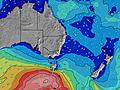 | |||||||||||||
Wave Height (m) Direction Period (s) | SE 10 | SE 10 | ESE 11 | ESE 10 | ESE 10 | ESE 10 | SE 9 | ESE 8 | S 8 | SSE 9 | S 11 | S 7 | E 10 | S 7 | SSE 7 | SSE 9 | S 7 | SE 8 | SE 8 | SE 8 | SE 10 |
Wave Graph | |||||||||||||||||||||
530 | 257 | 563 | 320 | 200 | 157 | 79 | 40 | 32 | 15 | 9 | 26 | 8 | 245 | 426 | 666 | 214 | 573 | 604 | 579 | 1153 | |
Wind (km/h) | |||||||||||||||||||||
Wind State on-shore cross-onshore cross-shore cross-offshore off-shore glassy | cross | glassy | cross-off | off | off | on | cross | glassy | cross-on | cross-off | glassy | cross-on | cross-off | cross-on | cross-on | cross-on | cross-on | cross-on | cross-on | on | cross-on |
High Tide | 4:38AM1.02m | 5:26PM1.62m | 5:46AM1.02m | 6:22PM1.74m | 6:48AM1.05m | 7:16PM1.84m | 7:44AM1.08m | 8:07PM1.89m | 8:36AM1.12m | 8:55PM1.89m | 9:26AM1.15m | 9:42PM1.82m | 10:15AM1.17m | ||||||||
Low Tide | 11:06PM0.32m | 10:35AM0.15m | 00:13AM0.20m | 11:34AM0.11m | 1:11AM0.09m | 12:30PM0.06m | 2:04AM0.01m | 1:24PM0.03m | 2:53AM-0.03m | 2:15PM0.02m | 3:40AM-0.04m | 3:06PM0.04m | 4:23AM-0.02m | 3:56PM0.11m | |||||||
— | 6:43 | — | — | 6:41 | — | — | 6:41 | — | — | 6:41 | — | — | 6:41 | — | — | 6:41 | — | — | 6:41 | — | |
— | — | 5:01 | — | — | 5:01 | — | — | 5:02 | — | — | 5:02 | — | — | 5:04 | — | — | 5:04 | — | — | 5:05 | |
mm | — | — | — | — | — | — | — | — | — | — | — | — | — | — | 1 | — | — | 1 | — | 2 | 2 |
Temp °C | 14 | 17 | 18 | 14 | 21 | 20 | 14 | 15 | 16 | 13 | 16 | 16 | 15 | 16 | 15 | 17 | 17 | 17 | 17 | 17 | 17 |
Feels °C | 12 | 14 | 15 | 12 | 19 | 18 | 11 | 13 | 14 | 11 | 13 | 13 | 12 | 8 | 7 | 8 | 9 | 10 | 11 | 11 | 11 |
Swell 1 Height (m) Direction Period (s) | SE 10 | SE 10 | ESE 11 | ESE 10 | ESE 10 | ESE 10 | SE 9 | ESE 8 | S 8 | SSE 9 | SSE 4 | S 7 | S 8 | E 9 | E 9 | — | ESE 8 | N 10 | ESE 10 | E 10 | SSW 12 |
530 | 257 | 563 | 320 | 200 | 157 | 79 | 40 | 32 | 15 | 5 | 26 | 4 | 2 | 2 | — | 183 | 2 | 35 | 127 | 30 | |
Swell 2 Height (m) Direction Period (s) | ESE 15 | ESE 12 | SSE 9 | SSE 9 | SSE 8 | SSE 8 | — | S 8 | ESE 8 | ESE 8 | S 11 | E 10 | S 4 | E 10 | E 9 | — | SSE 9 | N 10 | NE 9 | NE 9 | — |
21 | 220 | 158 | 86 | 57 | 40 | — | 22 | 13 | 6 | 9 | 2 | 1 | 2 | 2 | — | 132 | 2 | 3 | 3 | — | |
Swell 3 Height (m) Direction Period (s) | S 21 | S 18 | S 18 | S 17 | S 16 | N 4 | — | S 4 | E 10 | SSE 4 | SE 8 | E 7 | E 10 | N 10 | — | — | — | — | S 14 | NE 9 | — |
9 | 6 | 6 | 6 | 5 | 2 | — | 1 | 8 | 2 | 2 | 1 | 8 | 2 | — | — | — | — | 4 | 3 | — | |
Wind waves Height (m) Direction Period (s) | — | — | — | NW 2 | NW 2 | WSW 3 | WSW 2 | SSW 4 | — | — | — | — | — | S 7 | SSE 7 | SSE 9 | S 7 | SE 8 | SE 8 | SE 8 | SE 10 |
— | — | — | 1 | 2 | 1 | 1 | 5 | — | — | — | — | — | 245 | 426 | 666 | 214 | 573 | 604 | 579 | 1153 | |
Nearest Offshore or Glassy | |||||||||||||||||||||
Distance (km) | 11 | 2 | 0 | 0 | 0 | 0 | 0 | 2 | 0 | 224 | 81 | 55 | 147 | 100 | 11 | 100 | 11 | 11 | 100 | 2 | 2 |
Best forecast wave conditions in North Coast - New South Wales | |||||||||||||||||||||
Best forecast wave conditions in Australia | |||||||||||||||||||||
Header Global | |||||||||||||||||||||
- Map Icons:
 Break
Break Live Wave Height (m)
 Live Wind Speed (km/h)
 Surf Rating (10 Max)
 Ocean Swells (m)
- Wind Speed (km/h)


FREE! Surf-Forecast.com widget for your website
The surf report / weather widget below is available to embed on third party websites free of charge and provides a summary of our Macauleys surf forecast. Simply grab the html code snippet that we provide and paste it into your own site. You can choose your preferred language and metric/imperial units for the surf forecast feed to suit users of your site. Click here to get the code.
Information about the Macauleys Surf forecast
The above surf forecast table for Macauleys provides essential information for determining whether the surfing conditions will be good over the next 16 days. A general guide to surfing at Macauleys can be found by selecting the local surf guide option on the grey menu. Our Macauleys surf forecast is unique since it includes wave energy (power) that defines the real feel of the surf rather than just the height or the period. If you surf the same spot (Macauleys) regularly then make a mental note of the wave energy from the surf forecast table each time you go. Very soon you may start to choose your surf days based on the wave energy alone combined with our forecast of favourable offshore wind conditions. Our star ratings will help here and of course you will also find the usual wave height and period predictions on our surf forecasts as well as a full break down of the swell components under our advanced users option (to reveal that, click the little Einstein character under the tide times).
Further information to help with frequently asked questions about our surf forecast for Macauleys may be found under the help tab on the top menu and also by moving your mouse over the question marks on the surf forecast table itself. Please always bear in mind that the forecast is for near-shore open water and local factors at each surf break influence the actual breaking wave height, such as the beach / reef profile, water depths offshore and shelter.
Are you planning a holiday in North Coast - New South Wales? If you are looking for accommodation near Macauleys, camping, hotels and holiday cottages in North Coast - New South Wales, consider staying in Coffs Harbour which is 18 km (11 miles) away. Alternatively, find information about places to stay and car hire in South Grafton which is 56 km (35 miles) away
 Nearest