

Surf Forecasts:

Kennebunk Beach surf forecast from 3 Aug 2026:
- Most powerful swell: Monday 3 Aug, 5PM (local time) - 8ft (2.5m), 8s period, SSE swell with 711 kJ wave energy.
Best Forecast Surf Conditions for Kennebunk Beach this week:
The most powerful waves expected at Kennebunk Beach in the next 16 days are 2.5m 8s and forecast to arrive on Monday (Aug 03) at 5PM. Winds are predicted to be cross-onshore at the time the swell arrives. The largest open ocean swell (not directed at the beach) is 2.4m 8s period and expected on Monday (Aug 03) at 8PM.
| Wave Type | Time (EDT) & Date | Wave Height & Period |
|---|---|---|
| Next good surf (1 star+) | - | - |
| Best Surf | - | - |
| Most Powerful | 5PM (Mon 3rd Aug) | 8ft (2.5m) 8s |
Table - best surf conditions forecast for Kennebunk Beach over the next 16 days.
The Lowdown
Alright, folks, Rusty here. Let’s be real about it. I’ve scanned the charts for our local stretch, and I gotta tell you, it’s a tough one. We’re looking at a long, dry spell with barely a ripple to get excited about. The whole 16-day window is pretty much a bust for paddle surfing.
Kennebunk Beach is the only break on the menu, and it’s a sheltered setup that’s not catching much of anything. The water is sitting at 65°, which is pretty much spot on for the time of year, nothing weird going on there.
We kick off Monday the 3rd with a bit of a pulse, but it’s a mess. A 5ft swell from the SSE is pushing through, but it’s got no guts—a weak 5-second period—and a 15 mph south wind is just tearing it up. The combined energy is a measly 97, so there’s just no power. It’s a write-off. By the afternoon, the wind picks up to 19 mph and the swell jumps to 8ft, but the period is still a short 8 seconds and the wind is cross-on. That’s lumpy, nasty, and too big for beginners. It looks more interesting for kite surfing than paddle surfing.
The rest of the week is a slow bleed. Tuesday the 4th drops to 3ft, and the wind might ease, but it’s still cross-on and weak. Wednesday through to the following Monday, we’re talking ankle-biters. Swells are consistently under 2ft with periods of 4 to 8 seconds, so the energy is tiny—mostly in the single digits or low twenties. The wind is all over the place, but mostly cross-on or cross-shore, keeping things choppy and messy. There’s a moment on Tuesday the 11th where it goes glassy, but with only 0.7ft of swell, it’s flat as a pancake.
We get a few clean mornings around the 12th and 14th with light offshore winds, but the swell is still only 0.3ft to 1.0ft. You could paddle around on a log, but you won’t be catching anything. The long period swells (14 seconds) that show up on the 12th are just too small to do anything with.
The second week is more of the same. A few glassy moments on the 15th and 16th, but the swell is tiny. The 17th sees a little bump back to 2ft, but it’s short-period windswell from the SSW with a cross-on wind, so it’s junk.
Honestly, there’s nothing here to recommend. The consistency is poor, the energy is weak, and the winds are rarely on our side. It’s a blank run, and for this area, that’s just how it goes sometimes. Don’t hold your breath. The forecasts can change, but right now, it’s a no-go.
Rusty.
Short Range ForecastHeavy rain (total 28mm), heaviest during Mon morning. Warm (max 31°C on Tue afternoon, min 18°C on Mon night). Winds decreasing (fresh winds from the S on Mon afternoon, calm by Wed morning). | Days 4-6 Weather SummaryMostly dry. Warm (max 32°C on Fri afternoon, min 22°C on Thu morning). Wind will be generally light. | ||||||||||||||||||||
Monday 3 | Tuesday 4 | Wednesday 5 | Thursday 6 | Friday 7 | Saturday 8 | Sunday 9 | |||||||||||||||
AM | PM | Night | AM | PM | Night | AM | PM | Night | AM | PM | Night | AM | PM | Night | AM | PM | Night | AM | PM | Night | |
Swell Height Map | 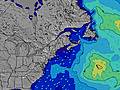 | 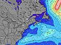 | 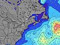 | 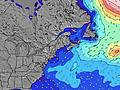 | 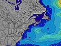 | 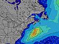 | 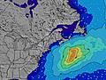 | ||||||||||||||
Wave Height (m) Direction Period (s) | SSE 5 | SSE 8 | SSE 8 | SSE 8 | SSE 8 | S 5 | SSE 7 | SSE 7 | SSE 7 | SSE 6 | SSE 6 | SSE 8 | SSE 8 | S 5 | SE 8 | SE 8 | SE 8 | SE 8 | SSE 4 | SE 9 | SE 10 |
Wave Graph | |||||||||||||||||||||
94 | 711 | 273 | 71 | 50 | 43 | 31 | 30 | 52 | 21 | 20 | 6 | 6 | 13 | 10 | 10 | 10 | 9 | 4 | 3 | 4 | |
Wind (km/h) | |||||||||||||||||||||
Wind State on-shore cross-onshore cross-shore cross-offshore off-shore glassy | cross-on | cross-on | cross-on | cross-on | on | cross-on | cross | cross-on | on | cross-on | cross-on | on | cross-on | cross-on | cross-on | cross-off | cross | glassy | cross-on | cross-on | on |
High Tide | 3:13PM2.78m | 3:30AM2.73m | 3:55PM2.85m | 4:19AM2.65m | 4:41PM2.90m | 5:15AM2.55m | 5:35PM2.94m | 6:16AM2.48m | 6:35PM2.97m | 7:23AM2.46m | 7:39PM3.02m | 8:30AM2.50m | 8:45PM3.09m | ||||||||
Low Tide | 8:54AM0.08m | 9:17PM0.18m | 9:35AM0.12m | 10:07PM0.15m | 10:21AM0.18m | 11:01PM0.13m | 11:12AM0.24m | 00:01AM0.11m | 12:10PM0.30m | 1:06AM0.08m | 1:14PM0.31m | 2:14AM0.01m | 2:20PM0.27m | 3:19AM-0.08m | |||||||
5:33 | — | — | 5:33 | — | — | 5:35 | — | — | 5:35 | — | — | 5:37 | — | — | 5:39 | — | — | 5:39 | — | — | |
— | 8:01 | — | — | 8:00 | — | — | 7:59 | — | — | 7:58 | — | — | 7:57 | — | — | 7:54 | — | — | 7:53 | — | |
mm | 20 | 6 | 2 | — | — | — | — | — | — | — | — | — | — | — | — | — | — | — | — | — | — |
Temp °C | 21 | 23 | 21 | 27 | 31 | 27 | 24 | 26 | 24 | 28 | 31 | 30 | 31 | 32 | 29 | 25 | 27 | 24 | 27 | 29 | 27 |
Feels °C | 22 | 24 | 19 | 24 | 29 | 26 | 23 | 24 | 25 | 28 | 30 | 32 | 32 | 33 | 31 | 28 | 28 | 27 | 29 | 29 | 28 |
Swell 1 Height (m) Direction Period (s) | SE 9 | — | SSE 8 | SSE 8 | SSE 8 | SSE 5 | SSE 7 | SSE 7 | SSE 7 | SSE 6 | SSE 8 | S 5 | S 6 | SE 8 | SSE 5 | SE 8 | SE 8 | SSE 4 | SSE 4 | SE 7 | S 6 |
3 | — | 273 | 71 | 50 | 39 | 31 | 30 | 52 | 21 | 6 | 12 | 18 | 9 | 4 | 10 | 10 | 2 | 4 | 2 | 1 | |
Swell 2 Height (m) Direction Period (s) | — | — | — | — | — | SSE 7 | E 10 | S 10 | E 9 | SE 8 | — | SSE 8 | SSE 8 | E 9 | SE 8 | SSE 5 | E 9 | SE 8 | SE 7 | SE 9 | SE 7 |
— | — | — | — | — | 19 | 2 | 2 | 2 | 3 | — | 6 | 6 | 2 | 10 | 4 | 1 | 9 | 2 | 3 | 2 | |
Swell 3 Height (m) Direction Period (s) | — | — | — | — | — | — | — | E 9 | — | E 9 | E 9 | E 10 | E 9 | E 9 | E 8 | E 8 | E 9 | E 8 | — | E 8 | SE 10 |
— | — | — | — | — | — | — | 2 | — | 2 | 2 | 2 | 2 | 2 | 1 | 1 | 1 | 1 | — | 1 | 4 | |
Wind waves Height (m) Direction Period (s) | SSE 5 | SSE 8 | WSW 4 | SW 3 | S 4 | S 5 | — | — | — | — | SSE 6 | — | — | S 5 | — | — | SSE 6 | — | — | SSE 4 | S 3 |
94 | 711 | 22 | 7 | 10 | 43 | — | — | — | — | 20 | — | — | 13 | — | — | 4 | — | — | 2 | 2 | |
Nearest Offshore or Glassy | |||||||||||||||||||||
Distance (km) | 657 | 433 | 11 | 11 | 11 | 11 | 210 | 163 | 234 | 438 | 2795 | 431 | 438 | 431 | 231 | 231 | 1342 | 398 | 276 | 438 | 1740 |
Best forecast wave conditions in Maine | |||||||||||||||||||||
Best forecast wave conditions in United States | |||||||||||||||||||||
Header Global | |||||||||||||||||||||
- Map Icons:
 Break
Break Live Wave Height (m)
 Live Wind Speed (km/h)
 Surf Rating (10 Max)
 Ocean Swells (m)
- Wind Speed (km/h)
Latest Updates


FREE! Surf-Forecast.com widget for your website
The surf report / weather widget below is available to embed on third party websites free of charge and provides a summary of our Kennebunk Beach surf forecast. Simply grab the html code snippet that we provide and paste it into your own site. You can choose your preferred language and metric/imperial units for the surf forecast feed to suit users of your site. Click here to get the code.
Information about the Kennebunk Beach Surf forecast
The above surf forecast table for Kennebunk Beach provides essential information for determining whether the surfing conditions will be good over the next 16 days. A general guide to surfing at Kennebunk Beach can be found by selecting the local surf guide option on the grey menu. Our Kennebunk Beach surf forecast is unique since it includes wave energy (power) that defines the real feel of the surf rather than just the height or the period. If you surf the same spot (Kennebunk Beach) regularly then make a mental note of the wave energy from the surf forecast table each time you go. Very soon you may start to choose your surf days based on the wave energy alone combined with our forecast of favourable offshore wind conditions. Our star ratings will help here and of course you will also find the usual wave height and period predictions on our surf forecasts as well as a full break down of the swell components under our advanced users option (to reveal that, click the little Einstein character under the tide times).
Further information to help with frequently asked questions about our surf forecast for Kennebunk Beach may be found under the help tab on the top menu and also by moving your mouse over the question marks on the surf forecast table itself. Please always bear in mind that the forecast is for near-shore open water and local factors at each surf break influence the actual breaking wave height, such as the beach / reef profile, water depths offshore and shelter.
Kennebunk Beach is 17 km (11 miles) from Biddeford. If you plan a vacation in Maine, look for hotels and other accommodation in Biddeford. Biddeford has rooms for a wide range of budgets as well as car hire and transport links.
 Nearest