

Surf Forecasts:

Indian Head surf forecast from 26 Jul 2026:
- Best quality surf: Monday 27 Jul, 2AM (local time) - 2.5ft (0.8m), 19s period, SW swell with cross-offshore winds.
- Most powerful swell: Sunday 26 Jul, 5PM (local time) - 3ft (0.9m), 19s period, SW swell with 627 kJ wave energy.
- Next surfable swell (1★+): Monday 27 Jul, 2AM (local time) - 2.5ft (0.8m), 19s period with SW swell.
Best Forecast Surf Conditions for Indian Head this week:
The surf forecast for Indian Head over the next 16 days: The first swell (rated 1 star or higher) is forecast to arrive on Monday (Jul 27) at 2AM. The primary swell is predicted to be 0.8m and 19s period with a secondary swell of 0.7m and 9s. The wind is predicted to be cross-offshore as the swell arrives.
The most powerful waves expected at Indian Head in the next 16 days are 0.9m 19s and forecast to arrive on Sunday (Jul 26) at 5PM. Winds are predicted to be cross-onshore at the time the swell arrives.
| Wave Type | Time (PDT) & Date | Wave Height & Period |
|---|---|---|
| Next good surf (1 star+) | 2AM (Mon 27th Jul) | 2.5ft (0.8m) 19s |
| Best Surf | 2AM (Mon 27th Jul) | 2.5ft (0.8m) 19s |
| Most Powerful | 5PM (Sun 26th Jul) | 3ft (0.9m) 19s |
Table - best surf conditions forecast for Indian Head over the next 16 days.
The Lowdown
Alright folks, Rusty here. Let’s have a look at what’s cookin’ for Indian Head over the next couple weeks.
Well, I gotta be straight with you – this stretch is a real heartbreaker. We’ve got a long, dry run of nothing special on the cards. Starting from today, the 26th of July, right through the rest of the month and into the beginning of August, the surf is just barely hanging on. It’s not going to be worth paddling out for. The swell is tiny, mostly around 2 ft to 3 ft, and the wind is persistently cross or cross-onshore, messing up what little shape there is. We get a little bump of energy mid-week around the 29th with a combined swell energy of 604, but with a period of 17 seconds that’s a long-period groundswell, which can be a bit tricky at a beach break like this – it might just roll through or break too straight. And the wind is still cross-shore, so it’s going to be choppy and frustrating.
Then we hit a proper flat spell from the 1st of August all the way through to the 10th. For nearly ten days, the scores are zeros and the wave comments are all "poor surf conditions." The swell tries to pop a little on the 2nd with a 4 ft to 4 ft swell from the WNW, but that’s a short-period wind swell at 9 seconds, and the wind is still on it. It’s not going to be clean. Honestly, this setup looks more interesting for kite surfing than paddle surfing with that wind and chop.
There is one faint glimmer in the second week. Around the 9th of August, we see a small bump: a 4 ft swell from the WNW with the period stretching back up to 10 seconds. The combined energy hits 285, which is moderate, and the wind is light and onshore at 6 mph. It’s still marginal, but that’s the best looking wave in the whole window. It’s a promise that we might get something, but it's a long way out and far from certain.
Water temp is sitting at 57°F, which is a bit colder than normal for this time of year, about 2° cooler. So you’ll want a good suit.
Bottom line: there are no standouts here. It’s a long, blank run. For the area, this kind of quiet stretch happens. It tends not to stay poor forever, and forecasts can change, but right now, leave the board in the van for a bit.
- Rusty
Short Range ForecastMostly dry. Very mild (max 16°C on Sun morning, min 13°C on Tue night). Wind will be generally light. | Days 4-6 Weather SummaryMostly dry. Very mild (max 16°C on Fri morning, min 12°C on Wed night). Wind will be generally light. | ||||||||||||||||||||
Sunday 26 | Monday 27 | Tuesday 28 | Wednesday 29 | Thursday 30 | Friday 31 | Saturday 1 | |||||||||||||||
AM | PM | Night | AM | PM | Night | AM | PM | Night | AM | PM | Night | AM | PM | Night | AM | PM | Night | AM | PM | Night | |
Swell Height Map |  |  | 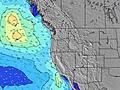 | 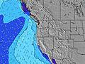 | 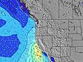 | 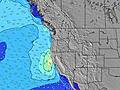 |  | ||||||||||||||
Wave Height (m) Direction Period (s) | SW 20 | SW 19 | SW 19 | SW 18 | SW 18 | SW 18 | SW 19 | SW 16 | SW 17 | SW 17 | SW 17 | SW 16 | SW 16 | SW 16 | SW 15 | SW 15 | SW 15 | SW 14 | SW 14 | W 8 | W 8 |
Wave Graph | |||||||||||||||||||||
455 | 627 | 450 | 375 | 455 | 465 | 358 | 206 | 423 | 423 | 346 | 254 | 251 | 201 | 149 | 136 | 134 | 132 | 102 | 72 | 74 | |
Wind (km/h) | |||||||||||||||||||||
Wind State on-shore cross-onshore cross-shore cross-offshore off-shore glassy | cross | cross-on | cross-off | cross-on | cross-on | cross-off | cross-on | cross-on | cross-off | cross | cross | cross-off | cross-on | cross-on | cross-off | cross | cross | cross-off | on | cross-on | glassy |
High Tide | 12:36PM1.23m | 10:54PM1.67m | 1:08PM1.28m | 11:36PM1.71m | 1:38PM1.32m | 00:15AM1.73m | 2:06PM1.37m | 00:53AM1.73m | 2:33PM1.41m | 1:32AM1.69m | 3:01PM1.47m | 2:11AM1.63m | 3:28PM1.52m | 2:54AM1.54m | |||||||
Low Tide | 6:20PM0.41m | 7:37AM-0.04m | 7:05PM0.39m | 8:12AM-0.06m | 7:46PM0.36m | 8:44AM-0.08m | 8:25PM0.34m | 9:15AM-0.08m | 9:04PM0.30m | 9:44AM-0.06m | 9:46PM0.27m | 10:14AM-0.03m | 10:29PM0.24m | ||||||||
5:50 | — | — | 5:52 | — | — | 5:52 | — | — | 5:54 | — | — | 5:54 | — | — | 5:56 | — | — | 5:58 | — | — | |
— | 8:52 | — | — | 8:51 | — | — | 8:50 | — | — | 8:49 | — | — | 8:47 | — | — | 8:46 | — | — | 8:45 | — | |
mm | — | — | — | — | — | — | — | — | — | — | — | — | — | — | — | — | — | — | — | — | — |
Temp °C | 16 | 16 | 16 | 16 | 16 | 16 | 16 | 16 | 16 | 15 | 15 | 14 | 14 | 15 | 15 | 16 | 16 | 15 | 16 | 16 | 16 |
Feels °C | 13 | 13 | 15 | 13 | 13 | 15 | 15 | 15 | 15 | 13 | 12 | 11 | 12 | 14 | 14 | 13 | 12 | 12 | 16 | 16 | 15 |
Swell 1 Height (m) Direction Period (s) | SW 20 | SW 19 | SW 19 | SW 18 | SW 18 | SW 18 | W 8 | W 8 | W 8 | W 9 | W 8 | WNW 8 | WNW 8 | WNW 8 | SW 15 | WNW 8 | WNW 8 | W 8 | W 8 | W 8 | W 8 |
455 | 627 | 450 | 375 | 455 | 465 | 111 | 156 | 173 | 181 | 140 | 112 | 68 | 67 | 149 | 67 | 87 | 76 | 58 | 72 | 74 | |
Swell 2 Height (m) Direction Period (s) | NW 10 | NW 9 | NW 9 | NW 9 | WNW 9 | WNW 8 | SW 19 | SW 16 | SW 17 | SW 17 | SW 17 | SW 16 | SW 16 | SW 16 | WNW 8 | SW 15 | SW 15 | SW 14 | SW 14 | SW 14 | SW 14 |
94 | 88 | 83 | 65 | 53 | 47 | 358 | 206 | 423 | 423 | 346 | 254 | 251 | 201 | 32 | 136 | 134 | 132 | 102 | 71 | 71 | |
Swell 3 Height (m) Direction Period (s) | SW 12 | SW 5 | WSW 6 | SW 21 | SSW 11 | WSW 5 | SW 16 | SW 19 | SW 12 | — | — | SSW 11 | SSW 11 | SSW 11 | SSW 11 | — | — | S 8 | W 10 | W 10 | SW 19 |
23 | 12 | 17 | 72 | 13 | 15 | 122 | 173 | 24 | — | — | 12 | 11 | 11 | 11 | — | — | 1 | 2 | 2 | 15 | |
Wind waves Height (m) Direction Period (s) | SW 5 | — | — | WSW 5 | WSW 5 | — | — | — | — | — | NW 3 | — | — | — | — | — | NW 3 | — | — | — | — |
14 | — | — | 19 | 17 | — | — | — | — | — | 1 | — | — | — | — | — | 1 | — | — | — | — | |
Nearest Offshore or Glassy | |||||||||||||||||||||
Distance (km) | 108 | 69 | 2 | 108 | 108 | 2 | 108 | 1012 | 2 | 111 | 1013 | 2 | 465 | 111 | 2 | 37 | 379 | 2 | 108 | 1012 | 2 |
Best forecast wave conditions in North Oregon | |||||||||||||||||||||
Best forecast wave conditions in United States | |||||||||||||||||||||
Header Global | |||||||||||||||||||||
- Map Icons:
 Break
Break Live Wave Height (m)
 Live Wind Speed (km/h)
 Surf Rating (10 Max)
 Ocean Swells (m)
- Wind Speed (km/h)


FREE! Surf-Forecast.com widget for your website
The surf report / weather widget below is available to embed on third party websites free of charge and provides a summary of our Indian Head surf forecast. Simply grab the html code snippet that we provide and paste it into your own site. You can choose your preferred language and metric/imperial units for the surf forecast feed to suit users of your site. Click here to get the code.
Information about the Indian Head Surf forecast
The above surf forecast table for Indian Head provides essential information for determining whether the surfing conditions will be good over the next 16 days. A general guide to surfing at Indian Head can be found by selecting the local surf guide option on the grey menu. Our Indian Head surf forecast is unique since it includes wave energy (power) that defines the real feel of the surf rather than just the height or the period. If you surf the same spot (Indian Head) regularly then make a mental note of the wave energy from the surf forecast table each time you go. Very soon you may start to choose your surf days based on the wave energy alone combined with our forecast of favourable offshore wind conditions. Our star ratings will help here and of course you will also find the usual wave height and period predictions on our surf forecasts as well as a full break down of the swell components under our advanced users option (to reveal that, click the little Einstein character under the tide times).
Further information to help with frequently asked questions about our surf forecast for Indian Head may be found under the help tab on the top menu and also by moving your mouse over the question marks on the surf forecast table itself. Please always bear in mind that the forecast is for near-shore open water and local factors at each surf break influence the actual breaking wave height, such as the beach / reef profile, water depths offshore and shelter.
Indian Head is 30 km (19 miles) from Astoria. If you plan a vacation in North Oregon, look for hotels and other accommodation in Astoria. Astoria has rooms for a wide range of budgets as well as car hire and transport links.
 Nearest