

Surf Forecasts:

Harbor House surf forecast from 1 Aug 2026:
- Most powerful swell: Thursday 6 Aug, 8AM (local time) - 3ft (0.9m), 5s period, ESE swell with 37 kJ wave energy.
Best Forecast Surf Conditions for Harbor House this week:
The most powerful waves expected at Harbor House in the next 16 days are 0.9m 5s and forecast to arrive on Thursday (Aug 06) at 8AM. Winds are predicted to be cross-onshore at the time the swell arrives. The largest open ocean swell (not directed at the beach) is 0.3m 2s period and expected on Tuesday (Aug 04) at 8PM.
| Wave Type | Time (EDT) & Date | Wave Height & Period |
|---|---|---|
| Next good surf (1 star+) | - | - |
| Best Surf | - | - |
| Most Powerful | 8AM (Thu 6th Aug) | 3ft (0.9m) 5s |
Table - best surf conditions forecast for Harbor House over the next 16 days.
The Lowdown
Alright folks, Rusty here. Let’s get straight into it. I’ve looked at the charts for our area, and honestly, I’m not gonna sugarcoat it. The next 16 days are looking pretty grim for a paddle. We’ve got a long stretch of poor conditions ahead.
The only break on the radar is Harbor House, a breakwater spot that’s more of a beginner-friendly zone. But the problem is, there’s really no decent surf on offer for the entire period. From Saturday the 1st of August right through to Sunday the 16th, every single report is flagged as "poor surf conditions." That’s a solid 16-day gap with no real recommendations.
The swell is tiny and weak. For the first week, we’re looking at waves mostly between 0.7 ft and 3 ft, with short, choppy periods of 3 to 8 seconds. The combined energy is feeble, often with values like 9 or 16, and only occasionally creeping up into the low 30s and 40s. That’s barely enough to tickle a longboard. The wind is almost always onshore or cross-onshore, and often strong, with speeds from 9 mph up to 22 mph, which is going to mess up whatever tiny bump there is.
There’s a slight uptick in size around Tuesday the 11th and Wednesday the 12th, with swell heights hitting 4 ft, and the combined energy climbs to 76 and 77. But even then, the wind is onshore and the period is still a short 5 seconds, so it’s going to be a lumpy, blown-out mess. Not worth the drive.
Water temp is sitting at 86°F early on, which is about normal for the time of year.
The only interesting thing is that the swell direction for Harbor House is optimum from the East, and we do see some East in the mix, but the size and wind just kill it. Because of the persistent onshore wind and poor wave quality, this setup honestly looks more suited for a kite surfer than a paddle surfer.
So, in short, hang up the boards for a bit, or go find a lake. It’s a flat spell, and it’s not likely to change quickly. Forecasts can shift, but as it stands, there’s nothing to get excited about.
Rusty
Short Range ForecastHeavy rain (total 49mm), heaviest during Mon night. Warm (max 31°C on Sat afternoon, min 25°C on Mon night). Wind will be generally light. | Days 4-6 Weather SummaryHeavy rain (total 24mm), heaviest during Tue night. Warm (max 31°C on Tue afternoon, min 26°C on Tue afternoon). Mainly fresh winds. | ||||||||||||||||||||
Saturday 1 | Sunday 2 | Monday 3 | Tuesday 4 | Wednesday 5 | Thursday 6 | Friday 7 | |||||||||||||||
AM | PM | Night | AM | PM | Night | AM | PM | Night | AM | PM | Night | AM | PM | Night | AM | PM | Night | AM | PM | Night | |
Swell Height Map |  |  |  | 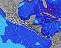 | 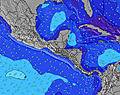 |  | 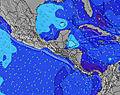 | ||||||||||||||
Wave Height (m) Direction Period (s) | E 8 | SSE 3 | E 8 | SSE 4 | ESE 5 | SSE 5 | E 5 | E 5 | E 8 | E 7 | E 8 | E 8 | ESE 4 | ESE 5 | ESE 5 | ESE 5 | E 4 | E 4 | ESE 4 | E 4 | E 4 |
Wave Graph | |||||||||||||||||||||
6 | 8 | 5 | 8 | 9 | 8 | 9 | 8 | 10 | 10 | 10 | 18 | 20 | 24 | 32 | 30 | 18 | 16 | 17 | 8 | 19 | |
Wind (km/h) | |||||||||||||||||||||
Wind State on-shore cross-onshore cross-shore cross-offshore off-shore glassy | cross-off | cross | cross | cross | cross-on | cross-on | cross | cross | cross-on | cross-on | on | cross-on | cross-on | on | on | cross-on | on | on | on | on | on |
High Tide | 10:51AM0.79m | 11:10PM0.81m | 11:33AM0.80m | 11:47PM0.80m | 12:18PM0.80m | 00:26AM0.78m | 1:07PM0.79m | 1:10AM0.77m | 2:02PM0.78m | 2:02AM0.75m | 3:04PM0.77m | 3:04AM0.74m | 4:13PM0.78m | 4:13AM0.75m | |||||||
Low Tide | 4:51PM0.03m | 5:15AM0.03m | 5:32PM0.06m | 5:57AM0.02m | 6:18PM0.10m | 6:43AM0.01m | 7:09PM0.14m | 7:36AM0.00m | 8:07PM0.18m | 8:38AM0.01m | 9:13PM0.20m | 9:44AM-0.00m | 10:21PM0.20m | ||||||||
6:46 | — | — | 6:46 | — | — | 6:47 | — | — | 6:47 | — | — | 6:48 | — | — | 6:48 | — | — | 6:48 | — | — | |
— | 8:06 | — | — | 8:06 | — | — | 8:05 | — | — | 8:05 | — | — | 8:04 | — | — | 8:02 | — | — | 8:01 | — | |
mm | — | — | 6 | 4 | — | 7 | — | 4 | 28 | — | 4 | 4 | — | 3 | 9 | 1 | 1 | 2 | 1 | — | 2 |
Temp °C | 30 | 31 | 30 | 30 | 30 | 29 | 30 | 30 | 28 | 30 | 31 | 29 | 29 | 30 | 29 | 29 | 30 | 29 | 29 | 29 | 29 |
Feels °C | 32 | 32 | 32 | 31 | 31 | 31 | 32 | 30 | 29 | 33 | 33 | 29 | 30 | 31 | 30 | 30 | 31 | 31 | 31 | 30 | 31 |
Swell 1 Height (m) Direction Period (s) | E 8 | E 8 | ESE 4 | E 8 | S 4 | SSE 5 | E 5 | E 5 | SSE 4 | E 7 | E 8 | SSE 4 | E 7 | E 7 | E 7 | NE 8 | SSE 5 | SSE 5 | NE 8 | SSE 4 | NE 8 |
6 | 5 | 3 | 5 | 9 | 8 | 7 | 8 | 2 | 10 | 10 | 2 | 4 | 4 | 4 | 2 | 15 | 5 | 2 | 7 | 3 | |
Swell 2 Height (m) Direction Period (s) | NE 9 | NE 9 | E 8 | E 4 | ESE 5 | E 8 | E 8 | E 8 | E 8 | NE 8 | S 3 | NE 8 | NE 8 | NE 8 | E 8 | N 8 | N 8 | NE 10 | N 9 | E 7 | N 10 |
3 | 3 | 5 | 2 | 7 | 5 | 5 | 4 | 10 | 2 | 1 | 2 | 2 | 2 | 1 | 1 | 1 | 4 | 2 | 4 | 2 | |
Swell 3 Height (m) Direction Period (s) | — | — | SE 4 | NE 8 | E 8 | NE 8 | NE 8 | NE 8 | NE 8 | — | NE 8 | — | — | — | — | — | — | — | — | NE 10 | NE 8 |
— | — | 1 | 3 | 5 | 3 | 3 | 2 | 2 | — | 2 | — | — | — | — | — | — | — | — | 4 | 3 | |
Wind waves Height (m) Direction Period (s) | — | SSE 3 | S 4 | SSE 4 | — | E 5 | S 4 | SSE 4 | — | SE 2 | E 3 | E 8 | ESE 4 | ESE 5 | ESE 5 | ESE 5 | E 4 | E 4 | ESE 4 | E 4 | E 4 |
— | 8 | 4 | 8 | — | 7 | 9 | 7 | — | 1 | 1 | 18 | 20 | 24 | 32 | 30 | 18 | 16 | 17 | 8 | 19 | |
Nearest Offshore or Glassy | |||||||||||||||||||||
Distance (km) | 726 | 310 | 742 | 315 | 225 | 437 | 240 | 223 | 223 | 174 | 927 | 223 | 507 | 1568 | 507 | 1126 | 1750 | 872 | 1161 | 1652 | 507 |
Best forecast wave conditions in South Florida | |||||||||||||||||||||
Best forecast wave conditions in United States | |||||||||||||||||||||
Header Global | |||||||||||||||||||||
- Map Icons:
 Break
Break Live Wave Height (m)
 Live Wind Speed (km/h)
 Surf Rating (10 Max)
 Ocean Swells (m)
- Wind Speed (km/h)
Latest Updates


FREE! Surf-Forecast.com widget for your website
The surf report / weather widget below is available to embed on third party websites free of charge and provides a summary of our Harbor House surf forecast. Simply grab the html code snippet that we provide and paste it into your own site. You can choose your preferred language and metric/imperial units for the surf forecast feed to suit users of your site. Click here to get the code.
Information about the Harbor House Surf forecast
The above surf forecast table for Harbor House provides essential information for determining whether the surfing conditions will be good over the next 16 days. A general guide to surfing at Harbor House can be found by selecting the local surf guide option on the grey menu. Our Harbor House surf forecast is unique since it includes wave energy (power) that defines the real feel of the surf rather than just the height or the period. If you surf the same spot (Harbor House) regularly then make a mental note of the wave energy from the surf forecast table each time you go. Very soon you may start to choose your surf days based on the wave energy alone combined with our forecast of favourable offshore wind conditions. Our star ratings will help here and of course you will also find the usual wave height and period predictions on our surf forecasts as well as a full break down of the swell components under our advanced users option (to reveal that, click the little Einstein character under the tide times).
Further information to help with frequently asked questions about our surf forecast for Harbor House may be found under the help tab on the top menu and also by moving your mouse over the question marks on the surf forecast table itself. Please always bear in mind that the forecast is for near-shore open water and local factors at each surf break influence the actual breaking wave height, such as the beach / reef profile, water depths offshore and shelter.
Harbor House is 6 km (4 miles) from North Miami Beach. If you plan a vacation in South Florida, look for hotels and other accommodation in North Miami Beach. North Miami Beach has rooms for a wide range of budgets as well as car hire and transport links.
 Nearest