

Surf Forecasts:

Fish Pass Jetty surf forecast from 31 Jul 2026:
- Most powerful swell: Sunday 2 Aug, 1AM (local time) - 4ft (1.2m), 5s period, SSE swell with 73 kJ wave energy.
Best Forecast Surf Conditions for Fish Pass Jetty this week:
The most powerful waves expected at Fish Pass Jetty in the next 16 days are 1.2m 5s and forecast to arrive on Sunday (Aug 02) at 1AM. Winds are predicted to be cross-onshore at the time the swell arrives.
| Wave Type | Time (CDT) & Date | Wave Height & Period |
|---|---|---|
| Next good surf (1 star+) | - | - |
| Best Surf | - | - |
| Most Powerful | 1AM (Sun 2nd Aug) | 4ft (1.2m) 5s |
Table - best surf conditions forecast for Fish Pass Jetty over the next 16 days.
The Lowdown
Well, folks, it’s Rusty here, and I gotta be straight with you – this 16-day stretch is looking bleak for Fish Pass Jetty. The whole forecast is a write-off for proper waves. There’s simply no good surf on offer across the entire period.
We’re looking at a solid run of nothing. From the start of the forecast on Friday, July 31, right through to at least Saturday, August 15, every single session is marked as “poor surf conditions.” That’s over two weeks of flat, weak, or messy waves. The swell is tiny, barely scraping 2 ft to 4 ft, and it’s coming from the SSE or SE – which is the wrong direction for this spot. That optimum swell direction is from the SE, but the periods are a miserable 5 to 6 seconds. That’s short-period, wind-driven chop, not groundswell. The combined energy is weak, ranging from 20 to 98 – that’s nothing to get excited about.
The wind is the real killer here. It’s almost always onshore or cross-onshore, blowing at 9 to 22 mph from the SSE or SE. That means the water is going to be choppy, lumpy, and generally messy. There’s one brief moment on Sunday, August 2, when the morning looks glassy with a light WSW breeze at 3 mph, but even then the swell is a pathetic 2 ft with no energy. It’s a tease, but it’s not surfable.
The water temperature is 85°F with a 1°F anomaly – that’s about average for the time of year, so at least you won’t freeze while you’re staring at flat water.
Honestly, if you’re looking to paddle, don’t bother. If you’re into kite surfing, the onshore winds and knee-high chop might be more interesting than it is for a surfboard. But for a real wave, this is a total blank. For this area, a run this empty isn’t unusual – it’s just a bad spell. Forecasts can change, but as it stands, there’s nothing to recommend.
Rusty.
Short Range ForecastMostly dry. Warm (max 29°C on Sun afternoon, min 27°C on Fri night). Mainly fresh winds. | Days 4-6 Weather SummaryMostly dry. Warm (max 29°C on Mon morning, min 27°C on Mon night). Mainly fresh winds. | ||||||||||||||||||||
Friday 31 | Saturday 1 | Sunday 2 | Monday 3 | Tuesday 4 | Wednesday 5 | Thursday 6 | |||||||||||||||
AM | PM | Night | AM | PM | Night | AM | PM | Night | AM | PM | Night | AM | PM | Night | AM | PM | Night | AM | PM | Night | |
Swell Height Map | 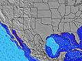 | 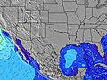 | 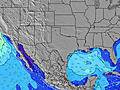 | 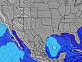 | 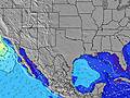 | 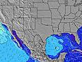 | 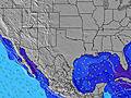 | ||||||||||||||
Wave Height (m) Direction Period (s) | SSE 5 | SSE 5 | SSE 5 | SSE 5 | SSE 5 | SSE 5 | SE 5 | SSE 5 | SSE 5 | SE 5 | SSE 5 | SSE 5 | SSE 5 | SE 5 | SE 5 | SE 5 | SE 5 | SE 5 | SE 5 | SE 6 | SE 7 |
Wave Graph | |||||||||||||||||||||
32 | 22 | 44 | 32 | 33 | 73 | 28 | 17 | 30 | 17 | 16 | 70 | 51 | 30 | 33 | 31 | 27 | 35 | 35 | 39 | 63 | |
Wind (km/h) | |||||||||||||||||||||
Wind State on-shore cross-onshore cross-shore cross-offshore off-shore glassy | on | on | cross-on | cross-on | on | cross-on | glassy | cross-on | cross-on | cross | on | cross-on | cross-on | on | on | on | on | on | on | on | on |
High Tide | 2:15PM0.33m | 6:55AM0.41m | 4:10PM0.33m | 6:51AM0.40m | 6:03PM0.34m | 6:41AM0.41m | 8:16PM0.39m | 6:21AM0.44m | 11:02PM0.48m | 5:33AM0.48m | 1:24AM0.59m | 2:30AM0.68m | |||||||||
Low Tide | 12:29PM0.33m | 10:51PM-0.05m | 12:28PM0.29m | 11:25PM0.06m | 12:49PM0.24m | 00:03AM0.19m | 1:20PM0.18m | 00:49AM0.33m | 2:01PM0.12m | 2:02AM0.47m | 2:51PM0.05m | 3:50PM-0.03m | |||||||||
6:50 | — | — | 6:50 | — | — | 6:50 | — | — | 6:52 | — | — | 6:52 | — | — | 6:52 | — | — | 6:52 | — | — | |
— | 8:17 | — | — | 8:16 | — | — | 8:16 | — | — | 8:15 | — | — | 8:15 | — | — | 8:15 | — | — | 8:14 | — | |
mm | — | — | — | — | — | — | — | — | — | — | — | — | — | — | — | — | — | — | 1 | — | — |
Temp °C | 28 | 28 | 28 | 28 | 28 | 28 | 28 | 29 | 28 | 29 | 29 | 28 | 28 | 29 | 28 | 29 | 29 | 28 | 28 | 29 | 28 |
Feels °C | 31 | 29 | 29 | 31 | 29 | 28 | 33 | 31 | 30 | 31 | 30 | 28 | 31 | 31 | 30 | 32 | 31 | 29 | 31 | 31 | 28 |
Swell 1 Height (m) Direction Period (s) | SE 7 | SE 7 | SE 7 | SSE 5 | — | — | SE 5 | SSE 5 | SE 10 | SE 5 | ESE 9 | ESE 9 | SE 9 | ESE 9 | SE 8 | SE 5 | SE 8 | — | SE 5 | SE 6 | — |
2 | 2 | 2 | 32 | — | — | 28 | 17 | 4 | 17 | 8 | 8 | 3 | 8 | 3 | 31 | 3 | — | 35 | 39 | — | |
Swell 2 Height (m) Direction Period (s) | — | — | — | — | — | — | E 9 | SE 9 | ESE 10 | SSW 4 | — | — | — | — | — | E 9 | SE 8 | — | — | — | — |
— | — | — | — | — | — | 2 | 3 | 9 | 7 | — | — | — | — | — | 2 | 3 | — | — | — | — | |
Swell 3 Height (m) Direction Period (s) | — | — | — | — | — | — | — | — | — | ESE 10 | — | — | — | — | — | — | — | — | — | — | — |
— | — | — | — | — | — | — | — | — | 9 | — | — | — | — | — | — | — | — | — | — | — | |
Wind waves Height (m) Direction Period (s) | SSE 5 | SSE 5 | SSE 5 | — | SSE 5 | SSE 5 | — | — | SSE 5 | — | SSE 5 | SSE 5 | SSE 5 | SE 5 | SE 5 | S 5 | SE 5 | SE 5 | — | — | SE 7 |
32 | 22 | 44 | — | 33 | 73 | — | — | 30 | — | 16 | 70 | 51 | 30 | 33 | 13 | 27 | 35 | — | — | 63 | |
Nearest Offshore or Glassy | |||||||||||||||||||||
Distance (km) | 1055 | 1155 | 1033 | 1055 | 1307 | 1050 | 32 | 1155 | 963 | 1011 | 1228 | 1050 | 1055 | 1536 | 1050 | 1055 | 1154 | 1050 | 1055 | 1157 | 1050 |
Best forecast wave conditions in Texas | |||||||||||||||||||||
Best forecast wave conditions in United States | |||||||||||||||||||||
Header Global | |||||||||||||||||||||
- Map Icons:
 Break
Break Live Wave Height (m)
 Live Wind Speed (km/h)
 Surf Rating (10 Max)
 Ocean Swells (m)
- Wind Speed (km/h)
Latest Updates


FREE! Surf-Forecast.com widget for your website
The surf report / weather widget below is available to embed on third party websites free of charge and provides a summary of our Fish Pass Jetty surf forecast. Simply grab the html code snippet that we provide and paste it into your own site. You can choose your preferred language and metric/imperial units for the surf forecast feed to suit users of your site. Click here to get the code.
Information about the Fish Pass Jetty Surf forecast
The above surf forecast table for Fish Pass Jetty provides essential information for determining whether the surfing conditions will be good over the next 16 days. A general guide to surfing at Fish Pass Jetty can be found by selecting the local surf guide option on the grey menu. Our Fish Pass Jetty surf forecast is unique since it includes wave energy (power) that defines the real feel of the surf rather than just the height or the period. If you surf the same spot (Fish Pass Jetty) regularly then make a mental note of the wave energy from the surf forecast table each time you go. Very soon you may start to choose your surf days based on the wave energy alone combined with our forecast of favourable offshore wind conditions. Our star ratings will help here and of course you will also find the usual wave height and period predictions on our surf forecasts as well as a full break down of the swell components under our advanced users option (to reveal that, click the little Einstein character under the tide times).
Further information to help with frequently asked questions about our surf forecast for Fish Pass Jetty may be found under the help tab on the top menu and also by moving your mouse over the question marks on the surf forecast table itself. Please always bear in mind that the forecast is for near-shore open water and local factors at each surf break influence the actual breaking wave height, such as the beach / reef profile, water depths offshore and shelter.
Are you planning a vacation in Texas? If you are looking for accommodation near Fish Pass Jetty, camping, hotels and condos and appartments in Texas, consider staying in Portland which is 25 km (16 miles) away. Other places in and around Texas where you can find information about places to rent, and car hire include Rockport - Arkansas County which is 26 km (16 miles) away, Corpus Christi, Kingsville and Corpus Christi.
 Nearest