

Surf Forecasts:

Fifth Street (Miami) surf forecast from 3 Aug 2026:
- Most powerful swell: Friday 7 Aug, 2PM (local time) - 4ft (1.2m), 5s period, E swell with 77 kJ wave energy.
Best Forecast Surf Conditions for Fifth Street (Miami) this week:
The most powerful waves expected at Fifth Street (Miami) in the next 16 days are 1.2m 5s and forecast to arrive on Friday (Aug 07) at 2PM. Winds are predicted to be onshore at the time the swell arrives. The largest open ocean swell (not directed at the beach) is 0.7m 5s period and expected on Saturday (Aug 08) at 5PM.
| Wave Type | Time (EDT) & Date | Wave Height & Period |
|---|---|---|
| Next good surf (1 star+) | - | - |
| Best Surf | - | - |
| Most Powerful | 2PM (Fri 7th Aug) | 4ft (1.2m) 5s |
Table - best surf conditions forecast for Fifth Street (Miami) over the next 16 days.
The Lowdown
Alright, surfers, Rusty here. Let’s cut to the chase. I’ve looked at the numbers for the next couple of weeks, and honestly, it’s a tough one. We’re staring down the barrel of a long, flat spell with nothing worth paddling out for.
We’re talking about Fifth Street in Miami, a sheltered beach and reef setup, and it’s just not doing anything. The water is a warm 87°, which is about average for this time of year, so at least you can have a nice swim. But that’s where the good news ends.
From now all the way through to the 18th of August, we’re looking at a constant run of tiny, weak slop. The swell is practically non-existent, with wave heights barely scraping 0.3 ft to 4 ft at best, and when it does show a pulse, the period is short—around 4 to 5 seconds. That’s pure wind chop, not a wave you want to ride. The combined energy is laughable, staying under 100 (1 to 70) for the whole period, which is just weak.
The wind is the real killer here. It’s almost always onshore or cross-onshore, blowing at 9 to 16 mph, which just tears up what little bump there is. Every single forecast entry says “poor surf conditions.” There’s no getting around it.
The only time the size gets close to 3 ft is around the 7th and 8th of August, with 4 ft coming from the east, but with that onshore wind and short period, it’s just a messy, choppy shorebreak. This is the kind of setup that’s more interesting for kite surfing than paddle surfing, if you’re into that.
There is one tiny, weird glimmer on the 15th of August: Saturday morning shows a 3 ft swell from the southeast with a 5-second period and a gentle cross-onshore breeze. It’s still not good, but it’s the least bad the whole run. And on the 18th of August, Tuesday morning, the period jumps to 10 seconds from the east, but the swell is only 0.3 ft. A long-period groundswell with no power is just a tease.
So here’s the bottom line: there are no standouts, no good days, nothing to get excited about. This is a blank run. For this area, a long stretch of flatness is just part of the deal. Forecasts can change, but right now, I’d leave the boards at home and find something else to do.
Rusty.
Short Range ForecastHeavy rain (total 27mm), heaviest during Mon night. Warm (max 30°C on Mon afternoon, min 24°C on Mon night). Mainly fresh winds. | Days 4-6 Weather SummaryHeavy rain (total 32mm), heaviest during Fri morning. Warm (max 29°C on Thu morning, min 28°C on Sat night). Wind will be generally light. | ||||||||||||||||||||
Monday 3 | Tuesday 4 | Wednesday 5 | Thursday 6 | Friday 7 | Saturday 8 | Sunday 9 | |||||||||||||||
AM | PM | Night | AM | PM | Night | AM | PM | Night | AM | PM | Night | AM | PM | Night | AM | PM | Night | AM | PM | Night | |
Swell Height Map |  |  |  | 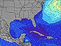 | 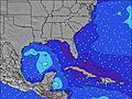 | 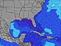 | 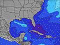 | ||||||||||||||
Wave Height (m) Direction Period (s) | E 8 | SSE 4 | E 8 | E 8 | E 8 | SE 4 | SE 4 | ENE 4 | E 4 | E 4 | ENE 5 | E 5 | E 5 | E 5 | E 4 | ESE 5 | ENE 5 | E 4 | ESE 4 | ENE 4 | ESE 4 |
Wave Graph | |||||||||||||||||||||
1 | 2 | 2 | 2 | 2 | 3 | 13 | 6 | 16 | 33 | 28 | 59 | 59 | 62 | 48 | 44 | 14 | 31 | 25 | 13 | 24 | |
Wind (km/h) | |||||||||||||||||||||
Wind State on-shore cross-onshore cross-shore cross-offshore off-shore glassy | cross | cross-on | on | cross-on | cross-on | on | cross-on | on | on | on | on | on | on | on | cross-on | cross-on | on | on | on | on | cross-on |
High Tide | 12:11PM0.78m | 00:21AM0.77m | 1:01PM0.77m | 1:07AM0.76m | 1:58PM0.76m | 2:01AM0.74m | 3:02PM0.75m | 3:04AM0.73m | 4:11PM0.77m | 4:13AM0.74m | 5:20PM0.79m | 5:24AM0.77m | 6:23PM0.84m | ||||||||
Low Tide | 6:16PM0.08m | 6:40AM-0.00m | 7:05PM0.11m | 7:31AM-0.00m | 8:01PM0.15m | 8:30AM-0.00m | 9:05PM0.17m | 9:35AM-0.00m | 10:15PM0.17m | 10:44AM-0.02m | 11:25PM0.14m | 11:51AM-0.05m | 00:30AM0.10m | ||||||||
6:47 | — | — | 6:48 | — | — | 6:48 | — | — | 6:48 | — | — | 6:48 | — | — | 6:50 | — | — | 6:50 | — | — | |
— | 8:05 | — | — | 8:04 | — | — | 8:04 | — | — | 8:02 | — | — | 8:01 | — | — | 8:01 | — | — | 8:00 | — | |
mm | — | 1 | 13 | — | — | 8 | 2 | 2 | 1 | — | 6 | 5 | 6 | 2 | 12 | 1 | — | — | — | 2 | 4 |
Temp °C | 29 | 30 | 28 | 29 | 30 | 29 | 29 | 30 | 29 | 29 | 29 | 29 | 29 | 29 | 29 | 29 | 29 | 29 | 29 | 30 | 29 |
Feels °C | 32 | 32 | 29 | 32 | 32 | 30 | 30 | 32 | 31 | 30 | 30 | 30 | 30 | 31 | 31 | 31 | 31 | 30 | 31 | 32 | 31 |
Swell 1 Height (m) Direction Period (s) | SSE 4 | — | E 8 | E 8 | E 8 | E 8 | E 7 | SSE 4 | SSE 5 | SSE 4 | SSE 5 | SSE 5 | N 11 | NE 9 | NNE 8 | NE 9 | SSE 5 | NNE 9 | NE 9 | SE 4 | NE 8 |
4 | — | 1 | 1 | 1 | 1 | 1 | 12 | 5 | 6 | 9 | 3 | 2 | 3 | 7 | 13 | 25 | 8 | 3 | 9 | 3 | |
Swell 2 Height (m) Direction Period (s) | — | E 8 | NE 8 | NE 8 | NE 8 | NE 8 | N 8 | E 7 | — | — | — | N 10 | N 8 | E 8 | NE 10 | E 8 | NNE 9 | NNE 9 | E 8 | NE 9 | E 7 |
— | 1 | 2 | 2 | 2 | 2 | 1 | 1 | — | — | — | 2 | 1 | 5 | 4 | 5 | 8 | 8 | 1 | 3 | 1 | |
Swell 3 Height (m) Direction Period (s) | E 8 | NE 8 | — | — | — | — | — | N 8 | — | — | — | — | — | — | — | NE 5 | E 8 | — | — | E 7 | — |
1 | 2 | — | — | — | — | — | 1 | — | — | — | — | — | — | — | 1 | 5 | — | — | 1 | — | |
Wind waves Height (m) Direction Period (s) | — | SSE 4 | SSE 4 | SSE 3 | SSE 3 | SE 4 | SE 4 | ENE 4 | E 4 | E 4 | ENE 5 | E 5 | E 5 | E 5 | E 4 | ESE 5 | ENE 5 | E 4 | ESE 4 | ENE 4 | ESE 4 |
— | 2 | 1 | 1 | 1 | 3 | 13 | 6 | 16 | 33 | 28 | 59 | 59 | 62 | 48 | 44 | 14 | 31 | 25 | 13 | 24 | |
Nearest Offshore or Glassy | |||||||||||||||||||||
Distance (km) | 450 | 175 | 1166 | 236 | 315 | 236 | 450 | 386 | 1166 | 468 | 1632 | 1148 | 860 | 338 | 927 | 847 | 847 | 328 | 362 | 1514 | 362 |
Best forecast wave conditions in South Florida | |||||||||||||||||||||
Best forecast wave conditions in United States | |||||||||||||||||||||
Header Global | |||||||||||||||||||||
- Map Icons:
 Break
Break Live Wave Height (m)
 Live Wind Speed (km/h)
 Surf Rating (10 Max)
 Ocean Swells (m)
- Wind Speed (km/h)
Latest Updates


FREE! Surf-Forecast.com widget for your website
The surf report / weather widget below is available to embed on third party websites free of charge and provides a summary of our Fifth Street (Miami) surf forecast. Simply grab the html code snippet that we provide and paste it into your own site. You can choose your preferred language and metric/imperial units for the surf forecast feed to suit users of your site. Click here to get the code.
Information about the Fifth Street (Miami) Surf forecast
The above surf forecast table for Fifth Street (Miami) provides essential information for determining whether the surfing conditions will be good over the next 16 days. A general guide to surfing at Fifth Street (Miami) can be found by selecting the local surf guide option on the grey menu. Our Fifth Street (Miami) surf forecast is unique since it includes wave energy (power) that defines the real feel of the surf rather than just the height or the period. If you surf the same spot (Fifth Street (Miami)) regularly then make a mental note of the wave energy from the surf forecast table each time you go. Very soon you may start to choose your surf days based on the wave energy alone combined with our forecast of favourable offshore wind conditions. Our star ratings will help here and of course you will also find the usual wave height and period predictions on our surf forecasts as well as a full break down of the swell components under our advanced users option (to reveal that, click the little Einstein character under the tide times).
Further information to help with frequently asked questions about our surf forecast for Fifth Street (Miami) may be found under the help tab on the top menu and also by moving your mouse over the question marks on the surf forecast table itself. Please always bear in mind that the forecast is for near-shore open water and local factors at each surf break influence the actual breaking wave height, such as the beach / reef profile, water depths offshore and shelter.
Fifth Street (Miami) is 1 km (1 miles) from the city of Miami Beach. If you plan a vacation in South Florida, look for hotels and other accommodation in Miami Beach. Miami Beach has rooms for a wide range of budgets as well as car hire and transport links.
 Nearest