

Surf Forecasts:
Clearwater Pass surf forecast from 1 Aug 2026:
- Best quality surf: Monday 3 Aug, 5PM (local time) - 4.5ft (1.3m), 5s period, SW swell with cross-offshore winds.
- Most powerful swell: Monday 3 Aug, 5PM (local time) - 4.5ft (1.3m), 5s period, SW swell with 84 kJ wave energy.
- Next surfable swell (1★+): Monday 3 Aug, 5PM (local time) - 4.5ft (1.3m), 5s period with SW swell.
Best Forecast Surf Conditions for Clearwater Pass this week:
The surf forecast for Clearwater Pass over the next 16 days: The first swell (rated 1 star or higher) is forecast to arrive on Monday (Aug 03) at 5PM. The primary swell is predicted to be 1.3m and 5s period. The wind is predicted to be cross-offshore as the swell arrives.
The most powerful waves expected at Clearwater Pass in the next 16 days are 1.3m 5s and forecast to arrive on Monday (Aug 03) at 5PM. Winds are predicted to be cross-offshore at the time the swell arrives. The largest open ocean swell (not directed at the beach) is 0.7m 4s period and expected on Saturday (Aug 08) at 8AM.
| Wave Type | Time (EDT) & Date | Wave Height & Period |
|---|---|---|
| Next good surf (1 star+) | 5PM (Mon 3rd Aug) | 4.5ft (1.3m) 5s |
| Best Surf | 5PM (Mon 3rd Aug) | 4.5ft (1.3m) 5s |
| Most Powerful | 5PM (Mon 3rd Aug) | 4.5ft (1.3m) 5s |
Table - best surf conditions forecast for Clearwater Pass over the next 16 days.
The Lowdown
Alright, Rusty here. Let's have a look at what's on the table for your local stretch.
Honestly, I'm staring at a pretty bleak run of surf ahead. We’ve got a massive 16-day window, but the first surf that's even worth mentioning doesn't show up until Monday the 3rd of August, and even then, it's a pretty sorry sight. There's a real drought from now until then, with nothing but flat, gutless conditions and poor scores.
The only real standout in this whole period is a brief moment on Monday afternoon, the 3rd of August. We're looking at Clearwater Pass, a point break that rarely breaks. It's a beginner-friendly spot, but man, it's inconsistent. On that afternoon, we'll see a tiny 4ft swell coming from the southwest. The wind will be light and cross-off, which should keep the surface clean. The combined swell energy is a weak 84. The water is sitting at a warm 87°, which is about average for this time of year.
But don't get your hopes up too high. The rest of the week is a washout. By the 4th and 5th of August, the swell completely fades, and we're back to tiny, onshore junk. The second week, from the 6th of August onwards, is a total write-off. There's a long stretch of near-zero swell energy, with wind either onshore or cross-off but no real waves to work with. The best we see are glassy mornings on the 13th of August, but with no swell, it's just a flat, shiny lake. It's a proper blank run, and for this area, that's not unusual.
To sum it up: if you're desperate, that Monday afternoon is your only shot, but it's a poor one. Otherwise, you're better off saving the wax for another week. The forecasts can change, but right now, it's looking grim.
Rusty.
Short Range ForecastHeavy rain (total 23mm), heaviest during Mon morning. Warm (max 29°C on Sat morning, min 25°C on Sun night). Mainly fresh winds. | Days 4-6 Weather SummaryModerate rain (total 14mm), heaviest on Wed night. Warm (max 32°C on Thu afternoon, min 26°C on Wed morning). Wind will be generally light. | ||||||||||||||||||||
Saturday 1 | Sunday 2 | Monday 3 | Tuesday 4 | Wednesday 5 | Thursday 6 | Friday 7 | |||||||||||||||
AM | PM | Night | AM | PM | Night | AM | PM | Night | AM | PM | Night | AM | PM | Night | AM | PM | Night | AM | PM | Night | |
Swell Height Map |  |  |  | 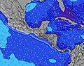 | 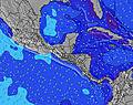 | 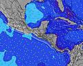 | 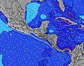 | ||||||||||||||
Wave Height (m) Direction Period (s) | W 5 | WNW 4 | WNW 5 | W 5 | WSW 6 | W 6 | W 6 | SW 5 | W 6 | W 6 | W 5 | W 5 | W 5 | W 5 | N 3 | SSE 4 | S 4 | S 4 | SSE 4 | S 4 | SSE 4 |
Wave Graph | |||||||||||||||||||||
16 | 27 | 30 | 25 | 42 | 39 | 26 | 84 | 26 | 16 | 9 | 5 | 2 | 2 | 0 | 0 | 4 | 2 | 0 | 3 | 0 | |
Wind (km/h) | |||||||||||||||||||||
Wind State on-shore cross-onshore cross-shore cross-offshore off-shore glassy | on | cross-on | cross-on | cross-on | cross-on | cross | cross-on | cross-off | cross-off | cross-on | cross-on | cross-off | cross-off | cross-on | cross-off | off | cross-off | off | off | cross-on | cross |
High Tide | 1:41PM0.91m | 2:46AM0.74m | 2:24PM0.84m | 3:08AM0.78m | 3:14PM0.76m | 3:35AM0.81m | 4:16PM0.66m | 4:10AM0.85m | 5:42PM0.57m | 4:57AM0.88m | 7:57PM0.52m | 6:00AM0.91m | 10:55PM0.54m | ||||||||
Low Tide | 8:25PM0.07m | 8:26AM0.25m | 8:53PM0.14m | 9:17AM0.22m | 9:22PM0.23m | 10:15AM0.19m | 9:53PM0.32m | 11:27AM0.16m | 10:25PM0.41m | 12:54PM0.12m | 10:58PM0.49m | 2:24PM0.05m | 11:56PM0.54m | ||||||||
6:52 | — | — | 6:54 | — | — | 6:54 | — | — | 6:54 | — | — | 6:54 | — | — | 6:56 | — | — | 6:56 | — | — | |
— | 8:21 | — | — | 8:20 | — | — | 8:19 | — | — | 8:19 | — | — | 8:17 | — | — | 8:16 | — | — | 8:15 | — | |
mm | — | 4 | 2 | 3 | — | 2 | 11 | 1 | — | — | 1 | 1 | — | 1 | 6 | — | — | 5 | — | 1 | 10 |
Temp °C | 29 | 29 | 29 | 29 | 29 | 27 | 28 | 27 | 28 | 28 | 30 | 29 | 28 | 30 | 29 | 28 | 32 | 30 | 28 | 31 | 27 |
Feels °C | 31 | 30 | 30 | 30 | 28 | 27 | 28 | 29 | 32 | 31 | 33 | 33 | 30 | 33 | 31 | 29 | 34 | 31 | 30 | 34 | 27 |
Swell 1 Height (m) Direction Period (s) | — | — | WNW 5 | W 5 | WSW 6 | W 6 | W 6 | — | W 6 | W 6 | W 5 | W 5 | W 5 | S 4 | N 3 | — | S 4 | S 4 | — | S 4 | — |
— | — | 30 | 25 | 42 | 39 | 26 | — | 26 | 16 | 9 | 5 | 2 | 1 | 1 | — | 4 | 2 | — | 3 | — | |
Swell 2 Height (m) Direction Period (s) | — | — | — | — | — | — | — | — | — | — | S 4 | — | S 4 | — | — | — | — | — | — | — | — |
— | — | — | — | — | — | — | — | — | — | 3 | — | 1 | — | — | — | — | — | — | — | — | |
Swell 3 Height (m) Direction Period (s) | — | — | — | — | — | — | — | — | — | — | — | — | — | — | — | — | — | — | — | — | — |
— | — | — | — | — | — | — | — | — | — | — | — | — | — | — | — | — | — | — | — | — | |
Wind waves Height (m) Direction Period (s) | W 5 | WNW 4 | — | SSW 3 | SSW 4 | SSW 4 | SSW 4 | SW 5 | S 4 | S 4 | — | — | — | W 5 | — | SSE 4 | — | SE 3 | SSE 4 | SSE 4 | SSE 4 |
16 | 27 | — | 3 | 5 | 9 | 24 | 84 | 9 | 7 | — | — | — | 2 | — | 12 | — | 2 | 7 | 7 | 5 | |
Nearest Offshore or Glassy | |||||||||||||||||||||
Distance (km) | 1097 | 676 | 981 | 296 | 231 | 248 | 248 | 0 | 248 | 221 | 751 | 221 | 296 | 822 | 981 | 822 | 1735 | 1510 | 1062 | 271 | 221 |
Best forecast wave conditions in Gulf Coast, Florida | |||||||||||||||||||||
Best forecast wave conditions in United States | |||||||||||||||||||||
Header Global | |||||||||||||||||||||
- Map Icons:
 Break
Break Live Wave Height (m)
 Live Wind Speed (km/h)
 Surf Rating (10 Max)
 Ocean Swells (m)
- Wind Speed (km/h)
Latest Updates


FREE! Surf-Forecast.com widget for your website
The surf report / weather widget below is available to embed on third party websites free of charge and provides a summary of our Clearwater Pass surf forecast. Simply grab the html code snippet that we provide and paste it into your own site. You can choose your preferred language and metric/imperial units for the surf forecast feed to suit users of your site. Click here to get the code.
Information about the Clearwater Pass Surf forecast
The above surf forecast table for Clearwater Pass provides essential information for determining whether the surfing conditions will be good over the next 16 days. A general guide to surfing at Clearwater Pass can be found by selecting the local surf guide option on the grey menu. Our Clearwater Pass surf forecast is unique since it includes wave energy (power) that defines the real feel of the surf rather than just the height or the period. If you surf the same spot (Clearwater Pass) regularly then make a mental note of the wave energy from the surf forecast table each time you go. Very soon you may start to choose your surf days based on the wave energy alone combined with our forecast of favourable offshore wind conditions. Our star ratings will help here and of course you will also find the usual wave height and period predictions on our surf forecasts as well as a full break down of the swell components under our advanced users option (to reveal that, click the little Einstein character under the tide times).
Further information to help with frequently asked questions about our surf forecast for Clearwater Pass may be found under the help tab on the top menu and also by moving your mouse over the question marks on the surf forecast table itself. Please always bear in mind that the forecast is for near-shore open water and local factors at each surf break influence the actual breaking wave height, such as the beach / reef profile, water depths offshore and shelter.
Clearwater Pass is 4 km (2 miles) from Clearwater. If you plan a vacation in Gulf Coast, Florida, look for hotels and other accommodation in Clearwater. Clearwater has rooms for a wide range of budgets as well as car hire and transport links.
 Nearest