

Surf Forecasts:

Ballina South Wall surf forecast from 11 Jul 2026:
- Best quality surf: Saturday 18 Jul, 7PM (local time) - 15ft (4.5m), 12s period, SE swell with onshore winds.
- Most powerful swell: Saturday 18 Jul, 7PM (local time) - 15ft (4.5m), 12s period, SE swell with 4,836 kJ wave energy.
- Next surfable swell (1★+): Sunday 12 Jul, 4AM (local time) - 4ft (1.2m), 11s period with SE swell.
Best Forecast Surf Conditions for Ballina South Wall this week:
The surf forecast for Ballina South Wall over the next 16 days: The first swell (rated 1 star or higher) is forecast to arrive on Sunday (Jul 12) at 4AM. The primary swell is predicted to be 1.2m and 11s period with a secondary swell of 0.6m and 9s. The wind is predicted to be offshore as the swell arrives.
The most powerful waves expected at Ballina South Wall in the next 16 days are 4.5m 12s and forecast to arrive on Saturday (Jul 18) at 7PM. Winds are predicted to be onshore at the time the swell arrives. The largest open ocean swell (not directed at the beach) is 3.5m 8s period and expected on Thursday (Jul 16) at 7AM.
| Wave Type | Time (AEST) & Date | Wave Height & Period |
|---|---|---|
| Next good surf (1 star+) | 4AM (Sun 12th Jul) | 4ft (1.2m) 11s |
| Best Surf | 7PM (Sat 18th Jul) | 15ft (4.5m) 12s |
| Most Powerful | 7PM (Sat 18th Jul) | 15ft (4.5m) 12s |
Table - best surf conditions forecast for Ballina South Wall over the next 16 days.
G’day, Rusty here. Look, I’m not gonna sugarcoat it – the next week and a half at Ballina South Wall is a write-off for a proper paddle session. There’s a huge slug of onshore wind and big swell coming in that’s just gonna make a mess of things. We’ve got a solid 10 days of nothing worth paddling out for, from Sunday the 13th all the way through to Tuesday the 22nd. It’s a long, quiet stretch for this break.
The one real window that’s worth getting excited about is a little way off, but it’s a beauty. Mark your calendar for Monday the 21st of July. The morning is the standout. We’ve got a clean 8ft SE groundswell with a long 12-second period pushing in. That’s proper energy for a bigger day, and with a light offshore breeze from the WSW, it’s going to be smooth and lined up. The combined energy is a meaty 1793 (moderate-strong), so there’s plenty of push. This is definitely for experienced surfers only – 8ft is big, and the swell direction is hitting the optimum ENE exposure of the break. The water temp is about average for the time of year, nothing weird going on there.
Before that, the only other half-decent window is this coming Sunday morning, the 12th of July. It’s a small one – 4ft SE swell with a 10-second period, and a clean 20 km/h offshore from the WNW. Combined energy is a weak 245, so it’s gutless, but it’ll be clean. It’s a beginner-friendly size, but it’s not gonna blow your mind. After Sunday arvo, it’s all downhill into that big, windy, onshore mess from Thursday the 16th through the 19th, with swell pumping up to 15ft and strong onshore winds. That’s more kite-surfing territory than paddle surfing.
There’s a couple of little cameos on the 24th and 25th of July with clean 4ft – 4ft swells and offshore winds, but they’re small, fun-size days. The real prize is that Monday the 21st morning session. Keep an eye on it, but it’s a long way out. Be patient.
Rusty.
Short Range ForecastMostly dry. Warm (max 21°C on Sun morning, min 12°C on Mon night). Wind will be generally light. | Days 5-7 Weather SummaryModerate rain (total 17mm), heaviest on Wed afternoon. Very mild (max 18°C on Thu morning, min 12°C on Tue night). Winds increasing (light winds from the SSW on Tue night, fresh winds from the S by Wed afternoon). | ||||||||||||||||||||
Sunday 12 | Monday 13 | Tuesday 14 | Wednesday 15 | Thursday 16 | Friday 17 | Sat 18 | |||||||||||||||
Night | AM | PM | Night | AM | PM | Night | AM | PM | Night | AM | PM | Night | AM | PM | Night | AM | PM | Night | AM | PM | |
Swell Height Map |  |  |  |  |  |  |  | 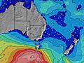 | |||||||||||||
Wave Height (m) Direction Period (s) | SE 11 | SE 10 | SE 10 | SE 10 | SE 9 | SE 8 | ESE 10 | ESE 10 | S 5 | ESE 10 | S 4 | NE 10 | S 8 | NE 9 | SSE 9 | SE 10 | SSE 9 | SSE 9 | SSE 10 | SE 10 | SE 11 |
Wave Graph | |||||||||||||||||||||
347 | 243 | 145 | 74 | 39 | 20 | 20 | 20 | 11 | 9 | 13 | 4 | 0 | 3 | 2684 | 3173 | 2354 | 2244 | 2936 | 3400 | 4577 | |
Wind (km/h) | |||||||||||||||||||||
Wind State on-shore cross-onshore cross-shore cross-offshore off-shore glassy | off | off | off | cross-off | cross-off | cross | cross-off | cross-off | cross-on | cross-off | cross | cross-on | cross-on | on | on | on | on | on | on | on | on |
High Tide | 6:09AM1.02m | 6:52PM1.74m | 7:09AM1.06m | 7:43PM1.83m | 8:02AM1.09m | 8:31PM1.86m | 8:52AM1.12m | 9:17PM1.84m | 9:40AM1.14m | 10:01PM1.75m | 10:26AM1.14m | 10:43PM1.62m | 11:13AM1.13m | ||||||||
Low Tide | 00:42AM0.37m | 11:51AM0.21m | 1:39AM0.28m | 12:49PM0.17m | 2:30AM0.20m | 1:43PM0.13m | 3:16AM0.15m | 2:35PM0.11m | 4:00AM0.12m | 3:25PM0.12m | 4:42AM0.12m | 4:14PM0.16m | 5:21AM0.14m | 5:02PM0.24m | |||||||
— | 6:37 | — | — | 6:37 | — | — | 6:37 | — | — | 6:37 | — | — | 6:37 | — | — | 6:37 | — | — | 6:37 | — | |
— | — | 5:02 | — | — | 5:04 | — | — | 5:04 | — | — | 5:05 | — | — | 5:05 | — | — | 5:06 | — | — | 5:06 | |
mm | — | — | — | — | — | — | — | — | — | — | — | 7 | 7 | 2 | 1 | — | — | — | 2 | 1 | 1 |
Temp °C | 16 | 21 | 21 | 17 | 17 | 17 | 17 | 16 | 16 | 16 | 16 | 16 | 16 | 18 | 18 | 18 | 18 | 18 | 18 | 18 | 18 |
Feels °C | 14 | 17 | 19 | 13 | 16 | 15 | 13 | 13 | 13 | 15 | 10 | 10 | 9 | 10 | 10 | 10 | 11 | 12 | 12 | 13 | 14 |
Swell 1 Height (m) Direction Period (s) | SE 11 | SE 10 | SE 10 | SE 10 | SE 9 | S 8 | S 8 | S 8 | S 5 | S 4 | S 13 | NE 10 | — | NE 9 | NNE 9 | NNE 8 | S 14 | — | S 18 | S 19 | S 19 |
347 | 243 | 145 | 74 | 39 | 43 | 32 | 20 | 7 | 6 | 14 | 4 | — | 3 | 8 | 7 | 14 | — | 6 | 29 | 28 | |
Swell 2 Height (m) Direction Period (s) | SSE 9 | S 9 | S 9 | SSE 8 | S 8 | SE 8 | SE 8 | ESE 10 | ESE 10 | S 8 | ESE 9 | NE 10 | — | — | — | — | S 18 | — | — | ENE 10 | ENE 10 |
82 | 39 | 38 | 22 | 32 | 18 | 10 | 20 | 10 | 11 | 9 | 4 | — | — | — | — | 6 | — | — | 10 | 10 | |
Swell 3 Height (m) Direction Period (s) | S 16 | N 3 | E 11 | N 5 | ESE 10 | ESE 10 | ESE 10 | SE 8 | S 7 | ESE 10 | S 10 | — | — | — | — | — | — | — | — | — | — |
5 | 2 | 2 | 4 | 21 | 20 | 20 | 2 | 4 | 9 | 2 | — | — | — | — | — | — | — | — | — | — | |
Wind waves Height (m) Direction Period (s) | NW 3 | WNW 3 | NNW 4 | WSW 3 | SW 7 | — | WNW 3 | SW 3 | S 5 | — | S 4 | S 7 | S 8 | SSE 8 | SSE 9 | SE 10 | SSE 9 | SSE 9 | SSE 10 | SE 10 | SE 11 |
2 | 1 | 6 | 6 | 24 | — | 6 | 2 | 11 | — | 13 | 573 | 1422 | 1667 | 2684 | 3173 | 2354 | 2244 | 2936 | 3400 | 4577 | |
Nearest Offshore or Glassy | |||||||||||||||||||||
Distance (km) | 0 | 0 | 0 | 0 | 0 | 188 | 4 | 265 | 247 | 315 | 189 | 38 | 79 | 573 | 490 | 65 | 65 | 65 | 65 | 27 | 27 |
Best forecast wave conditions in North Coast - New South Wales | |||||||||||||||||||||
Best forecast wave conditions in Australia | |||||||||||||||||||||
Header Global | |||||||||||||||||||||
- Map Icons:
 Break
Break Live Wave Height (m)
 Live Wind Speed (km/h)
 Surf Rating (10 Max)
 Ocean Swells (m)
- Wind Speed (km/h)


FREE! Surf-Forecast.com widget for your website
The surf report / weather widget below is available to embed on third party websites free of charge and provides a summary of our Ballina South Wall surf forecast. Simply grab the html code snippet that we provide and paste it into your own site. You can choose your preferred language and metric/imperial units for the surf forecast feed to suit users of your site. Click here to get the code.
Information about the Ballina South Wall Surf forecast
The above surf forecast table for Ballina South Wall provides essential information for determining whether the surfing conditions will be good over the next 16 days. A general guide to surfing at Ballina South Wall can be found by selecting the local surf guide option on the grey menu. Our Ballina South Wall surf forecast is unique since it includes wave energy (power) that defines the real feel of the surf rather than just the height or the period. If you surf the same spot (Ballina South Wall) regularly then make a mental note of the wave energy from the surf forecast table each time you go. Very soon you may start to choose your surf days based on the wave energy alone combined with our forecast of favourable offshore wind conditions. Our star ratings will help here and of course you will also find the usual wave height and period predictions on our surf forecasts as well as a full break down of the swell components under our advanced users option (to reveal that, click the little Einstein character under the tide times).
Further information to help with frequently asked questions about our surf forecast for Ballina South Wall may be found under the help tab on the top menu and also by moving your mouse over the question marks on the surf forecast table itself. Please always bear in mind that the forecast is for near-shore open water and local factors at each surf break influence the actual breaking wave height, such as the beach / reef profile, water depths offshore and shelter.
Ballina South Wall is 3 km (2 miles) from Ballina. If you plan a holiday in North Coast - New South Wales, look for hotels and other accommodation in Ballina. Ballina has rooms for a wide range of budgets as well as car hire and transport links.
 Nearest