

Surf Forecasts:

Turtles surf forecast from 12 Jul 2026:
- Best quality surf: Sunday 19 Jul, 12AM (local time) - 1.5ft (0.4m), 15s period, E swell with offshore winds.
- Most powerful swell: Sunday 12 Jul, 12PM (local time) - 2.5ft (0.7m), 11s period, W swell with 116 kJ wave energy.
- Next surfable swell (1★+): Sunday 19 Jul, 12AM (local time) - 1.5ft (0.4m), 15s period with E swell.
Best Forecast Surf Conditions for Turtles this week:
The surf forecast for Turtles over the next 16 days: The first swell (rated 1 star or higher) is forecast to arrive on Sunday (Jul 19) at 12AM. The primary swell is predicted to be 0.4m and 15s period. The wind is predicted to be offshore as the swell arrives.
The most powerful waves expected at Turtles in the next 16 days are 0.7m 11s and forecast to arrive on Sunday (Jul 12) at 12PM. Winds are predicted to be cross-shore at the time the swell arrives. The largest open ocean swell (not directed at the beach) is 3.5m 11s period and expected on Sunday (Jul 12) at 12PM.
| Wave Type | Time (JST) & Date | Wave Height & Period |
|---|---|---|
| Next good surf (1 star+) | 12AM (Sun 19th Jul) | 1.5ft (0.4m) 15s |
| Best Surf | 12AM (Sun 19th Jul) | 1.5ft (0.4m) 15s |
| Most Powerful | 12PM (Sun 12th Jul) | 2.5ft (0.7m) 11s |
Table - best surf conditions forecast for Turtles over the next 16 days.
Right, let’s be honest from the start. Lookin’ at the whole 16-day window for Turtles here, it’s a real mixed bag with a lot of flat spells and ordinary conditions. The first week is a write-off, but there’s a glimmer of something half-decent further out.
The first few days, from Sunday the 12th right through to the middle of the next week, are pretty grim. We’ve got a tiny bit of swell on the 12th, a weak 2ft from the west, but the wind is a fresh cross-shore and the combined energy is a measly 85 – just a weak, lumpy mess. That’s a no-go. Then, from the 13th through to the 16th, it’s flat as a pancake with nothing but onshore breezes. A real dry spell.
There’s a little blip of hope on Sunday the 19th afternoon. The wind finally swings offshore, clean as a whistle, and a small 3ft easterly swell shows up with a moderate energy of 167. But the comment says “surfable waves but very ordinary conditions,” so it’s a one-star day at best. Not something to get excited about.
The real standout, the one that makes you check your calendar, is Thursday the 23rd. The morning looks like the pick of the whole forecast. You’ve got a clean 4ft swell from the east with a nice 11-second period, which gives it a bit of push. The wind is a moderate offshore from the east, and the combined energy is a solid 289 – that’s moderate wave energy and the best we’ll see. The comment even says “expect good surf conditions”. It’s still gonna be a bit small for a barrel, but it’ll be clean and fun. The afternoon drops off a little but is still surfable.
For the rest of the second week, it’s a bit of a slide. Friday the 24th is surfable but ordinary, then the weekend of the 25th and 26th gets messy again with stronger winds and a drop in quality. The last couple of days are flat again.
So, if you’re a surfer and you’re jonesing, your best bet is Thursday the 23rd. That morning at Turtles is the only time the stars align for a clean, surfable wave. The water temp is 84°, which is right about average for the time of year, so no surprises there.
This is Rusty, signing off.
Short Range ForecastLight rain (total 3mm), mostly falling on Sun morning. Warm (max 30°C on Mon morning, min 27°C on Tue night). Winds decreasing (fresh winds from the SSE on Sun morning, light winds from the S by Tue night). | Days 4-6 Weather SummaryLight rain (total 2mm), mostly falling on Fri night. Warm (max 30°C on Fri morning, min 28°C on Wed morning). Wind will be generally light. | ||||||||||||||||||||
Sunday 12 | Monday 13 | Tuesday 14 | Wednesday 15 | Thursday 16 | Friday 17 | Saturday 18 | |||||||||||||||
AM | PM | Night | AM | PM | Night | AM | PM | Night | AM | PM | Night | AM | PM | Night | AM | PM | Night | AM | PM | Night | |
Swell Height Map |  |  |  | 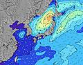 | 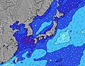 |  |  | ||||||||||||||
Wave Height (m) Direction Period (s) | W 11 | W 10 | W 9 | W 11 | E 9 | E 9 | E 9 | E 9 | E 9 | E 10 | SSW 10 | SW 11 | SW 10 | SW 10 | SW 10 | E 10 | E 10 | SW 9 | SW 9 | SW 9 | E 15 |
Wave Graph | |||||||||||||||||||||
85 | 77 | 42 | 9 | 7 | 15 | 15 | 15 | 15 | 16 | 0 | 0 | 0 | 0 | 0 | 16 | 16 | 0 | 0 | 0 | 67 | |
Wind (km/h) | |||||||||||||||||||||
Wind State on-shore cross-onshore cross-shore cross-offshore off-shore glassy | cross | cross | cross | cross | cross | cross | cross | cross-on | cross-on | cross-on | on | on | on | on | cross-on | on | cross-on | glassy | cross-off | off | off |
High Tide | 6:21PM1.85m | 5:24AM2.01m | 7:12PM1.94m | 6:18AM2.10m | 7:57PM2.00m | 7:09AM2.16m | 8:39PM2.02m | 7:58AM2.17m | 9:17PM2.01m | 8:46AM2.13m | 9:54PM1.97m | 9:33AM2.02m | 10:30PM1.92m | ||||||||
Low Tide | 11:29AM0.15m | 11:46PM1.04m | 12:23PM0.01m | 00:39AM0.98m | 1:13PM-0.07m | 1:27AM0.90m | 1:59PM-0.09m | 2:12AM0.83m | 2:43PM-0.03m | 2:56AM0.77m | 3:25PM0.09m | 3:40AM0.73m | 4:04PM0.27m | ||||||||
5:43 | — | — | 5:43 | — | — | 5:45 | — | — | 5:45 | — | — | 5:45 | — | — | 5:46 | — | — | 5:46 | — | — | |
— | 7:23 | — | — | 7:23 | — | — | 7:23 | — | — | 7:23 | — | — | 7:22 | — | — | 7:22 | — | — | 7:22 | — | |
mm | 2 | — | — | — | — | — | — | — | 1 | — | — | — | — | — | — | — | — | 2 | 1 | 3 | 1 |
Temp °C | 29 | 29 | 28 | 30 | 30 | 28 | 30 | 30 | 28 | 29 | 29 | 28 | 29 | 29 | 28 | 30 | 30 | 28 | 29 | 29 | 28 |
Feels °C | 31 | 31 | 30 | 32 | 32 | 32 | 33 | 33 | 33 | 32 | 32 | 32 | 33 | 33 | 33 | 35 | 34 | 33 | 33 | 32 | 31 |
Swell 1 Height (m) Direction Period (s) | SW 12 | SW 11 | SW 10 | E 9 | E 9 | S 9 | E 9 | SSW 8 | SSW 8 | SSW 9 | SSW 10 | SW 11 | SW 10 | SW 10 | SW 10 | SW 9 | SW 9 | SW 9 | SW 9 | SW 9 | ESE 10 |
899 | 268 | 94 | 7 | 7 | 390 | 15 | 120 | 84 | 199 | 251 | 254 | 170 | 138 | 92 | 119 | 135 | 152 | 109 | 91 | 125 | |
Swell 2 Height (m) Direction Period (s) | W 11 | W 10 | W 9 | W 11 | SE 13 | E 9 | SE 12 | SSE 8 | SW 10 | S 7 | S 8 | ESE 10 | S 7 | S 7 | S 7 | S 7 | E 10 | ESE 10 | E 9 | E 8 | SW 8 |
85 | 77 | 42 | 9 | 7 | 15 | 6 | 115 | 27 | 9 | 11 | 37 | 26 | 15 | 15 | 8 | 16 | 31 | 41 | 37 | 71 | |
Swell 3 Height (m) Direction Period (s) | — | SE 12 | SE 13 | SE 13 | ESE 13 | SE 10 | SE 9 | E 9 | E 9 | E 10 | SE 11 | SE 11 | ESE 9 | ESE 9 | ESE 9 | E 10 | S 7 | S 7 | ESE 12 | ESE 12 | E 15 |
— | 24 | 7 | 7 | 16 | 4 | 3 | 15 | 15 | 16 | 18 | 18 | 35 | 29 | 17 | 16 | 4 | 4 | 15 | 45 | 67 | |
Wind waves Height (m) Direction Period (s) | S 12 | S 11 | S 10 | S 9 | S 9 | — | S 8 | S 8 | S 8 | S 8 | — | S 7 | — | — | — | — | — | — | — | — | — |
3643 | 2018 | 1138 | 723 | 505 | — | 273 | 223 | 80 | 124 | — | 25 | — | — | — | — | — | — | — | — | — | |
Nearest Offshore or Glassy | |||||||||||||||||||||
Distance (km) | 618 | 618 | 618 | 669 | 635 | 635 | 669 | 623 | 2 | 79 | 600 | 24 | 79 | 29 | 79 | 661 | 1248 | 2 | 2 | 2 | 0 |
Best forecast wave conditions in Okinawa | |||||||||||||||||||||
Best forecast wave conditions in Japan | |||||||||||||||||||||
Header Global | |||||||||||||||||||||
- Map Icons:
 Break
Break Live Wave Height (m)
 Live Wind Speed (km/h)
 Surf Rating (10 Max)
 Ocean Swells (m)
- Wind Speed (km/h)


FREE! Surf-Forecast.com widget for your website
The surf report / weather widget below is available to embed on third party websites free of charge and provides a summary of our Turtles surf forecast. Simply grab the html code snippet that we provide and paste it into your own site. You can choose your preferred language and metric/imperial units for the surf forecast feed to suit users of your site. Click here to get the code.
Information about the Turtles Surf forecast
The above surf forecast table for Turtles provides essential information for determining whether the surfing conditions will be good over the next 16 days. A general guide to surfing at Turtles can be found by selecting the local surf guide option on the grey menu. Our Turtles surf forecast is unique since it includes wave energy (power) that defines the real feel of the surf rather than just the height or the period. If you surf the same spot (Turtles) regularly then make a mental note of the wave energy from the surf forecast table each time you go. Very soon you may start to choose your surf days based on the wave energy alone combined with our forecast of favourable offshore wind conditions. Our star ratings will help here and of course you will also find the usual wave height and period predictions on our surf forecasts as well as a full break down of the swell components under our advanced users option (to reveal that, click the little Einstein character under the tide times).
Further information to help with frequently asked questions about our surf forecast for Turtles may be found under the help tab on the top menu and also by moving your mouse over the question marks on the surf forecast table itself. Please always bear in mind that the forecast is for near-shore open water and local factors at each surf break influence the actual breaking wave height, such as the beach / reef profile, water depths offshore and shelter.
Turtles is 3 km (2 miles) from the city of Chatan. If you plan a holiday in Okinawa, look for hotels and other accommodation in Chatan. Chatan has rooms for a wide range of budgets as well as car hire and transport links.
 Nearest