

Surf Forecasts:

How big are the waves at Turtles today (03 Aug):
- Morning surf: Morning surf (03 Aug, local time) - 1.5ft (0.4m), 8s period with NE swell.
- Afternoon surf: Afternoon surf (03 Aug, local time) - 0.5ft (0.2m), 7s period with WNW swell.
The current surf forecast for Turtles at 2PM is: 0.2m 7s primary swell from a West-northwest direction (forecast issued at 08:00am August 03). An open ocean swell of 1.1m 16s is not directed at the surf break, a second open ocean swell of 0.2m 7s is not directed at the surf break. The wind direction is predicted to be cross-offshore.
| Time (JST) & Date | Wave Height | Wave Period |
|---|---|---|
| Morning (03 Aug) | 1.5ft (0.4m) | 8s |
| Afternoon (03 Aug) | 0.5ft (0.2m) | 7s |
| Evening (03 Aug) | - | - |
Table - waves today at Turtles. (Swell directed towards the surf break)
Short Range ForecastModerate rain (total 19mm), heaviest on Mon night. Warm (max 30°C on Mon morning, min 28°C on Mon night). Winds increasing (light winds from the NE on Mon night, fresh winds from the N by Wed night). | ||||||||||||||||||||||
Monday 3 | Tuesday 4 | Wednesday 5 | ||||||||||||||||||||
6 AM | 9 AM | 12 PM | 3 PM | 6 PM | 9 PM | 12 AM | 3 AM | 6 AM | 9 AM | 12 PM | 3 PM | 6 PM | 9 PM | 12 AM | 3 AM | 6 AM | 9 AM | 12 PM | 3 PM | 6 PM | 9 PM | |
Swell Height Map |  |  |  | 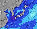 |  |  | 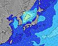 |  | ||||||||||||||
Wave Height (m) Direction Period (s) | ENE 8 | NE 8 | W 7 | W 7 | WNW 7 | ESE 16 | ESE 16 | ESE 16 | NNE 4 | E 17 | E 17 | E 17 | E 17 | ESE 17 | E 17 | E 17 | E 17 | E 18 | E 18 | E 18 | E 18 | E 18 |
Wave Graph | ||||||||||||||||||||||
13 | 16 | 4 | 5 | 5 | 0 | 0 | 0 | 6 | 0 | 0 | 0 | 1954 | 0 | 0 | 0 | 0 | 3231 | 3637 | 4251 | 6315 | 8259 | |
Wind (km/h) | ||||||||||||||||||||||
Wind State on-shore cross-onshore cross-shore cross-offshore off-shore glassy | cross-off | cross-off | cross-off | cross-off | cross-off | cross-off | cross-off | cross-off | cross-off | cross-off | cross-off | off | off | off | off | off | off | cross-off | cross-off | cross-off | cross-off | cross-off |
High Tide | 9:45AM1.90m | 10:17PM1.94m | 10:31AM1.79m | 10:50PM1.90m | 11:26AM1.66m | |||||||||||||||||
Low Tide | 3:45AM0.62m | 3:57PM0.47m | 4:26AM0.60m | 4:31PM0.63m | 5:14AM0.59m | 5:10PM0.81m | ||||||||||||||||
5:54 | — | — | — | — | — | — | 5:54 | — | — | — | — | — | — | — | 5:54 | — | — | — | — | — | — | |
— | — | — | — | 7:15 | — | — | — | — | — | — | — | 7:14 | — | — | — | — | — | — | — | 7:13 | — | |
mm | — | — | — | — | — | — | — | 4 | 1 | 2 | 1 | 2 | 1 | 1 | — | 1 | 1 | — | 2 | 1 | 2 | — |
Temp °C | 28 | 29 | 30 | 30 | 30 | 29 | 29 | 28 | 28 | 29 | 30 | 30 | 29 | 28 | 28 | 28 | 28 | 29 | 30 | 30 | 29 | 28 |
Feels °C | 31 | 32 | 32 | 32 | 32 | 32 | 32 | 31 | 32 | 33 | 33 | 33 | 32 | 32 | 32 | 32 | 31 | 31 | 32 | 31 | 31 | 29 |
Swell 1 Height (m) Direction Period (s) | ESE 15 | ESE 15 | ESE 16 | ESE 16 | ESE 16 | ESE 16 | ESE 16 | ESE 16 | ESE 17 | E 17 | E 17 | E 17 | E 17 | ESE 17 | E 17 | E 17 | E 17 | E 18 | E 18 | E 18 | E 18 | E 18 |
402 | 392 | 620 | 636 | 768 | 671 | 793 | 940 | 1086 | 1389 | 1573 | 1555 | 1954 | 2238 | 2441 | 2651 | 2651 | 3231 | 3637 | 4251 | 6315 | 8259 | |
Swell 2 Height (m) Direction Period (s) | SSE 9 | SSE 9 | S 7 | SSE 7 | SSE 7 | S 7 | S 7 | S 8 | NNE 4 | SSE 7 | SSE 8 | SSE 8 | SSE 8 | SE 8 | SE 8 | SSE 8 | SSE 8 | SSE 8 | S 7 | S 7 | — | — |
8 | 7 | 4 | 5 | 5 | 4 | 4 | 5 | 6 | 10 | 20 | 21 | 25 | 15 | 14 | 33 | 19 | 32 | 17 | 9 | — | — | |
Swell 3 Height (m) Direction Period (s) | S 7 | S 7 | W 7 | W 7 | SE 14 | SW 7 | SW 7 | SW 7 | S 7 | — | — | — | — | — | — | — | — | SW 8 | — | — | — | — |
4 | 4 | 4 | 4 | 8 | 2 | 2 | 2 | 9 | — | — | — | — | — | — | — | — | 9 | — | — | — | — | |
Wind waves Height (m) Direction Period (s) | ENE 8 | NE 8 | — | WNW 7 | WNW 7 | N 3 | N 4 | N 4 | — | — | — | — | SE 8 | — | — | SE 8 | NE 5 | SE 8 | NE 5 | NE 5 | — | — |
13 | 16 | — | 5 | 5 | 5 | 7 | 8 | — | — | — | — | 21 | — | — | 20 | 21 | 28 | 41 | 72 | — | — | |
Nearest Offshore or Glassy | ||||||||||||||||||||||
Distance (km) | 3 | 3 | 29 | 29 | 24 | 39 | 600 | 3 | 3 | 3 | 3 | 3 | 0 | 3 | 3 | 2 | 3 | 34 | 609 | 792 | 609 | 609 |
Best forecast wave conditions in Okinawa | ||||||||||||||||||||||
Best forecast wave conditions in Japan | ||||||||||||||||||||||
Header Global | ||||||||||||||||||||||
- Map Icons:
 Break
Break Live Wave Height (m)
 Live Wind Speed (km/h)
 Surf Rating (10 Max)
 Ocean Swells (m)
- Wind Speed (km/h)
Latest Updates


FREE! Surf-Forecast.com widget for your website
The surf report / weather widget below is available to embed on third party websites free of charge and provides a summary of our Turtles surf forecast. Simply grab the html code snippet that we provide and paste it into your own site. You can choose your preferred language and metric/imperial units for the surf forecast feed to suit users of your site. Click here to get the code.
 Nearest