

Surf Forecasts:

Byron Bay - The Wreck surf forecast from 10 Jul 2026:
- Best quality surf: Friday 10 Jul, 10PM (local time) - 6ft (1.9m), 11s period, SE swell with cross-offshore winds.
- Most powerful swell: Friday 17 Jul, 10PM (local time) - 7ft (2.2m), 10s period, ESE swell with 913 kJ wave energy.
- Next surfable swell (1★+): Friday 10 Jul, 10PM (local time) - 6ft (1.9m), 11s period with SE swell.
Best Forecast Surf Conditions for Byron Bay - The Wreck this week:
The surf forecast for Byron Bay - The Wreck over the next 16 days: The first swell (rated 1 star or higher) is forecast to arrive on Friday (Jul 10) at 10PM. The primary swell is predicted to be 1.9m and 11s period with a secondary swell of 0.1m and 20s. The wind is predicted to be cross-offshore as the swell arrives.
The most powerful waves expected at Byron Bay - The Wreck in the next 16 days are 2.2m 10s and forecast to arrive on Friday (Jul 17) at 10PM. Winds are predicted to be cross-offshore at the time the swell arrives. The largest open ocean swell (not directed at the beach) is 0.8m 4s period and expected on Wednesday (Jul 15) at 10AM.
| Wave Type | Time (AEST) & Date | Wave Height & Period |
|---|---|---|
| Next good surf (1 star+) | 10PM (Fri 10th Jul) | 6ft (1.9m) 11s |
| Best Surf | 10PM (Fri 10th Jul) | 6ft (1.9m) 11s |
| Most Powerful | 10PM (Fri 17th Jul) | 7ft (2.2m) 10s |
Table - best surf conditions forecast for Byron Bay - The Wreck over the next 16 days.
Alright, let's get into it. This is the outlook for the next couple of weeks around Byron Bay. It's a mixed bag, but we've got a few windows if you're keen.
The main story here is The Wreck. It's a sheltered reef setup, which is good because this swell is mostly coming from the SE, right in its optimum zone. Water temp is sitting at about 69° Fahrenheit, which is pretty average for this time of year, no surprises there.
We kick things off on Friday afternoon, the 10th of July. There's a solid 7-foot SE swell rolling in with an 11-second period. The combined swell energy is moderate at 997 and the wind is offshore from the south. This is the pick of the forecast, clean, decent size, and that reef will handle the long period nicely. Good luck getting a park, crowds are often here.
Saturday morning, the 11th, the swell drops to 5-foot from the SE, period is 10 seconds. Wind is light offshore from the SW, so it's clean. It's a solid morning but not the standout of the day. By Saturday afternoon, the wind goes glassy from the east, and the swell eases to 4-foot ESE at 12 seconds. The energy drops to 619, but for an afternoon session on the reef, it'll be clean and fun.
Sunday the 12th is a write-off with bumpy cross-shore and cross-onshore winds, and the swell is shrinking fast. Energy drops to 289, then 175.
From Monday the 13th through most of the second week, it's a tough run. The swell goes tiny, with energy readings dropping well below 100 for a few days. There's a blip on Wednesday the 15th with an 8-foot S swell, but it's got a short, choppy 7-second period and fresh SSE winds blowing 19 mph. That makes for poor quality. Thursday the 16th is similar, with 8-foot SSE swells, still short period, and bumpy winds.
We get another look on Friday the 17th with a 7-foot SE swell and light cross-off winds. It’s surfable, but the 7-second period means it's not that clean. Saturday the 18th keeps that trend, with moderate winds and short-period swell.
Now, the second week has a few glimmers. Sunday the 19th of July sees some relief. The morning has light offshore winds from the SW, with a 4-foot E swell. By the afternoon, it goes glassy from the south with a 5-foot ESE swell. Energy is still moderate at 331, but it'll be clean. Monday the 20th continues that with glassy conditions in the morning, but the swell is a bit smaller.
From the 21st onwards, it's mostly onshore, cross-on, or bumpy winds with small swell, under 4 feet. There's a moment on Thursday the 23rd morning with glassy conditions and a tiny 3-foot ENE swell, but it's barely worth the paddle.
The real standout is that Friday afternoon, the 10th of July, at The Wreck. It's the only time we get decent size, a good period, and clean offshore wind together. Saturday the 11th morning and afternoon are worth a mention too, especially the glassy afternoon session.
So, in short, there are long gaps of flat or poor surf, especially mid-week. If you're picky, Friday the 10th is the one to aim for. After that, you're chasing clean but small windows on the 19th and 20th of July.
Rusty.
Short Range ForecastLight rain (total 8mm), mostly falling on Fri afternoon. Warm (max 21°C on Sun morning, min 12°C on Fri night). Wind will be generally light. | Days 5-7 Weather SummarySome drizzle, heaviest during Wed afternoon. Very mild (max 18°C on Wed afternoon, min 12°C on Mon night). Winds increasing (light winds from the ENE on Mon afternoon, fresh winds from the S by Wed morning). | ||||||||||||||||||||
Fri 10 | Saturday 11 | Sunday 12 | Monday 13 | Tuesday 14 | Wednesday 15 | Thursday 16 | |||||||||||||||
PM | Night | AM | PM | Night | AM | PM | Night | AM | PM | Night | AM | PM | Night | AM | PM | Night | AM | PM | Night | AM | |
Swell Height Map |  |  |  |  |  |  |  | 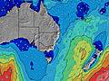 | |||||||||||||
Wave Height (m) Direction Period (s) | SE 11 | SE 11 | SE 10 | ESE 12 | ESE 11 | SE 10 | SE 10 | SE 9 | SE 9 | S 8 | S 8 | S 8 | S 5 | S 7 | SSE 13 | S 7 | SSE 8 | SSE 7 | SSE 7 | SSE 7 | SE 7 |
Wave Graph | |||||||||||||||||||||
990 | 777 | 424 | 399 | 366 | 248 | 145 | 70 | 39 | 28 | 30 | 22 | 12 | 34 | 18 | 628 | 707 | 603 | 758 | 542 | 398 | |
Wind (km/h) | |||||||||||||||||||||
Wind State on-shore cross-onshore cross-shore cross-offshore off-shore glassy | off | cross-off | off | glassy | cross-on | cross | cross-on | cross-off | off | cross-on | cross-off | cross-off | cross-off | cross-off | off | cross-off | cross-off | cross-off | cross-off | cross-off | cross-off |
High Tide | 4:26PM1.47m | 4:32AM1.02m | 5:27PM1.63m | 5:42AM1.01m | 6:24PM1.77m | 6:43AM1.03m | 7:18PM1.89m | 7:38AM1.06m | 8:08PM1.96m | 8:28AM1.10m | 8:55PM1.96m | 9:16AM1.13m | 9:40PM1.89m | 10:03AM1.16m | |||||||
Low Tide | 11:05PM0.36m | 10:34AM0.15m | 00:15AM0.24m | 11:33AM0.09m | 1:15AM0.13m | 12:28PM0.03m | 2:07AM0.05m | 1:20PM-0.03m | 2:54AM0.01m | 2:10PM-0.05m | 3:39AM-0.00m | 2:59PM-0.03m | 4:21AM0.02m | ||||||||
— | — | 6:37 | — | — | 6:37 | — | — | 6:37 | — | — | 6:37 | — | — | 6:37 | — | — | 6:37 | — | — | 6:35 | |
5:02 | — | — | 5:02 | — | — | 5:04 | — | — | 5:04 | — | — | 5:05 | — | — | 5:05 | — | — | 5:06 | — | 5:06 | |
mm | 5 | 3 | — | — | — | — | — | — | — | — | — | — | — | — | — | 1 | — | — | 1 | 7 | 4 |
Temp °C | 16 | 14 | 16 | 16 | 15 | 21 | 21 | 17 | 17 | 16 | 16 | 16 | 16 | 16 | 16 | 18 | 17 | 18 | 17 | 16 | 18 |
Feels °C | 14 | 13 | 15 | 16 | 13 | 18 | 18 | 13 | 15 | 14 | 14 | 12 | 13 | 14 | 10 | 11 | 12 | 12 | 12 | 13 | 16 |
Swell 1 Height (m) Direction Period (s) | SE 11 | SE 11 | SE 10 | ESE 12 | ESE 11 | SE 10 | SE 10 | SE 9 | SE 9 | S 8 | S 8 | S 8 | S 5 | S 7 | ESE 9 | NE 10 | NE 10 | NE 9 | NNE 9 | NE 9 | NE 9 |
990 | 777 | 424 | 399 | 366 | 248 | 145 | 70 | 39 | 28 | 30 | 22 | 12 | 34 | 9 | 4 | 4 | 3 | 7 | 3 | 3 | |
Swell 2 Height (m) Direction Period (s) | S 20 | ESE 15 | ESE 13 | SSE 10 | S 9 | S 9 | SSE 9 | SSE 8 | SSE 8 | SE 8 | ESE 10 | ESE 10 | S 8 | ESE 10 | S 10 | — | — | — | — | S 15 | S 14 |
7 | 21 | 235 | 214 | 79 | 39 | 25 | 22 | 21 | 25 | 20 | 10 | 5 | 10 | 8 | — | — | — | — | 4 | 14 | |
Swell 3 Height (m) Direction Period (s) | — | S 21 | S 19 | S 17 | S 16 | — | E 11 | N 4 | ESE 10 | ESE 10 | SE 8 | N 4 | ESE 10 | S 11 | SSE 13 | — | — | — | — | — | NE 9 |
— | 8 | 7 | 6 | 5 | — | 2 | 3 | 21 | 20 | 10 | 1 | 10 | 3 | 18 | — | — | — | — | — | 3 | |
Wind waves Height (m) Direction Period (s) | — | — | — | — | NNW 3 | NW 3 | NNW 3 | WSW 3 | SW 2 | — | W 2 | SW 3 | S 5 | — | S 4 | S 7 | SSE 8 | SSE 7 | SSE 7 | SSE 7 | SE 7 |
— | — | — | — | 3 | 2 | 3 | 7 | 1 | — | 1 | 2 | 17 | — | 19 | 628 | 707 | 603 | 758 | 542 | 398 | |
Nearest Offshore or Glassy | |||||||||||||||||||||
Distance (km) | 0 | 0 | 0 | 0 | 2 | 2 | 2 | 2 | 2 | 53 | 2 | 34 | 320 | 6 | 162 | 273 | 13 | 53 | 2 | 0 | 0 |
Best forecast wave conditions in North Coast - New South Wales | |||||||||||||||||||||
Best forecast wave conditions in Australia | |||||||||||||||||||||
Header Global | |||||||||||||||||||||
- Map Icons:
 Break
Break Live Wave Height (m)
 Live Wind Speed (km/h)
 Surf Rating (10 Max)
 Ocean Swells (m)
- Wind Speed (km/h)


FREE! Surf-Forecast.com widget for your website
The surf report / weather widget below is available to embed on third party websites free of charge and provides a summary of our Byron Bay - The Wreck surf forecast. Simply grab the html code snippet that we provide and paste it into your own site. You can choose your preferred language and metric/imperial units for the surf forecast feed to suit users of your site. Click here to get the code.
Information about the Byron Bay - The Wreck Surf forecast
The above surf forecast table for Byron Bay - The Wreck provides essential information for determining whether the surfing conditions will be good over the next 16 days. A general guide to surfing at Byron Bay - The Wreck can be found by selecting the local surf guide option on the grey menu. Our Byron Bay - The Wreck surf forecast is unique since it includes wave energy (power) that defines the real feel of the surf rather than just the height or the period. If you surf the same spot (Byron Bay - The Wreck) regularly then make a mental note of the wave energy from the surf forecast table each time you go. Very soon you may start to choose your surf days based on the wave energy alone combined with our forecast of favourable offshore wind conditions. Our star ratings will help here and of course you will also find the usual wave height and period predictions on our surf forecasts as well as a full break down of the swell components under our advanced users option (to reveal that, click the little Einstein character under the tide times).
Further information to help with frequently asked questions about our surf forecast for Byron Bay - The Wreck may be found under the help tab on the top menu and also by moving your mouse over the question marks on the surf forecast table itself. Please always bear in mind that the forecast is for near-shore open water and local factors at each surf break influence the actual breaking wave height, such as the beach / reef profile, water depths offshore and shelter.
The Wreck is 26 km (16 miles) from Ballina. If you plan a holiday in North Coast - New South Wales, look for hotels and other accommodation in Ballina. Ballina has rooms for a wide range of budgets as well as car hire and transport links.
 Nearest