

Surf Forecasts:

How big are the waves at T-Bones today (02 Aug):
- Morning surf: Morning surf (02 Aug, local time) - 7ft (2.2m), 8s period with ENE swell.
- Afternoon surf: Afternoon surf (02 Aug, local time) - 7ft (2.1m), 8s period with ENE swell.
- Evening surf: Evening surf (02 Aug, local time) - 7ft (2.1m), 8s period with ENE swell.
The current surf forecast for T-Bones at 8PM is: 2.1m 8s primary swell from a East-northeast direction and 0.6m 13s secondary swell from a East direction, 0.3m 9s secondary swell from a North direction (forecast issued at 01:00pm August 02). The wind direction is predicted to be cross-onshore.
| Time (HST) & Date | Wave Height | Wave Period |
|---|---|---|
| Morning (02 Aug) | 7ft (2.2m) | 8s |
| Afternoon (02 Aug) | 7ft (2.1m) | 8s |
| Evening (02 Aug) | 7ft (2.1m) | 8s |
Table - waves today at T-Bones. (Swell directed towards the surf break)
Short Range ForecastLight rain (total 2mm), mostly falling on Mon night. Warm (max 26°C on Mon morning, min 25°C on Sun afternoon). Mainly fresh winds. | |||||||||||||||||||||
Sun 2 | Monday 3 | Tuesday 4 | |||||||||||||||||||
11 AM | 2 PM | 5 PM | 8 PM | 11 PM | 2 AM | 5 AM | 8 AM | 11 AM | 2 PM | 5 PM | 8 PM | 11 PM | 2 AM | 5 AM | 8 AM | 11 AM | 2 PM | 5 PM | 8 PM | 11 PM | |
Swell Height Map |  |  |  |  |  |  | 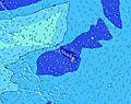 |  | |||||||||||||
Wave Height (m) Direction Period (s) | ENE 8 | ENE 8 | ENE 8 | ENE 8 | ENE 8 | ENE 8 | ENE 8 | ENE 8 | ENE 8 | ENE 8 | ENE 8 | ENE 8 | ENE 9 | ENE 11 | ENE 11 | ENE 11 | ENE 11 | ENE 11 | ENE 11 | ENE 11 | ENE 10 |
Wave Graph | |||||||||||||||||||||
699 | 621 | 554 | 560 | 547 | 492 | 446 | 353 | 286 | 306 | 306 | 329 | 344 | 704 | 593 | 485 | 476 | 487 | 496 | 427 | 388 | |
Wind (km/h) | |||||||||||||||||||||
Wind State on-shore cross-onshore cross-shore cross-offshore off-shore glassy | cross-on | cross-on | cross-on | cross-on | cross-on | cross-on | cross-on | cross-on | cross-on | cross-on | cross-on | cross-on | cross-on | cross-on | cross | cross | cross-on | cross-on | cross-on | cross-on | cross-on |
High Tide | 4:41PM0.79m | 5:28AM0.60m | 4:58PM0.73m | 6:39AM0.61m | 5:12PM0.67m | ||||||||||||||||
Low Tide | 10:08AM0.26m | 11:24PM0.22m | 10:47AM0.36m | 11:55PM0.20m | 11:37AM0.46m | ||||||||||||||||
— | — | — | — | — | — | 6:01 | — | — | — | — | — | — | — | 6:01 | — | — | — | — | — | — | |
— | — | 7:05 | — | — | — | — | — | — | — | 7:04 | — | — | — | — | — | — | — | 7:04 | — | — | |
mm | — | — | — | — | — | — | — | — | — | — | — | — | 1 | 1 | — | — | — | — | — | — | — |
Temp °C | 25 | 25 | 25 | 25 | 25 | 25 | 25 | 25 | 26 | 26 | 26 | 25 | 25 | 25 | 25 | 25 | 26 | 26 | 26 | 26 | 25 |
Feels °C | 22 | 22 | 23 | 23 | 23 | 24 | 24 | 24 | 25 | 26 | 26 | 25 | 25 | 26 | 26 | 26 | 27 | 27 | 26 | 27 | 26 |
Swell 1 Height (m) Direction Period (s) | E 14 | E 14 | E 13 | E 13 | E 13 | E 13 | E 13 | E 13 | E 13 | E 12 | E 12 | E 12 | E 12 | NNW 7 | W 11 | ENE 11 | ESE 8 | ENE 11 | W 13 | W 13 | ESE 8 |
183 | 189 | 173 | 121 | 125 | 125 | 85 | 84 | 119 | 106 | 104 | 139 | 134 | 9 | 10 | 485 | 6 | 487 | 13 | 13 | 6 | |
Swell 2 Height (m) Direction Period (s) | N 9 | N 9 | N 9 | N 9 | N 8 | N 8 | N 8 | N 8 | N 6 | N 7 | N 7 | N 7 | N 7 | W 12 | N 7 | N 7 | N 7 | W 13 | ESE 8 | ESE 8 | W 13 |
27 | 25 | 25 | 13 | 13 | 12 | 12 | 11 | 17 | 17 | 16 | 4 | 4 | 11 | 4 | 4 | 4 | 3 | 6 | 6 | 13 | |
Swell 3 Height (m) Direction Period (s) | SSW 14 | SSW 14 | SSW 13 | W 12 | W 12 | W 12 | W 11 | W 11 | N 8 | W 11 | W 12 | W 12 | W 12 | SW 12 | SW 17 | SW 16 | W 11 | W 11 | N 10 | N 10 | NNE 10 |
20 | 19 | 18 | 11 | 11 | 11 | 10 | 10 | 10 | 10 | 11 | 11 | 11 | 6 | 11 | 11 | 2 | 2 | 8 | 8 | 9 | |
Wind waves Height (m) Direction Period (s) | ENE 8 | ENE 8 | ENE 8 | ENE 8 | ENE 8 | ENE 8 | ENE 8 | ENE 8 | ENE 8 | ENE 8 | ENE 8 | ENE 8 | ENE 9 | ENE 11 | ENE 11 | — | ENE 11 | — | ENE 11 | ENE 11 | ENE 10 |
699 | 621 | 554 | 560 | 547 | 492 | 446 | 353 | 286 | 306 | 306 | 329 | 344 | 704 | 593 | — | 476 | — | 496 | 427 | 388 | |
Nearest Offshore or Glassy | |||||||||||||||||||||
Distance (km) | 33 | 46 | 33 | 55 | 33 | 33 | 33 | 33 | 25 | 22 | 33 | 33 | 41 | 26 | 18 | 18 | 18 | 26 | 23 | 29 | 26 |
Best forecast wave conditions in Molokai | |||||||||||||||||||||
Best forecast wave conditions in United States | |||||||||||||||||||||
Header Global | |||||||||||||||||||||
- Map Icons:
 Break
Break Live Wave Height (m)
 Live Wind Speed (km/h)
 Surf Rating (10 Max)
 Ocean Swells (m)
- Wind Speed (km/h)
Latest Updates


FREE! Surf-Forecast.com widget for your website
The surf report / weather widget below is available to embed on third party websites free of charge and provides a summary of our T-Bones surf forecast. Simply grab the html code snippet that we provide and paste it into your own site. You can choose your preferred language and metric/imperial units for the surf forecast feed to suit users of your site. Click here to get the code.
 Nearest