

Surf Forecasts:

Sunderland Bay surf forecast from 26 Jul 2026:
- Best quality surf: Sunday 2 Aug, 4AM (local time) - 4ft (1.2m), 16s period, SW swell with offshore winds.
- Most powerful swell: Wednesday 29 Jul, 10AM (local time) - 10ft (3.0m), 16s period, SW swell with 5,105 kJ wave energy.
- Next surfable swell (1★+): Sunday 26 Jul, 4PM (local time) - 4.5ft (1.3m), 11s period with SW swell.
Best Forecast Surf Conditions for Sunderland Bay this week:
The surf forecast for Sunderland Bay over the next 16 days: The first swell (rated 1 star or higher) is forecast to arrive on Sunday (Jul 26) at 4PM. The primary swell is predicted to be 1.3m and 11s period with a secondary swell of 0.1m and 16s. The wind is predicted to be cross-offshore as the swell arrives.
The most powerful waves expected at Sunderland Bay in the next 16 days are 3.0m 16s and forecast to arrive on Wednesday (Jul 29) at 10AM. Winds are predicted to be onshore at the time the swell arrives. The largest open ocean swell (not directed at the beach) is 1.2m 5s period and expected on Tuesday (Jul 28) at 10AM.
| Wave Type | Time (AEST) & Date | Wave Height & Period |
|---|---|---|
| Next good surf (1 star+) | 4PM (Sun 26th Jul) | 4.5ft (1.3m) 11s |
| Best Surf | 4AM (Sun 2nd Aug) | 4ft (1.2m) 16s |
| Most Powerful | 10AM (Wed 29th Jul) | 10ft (3.0m) 16s |
Table - best surf conditions forecast for Sunderland Bay over the next 16 days.
The Lowdown
G’day, Rusty here.
Righto, for this stretch we’re looking at Sunderland Bay, a point break that’s inconsistent but when it does fire, it has some real potential. It’s fairly exposed to the south swell, and the water temp is sitting around 57°, which is about normal for this time of year. Nothing crazy there.
The first bit of action is Sunday morning the 26th of July, but it’s a bit of a mixed bag. We’ve got a 7ft swell out of the WSW with an 11-second period, but that cross wind is putting a chop on it. The combined energy is moderate at 1376, but the surf’s marginal and the conditions aren’t doing it any favours. Sunday afternoon cleans up a bit as the wind drops and goes cross-off, with a smaller 4ft SW swell, but the score’s low.
Monday the 27th through Tuesday the 28th has some clean surf on the cards with cross-off winds, but the swell is small, around 3ft to 4ft, and the scores are poor. The winds are howling midweek—Wednesday the 29th sees 28 mph gusts and heavy rain, with a big 10ft SW swell coming in, combined energy of 5105 (strong), but it’s a total write-off with onshore winds and a messy ocean. That big groundswell has a 16-second period, which would usually be unreal at a point, but the wind just kills it. Kite surfers might have a look, but for paddle surfing, it’s a no-go.
Thursday the 30th and Friday the 31st are more of the same—messy, choppy, and small. We’ve got a bit of a lull with no real standouts.
Now, Saturday the 1st of August looks promising. Morning shows a tiny 2ft SW swell, but the period jumps to 18 seconds—very long-period groundswell—and a gentle offshore breeze from the north. The combined energy is 384 (weak), but it’ll be glassy and clean. This is for the confident surfer on a log or a longboard, as that long period will make it fat and lined up at the point. Sunday the 2nd of August morning builds on that: 4ft SW swell, 15-second period, and moderate offshore winds. The combined energy climbs to 1185 (moderate), and the conditions look clean. This is the first true standout of the outlook—clean, offshore, and a solid groundswell pushing through.
But the real highlight comes on Wednesday the 5th of August. Morning has a 6ft SSW swell at a 16-second period, with a glassy offshore breeze (NNE at 3 mph). The combined energy is 1815 (moderate to strong), and it’s a perfect point-break setup. That long-period groundswell will wrap nicely into the bay, offering clean, powerful lines. This is the best on offer for experienced surfers. The crowd profile says it’s “often” busy here, so expect company, but for this quality, it’s worth it.
Thursday the 6th and Friday the 7th are less impressive—clean but smaller, with some cross-off winds. Saturday the 8th of August morning brings another standout: a 7ft SSW swell, 17-second period, combined energy of 4738 (strong), and light offshore winds from the north. That’s a heavy swell—over 8ft, so only for the experts. The point should handle it well, but be aware of the power. After that, the surf fades into smaller, cleaner options through to the 9th and 10th of August, but the winds pick up again, turning messy by Monday afternoon.
So, if you’re picking your days: Sunday the 2nd of August morning for a clean, moderate swell, and Wednesday the 5th of August morning for the top-shelf, quality session. The Saturday the 8th of August morning is the big-wave call for the experts.
Catch ya out there.
Rusty.
Short Range ForecastModerate rain (total 14mm), heaviest on Tue afternoon. Very mild (max 15°C on Mon morning, min 9°C on Tue afternoon). Winds increasing (light winds from the NW on Sun afternoon, near gales from the W by Tue afternoon). | Days 4-6 Weather SummaryModerate rain (total 13mm), heaviest on Wed night. Very mild (max 12°C on Wed night, min 9°C on Wed night). Winds decreasing (strong winds from the SW on Wed morning, calm by Fri afternoon). | ||||||||||||||||||||
Sunday 26 | Monday 27 | Tuesday 28 | Wednesday 29 | Thursday 30 | Friday 31 | Saturday 1 | |||||||||||||||
AM | PM | Night | AM | PM | Night | AM | PM | Night | AM | PM | Night | AM | PM | Night | AM | PM | Night | AM | PM | Night | |
Swell Height Map |  |  |  | 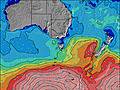 | 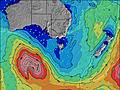 | 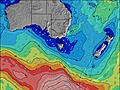 | 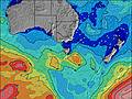 | ||||||||||||||
Wave Height (m) Direction Period (s) | WSW 11 | SW 11 | SW 11 | SW 11 | SW 11 | SW 13 | SW 13 | SW 12 | WSW 15 | SW 16 | WSW 15 | WSW 14 | SW 13 | SW 13 | SW 12 | SW 12 | SW 12 | SW 12 | SW 18 | SW 16 | SW 16 |
Wave Graph | |||||||||||||||||||||
890 | 371 | 282 | 228 | 309 | 480 | 512 | 423 | 3385 | 5105 | 3778 | 2191 | 919 | 669 | 335 | 361 | 264 | 228 | 194 | 208 | 728 | |
Wind (km/h) | |||||||||||||||||||||
Wind State on-shore cross-onshore cross-shore cross-offshore off-shore glassy | cross | cross-off | cross-off | cross-off | cross-off | cross-off | cross-off | cross-off | cross | on | cross-on | on | cross-on | cross-on | on | cross | cross-on | off | off | cross-off | cross-off |
High Tide | 7:57PM1.89m | 9:46AM1.91m | 8:51PM1.82m | 10:50AM1.93m | 9:54PM1.78m | 11:49AM1.99m | 11:02PM1.78m | 12:40PM2.07m | 00:06AM1.81m | 1:23PM2.15m | 1:03AM1.87m | 2:01PM2.23m | 1:54AM1.94m | ||||||||
Low Tide | 2:23PM1.16m | 2:49AM0.52m | 3:25PM1.22m | 3:45AM0.55m | 4:35PM1.22m | 4:45AM0.55m | 5:43PM1.17m | 5:42AM0.52m | 6:42PM1.07m | 6:34AM0.50m | 7:30PM0.94m | 7:21AM0.48m | 8:11PM0.80m | ||||||||
7:26 | — | — | 7:24 | — | — | 7:24 | — | — | 7:24 | — | — | 7:22 | — | — | 7:22 | — | — | 7:20 | — | — | |
— | 5:23 | — | — | 5:24 | — | — | 5:25 | — | — | 5:27 | — | — | 5:27 | — | — | 5:28 | — | — | 5:29 | — | |
mm | — | — | — | — | — | — | — | 6 | 8 | 1 | 2 | 3 | — | 2 | 3 | 2 | — | — | — | — | — |
Temp °C | 12 | 14 | 13 | 15 | 15 | 14 | 15 | 14 | 10 | 11 | 11 | 12 | 12 | 12 | 12 | 10 | 11 | 11 | 11 | 14 | 12 |
Feels °C | 8 | 11 | 10 | 9 | 9 | 4 | 5 | 5 | -1 | 0 | 1 | 6 | 6 | 5 | 8 | 7 | 9 | 9 | 7 | 11 | 7 |
Swell 1 Height (m) Direction Period (s) | SW 11 | SW 11 | SW 11 | SW 11 | SW 11 | SW 13 | SW 13 | SW 12 | SW 15 | — | WSW 15 | WSW 14 | SW 13 | SW 13 | SW 12 | SW 12 | SW 12 | SW 12 | SW 12 | SW 12 | SW 16 |
475 | 371 | 282 | 228 | 309 | 480 | 512 | 423 | 1835 | — | 3778 | 2191 | 919 | 669 | 335 | 361 | 264 | 228 | 184 | 132 | 728 | |
Swell 2 Height (m) Direction Period (s) | SW 17 | SW 16 | SSW 16 | SW 15 | — | — | — | SW 15 | — | — | — | — | — | — | SW 24 | SW 21 | SW 20 | SW 19 | SW 18 | SW 16 | WSW 20 |
11 | 10 | 26 | 75 | — | — | — | 273 | — | — | — | — | — | — | 22 | 18 | 63 | 96 | 194 | 208 | 75 | |
Swell 3 Height (m) Direction Period (s) | — | — | — | — | — | — | — | — | — | — | — | — | — | — | — | S 22 | S 20 | — | SE 12 | SE 12 | WSW 19 |
— | — | — | — | — | — | — | — | — | — | — | — | — | — | — | 9 | 8 | — | 6 | 6 | 37 | |
Wind waves Height (m) Direction Period (s) | WSW 11 | — | NNW 2 | NNW 3 | NNW 3 | NNW 4 | NW 5 | NW 4 | WSW 15 | SW 16 | SW 15 | SW 14 | SSW 6 | — | SW 6 | — | — | — | — | NW 3 | NNW 4 |
890 | — | 1 | 1 | 1 | 18 | 62 | 45 | 3385 | 5105 | 3204 | 1918 | 80 | — | 50 | — | — | — | — | 2 | 5 | |
Nearest Offshore or Glassy | |||||||||||||||||||||
Distance (km) | 1 | 0 | 1 | 0 | 0 | 103 | 248 | 482 | 460 | 787 | 317 | 441 | 85 | 81 | 13 | 0 | 1 | 0 | 0 | 0 | 0 |
Best forecast wave conditions in Phillip Island | |||||||||||||||||||||
Best forecast wave conditions in Australia | |||||||||||||||||||||
Header Global | |||||||||||||||||||||
- Map Icons:
 Break
Break Live Wave Height (m)
 Live Wind Speed (km/h)
 Surf Rating (10 Max)
 Ocean Swells (m)
- Wind Speed (km/h)


FREE! Surf-Forecast.com widget for your website
The surf report / weather widget below is available to embed on third party websites free of charge and provides a summary of our Sunderland Bay surf forecast. Simply grab the html code snippet that we provide and paste it into your own site. You can choose your preferred language and metric/imperial units for the surf forecast feed to suit users of your site. Click here to get the code.
Information about the Sunderland Bay Surf forecast
The above surf forecast table for Sunderland Bay provides essential information for determining whether the surfing conditions will be good over the next 16 days. A general guide to surfing at Sunderland Bay can be found by selecting the local surf guide option on the grey menu. Our Sunderland Bay surf forecast is unique since it includes wave energy (power) that defines the real feel of the surf rather than just the height or the period. If you surf the same spot (Sunderland Bay) regularly then make a mental note of the wave energy from the surf forecast table each time you go. Very soon you may start to choose your surf days based on the wave energy alone combined with our forecast of favourable offshore wind conditions. Our star ratings will help here and of course you will also find the usual wave height and period predictions on our surf forecasts as well as a full break down of the swell components under our advanced users option (to reveal that, click the little Einstein character under the tide times).
Further information to help with frequently asked questions about our surf forecast for Sunderland Bay may be found under the help tab on the top menu and also by moving your mouse over the question marks on the surf forecast table itself. Please always bear in mind that the forecast is for near-shore open water and local factors at each surf break influence the actual breaking wave height, such as the beach / reef profile, water depths offshore and shelter.
Sunderland Bay is 39 km (24 miles) from Mornington. If you plan a holiday in Phillip Island, look for hotels and other accommodation in Mornington. Mornington has rooms for a wide range of budgets as well as car hire and transport links.
 Nearest