

Surf Forecasts:

Kitty Miller Bay surf forecast from 15 Jul 2026:
- Best quality surf: Thursday 16 Jul, 1AM (local time) - 6ft (1.8m), 14s period, SW swell with offshore winds.
- Most powerful swell: Thursday 16 Jul, 7PM (local time) - 6ft (1.8m), 15s period, SW swell with 1,500 kJ wave energy.
- Next surfable swell (1★+): Wednesday 15 Jul, 10PM (local time) - 6ft (1.8m), 14s period with SW swell.
Best Forecast Surf Conditions for Kitty Miller Bay this week:
The surf forecast for Kitty Miller Bay over the next 16 days: The first swell (rated 1 star or higher) is forecast to arrive on Wednesday (Jul 15) at 10PM. The primary swell is predicted to be 1.8m and 14s period. The wind is predicted to be offshore as the swell arrives.
The most powerful waves expected at Kitty Miller Bay in the next 16 days are 1.8m 15s and forecast to arrive on Thursday (Jul 16) at 7PM. Winds are predicted to be cross-offshore at the time the swell arrives. The largest open ocean swell (not directed at the beach) is 0.7m 4s period and expected on Tuesday (Jul 21) at 4AM.
| Wave Type | Time (AEST) & Date | Wave Height & Period |
|---|---|---|
| Next good surf (1 star+) | 10PM (Wed 15th Jul) | 6ft (1.8m) 14s |
| Best Surf | 1AM (Thu 16th Jul) | 6ft (1.8m) 14s |
| Most Powerful | 7PM (Thu 16th Jul) | 6ft (1.8m) 15s |
Table - best surf conditions forecast for Kitty Miller Bay over the next 16 days.
The Lowdown
Alright folks, Rusty here. Let’s have a look at what’s shaping up for Kitty Miller Bay over the next couple of weeks.
We’ve got a decent run of surf coming through, but it’s not all plain sailing. The water temp is sitting at 57°F, which is about average for this time of year, so nothing weird there.
The action kicks off on Wednesday the 15th with a solid 7ft SW swell rolling in at 14 seconds. That’s a lot of energy (1528) and it’s pushing straight from the optimum direction. The wind is a clean offshore from the W at 12 mph, so the setup looks excellent for experienced surfers – this one’s for the crew who know what they’re doing. It’s a beach and point setup, but it’s inconsistent, so you’ll need patience.
Thursday the 16th keeps the goods coming with 6ft SW swell and a 15-second period, meaning long, powerful lines. The combined energy is still high (1460 to 1480) and the wind is a light cross-off, keeping things clean. Another one for the experienced.
Friday the 17th is a standout. The swell drops a touch to 5ft, but the period stretches to 16 seconds – that’s very long interval groundswell. The energy is still strong (1281 to 1314). The morning is clear with a light cross-off, but the afternoon steals the show: clear skies, 3 mph NW offshore wind, almost glassy. That’s about as good as it gets here for a Friday arvo session.
Saturday the 18th is still fun, with 4ft to 5ft SW swell, and Saturday afternoon sees the wind drop to zero – totally glassy. That’s a rare treat. The waves are a bit smaller, but the clean conditions will make up for it.
Sunday the 19th and Monday the 20th see the swell drop off, and by Monday the wind jumps to 19 mph from the NNW, making it messy. The energy plummets (269 to 442), and the surf quality is poor. From Monday afternoon through Tuesday the 21st, it’s pretty ordinary – small waves and strong wind.
We get a little reprieve on Wednesday the 22nd with a 3ft SW swell and a light offshore, but it’s not gonna set the world on fire. Then Thursday the 23rd and Friday the 24th show a pulse of 5ft to 6ft swell, but the wind is moderate to fresh, and the conditions are only marginal. The energy picks up again (1029 to 1413), but it’s not clean enough to get excited about.
Now, the real highlight for the second week? Saturday the 25th of July. We’ve got 7ft SW swell, 16-second period, and combined energy of 2445 to 2133 – that’s strong wave energy. The wind is cross-off from the WSW at 12-16 mph, so it’s clean. But this is big for this spot. At 7ft, it’s pushing into expert territory, and it’s a beach and point break, so that long period groundswell might make it a bit straight and tricky. Still, for the experienced crew, this is the best on offer in the second week.
The rest of the run into the 27th, 28th, and 29th has some size but the wind is onshore or cross, and the energy is all over the place. The 29th looks like a small cleanup with light offshore wind, but nothing special.
So, to sum it up: the best waves are on the 15th, 16th, and 17th for the first week, with Friday the 17th being the true standout for clean, powerful lines. In the second week, Saturday the 25th is the big one, but it’s only for the experts. The rest of the time is a mix of small, windy, or messy conditions.
Rusty.
Short Range ForecastMostly dry. Very mild (max 13°C on Wed afternoon, min 10°C on Fri morning). Wind will be generally light. | Days 5-7 Weather SummaryMostly dry. Very mild (max 15°C on Sun afternoon, min 11°C on Sat night). Winds increasing (calm on Sat afternoon, fresh winds from the NNW by Mon morning). | ||||||||||||||||||||
Wed 15 | Thursday 16 | Friday 17 | Saturday 18 | Sunday 19 | Monday 20 | Tuesday 21 | |||||||||||||||
PM | Night | AM | PM | Night | AM | PM | Night | AM | PM | Night | AM | PM | Night | AM | PM | Night | AM | PM | Night | AM | |
Swell Height Map |  |  |  | 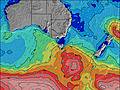 | 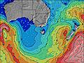 | 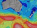 | 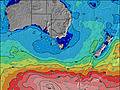 | 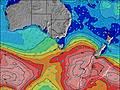 | |||||||||||||
Wave Height (m) Direction Period (s) | SW 14 | SW 14 | SW 15 | SW 15 | SW 15 | SW 16 | SW 16 | SW 15 | SW 14 | SW 14 | SW 13 | SW 13 | SW 12 | SW 18 | SW 16 | SW 15 | SW 14 | SW 13 | SW 13 | SW 11 | SW 12 |
Wave Graph | |||||||||||||||||||||
1528 | 1363 | 1460 | 1480 | 1138 | 1281 | 1314 | 1053 | 791 | 586 | 374 | 269 | 172 | 114 | 432 | 147 | 206 | 142 | 109 | 158 | 292 | |
Wind (km/h) | |||||||||||||||||||||
Wind State on-shore cross-onshore cross-shore cross-offshore off-shore glassy | off | off | cross-off | cross-off | glassy | cross-off | off | cross-off | cross-off | glassy | cross-off | cross-off | cross-off | cross-off | cross-off | cross-off | cross-off | cross-off | cross-off | cross-off | off |
High Tide | 11:40PM2.14m | 1:06PM2.42m | 00:49AM2.19m | 1:57PM2.48m | 1:54AM2.24m | 2:43PM2.51m | 2:53AM2.27m | 3:26PM2.51m | 3:48AM2.27m | 4:06PM2.48m | 4:39AM2.24m | 4:44PM2.40m | 5:28AM2.18m | ||||||||
Low Tide | 6:05PM0.94m | 6:18AM0.05m | 7:07PM0.79m | 7:18AM0.08m | 8:04PM0.62m | 8:13AM0.14m | 8:55PM0.46m | 9:04AM0.25m | 9:43PM0.34m | 9:51AM0.38m | 10:28PM0.27m | 10:36AM0.53m | 11:11PM0.26m | 11:19AM0.68m | |||||||
— | — | 7:33 | — | — | 7:31 | — | — | 7:31 | — | — | 7:31 | — | — | 7:31 | — | — | 7:30 | — | — | 7:28 | |
5:15 | — | — | 5:16 | — | — | 5:16 | — | — | 5:17 | — | — | 5:19 | — | — | 5:20 | — | — | 5:20 | — | 5:21 | |
mm | — | — | — | — | — | — | — | — | — | — | — | — | — | — | — | — | — | — | — | — | — |
Temp °C | 13 | 13 | 12 | 12 | 12 | 11 | 13 | 12 | 11 | 13 | 12 | 12 | 15 | 13 | 12 | 14 | 13 | 13 | 16 | 13 | 13 |
Feels °C | 9 | 11 | 9 | 10 | 10 | 9 | 12 | 10 | 9 | 12 | 10 | 9 | 13 | 10 | 6 | 8 | 7 | 8 | 13 | 8 | 9 |
Swell 1 Height (m) Direction Period (s) | SW 14 | SW 14 | SW 15 | SW 15 | SW 15 | SW 16 | SW 16 | SW 15 | SW 14 | SW 14 | SW 13 | SW 13 | SW 12 | SW 12 | SW 16 | SW 15 | SW 14 | SW 13 | WSW 11 | SW 11 | SW 12 |
1528 | 1363 | 1460 | 1480 | 1138 | 1281 | 1314 | 1053 | 791 | 586 | 374 | 269 | 172 | 114 | 432 | 147 | 206 | 142 | 75 | 150 | 292 | |
Swell 2 Height (m) Direction Period (s) | — | — | — | — | — | — | — | — | — | — | — | SW 21 | SW 20 | SW 18 | SSW 10 | SW 12 | SW 10 | SW 18 | SW 13 | SW 14 | — |
— | — | — | — | — | — | — | — | — | — | — | 17 | 60 | 111 | 10 | 66 | 4 | 13 | 109 | 158 | — | |
Swell 3 Height (m) Direction Period (s) | — | — | — | — | — | — | — | — | — | — | — | WSW 20 | WSW 20 | SSW 10 | — | SSW 10 | SE 10 | SE 10 | WSW 17 | E 10 | — |
— | — | — | — | — | — | — | — | — | — | — | 39 | 37 | 21 | — | 9 | 4 | 4 | 28 | 2 | — | |
Wind waves Height (m) Direction Period (s) | — | — | — | — | — | — | — | — | — | — | — | — | — | — | NW 3 | NW 3 | NNW 3 | NW 4 | NW 3 | — | NNW 2 |
— | — | — | — | — | — | — | — | — | — | — | — | — | — | 2 | 2 | 7 | 15 | 3 | — | 1 | |
Nearest Offshore or Glassy | |||||||||||||||||||||
Distance (km) | 0 | 0 | 0 | 0 | 0 | 0 | 0 | 0 | 0 | 0 | 0 | 0 | 0 | 3 | 19 | 14 | 8 | 14 | 0 | 3 | 0 |
Best forecast wave conditions in Phillip Island | |||||||||||||||||||||
Best forecast wave conditions in Australia | |||||||||||||||||||||
Header Global | |||||||||||||||||||||
- Map Icons:
 Break
Break Live Wave Height (m)
 Live Wind Speed (km/h)
 Surf Rating (10 Max)
 Ocean Swells (m)
- Wind Speed (km/h)


FREE! Surf-Forecast.com widget for your website
The surf report / weather widget below is available to embed on third party websites free of charge and provides a summary of our Kitty Miller Bay surf forecast. Simply grab the html code snippet that we provide and paste it into your own site. You can choose your preferred language and metric/imperial units for the surf forecast feed to suit users of your site. Click here to get the code.
Information about the Kitty Miller Bay Surf forecast
The above surf forecast table for Kitty Miller Bay provides essential information for determining whether the surfing conditions will be good over the next 16 days. A general guide to surfing at Kitty Miller Bay can be found by selecting the local surf guide option on the grey menu. Our Kitty Miller Bay surf forecast is unique since it includes wave energy (power) that defines the real feel of the surf rather than just the height or the period. If you surf the same spot (Kitty Miller Bay) regularly then make a mental note of the wave energy from the surf forecast table each time you go. Very soon you may start to choose your surf days based on the wave energy alone combined with our forecast of favourable offshore wind conditions. Our star ratings will help here and of course you will also find the usual wave height and period predictions on our surf forecasts as well as a full break down of the swell components under our advanced users option (to reveal that, click the little Einstein character under the tide times).
Further information to help with frequently asked questions about our surf forecast for Kitty Miller Bay may be found under the help tab on the top menu and also by moving your mouse over the question marks on the surf forecast table itself. Please always bear in mind that the forecast is for near-shore open water and local factors at each surf break influence the actual breaking wave height, such as the beach / reef profile, water depths offshore and shelter.
Kitty Miller Bay is 36 km (22 miles) from Mornington. If you plan a holiday in Phillip Island, look for hotels and other accommodation in Mornington. Mornington has rooms for a wide range of budgets as well as car hire and transport links.
 Nearest