

Surf Forecasts:

Crunchie Pt surf forecast from 4 Jul 2026:
- Best quality surf: Wednesday 8 Jul, 1PM (local time) - 6ft (1.8m), 18s period, SW swell with cross-offshore winds.
- Most powerful swell: Sunday 5 Jul, 7AM (local time) - 10ft (3.0m), 17s period, SW swell with 4,745 kJ wave energy.
- Next surfable swell (1★+): Monday 6 Jul, 7AM (local time) - 5.5ft (1.7m), 15s period with SW swell.
Best Forecast Surf Conditions for Crunchie Pt this week:
The surf forecast for Crunchie Pt over the next 16 days: The first swell (rated 1 star or higher) is forecast to arrive on Monday (Jul 06) at 7AM. The primary swell is predicted to be 1.7m and 15s period with a secondary swell of 0.7m and 5s. Another secondary swell of 0.4m and 5s is also forecast. The wind is predicted to be cross-offshore as the swell arrives.
The most powerful waves expected at Crunchie Pt in the next 16 days are 3.0m 17s and forecast to arrive on Sunday (Jul 05) at 7AM. Winds are predicted to be onshore at the time the swell arrives. The largest open ocean swell (not directed at the beach) is 0.5m 4s period and expected on Monday (Jul 06) at 10AM.
| Wave Type | Time (AEST) & Date | Wave Height & Period |
|---|---|---|
| Next good surf (1 star+) | 7AM (Mon 6th Jul) | 5.5ft (1.7m) 15s |
| Best Surf | 1PM (Wed 8th Jul) | 6ft (1.8m) 18s |
| Most Powerful | 7AM (Sun 5th Jul) | 10ft (3.0m) 17s |
Table - best surf conditions forecast for Crunchie Pt over the next 16 days.
Updates in hr min s Forecast update imminent
Alright, this is Rusty comin' at ya from the desk. We’ve got one spot on the radar for the next couple of weeks – Crunchie Pt. Let’s not sugarcoat it; the start of this run is a total write-off.
The first few days are a mess. Saturday the 4th and Sunday the 5th of July? Forget it. We’ve got a big, powerful southwest groundswell piling in, with wave energy climbing up to a massive 6367. The problem is the wind. It's a stiff cross-onshore breeze at 15-19 mph, turning that 8 ft to 10 ft of swell into a complete wind-blown chop. Not worth paddling out.
You have to wait until Monday the 6th of July before things get interesting. The swell drops to a cleaner 5 ft in the morning, and the wind swings around to a light cross-offshore from the NNE at 6 mph. The wave energy is still moderate. But the real gem is Monday afternoon. The wind goes glassy – calm, 3 mph from the south – and we’ve got waist-to-chest high sets at 4 ft. The water temp is sitting at a pretty normal 57° for this time of year. This is your window. Clean, lined-up waves at Crunchie Pt (a reef break), perfect for a beginner all the way up to an intermediate. It doesn’t get much better than a glassy reef.
Tuesday the 7th and Wednesday the 8th morning are a bit tricky – small swell and light cross-shore winds making for “marginal” conditions. But then Wednesday afternoon, the 8th of July, is another standout. The swell bumps up to a solid 7 ft from the southwest, with a long 18-second period. The wave energy is sitting at a strong 2765, and the wind is completely glassy again. This is powerful, excellent quality surf but at that size and with that long period, it’s for experienced surfers only. The sets will be well-spaced, making paddling easier, but the wave face will be steep and punchy over that reef. This is your real highlight of the window.
Thursday the 9th and Friday the 10th of July hold good, consistent conditions with clean 4 ft to 6 ft surf and light offshore or glassy winds. A solid run of quality.
Then we hit a wall from Saturday the 11th of July through to the middle of the following week. The swell goes small and weak (under 4 ft), or it gets blown out by strong, fresh winds (19-22 mph). There’s a three or four-day gap here where it’s just not worth paddling out.
A bit of promise returns around Saturday the 18th of July. We’ve got a cleaner, smaller swell at 5 ft to 5 ft from the west-southwest with gentle offshore winds. The wave energy is low but the vibe will be clean and fun. Sunday the 19th, however, the wind cranks up to a strong breeze from the NNW at 22-25 mph. The swell is small, and even though it’s offshore, it’s going to be a battle to paddle into those waves. That late in the window, it’s a promising but less certain prospect.
So, to sum it up: you’ve got to be patient. Kiss the first two days goodbye. The absolute best on offer is Wednesday afternoon, the 8th of July – glassy conditions and a strong 7 ft groundswell pushing in. Second best is Monday afternoon, the 6th of July, also glassy but smaller for the beginners. After that, there’s a long lull before a potential clean finish around the 18th.
Rusty.
Short Range ForecastSome drizzle, heaviest during Sat afternoon. Very mild (max 12°C on Sat afternoon, min 9°C on Sun afternoon). Winds decreasing (fresh winds from the E on Sun afternoon, calm by Mon morning). | Days 5-7 Weather SummaryMostly dry. Very mild (max 13°C on Tue afternoon, min 7°C on Wed morning). Wind will be generally light. | ||||||||||||||||||||
Sat 4 | Sunday 5 | Monday 6 | Tuesday 7 | Wednesday 8 | Thursday 9 | Friday 10 | |||||||||||||||
PM | Night | AM | PM | Night | AM | PM | Night | AM | PM | Night | AM | PM | Night | AM | PM | Night | AM | PM | Night | AM | |
Swell Height Map |  |  |  | 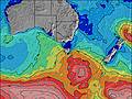 | 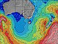 | 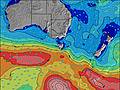 | 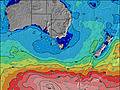 | 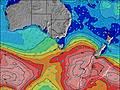 | |||||||||||||
Wave Height (m) Direction Period (s) | SW 13 | SW 14 | SW 17 | SW 16 | SW 16 | SW 14 | SW 14 | SW 13 | SW 17 | SW 16 | SW 15 | SW 18 | SW 18 | SW 16 | SW 15 | SW 15 | SW 15 | SW 16 | SW 15 | SW 14 | SW 14 |
Wave Graph | |||||||||||||||||||||
2180 | 2284 | 4745 | 3555 | 1904 | 1006 | 726 | 458 | 575 | 1096 | 1048 | 1342 | 2528 | 1571 | 1028 | 757 | 630 | 1571 | 1219 | 763 | 532 | |
Wind (km/h) | |||||||||||||||||||||
Wind State on-shore cross-onshore cross-shore cross-offshore off-shore glassy | cross-on | on | cross-on | cross-on | cross | cross-off | glassy | cross | cross | cross-on | cross-on | cross | glassy | cross-off | off | glassy | cross-off | cross-off | cross-off | cross-off | cross-off |
High Tide | 3:46AM2.47m | 4:25PM2.94m | 4:29AM2.52m | 4:57PM2.90m | 5:11AM2.58m | 5:29PM2.86m | 5:55AM2.64m | 6:01PM2.82m | 6:42AM2.68m | 6:37PM2.78m | 7:33AM2.71m | 7:18PM2.74m | 8:30AM2.73m | ||||||||
Low Tide | 10:01PM1.01m | 9:50AM0.62m | 10:35PM0.93m | 10:29AM0.69m | 11:08PM0.84m | 11:08AM0.79m | 11:42PM0.75m | 11:47AM0.91m | 00:19AM0.65m | 12:31PM1.05m | 1:01AM0.57m | 1:19PM1.19m | 1:49AM0.51m | ||||||||
— | — | 7:37 | — | — | 7:37 | — | — | 7:35 | — | — | 7:35 | — | — | 7:35 | — | — | 7:35 | — | — | 7:35 | |
5:09 | — | — | 5:09 | — | — | 5:10 | — | — | 5:12 | — | — | 5:12 | — | — | 5:13 | — | — | 5:13 | — | 5:14 | |
mm | 1 | — | — | — | — | — | — | — | — | — | — | — | — | — | — | — | — | — | — | — | — |
Temp °C | 12 | 12 | 11 | 11 | 9 | 10 | 12 | 12 | 11 | 13 | 11 | 8 | 10 | 10 | 9 | 10 | 10 | 10 | 12 | 10 | 12 |
Feels °C | 6 | 7 | 5 | 4 | 2 | 9 | 10 | 9 | 9 | 8 | 7 | 6 | 9 | 7 | 6 | 9 | 8 | 7 | 9 | 6 | 4 |
Swell 1 Height (m) Direction Period (s) | SSW 13 | SW 14 | SW 17 | SW 16 | SW 16 | SW 14 | SW 14 | SW 13 | SW 17 | SW 16 | SW 15 | SW 18 | SW 18 | SW 16 | SW 15 | SW 15 | SW 15 | SW 16 | SW 15 | SW 14 | SW 14 |
102 | 2284 | 4745 | 3555 | 1904 | 1006 | 726 | 458 | 575 | 1096 | 1048 | 1342 | 2528 | 1571 | 1028 | 757 | 606 | 1571 | 1219 | 763 | 532 | |
Swell 2 Height (m) Direction Period (s) | — | SW 17 | SSW 17 | SSW 17 | SSW 15 | SE 5 | SE 5 | SW 19 | SW 13 | SSW 16 | SSW 16 | SW 15 | SSW 17 | SSW 16 | SSW 15 | SSW 15 | SW 18 | SSW 16 | — | SSW 13 | — |
— | 962 | 1597 | 958 | 491 | 13 | 4 | 59 | 282 | 50 | 48 | 784 | 237 | 144 | 91 | 44 | 630 | 81 | — | 35 | — | |
Swell 3 Height (m) Direction Period (s) | — | — | — | — | — | — | — | S 19 | — | — | ESE 12 | SSW 18 | — | ESE 12 | ESE 11 | ESE 10 | SSW 18 | — | — | — | — |
— | — | — | — | — | — | — | 7 | — | — | 15 | 193 | — | 14 | 11 | 10 | 67 | — | — | — | — | |
Wind waves Height (m) Direction Period (s) | SW 13 | SW 15 | SE 5 | SE 4 | ESE 5 | NE 4 | — | E 4 | — | — | — | — | — | — | — | — | — | — | — | — | N 3 |
2180 | 2092 | 25 | 46 | 59 | 6 | — | 8 | — | — | — | — | — | — | — | — | — | — | — | — | 2 | |
Nearest Offshore or Glassy | |||||||||||||||||||||
Distance (km) | 81 | 134 | 124 | 119 | 101 | 0 | 0 | 5 | 11 | 12 | 11 | 11 | 0 | 0 | 0 | 0 | 0 | 0 | 0 | 17 | 34 |
Best forecast wave conditions in Mornington Peninsula | |||||||||||||||||||||
Best forecast wave conditions in Australia | |||||||||||||||||||||
Header Global | |||||||||||||||||||||
- Map Icons:
 Break
Break Live Wave Height (m)
 Live Wind Speed (km/h)
 Surf Rating (10 Max)
 Ocean Swells (m)
- Wind Speed (km/h)


FREE! Surf-Forecast.com widget for your website
The surf report / weather widget below is available to embed on third party websites free of charge and provides a summary of our Crunchie Pt surf forecast. Simply grab the html code snippet that we provide and paste it into your own site. You can choose your preferred language and metric/imperial units for the surf forecast feed to suit users of your site. Click here to get the code.
Information about the Crunchie Pt Surf forecast
The above surf forecast table for Crunchie Pt provides essential information for determining whether the surfing conditions will be good over the next 16 days. A general guide to surfing at Crunchie Pt can be found by selecting the local surf guide option on the grey menu. Our Crunchie Pt surf forecast is unique since it includes wave energy (power) that defines the real feel of the surf rather than just the height or the period. If you surf the same spot (Crunchie Pt) regularly then make a mental note of the wave energy from the surf forecast table each time you go. Very soon you may start to choose your surf days based on the wave energy alone combined with our forecast of favourable offshore wind conditions. Our star ratings will help here and of course you will also find the usual wave height and period predictions on our surf forecasts as well as a full break down of the swell components under our advanced users option (to reveal that, click the little Einstein character under the tide times).
Further information to help with frequently asked questions about our surf forecast for Crunchie Pt may be found under the help tab on the top menu and also by moving your mouse over the question marks on the surf forecast table itself. Please always bear in mind that the forecast is for near-shore open water and local factors at each surf break influence the actual breaking wave height, such as the beach / reef profile, water depths offshore and shelter.
Crunchie Pt is 22 km (14 miles) from Mornington. If you plan a holiday in Mornington Peninsula, look for hotels and other accommodation in Mornington. Mornington has rooms for a wide range of budgets as well as car hire and transport links.
 Nearest