

Surf Forecasts:

13th Beach-The Bluff surf forecast from 25 Jul 2026:
- Best quality surf: Thursday 30 Jul, 10PM (local time) - 7ft (2.2m), 12s period, SW swell with cross-offshore winds.
- Most powerful swell: Wednesday 29 Jul, 10AM (local time) - 13ft (4.0m), 16s period, SW swell with 7,409 kJ wave energy.
- Next surfable swell (1★+): Sunday 26 Jul, 7AM (local time) - 5.5ft (1.7m), 11s period with SW swell.
Best Forecast Surf Conditions for 13th Beach-The Bluff this week:
The surf forecast for 13th Beach-The Bluff over the next 16 days: The first swell (rated 1 star or higher) is forecast to arrive on Sunday (Jul 26) at 7AM. The primary swell is predicted to be 1.7m and 11s period with a secondary swell of 0.1m and 18s. The wind is predicted to be cross-offshore as the swell arrives.
The most powerful waves expected at 13th Beach-The Bluff in the next 16 days are 4.0m 16s and forecast to arrive on Wednesday (Jul 29) at 10AM. Winds are predicted to be cross-onshore at the time the swell arrives. The largest open ocean swell (not directed at the beach) is 1.1m 4s period and expected on Tuesday (Jul 28) at 4PM.
| Wave Type | Time (AEST) & Date | Wave Height & Period |
|---|---|---|
| Next good surf (1 star+) | 7AM (Sun 26th Jul) | 5.5ft (1.7m) 11s |
| Best Surf | 10PM (Thu 30th Jul) | 7ft (2.2m) 12s |
| Most Powerful | 10AM (Wed 29th Jul) | 13ft (4.0m) 16s |
Table - best surf conditions forecast for 13th Beach-The Bluff over the next 16 days.
The Lowdown
Alright, groms, Rusty here with a look at 13th Beach-The Bluff. It’s a reef break that loves a SW groundswell, and we’ve got a proper run of waves coming.
The start of the week is all right. Sunday and Monday look tidy with 4–5ft of clean SW swell and light offshore winds. The water temp is about what you’d expect for this time of year, no big anomalies. Moderate energy levels.
Midweek gets a bit rowdy. Tuesday the 28th has some solid 5ft sets, but the offshore wind picks up to a fresh breeze, keeping it clean enough. Then Wednesday the 29th is a write-off – 13ft of messy, cross-onshore junk with the combined energy pumping a massive 7409. If you’re not on a kite, stay on the beach.
The first real standout is Thursday, August 6th. Morning session, glassy light wind, and a clean 5–6ft of SW groundswell with a 14-second period. This is a proper groundswell. The energy is strong at 1164, and the outlook says excellent conditions for experienced surfers. The reef will turn that long-period swell into some proper lined-up walls. It’s not a beginner wave at that size and period, but if you’ve got the balls, it’s the best of the run.
Following that, Friday, August 7th is a beauty. Dead calm, glassy conditions, with a clean 3–4ft of SW swell on a 13-second period. It won’t be huge, but it’ll be perfect, clean, and uncrowded. A classic dawny.
The weekend of the 8th and 9th has smaller 3ft waves, but that period stretches out to 16–17 seconds. That long-period stuff can be a bit straight on a beach break, but on a reef like The Bluff, it’ll still be holding a nice shape. The wind stays favorable.
The final week brings another pulse. Monday, August 10th shows 7–8ft of SW swell with a massive 21-second period. That’s serious, ground-driven energy – the combined reading is 4585. Only for the experienced crew. The wind is a fresh offshore, so it should be clean, but that swell is powerful. The reef will be the place to be.
Overall, the long-range still holds promise, but that Thursday the 6th is the one to circle.
Rusty.
Short Range ForecastLight rain (total 5mm), mostly falling on Tue afternoon. Very mild (max 16°C on Mon morning, min 7°C on Tue afternoon). Winds increasing (light winds from the WNW on Sun afternoon, fresh winds from the NNW by Tue morning). | Days 5-7 Weather SummaryModerate rain (total 11mm), heaviest on Tue night. Very mild (max 12°C on Thu morning, min 7°C on Tue night). Winds decreasing (strong winds from the SSW on Tue night, light winds from the SSW by Fri afternoon). | ||||||||||||||||||
Sunday 26 | Monday 27 | Tuesday 28 | Wednesday 29 | Thursday 30 | Friday 31 | ||||||||||||||
Night | AM | PM | Night | AM | PM | Night | AM | PM | Night | AM | PM | Night | AM | PM | Night | AM | PM | Night | |
Swell Height Map |  |  |  |  | 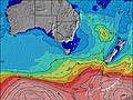 | 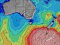 | 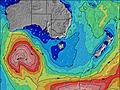 | ||||||||||||
Wave Height (m) Direction Period (s) | SW 12 | SW 11 | SW 11 | SW 11 | SW 11 | SW 11 | SW 13 | SW 13 | SW 14 | SW 14 | SW 16 | SW 15 | SW 14 | SW 13 | SW 13 | SW 12 | SW 12 | SW 11 | SW 11 |
Wave Graph | |||||||||||||||||||
1572 | 688 | 558 | 441 | 422 | 332 | 755 | 784 | 1171 | 1804 | 7409 | 5115 | 2523 | 1346 | 1374 | 772 | 594 | 447 | 369 | |
Wind (km/h) | |||||||||||||||||||
Wind State on-shore cross-onshore cross-shore cross-offshore off-shore glassy | cross-off | cross-off | cross-off | off | off | off | cross-off | off | cross-off | cross-off | cross-on | cross | cross | cross-off | cross-on | cross-off | cross-off | cross-on | off |
High Tide | 8:44AM1.51m | 7:19PM1.43m | 9:57AM1.51m | 8:17PM1.36m | 11:09AM1.55m | 9:38PM1.32m | 12:07PM1.63m | 11:00PM1.33m | 12:51PM1.71m | 00:08AM1.38m | 1:28PM1.78m | 1:02AM1.46m | |||||||
Low Tide | 1:35AM0.44m | 2:12PM1.09m | 2:29AM0.49m | 3:35PM1.13m | 3:34AM0.51m | 5:06PM1.10m | 4:41AM0.50m | 6:14PM1.02m | 5:41AM0.46m | 7:02PM0.92m | 6:32AM0.42m | 7:40PM0.80m | |||||||
— | 7:28 | — | — | 7:28 | — | — | 7:26 | — | — | 7:26 | — | — | 7:24 | — | — | 7:24 | — | — | |
— | — | 5:28 | — | — | 5:28 | — | — | 5:29 | — | — | 5:30 | — | — | 5:30 | — | — | 5:31 | — | |
mm | — | — | — | — | — | — | — | — | 5 | 2 | 3 | 1 | 2 | — | 2 | — | — | 1 | — |
Temp °C | 11 | 14 | 14 | 13 | 16 | 16 | 14 | 16 | 12 | 10 | 10 | 10 | 9 | 12 | 11 | 11 | 12 | 12 | 12 |
Feels °C | 7 | 11 | 12 | 10 | 12 | 11 | 7 | 8 | 4 | -1 | 0 | 2 | 3 | 6 | 5 | 8 | 9 | 9 | 11 |
Swell 1 Height (m) Direction Period (s) | SW 12 | SW 11 | SW 11 | SW 11 | SW 11 | SW 11 | SW 13 | SW 13 | SW 14 | SW 14 | — | SSW 15 | S 15 | SW 13 | SW 13 | SW 12 | SW 12 | SW 11 | SW 11 |
1040 | 688 | 558 | 441 | 422 | 332 | 755 | 784 | 1171 | 1804 | — | 47 | 17 | 1346 | 1127 | 772 | 594 | 447 | 369 | |
Swell 2 Height (m) Direction Period (s) | SW 18 | SW 16 | SW 16 | SW 16 | SW 15 | SW 14 | S 15 | — | SW 15 | S 13 | — | — | — | S 6 | — | SW 24 | SW 21 | SW 20 | SW 19 |
12 | 11 | 10 | 42 | 34 | 158 | 42 | — | 566 | 92 | — | — | — | 98 | — | 22 | 72 | 137 | 229 | |
Swell 3 Height (m) Direction Period (s) | — | — | — | — | S 16 | — | — | — | S 15 | — | — | — | — | — | — | — | — | S 20 | S 19 |
— | — | — | — | 5 | — | — | — | 121 | — | — | — | — | — | — | — | — | 8 | 7 | |
Wind waves Height (m) Direction Period (s) | SW 12 | — | — | NW 3 | NNW 2 | NNW 3 | N 4 | N 4 | NW 4 | NW 4 | SW 16 | SW 15 | SW 14 | — | SW 13 | — | — | — | — |
1572 | — | — | 2 | 1 | 1 | 27 | 34 | 51 | 16 | 7409 | 5115 | 2523 | — | 1374 | — | — | — | — | |
Nearest Offshore or Glassy | |||||||||||||||||||
Distance (km) | 11 | 9 | 0 | 0 | 0 | 0 | 30 | 309 | 316 | 88 | 715 | 1155 | 15 | 11 | 32 | 0 | 0 | 15 | 0 |
Best forecast wave conditions in Torquay | |||||||||||||||||||
Best forecast wave conditions in Australia | |||||||||||||||||||
Header Global | |||||||||||||||||||
- Map Icons:
 Break
Break Live Wave Height (m)
 Live Wind Speed (km/h)
 Surf Rating (10 Max)
 Ocean Swells (m)
- Wind Speed (km/h)


FREE! Surf-Forecast.com widget for your website
The surf report / weather widget below is available to embed on third party websites free of charge and provides a summary of our 13th Beach-The Bluff surf forecast. Simply grab the html code snippet that we provide and paste it into your own site. You can choose your preferred language and metric/imperial units for the surf forecast feed to suit users of your site. Click here to get the code.
Information about the 13th Beach-The Bluff Surf forecast
The above surf forecast table for 13th Beach-The Bluff provides essential information for determining whether the surfing conditions will be good over the next 16 days. A general guide to surfing at 13th Beach-The Bluff can be found by selecting the local surf guide option on the grey menu. Our 13th Beach-The Bluff surf forecast is unique since it includes wave energy (power) that defines the real feel of the surf rather than just the height or the period. If you surf the same spot (13th Beach-The Bluff) regularly then make a mental note of the wave energy from the surf forecast table each time you go. Very soon you may start to choose your surf days based on the wave energy alone combined with our forecast of favourable offshore wind conditions. Our star ratings will help here and of course you will also find the usual wave height and period predictions on our surf forecasts as well as a full break down of the swell components under our advanced users option (to reveal that, click the little Einstein character under the tide times).
Further information to help with frequently asked questions about our surf forecast for 13th Beach-The Bluff may be found under the help tab on the top menu and also by moving your mouse over the question marks on the surf forecast table itself. Please always bear in mind that the forecast is for near-shore open water and local factors at each surf break influence the actual breaking wave height, such as the beach / reef profile, water depths offshore and shelter.
13th Beach-The Bluff is 15 km (9 miles) from the city of Geelong. If you plan a holiday in Torquay, look for hotels and other accommodation in Geelong. Geelong has rooms for a wide range of budgets as well as car hire and transport links.
 Nearest