

Surf Forecasts:

Sellicks Beach surf forecast from 12 Jul 2026:
- Most powerful swell: Monday 13 Jul, 3PM (local time) - 4ft (1.2m), 6s period, W swell with 88 kJ wave energy.
Best Forecast Surf Conditions for Sellicks Beach this week:
The most powerful waves expected at Sellicks Beach in the next 16 days are 1.2m 6s and forecast to arrive on Monday (Jul 13) at 3PM. Winds are predicted to be onshore at the time the swell arrives. The largest open ocean swell (not directed at the beach) is 0.7m 4s period and expected on Sunday (Jul 19) at 6AM.
| Wave Type | Time (ACST) & Date | Wave Height & Period |
|---|---|---|
| Next good surf (1 star+) | - | - |
| Best Surf | - | - |
| Most Powerful | 3PM (Mon 13th Jul) | 4ft (1.2m) 6s |
Table - best surf conditions forecast for Sellicks Beach over the next 16 days.
Alright, let me have a look at what’s on offer for Sellicks Beach. I’m not gonna lie to ya, mate—this stretch of the coast is looking pretty flat and sad for the next little while. The whole 16-day window is a bit of a write-off, with no real decent surf to get excited about.
We’re starting with Sunday afternoon, July 12th, and straight away it’s a bummer. There’s a weak 5ft swell from the west, but the wind is howling onshore at 19 mph, so it’s a messy, blown-out scene. The combined energy is only 141—weak. Not worth paddling out for.
It doesn’t get much better through the rest of the week. Monday 13th, Tuesday 14th, and Wednesday 15th all have tiny amounts of swell, mostly under 3ft, with onshore or cross-onshore winds. The energy levels drop right off—down to 12 or 20—so it’s just flat and floppy. Thursday 16th and Friday 17th are almost dead flat, with waves barely 0.3ft to 0.7ft. You’d be surfing ripples, if that.
The weekend of July 18th–19th sees a tiny bump from the north, but it’s short-period windswell (4 seconds) and the wind is cross-shore, not offering any clean lines. The energy is still low, in the 30s. Not a serious option.
Now, here’s the only time in the whole outlook where things get a little interesting—but it’s still not great. On Wednesday 22nd July, in the afternoon, we get a pulse of 5ft swell from the west-southwest, with a period of 6 seconds. The combined energy jumps to 164 (moderate), and the wind is light and cross-offshore, making for clean conditions. The waves are surfable, but the report says “very ordinary conditions”. That’s the best we’ve got, and it’s still a tough sell.
After that, we get a bit more size on Friday 24th July morning—6ft from the west, period 6 seconds, combined energy 284 (moderate). That’s the biggest swell of the whole period, but it’s coming with a cross-shore wind, so it’ll be lumpy and messy. For experienced surfers only, given the size and the chop.
The rest of the run into the end of July stays small, onshore, and poor. Nothing to recommend.
Sellicks Beach is a sheltered, beginner-friendly spot, but the water temperature is currently 58°, which is about normal for this time of year. The crowds can be a problem here when it’s good, but honestly, that’s not going to be an issue for weeks.
So, to be straight with you—there’s nothing worth chasing in this 16-day window. Not a single standout. The forecast is a long, flat, and mostly windy stretch. It’s the kind of run that’s more for kite surfers than paddle surfers when the breeze picks up. Keep an eye on the charts, but for now, don’t hold your breath.
Rusty.
Short Range ForecastLight rain (total 4mm), mostly falling on Mon night. Very mild (max 15°C on Mon morning, min 11°C on Tue night). Winds decreasing (fresh winds from the W on Sun afternoon, calm by Tue night). | Days 5-7 Weather SummaryMostly dry. Very mild (max 13°C on Wed afternoon, min 10°C on Wed night). Wind will be generally light. | ||||||||||||||||||||
Sun 12 | Monday 13 | Tuesday 14 | Wednesday 15 | Thursday 16 | Friday 17 | Saturday 18 | |||||||||||||||
PM | Night | AM | PM | Night | AM | PM | Night | AM | PM | Night | AM | PM | Night | AM | PM | Night | AM | PM | Night | AM | |
Swell Height Map |  | 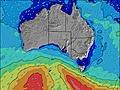 | 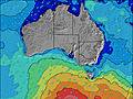 | 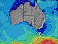 | 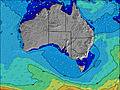 | 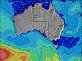 | 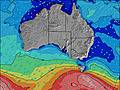 |  | |||||||||||||
Wave Height (m) Direction Period (s) | W 6 | W 5 | W 5 | W 6 | W 5 | WSW 5 | W 5 | WSW 8 | WSW 8 | WSW 8 | WSW 8 | WSW 7 | W 8 | W 8 | W 8 | W 9 | W 9 | SW 13 | SW 13 | W 10 | N 4 |
Wave Graph | |||||||||||||||||||||
141 | 80 | 79 | 88 | 50 | 29 | 13 | 21 | 12 | 12 | 6 | 5 | 5 | 1 | 1 | 1 | 2 | 7 | 7 | 2 | 27 | |
Wind (km/h) | |||||||||||||||||||||
Wind State on-shore cross-onshore cross-shore cross-offshore off-shore glassy | on | on | on | on | on | on | cross-on | glassy | glassy | cross-on | off | cross-off | glassy | cross-off | cross-off | glassy | cross-off | cross | cross | cross-off | cross |
High Tide | 5:51AM0.34m | 3:36PM0.74m | 5:36AM0.35m | 4:16PM0.78m | 5:38AM0.38m | 4:49PM0.81m | 5:47AM0.42m | 5:20PM0.80m | 6:02AM0.47m | 5:47PM0.77m | 6:23AM0.53m | 6:13PM0.72m | 6:47AM0.58m | ||||||||
Low Tide | 11:00PM0.04m | 8:17AM0.33m | 11:22PM0.01m | 9:19AM0.27m | 11:42PM0.00m | 10:02AM0.21m | 11:59PM0.01m | 10:41AM0.16m | 00:14AM0.02m | 11:18AM0.13m | 00:28AM0.03m | 11:55AM0.12m | 00:43AM0.04m | ||||||||
— | — | 7:22 | — | — | 7:22 | — | — | 7:22 | — | — | 7:22 | — | — | 7:22 | — | — | 7:20 | — | — | 7:20 | |
5:19 | — | — | 5:20 | — | — | 5:20 | — | — | 5:21 | — | — | 5:22 | — | — | 5:22 | — | — | 5:22 | — | 5:23 | |
mm | — | — | — | — | 4 | — | — | — | — | — | — | — | — | — | — | — | — | — | — | — | — |
Temp °C | 14 | 14 | 15 | 14 | 14 | 14 | 15 | 13 | 13 | 13 | 11 | 12 | 13 | 11 | 13 | 13 | 12 | 13 | 14 | 13 | 14 |
Feels °C | 8 | 9 | 10 | 9 | 10 | 12 | 13 | 13 | 12 | 12 | 9 | 11 | 12 | 9 | 11 | 12 | 10 | 9 | 11 | 10 | 8 |
Swell 1 Height (m) Direction Period (s) | — | — | — | — | S 15 | WSW 8 | W 5 | WSW 8 | WSW 8 | WSW 8 | WSW 8 | WSW 7 | W 8 | W 8 | W 8 | N 3 | W 9 | SW 13 | SW 13 | W 10 | WSW 8 |
— | — | — | — | 5 | 7 | 13 | 21 | 12 | 12 | 6 | 5 | 5 | 1 | 1 | 1 | 2 | 7 | 7 | 2 | 7 | |
Swell 2 Height (m) Direction Period (s) | — | — | — | — | — | S 15 | WSW 8 | — | — | — | S 14 | S 14 | — | — | S 14 | W 9 | S 14 | — | — | — | — |
— | — | — | — | — | 5 | 7 | — | — | — | 4 | 4 | — | — | 4 | 1 | 4 | — | — | — | — | |
Swell 3 Height (m) Direction Period (s) | — | — | — | — | — | — | S 15 | — | — | — | — | — | — | — | — | S 15 | — | — | — | — | — |
— | — | — | — | — | — | 5 | — | — | — | — | — | — | — | — | 5 | — | — | — | — | — | |
Wind waves Height (m) Direction Period (s) | W 6 | W 5 | W 5 | W 6 | W 5 | WSW 5 | — | — | — | — | — | — | N 3 | — | N 3 | — | — | NNE 3 | N 3 | NNE 3 | N 4 |
141 | 80 | 79 | 88 | 50 | 29 | — | — | — | — | — | — | 1 | — | 1 | — | — | 3 | 2 | 1 | 27 | |
Nearest Offshore or Glassy | |||||||||||||||||||||
Distance (km) | 1139 | 607 | 897 | 1232 | 600 | 29 | 615 | 29 | 29 | 35 | 29 | 29 | 29 | 29 | 29 | 29 | 29 | 29 | 29 | 29 | 29 |
Best forecast wave conditions in Adelaide | |||||||||||||||||||||
Best forecast wave conditions in Australia | |||||||||||||||||||||
Header Global | |||||||||||||||||||||
- Map Icons:
 Break
Break Live Wave Height (m)
 Live Wind Speed (km/h)
 Surf Rating (10 Max)
 Ocean Swells (m)
- Wind Speed (km/h)


FREE! Surf-Forecast.com widget for your website
The surf report / weather widget below is available to embed on third party websites free of charge and provides a summary of our Sellicks Beach surf forecast. Simply grab the html code snippet that we provide and paste it into your own site. You can choose your preferred language and metric/imperial units for the surf forecast feed to suit users of your site. Click here to get the code.
Information about the Sellicks Beach Surf forecast
The above surf forecast table for Sellicks Beach provides essential information for determining whether the surfing conditions will be good over the next 16 days. A general guide to surfing at Sellicks Beach can be found by selecting the local surf guide option on the grey menu. Our Sellicks Beach surf forecast is unique since it includes wave energy (power) that defines the real feel of the surf rather than just the height or the period. If you surf the same spot (Sellicks Beach) regularly then make a mental note of the wave energy from the surf forecast table each time you go. Very soon you may start to choose your surf days based on the wave energy alone combined with our forecast of favourable offshore wind conditions. Our star ratings will help here and of course you will also find the usual wave height and period predictions on our surf forecasts as well as a full break down of the swell components under our advanced users option (to reveal that, click the little Einstein character under the tide times).
Further information to help with frequently asked questions about our surf forecast for Sellicks Beach may be found under the help tab on the top menu and also by moving your mouse over the question marks on the surf forecast table itself. Please always bear in mind that the forecast is for near-shore open water and local factors at each surf break influence the actual breaking wave height, such as the beach / reef profile, water depths offshore and shelter.
Are you planning a holiday in Adelaide? If you are looking for accommodation near Sellicks Beach, camping, hotels and holiday cottages in Adelaide, consider staying in Morphett Vale which is 24 km (15 miles) away. Other places in and around Adelaide where you can find information about places to rent, and car hire include Rapid Bay which is 32 km (20 miles) away, Adelaide, Adelaide Hills and Port Adelaide.
 Nearest