

Surf Forecasts:

How big are the waves at Sebastian Inlet-Second Peak today (19 Jun):
- Morning surf: Morning surf (19 Jun, local time) - 2.5ft (0.7m), 5s period with SE swell.
- Afternoon surf: Afternoon surf (19 Jun, local time) - 2ft (0.6m), 5s period with SE swell.
- Evening surf: Evening surf (19 Jun, local time) - 0.5ft (0.1m), 13s period with E swell.
The current surf forecast for Sebastian Inlet-Second Peak at 4PM is: 0.6m 5s primary swell from a Southeast direction and 0.3m 6s secondary swell from a East direction (forecast issued at 01:00pm June 19). The wind direction is predicted to be cross-shore.
| Time (EDT) & Date | Wave Height | Wave Period |
|---|---|---|
| Morning (19 Jun) | 2.5ft (0.7m) | 5s |
| Afternoon (19 Jun) | 2ft (0.6m) | 5s |
| Evening (19 Jun) | 0.5ft (0.1m) | 13s |
Table - waves today at Sebastian Inlet-Second Peak. (Swell directed towards the surf break)
Updates in hr min s Forecast update imminent
Short Range ForecastHeavy rain (total 77mm), heaviest during Fri night. Warm (max 32°C on Fri afternoon, min 23°C on Sat night). Winds decreasing (fresh winds from the ENE on Fri night, calm by Sat afternoon). | ||||||||||||||||||||||||
Fri 19 | Saturday 20 | Sunday 21 | Mon 22 | |||||||||||||||||||||
11 AM | 2 PM | 5 PM | 8 PM | 11 PM | 2 AM | 5 AM | 8 AM | 11 AM | 2 PM | 5 PM | 8 PM | 11 PM | 2 AM | 5 AM | 8 AM | 11 AM | 2 PM | 5 PM | 8 PM | 11 PM | 2 AM | 5 AM | 8 AM | |
Swell Height Map |  |  |  | 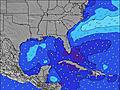 |  |  | 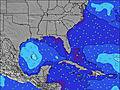 |  |  | |||||||||||||||
Wave Height (m) Direction Period (s) | ESE 5 | SE 5 | SE 5 | E 13 | ESE 5 | ESE 5 | ESE 7 | E 7 | E 7 | E 7 | E 7 | E 7 | E 7 | E 7 | E 7 | E 7 | N 5 | N 5 | ESE 7 | E 7 | E 7 | E 7 | E 7 | E 7 |
Wave Graph | ||||||||||||||||||||||||
14 | 12 | 23 | 4 | 9 | 10 | 9 | 8 | 9 | 4 | 4 | 4 | 4 | 4 | 4 | 4 | 5 | 5 | 9 | 4 | 4 | 4 | 4 | 4 | |
Wind (km/h) | ||||||||||||||||||||||||
Wind State on-shore cross-onshore cross-shore cross-offshore off-shore glassy | off | cross-off | cross-off | on | cross-off | off | off | off | off | glassy | cross | cross-off | on | off | off | cross-off | cross-off | cross-on | cross | cross | cross-off | off | cross-off | cross-off |
High Tide | 11:53AM0.30m | 00:25AM0.38m | 12:51PM0.29m | 1:19AM0.33m | 1:52PM0.28m | 2:16AM0.28m | ||||||||||||||||||
Low Tide | 6:00PM-0.37m | 6:45AM-0.32m | 7:00PM-0.32m | 7:38AM-0.30m | 8:04PM-0.27m | |||||||||||||||||||
— | — | — | — | — | — | 6:26 | — | — | — | — | — | — | — | 6:26 | — | — | — | — | — | — | — | 6:26 | — | |
— | — | — | 8:20 | — | — | — | — | — | — | — | 8:20 | — | — | — | — | — | — | — | 8:20 | — | — | — | 8:21 | |
mm | 3 | — | 1 | 28 | 1 | 2 | 2 | 1 | — | 1 | — | 17 | 21 | — | — | — | — | 1 | — | — | 2 | — | — | — |
Temp °C | 29 | 32 | 31 | 25 | 25 | 25 | 25 | 24 | 28 | 31 | 30 | 23 | 23 | 23 | 23 | 23 | 27 | 27 | 29 | 28 | 29 | 27 | 26 | 25 |
Feels °C | 32 | 34 | 32 | 22 | 25 | 27 | 27 | 27 | 32 | 35 | 31 | 23 | 26 | 25 | 25 | 25 | 31 | 30 | 32 | 30 | 33 | 30 | 29 | 28 |
Swell 1 Height (m) Direction Period (s) | ESE 5 | E 6 | E 6 | E 13 | ESE 5 | ESE 5 | ESE 7 | SE 5 | SE 4 | E 7 | E 7 | E 7 | E 7 | E 7 | E 7 | E 7 | N 5 | N 5 | N 5 | E 7 | E 7 | E 7 | SE 3 | SSE 4 |
14 | 7 | 3 | 4 | 9 | 10 | 9 | 5 | 5 | 4 | 4 | 4 | 4 | 4 | 4 | 4 | 5 | 5 | 2 | 4 | 4 | 4 | 2 | 1 | |
Swell 2 Height (m) Direction Period (s) | — | — | — | E 13 | E 13 | E 13 | SE 4 | E 7 | E 7 | — | — | — | SE 4 | WNW 3 | SE 4 | N 5 | E 7 | E 7 | ESE 7 | N 5 | — | — | E 7 | E 7 |
— | — | — | 3 | 3 | 3 | 5 | 8 | 9 | — | — | — | 1 | 1 | 1 | 2 | 4 | 4 | 9 | 2 | — | — | 4 | 4 | |
Swell 3 Height (m) Direction Period (s) | — | — | — | — | E 13 | E 13 | — | — | — | — | — | — | — | SE 4 | — | SE 4 | SE 4 | S 4 | S 4 | — | — | — | — | — |
— | — | — | — | 3 | 3 | — | — | — | — | — | — | — | 1 | — | 1 | 1 | 1 | 1 | — | — | — | — | — | |
Wind waves Height (m) Direction Period (s) | SSE 5 | SE 5 | SE 5 | SE 4 | SSE 4 | SSE 5 | — | — | WNW 2 | SE 4 | SE 4 | SE 4 | W 3 | — | — | — | — | SE 4 | — | SE 3 | SE 3 | SE 3 | S 4 | — |
15 | 12 | 23 | 38 | 12 | 7 | — | — | 1 | 3 | 3 | 4 | 5 | — | — | — | — | 1 | — | 3 | 2 | 1 | 6 | — | |
Nearest Offshore or Glassy | ||||||||||||||||||||||||
Distance (km) | 846 | 725 | 619 | 645 | 129 | 375 | 537 | 679 | 780 | 682 | 375 | 660 | 218 | 1090 | 483 | 838 | 935 | 375 | 375 | 375 | 375 | 1090 | 1141 | 1336 |
Best forecast wave conditions in North Florida | ||||||||||||||||||||||||
Best forecast wave conditions in United States | ||||||||||||||||||||||||
Header Global | ||||||||||||||||||||||||
- Map Icons:
 Break
Break Live Wave Height (m)
 Live Wind Speed (km/h)
 Surf Rating (10 Max)
 Ocean Swells (m)
- Wind Speed (km/h)


FREE! Surf-Forecast.com widget for your website
The surf report / weather widget below is available to embed on third party websites free of charge and provides a summary of our Sebastian Inlet-Second Peak surf forecast. Simply grab the html code snippet that we provide and paste it into your own site. You can choose your preferred language and metric/imperial units for the surf forecast feed to suit users of your site. Click here to get the code.
 Nearest