

Surf Forecasts:

Roads End surf forecast from 3 Aug 2026:
- Best quality surf: Tuesday 4 Aug, 11PM (local time) - 6.5ft (2.0m), 7s period, NW swell with cross-offshore winds.
- Most powerful swell: Monday 3 Aug, 11PM (local time) - 7ft (2.2m), 7s period, NNW swell with 453 kJ wave energy.
- Next surfable swell (1★+): Monday 3 Aug, 8AM (local time) - 5ft (1.6m), 8s period with NW swell.
Best Forecast Surf Conditions for Roads End this week:
The surf forecast for Roads End over the next 16 days: The first swell (rated 1 star or higher) is forecast to arrive on Monday (Aug 03) at 8AM. The primary swell is predicted to be 1.6m and 8s period with a secondary swell of 0.4m and 13s. The wind is predicted to be cross-offshore as the swell arrives.
The most powerful waves expected at Roads End in the next 16 days are 2.2m 7s and forecast to arrive on Monday (Aug 03) at 11PM. Winds are predicted to be cross-offshore at the time the swell arrives. The largest open ocean swell (not directed at the beach) is 0.7m 6s period and expected on Monday (Aug 03) at 8AM.
| Wave Type | Time (PDT) & Date | Wave Height & Period |
|---|---|---|
| Next good surf (1 star+) | 8AM (Mon 3rd Aug) | 5ft (1.6m) 8s |
| Best Surf | 11PM (Tue 4th Aug) | 6.5ft (2.0m) 7s |
| Most Powerful | 11PM (Mon 3rd Aug) | 7ft (2.2m) 7s |
Table - best surf conditions forecast for Roads End over the next 16 days.
The Lowdown
Alright, this is Rusty, and I’m looking at the forecast for Roads End. First thing I gotta tell you, the water is 54° right now, and that’s a solid 5° colder than it should be for this time of year. That’s not just a little chilly, that’s a proper winter wetsuit smash to the face.
Now, for the actual surf… it’s a tough stretch. The first real recommendation doesn’t even kick off until Monday the 4th of August, and even then it’s a struggle. The whole week is a battle with cross-shore winds. On Monday the 4th, we’ve got a 5ft NW swell at 7 seconds, but the wind is a gentle cross-shore, so it’s not totally blown out, just a little chopped. The wave energy is weak, sitting at (305), so it’s a small, weak little wave. Tuesday the 5th is similar, 5ft but cross-onshore, which makes it choppy. Not great.
There’s a real gap here. The whole first week is marginal at best, with scores of 0 or 1. The winds are nearly always cross or cross-on, and the swell is weak and short-period. It’s the kind of week you look at the forecast, then just go back to bed.
The real flicker of hope, and I mean the only stand-out, is the weekend of Saturday the 16th and Sunday the 17th of August. On Sunday the 16th afternoon, we’ve got a 5ft NW swell with an 8-second period. The key thing here is the wind goes light cross-onshore from the NW, which is better than the cross-shore trash we’ve had. The wave energy jumps up to a moderate (544), which is the highest in the whole forecast. It’s still not perfect, but it’s the best on offer. The morning of the 17th taps out at 4ft, and the energy is still decent at (430). These are the two sessions to pencil in. The rest of the run is small, weak, and windy.
The swell direction is a steady NW which is the optimum for Roads End, so the break is set up right, but the period is too short for any real grunt. It’s not going to have that long, clean wall. The break is a beach and reef, fairly consistent, and crowds are possible there. But with this quality, it won’t be packed.
So, to be straight with you: the first week is a write-off. The second week has a couple of days that are worth a look, but don’t expect magic. If you’re desperate, the 16th and 17th are your best bets.
Rusty.
Short Range ForecastMostly dry. Warm (max 23°C on Tue morning, min 13°C on Mon morning). Wind will be generally light. | Days 4-6 Weather SummaryMostly dry. Very mild (max 19°C on Thu afternoon, min 12°C on Fri night). Wind will be generally light. | ||||||||||||||||||||
Monday 3 | Tuesday 4 | Wednesday 5 | Thursday 6 | Friday 7 | Saturday 8 | Sunday 9 | |||||||||||||||
AM | PM | Night | AM | PM | Night | AM | PM | Night | AM | PM | Night | AM | PM | Night | AM | PM | Night | AM | PM | Night | |
Swell Height Map | 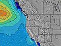 |  | 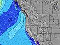 | 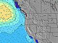 | 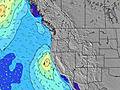 | 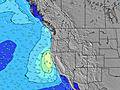 | 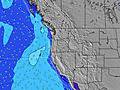 | ||||||||||||||
Wave Height (m) Direction Period (s) | NW 8 | NNW 6 | NNW 7 | NW 7 | NW 7 | NW 7 | NW 8 | NW 8 | NW 8 | NW 8 | NW 8 | NW 7 | NW 7 | NNW 7 | NNW 6 | NNW 6 | NNW 6 | NNW 6 | NNW 6 | NNW 6 | WNW 7 |
Wave Graph | |||||||||||||||||||||
239 | 329 | 363 | 241 | 323 | 396 | 324 | 349 | 333 | 233 | 277 | 160 | 109 | 163 | 181 | 123 | 131 | 164 | 126 | 181 | 146 | |
Wind (km/h) | |||||||||||||||||||||
Wind State on-shore cross-onshore cross-shore cross-offshore off-shore glassy | cross | cross | cross-off | cross | cross | cross-off | cross-on | cross | cross-off | cross-on | cross-on | cross | cross | cross | cross-off | cross | cross | cross | cross | cross | cross-off |
High Tide | 4:29PM1.90m | 4:40AM1.49m | 5:04PM1.95m | 5:50AM1.35m | 5:46PM2.00m | 7:17AM1.27m | 6:38PM2.03m | 8:55AM1.27m | 7:41PM2.07m | 10:18AM1.35m | 8:49PM2.13m | 11:19AM1.46m | 9:56PM2.20m | ||||||||
Low Tide | 10:21AM0.18m | 11:16PM0.34m | 10:55AM0.34m | 00:16AM0.27m | 11:35AM0.51m | 1:23AM0.18m | 12:25PM0.66m | 2:36AM0.08m | 1:32PM0.77m | 3:47AM-0.04m | 2:54PM0.81m | 4:50AM-0.16m | 4:13PM0.78m | ||||||||
6:03 | — | — | 6:03 | — | — | 6:05 | — | — | 6:05 | — | — | 6:07 | — | — | 6:09 | — | — | 6:09 | — | — | |
— | 8:39 | — | — | 8:38 | — | — | 8:37 | — | — | 8:36 | — | — | 8:35 | — | — | 8:32 | — | — | 8:31 | — | |
mm | — | — | — | — | — | — | — | — | — | — | — | — | — | — | — | — | — | — | — | — | — |
Temp °C | 19 | 20 | 16 | 23 | 22 | 16 | 20 | 20 | 15 | 18 | 19 | 15 | 18 | 19 | 15 | 18 | 18 | 15 | 18 | 18 | 15 |
Feels °C | 16 | 15 | 13 | 20 | 19 | 14 | 19 | 18 | 14 | 18 | 18 | 14 | 16 | 16 | 13 | 15 | 15 | 13 | 16 | 15 | 13 |
Swell 1 Height (m) Direction Period (s) | SW 13 | SW 13 | SW 16 | WSW 16 | SW 16 | SW 15 | NW 8 | NW 8 | NW 8 | NW 8 | SW 13 | NW 7 | SW 13 | SW 13 | WNW 12 | SW 12 | WNW 11 | W 11 | WNW 10 | WNW 10 | WNW 7 |
44 | 27 | 41 | 25 | 64 | 56 | 324 | 349 | 333 | 233 | 63 | 160 | 59 | 58 | 46 | 54 | 45 | 58 | 38 | 36 | 146 | |
Swell 2 Height (m) Direction Period (s) | WSW 18 | WSW 17 | SW 13 | SSW 12 | SSW 12 | SSW 12 | SW 15 | SW 14 | SW 14 | SW 14 | SW 19 | SW 13 | WNW 8 | SW 18 | SW 13 | WNW 11 | SW 12 | SW 17 | SW 16 | SW 16 | SW 15 |
30 | 29 | 26 | 15 | 14 | 14 | 54 | 73 | 68 | 66 | 15 | 61 | 13 | 49 | 57 | 46 | 55 | 45 | 62 | 85 | 37 | |
Swell 3 Height (m) Direction Period (s) | — | — | SW 13 | SW 12 | — | — | SSW 12 | — | SW 11 | SSW 11 | W 16 | WNW 8 | WNW 15 | WNW 8 | SW 18 | SW 16 | SW 16 | SW 12 | W 13 | W 12 | W 12 |
— | — | 26 | 24 | — | — | 14 | — | 5 | 12 | 5 | 14 | 21 | 6 | 48 | 42 | 67 | 37 | 28 | 28 | 12 | |
Wind waves Height (m) Direction Period (s) | NW 8 | NNW 6 | NNW 7 | NW 7 | NW 7 | NW 7 | — | — | — | — | NW 8 | — | NW 7 | NNW 7 | NNW 6 | NNW 6 | NNW 6 | NNW 6 | NNW 6 | NNW 6 | NNW 7 |
239 | 329 | 363 | 241 | 323 | 396 | — | — | — | — | 277 | — | 109 | 163 | 181 | 123 | 131 | 164 | 126 | 181 | 139 | |
Nearest Offshore or Glassy | |||||||||||||||||||||
Distance (km) | 207 | 378 | 6 | 207 | 344 | 6 | 300 | 300 | 6 | 212 | 462 | 29 | 360 | 553 | 6 | 378 | 2327 | 85 | 263 | 554 | 6 |
Best forecast wave conditions in North Oregon | |||||||||||||||||||||
Best forecast wave conditions in United States | |||||||||||||||||||||
Header Global | |||||||||||||||||||||
- Map Icons:
 Break
Break Live Wave Height (m)
 Live Wind Speed (km/h)
 Surf Rating (10 Max)
 Ocean Swells (m)
- Wind Speed (km/h)
Latest Updates


FREE! Surf-Forecast.com widget for your website
The surf report / weather widget below is available to embed on third party websites free of charge and provides a summary of our Roads End surf forecast. Simply grab the html code snippet that we provide and paste it into your own site. You can choose your preferred language and metric/imperial units for the surf forecast feed to suit users of your site. Click here to get the code.
Information about the Roads End Surf forecast
The above surf forecast table for Roads End provides essential information for determining whether the surfing conditions will be good over the next 16 days. A general guide to surfing at Roads End can be found by selecting the local surf guide option on the grey menu. Our Roads End surf forecast is unique since it includes wave energy (power) that defines the real feel of the surf rather than just the height or the period. If you surf the same spot (Roads End) regularly then make a mental note of the wave energy from the surf forecast table each time you go. Very soon you may start to choose your surf days based on the wave energy alone combined with our forecast of favourable offshore wind conditions. Our star ratings will help here and of course you will also find the usual wave height and period predictions on our surf forecasts as well as a full break down of the swell components under our advanced users option (to reveal that, click the little Einstein character under the tide times).
Further information to help with frequently asked questions about our surf forecast for Roads End may be found under the help tab on the top menu and also by moving your mouse over the question marks on the surf forecast table itself. Please always bear in mind that the forecast is for near-shore open water and local factors at each surf break influence the actual breaking wave height, such as the beach / reef profile, water depths offshore and shelter.
Roads End is 68 km (42 miles) from the city of McMinnville. If you plan a vacation in North Oregon, look for hotels and other accommodation in McMinnville. McMinnville has rooms for a wide range of budgets as well as car hire and transport links.
 Nearest