

Surf Forecasts:

Pic Kipu surf forecast from 3 Jul 2026:
- Best quality surf: Saturday 4 Jul, 5AM (local time) - 3.5ft (1.0m), 10s period, W swell with cross-offshore winds.
- Most powerful swell: Saturday 4 Jul, 2AM (local time) - 3.5ft (1.1m), 10s period, W swell with 250 kJ wave energy.
- Next surfable swell (1★+): Saturday 4 Jul, 5AM (local time) - 3.5ft (1.0m), 10s period with W swell.
Best Forecast Surf Conditions for Pic Kipu this week:
The surf forecast for Pic Kipu over the next 16 days: The first swell (rated 1 star or higher) is forecast to arrive on Saturday (Jul 04) at 5AM. The primary swell is predicted to be 1.0m and 10s period with a secondary swell of 0.4m and 3s. The wind is predicted to be cross-offshore as the swell arrives.
The most powerful waves expected at Pic Kipu in the next 16 days are 1.1m 10s and forecast to arrive on Saturday (Jul 04) at 2AM. Winds are predicted to be cross-offshore at the time the swell arrives. The largest open ocean swell (not directed at the beach) is 1.0m 5s period and expected on Friday (Jul 03) at 11PM.
| Wave Type | Time (CEST) & Date | Wave Height & Period |
|---|---|---|
| Next good surf (1 star+) | 5AM (Sat 4th Jul) | 3.5ft (1.0m) 10s |
| Best Surf | 5AM (Sat 4th Jul) | 3.5ft (1.0m) 10s |
| Most Powerful | 2AM (Sat 4th Jul) | 3.5ft (1.1m) 10s |
Table - best surf conditions forecast for Pic Kipu over the next 16 days.
Updates in hr min s Forecast update imminent
Alright, Rusty here. Let’s talk about what’s on the table.
Alright, so for Pic Kipu, a sheltered reef break that loves a west-southwest swell, we’ve got a long quiet stretch ahead. There’s nothing worthwhile for quite a while. The water is sitting around 66°, which is a touch warmer than normal for this time of year, so that’s something.
The next couple of weeks are a bit of a flat spell. We don’t get anything that qualifies as a real standout. But hold on, towards the end of the forecast period, things start to perk up.
On the 17th of July, Friday morning, we start seeing some life. A clean 4 ft from the WNW with a 10-second interval, 19 mph cross-offshore wind, and the combined swell energy is 258 (moderate). That’s surfable, but the conditions are still pretty ordinary. The afternoon looks similar, with a 4 ft swell and offshore wind. This isn't a gem, but it’s the best we see. The 18th of July, Saturday morning, picks up a little more, with 4 ft WNW swell and light 3 mph winds, giving clean lines, but the period drops to 8 seconds. That’s a bit less refined. The afternoon shows 5 ft WNW swell with 9 mph offshore winds and 284 energy. That’s the best energy in the whole outlook. Still, it’s nothing to scream about.
Because this break is inconsistent, it’s not surprising to see this gap. And when it fires, there’s a reef bottom to consider. The 18th afternoon offers the best chance for a clean wave. The swell is not too big for an intermediate.
Overall, if you’re desperate, the 17th and 18th of July mornings and afternoons are your windows. Nothing else in the 16 days is worth paddling out for.
Rusty.
Short Range ForecastMostly dry. Warm (max 29°C on Sat night, min 17°C on Sat morning). Wind will be generally light. | Days 5-7 Weather SummaryMostly dry. Warm (max 34°C on Tue night, min 20°C on Wed morning). Wind will be generally light. | ||||||||||||||||||||
Fri 3 | Saturday 4 | Sunday 5 | Monday 6 | Tuesday 7 | Wednesday 8 | Thursday 9 | |||||||||||||||
PM | Night | AM | PM | Night | AM | PM | Night | AM | PM | Night | AM | PM | Night | AM | PM | Night | AM | PM | Night | AM | |
Swell Height Map | 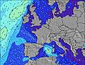 |  |  |  |  |  |  | 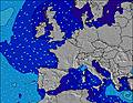 | |||||||||||||
Wave Height (m) Direction Period (s) | WNW 10 | W 10 | W 10 | W 10 | WNW 10 | W 10 | W 9 | WNW 9 | W 9 | W 9 | W 8 | W 9 | W 9 | WNW 8 | W 10 | WNW 9 | W 9 | W 9 | W 9 | W 9 | WNW 9 |
Wave Graph | |||||||||||||||||||||
363 | 250 | 167 | 245 | 160 | 92 | 60 | 62 | 40 | 38 | 36 | 39 | 55 | 13 | 49 | 69 | 43 | 42 | 41 | 41 | 26 | |
Wind (km/h) | |||||||||||||||||||||
Wind State on-shore cross-onshore cross-shore cross-offshore off-shore glassy | cross-off | cross-off | cross | cross-off | cross-off | cross | cross-off | cross | cross-on | cross | cross | cross-off | cross-off | cross-off | cross-on | cross-off | cross | cross-on | cross | cross | cross-on |
High Tide | 7:44PM3.82m | 8:03AM3.52m | 8:20PM3.76m | 8:41AM3.46m | 8:58PM3.68m | 9:22AM3.39m | 9:41PM3.59m | 10:10AM3.32m | 10:31PM3.48m | 11:07AM3.27m | 11:33PM3.39m | 12:15PM3.27m | 00:47AM3.36m | 1:30PM3.36m | |||||||
Low Tide | 2:11AM0.63m | 2:19PM0.71m | 2:49AM0.69m | 2:58PM0.79m | 3:29AM0.76m | 3:41PM0.89m | 4:15AM0.83m | 4:32PM0.98m | 5:09AM0.90m | 5:32PM1.04m | 6:10AM0.94m | 6:40PM1.03m | 7:18AM0.92m | ||||||||
— | — | 6:20 | — | — | 6:20 | — | — | 6:22 | — | — | 6:22 | — | — | 6:22 | — | — | 6:24 | — | — | 6:24 | |
— | 10:14 | — | — | 10:14 | — | — | 10:14 | — | — | 10:13 | — | — | 10:13 | — | — | 10:12 | — | — | 10:12 | 10:10 | |
mm | — | — | — | — | — | — | — | — | — | — | — | — | — | — | — | — | — | — | — | — | — |
Temp °C | 23 | 27 | 22 | 25 | 29 | 23 | 28 | 29 | 26 | 30 | 30 | 28 | 32 | 34 | 26 | 30 | 30 | 27 | 33 | 33 | 29 |
Feels °C | 20 | 23 | 20 | 21 | 24 | 22 | 27 | 28 | 24 | 27 | 26 | 26 | 29 | 28 | 25 | 28 | 28 | 24 | 30 | 29 | 25 |
Swell 1 Height (m) Direction Period (s) | WNW 10 | W 10 | W 10 | W 10 | WNW 10 | W 10 | W 9 | WNW 9 | W 9 | W 9 | W 8 | W 9 | — | NW 5 | W 10 | WNW 9 | WNW 5 | W 9 | W 9 | W 9 | WNW 9 |
363 | 250 | 167 | 245 | 160 | 92 | 60 | 62 | 40 | 38 | 36 | 39 | — | 11 | 49 | 69 | 15 | 42 | 41 | 41 | 26 | |
Swell 2 Height (m) Direction Period (s) | — | — | ENE 3 | NW 12 | W 10 | NNE 3 | NW 9 | W 3 | SE 4 | ESE 3 | W 10 | ENE 3 | — | WNW 8 | W 10 | W 7 | W 9 | NW 4 | — | — | — |
— | — | 1 | 5 | 2 | 1 | 41 | 1 | 1 | 1 | 8 | 1 | — | 13 | 8 | 1 | 43 | 3 | — | — | — | |
Swell 3 Height (m) Direction Period (s) | — | — | — | — | NW 10 | — | E 3 | — | — | SE 4 | — | — | — | W 10 | — | — | — | — | — | — | — |
— | — | — | — | 17 | — | 1 | — | — | 1 | — | — | — | 8 | — | — | — | — | — | — | — | |
Wind waves Height (m) Direction Period (s) | — | NNE 3 | — | — | NNE 3 | E 3 | — | ENE 3 | E 4 | — | NE 3 | — | W 9 | NE 3 | ENE 3 | — | NE 3 | NE 3 | WNW 2 | NE 4 | E 4 |
— | 3 | — | — | 4 | 2 | — | 6 | 6 | — | 3 | — | 55 | 1 | 1 | — | 3 | 2 | 1 | 17 | 24 | |
Nearest Offshore or Glassy | |||||||||||||||||||||
Distance (km) | 184 | 2 | 0 | 194 | 8 | 2 | 60 | 8 | 44 | 60 | 60 | 88 | 194 | 60 | 44 | 194 | 9 | 74 | 8 | 74 | 74 |
Best forecast wave conditions in Morbihan - Brittany | |||||||||||||||||||||
Best forecast wave conditions in France | |||||||||||||||||||||
Header Global | |||||||||||||||||||||
- Map Icons:
 Break
Break Live Wave Height (m)
 Live Wind Speed (km/h)
 Surf Rating (10 Max)
 Ocean Swells (m)
- Wind Speed (km/h)


FREE! Surf-Forecast.com widget for your website
The surf report / weather widget below is available to embed on third party websites free of charge and provides a summary of our Pic Kipu surf forecast. Simply grab the html code snippet that we provide and paste it into your own site. You can choose your preferred language and metric/imperial units for the surf forecast feed to suit users of your site. Click here to get the code.
Information about the Pic Kipu Surf forecast
The above surf forecast table for Pic Kipu provides essential information for determining whether the surfing conditions will be good over the next 16 days. A general guide to surfing at Pic Kipu can be found by selecting the local surf guide option on the grey menu. Our Pic Kipu surf forecast is unique since it includes wave energy (power) that defines the real feel of the surf rather than just the height or the period. If you surf the same spot (Pic Kipu) regularly then make a mental note of the wave energy from the surf forecast table each time you go. Very soon you may start to choose your surf days based on the wave energy alone combined with our forecast of favourable offshore wind conditions. Our star ratings will help here and of course you will also find the usual wave height and period predictions on our surf forecasts as well as a full break down of the swell components under our advanced users option (to reveal that, click the little Einstein character under the tide times).
Further information to help with frequently asked questions about our surf forecast for Pic Kipu may be found under the help tab on the top menu and also by moving your mouse over the question marks on the surf forecast table itself. Please always bear in mind that the forecast is for near-shore open water and local factors at each surf break influence the actual breaking wave height, such as the beach / reef profile, water depths offshore and shelter.
Pic Kipu is 4 km (2 miles) from Lorient. If you plan a holiday in Morbihan - Brittany, look for hotels and other accommodation in Lorient. Lorient has rooms for a wide range of budgets as well as car hire and transport links.
 Nearest