

Surf Forecasts:

Anglet - La Petite Barre surf forecast from 16 Jul 2026:
- Most powerful swell: Tuesday 21 Jul, 8PM (local time) - 3ft (0.9m), 6s period, NNW swell with 64 kJ wave energy.
Best Forecast Surf Conditions for Anglet - La Petite Barre this week:
The most powerful waves expected at Anglet - La Petite Barre in the next 16 days are 0.9m 6s and forecast to arrive on Tuesday (Jul 21) at 8PM. Winds are predicted to be onshore at the time the swell arrives. The largest open ocean swell (not directed at the beach) is 1.2m 7s period and expected on Monday (Jul 20) at 11PM.
| Wave Type | Time (CEST) & Date | Wave Height & Period |
|---|---|---|
| Next good surf (1 star+) | - | - |
| Best Surf | - | - |
| Most Powerful | 8PM (Tue 21st Jul) | 3ft (0.9m) 6s |
Table - best surf conditions forecast for Anglet - La Petite Barre over the next 16 days.
The Lowdown
Alright folks, Rusty here. I’ve had a good look at the charts for our little corner of the coast, and I gotta be straight with you—this is a tough one. Over the next 16 days, starting from now, we’re looking at a real dry spell. The first surfable wave isn’t even on the radar until about a week from now, and even then, it’s questionable.
Let’s break it down. For the next several days—from Thursday, July 16th, right through to Wednesday, July 22nd morning—we’re staring at a big fat zero in terms of surf. The swell is nonexistent, and when there is a tiny pulse, it’s all short-period, onshore slop. The combined energy is barely a whisper, with readings like 0 and 10 (out of a possible strong energy). It’s a complete flat spell. We get a little glimmer of glassy conditions on Saturday morning, July 18th and again on Tuesday morning, July 21st, but there’s no swell to go with it. Just a mirror-flat ocean. A kite surfer wouldn’t even bother. The water temp is about average for July, nothing weird there.
Then, on Wednesday afternoon, July 22nd, things get a tiny bit interesting for Anglet - La Petite Barre (La-Barre). We’ve got a little 2ft swell from the NNW, but the period is a weak 6 seconds, and the wind is a moderate cross-onshore at 12 mph. The combined energy climbs to a meager 28. It’s not good, but it’s something. That said, this break rarely breaks, so seeing any ripple here is a little surprising. It’s a beach and jetty setup, so expect it to be choppy and messy. Honestly, this looks more like something for a kite to play in than a surfboard.
The rest of the run into late July doesn’t get any better. We see a few more days with tiny 1ft to 2ft swells, but the periods stay short (3 to 6 seconds) and the winds are generally onshore or cross-onshore. The last little gasp of possibility comes on Monday afternoon, July 27th, with a 2ft WNW swell and a 5-second period, but with a moderate cross-shore wind at 12 mph, it’s going to be a bumpy, choppy mess.
So, the bottom line? There are no standouts. The entire 16-day window is a write-off for a decent paddle. The good news is that this area *can* be much more consistent, so don’t let this blank run get you down. Forecasts can change, but for now, I’d say save the wax, check the kite gear if you’ve got it, and wait for the next system to roll in. This is one of those times where the ocean just says, “Not today.”
Rusty.
Short Range ForecastMostly dry. Warm (max 22°C on Wed night, min 19°C on Thu morning). Wind will be generally light. | Days 5-7 Weather SummaryMostly dry. Warm (max 25°C on Tue afternoon, min 19°C on Sat night). Wind will be generally light. | ||||||||||||||||||||
Thursday 16 | Friday 17 | Saturday 18 | Sunday 19 | Monday 20 | Tuesday 21 | Wed 22 | |||||||||||||||
Night | AM | PM | Night | AM | PM | Night | AM | PM | Night | AM | PM | Night | AM | PM | Night | AM | PM | Night | AM | PM | |
Swell Height Map |  |  |  |  |  |  |  | 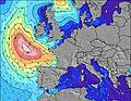 | |||||||||||||
Wave Height (m) Direction Period (s) | NW 4 | NW 5 | NW 5 | NW 5 | NW 5 | NW 5 | NW 5 | NW 5 | NW 5 | NNW 5 | NNW 5 | NNW 5 | NNW 6 | NW 8 | N 6 | NNW 7 | NNW 6 | NNW 6 | NNW 6 | NNW 6 | NNW 6 |
Wave Graph | |||||||||||||||||||||
3 | 0 | 10 | 0 | 20 | 12 | 0 | 0 | 6 | 0 | 0 | 10 | 0 | 0 | 0 | 0 | 0 | 0 | 0 | 0 | 28 | |
Wind (km/h) | |||||||||||||||||||||
Wind State on-shore cross-onshore cross-shore cross-offshore off-shore glassy | on | on | cross-on | on | on | cross-on | on | glassy | cross-on | on | on | on | cross-on | on | on | cross-on | glassy | cross-on | cross | off | cross-on |
High Tide | 6:40AM4.02m | 6:57PM4.33m | 7:26AM3.96m | 7:44PM4.25m | 8:12AM3.84m | 8:31PM4.09m | 8:58AM3.68m | 9:18PM3.87m | 9:47AM3.51m | 10:10PM3.62m | 10:41AM3.34m | 11:08PM3.38m | 11:43AM3.22m | ||||||||
Low Tide | 00:51AM0.62m | 1:04PM0.83m | 1:37AM0.64m | 1:49PM0.86m | 2:22AM0.75m | 2:33PM0.96m | 3:06AM0.93m | 3:17PM1.12m | 3:50AM1.14m | 4:03PM1.31m | 4:36AM1.37m | 4:53PM1.51m | 5:27AM1.58m | 5:51PM1.68m | |||||||
— | 6:39 | — | — | 6:39 | — | — | 6:39 | — | — | 6:41 | — | — | 6:41 | — | — | 6:43 | — | — | 6:43 | — | |
9:45 | — | — | 9:44 | — | — | 9:43 | — | — | 9:43 | — | — | 9:42 | — | — | 9:40 | — | — | 9:39 | — | 9:38 | |
mm | — | — | — | — | — | — | — | — | — | — | — | — | — | — | — | — | — | — | — | — | — |
Temp °C | 22 | 21 | 22 | 22 | 20 | 21 | 21 | 21 | 22 | 22 | 21 | 22 | 22 | 22 | 23 | 23 | 22 | 25 | 24 | 26 | 30 |
Feels °C | 23 | 22 | 22 | 22 | 20 | 21 | 22 | 22 | 21 | 23 | 22 | 22 | 22 | 22 | 23 | 23 | 23 | 22 | 24 | 23 | 26 |
Swell 1 Height (m) Direction Period (s) | W 9 | NW 5 | WNW 9 | NW 5 | W 9 | W 9 | NW 5 | NW 5 | W 8 | NNW 5 | NNW 5 | WNW 8 | NNW 6 | N 6 | N 6 | NNW 7 | NNW 6 | WNW 11 | NNW 6 | NNW 6 | WNW 10 |
6 | 6 | 8 | 9 | 6 | 6 | 9 | 6 | 5 | 11 | 10 | 7 | 30 | 18 | 22 | 85 | 34 | 12 | 70 | 28 | 9 | |
Swell 2 Height (m) Direction Period (s) | W 9 | W 9 | — | W 10 | — | — | W 8 | W 8 | — | WNW 9 | WNW 8 | NW 9 | NW 8 | NW 8 | NW 8 | W 12 | WNW 11 | — | WNW 10 | WNW 10 | — |
2 | 6 | — | 7 | — | — | 5 | 5 | — | 7 | 7 | 3 | 9 | 15 | 9 | 3 | 12 | — | 10 | 10 | — | |
Swell 3 Height (m) Direction Period (s) | W 7 | — | — | — | — | — | — | — | — | NW 10 | NW 10 | — | — | W 10 | NW 9 | — | — | — | — | — | — |
1 | — | — | — | — | — | — | — | — | 4 | 4 | — | — | 2 | 3 | — | — | — | — | — | — | |
Wind waves Height (m) Direction Period (s) | NW 4 | — | NW 5 | — | NW 5 | NW 5 | — | — | NW 5 | — | — | NNW 5 | — | — | — | — | — | NNW 6 | — | — | NNW 6 |
3 | — | 10 | — | 20 | 12 | — | — | 6 | — | — | 10 | — | — | — | — | — | 33 | — | — | 28 | |
Nearest Offshore or Glassy | |||||||||||||||||||||
Distance (km) | 328 | 619 | 1044 | 420 | 779 | 1046 | 702 | 895 | 1161 | 320 | 351 | 363 | 29 | 14 | 95 | 25 | 0 | 95 | 4 | 0 | 95 |
Best forecast wave conditions in La Cote Basque | |||||||||||||||||||||
Best forecast wave conditions in France | |||||||||||||||||||||
Header Global | |||||||||||||||||||||
- Map Icons:
 Break
Break Live Wave Height (m)
 Live Wind Speed (km/h)
 Surf Rating (10 Max)
 Ocean Swells (m)
- Wind Speed (km/h)


FREE! Surf-Forecast.com widget for your website
The surf report / weather widget below is available to embed on third party websites free of charge and provides a summary of our Anglet - La Petite Barre surf forecast. Simply grab the html code snippet that we provide and paste it into your own site. You can choose your preferred language and metric/imperial units for the surf forecast feed to suit users of your site. Click here to get the code.
Information about the Anglet - La Petite Barre Surf forecast
The above surf forecast table for Anglet - La Petite Barre provides essential information for determining whether the surfing conditions will be good over the next 16 days. A general guide to surfing at Anglet - La Petite Barre can be found by selecting the local surf guide option on the grey menu. Our Anglet - La Petite Barre surf forecast is unique since it includes wave energy (power) that defines the real feel of the surf rather than just the height or the period. If you surf the same spot (Anglet - La Petite Barre) regularly then make a mental note of the wave energy from the surf forecast table each time you go. Very soon you may start to choose your surf days based on the wave energy alone combined with our forecast of favourable offshore wind conditions. Our star ratings will help here and of course you will also find the usual wave height and period predictions on our surf forecasts as well as a full break down of the swell components under our advanced users option (to reveal that, click the little Einstein character under the tide times).
Further information to help with frequently asked questions about our surf forecast for Anglet - La Petite Barre may be found under the help tab on the top menu and also by moving your mouse over the question marks on the surf forecast table itself. Please always bear in mind that the forecast is for near-shore open water and local factors at each surf break influence the actual breaking wave height, such as the beach / reef profile, water depths offshore and shelter.
Anglet - La Petite Barre is 4 km (2 miles) from Biarritz. If you plan a holiday in La Cote Basque, look for hotels and other accommodation in Biarritz. Biarritz has rooms for a wide range of budgets as well as car hire and transport links.
 Nearest