

Surf Forecasts:

Kamer Van surf forecast from 14 Jul 2026:
- Best quality surf: Wednesday 15 Jul, 8PM (local time) - 10ft (3.0m), 14s period, SW swell with glassy winds.
- Most powerful swell: Tuesday 21 Jul, 2PM (local time) - 13ft (4.0m), 15s period, SW swell with 7,701 kJ wave energy.
- Next surfable swell (1★+): Wednesday 15 Jul, 5PM (local time) - 8ft (2.5m), 16s period with SW swell.
Best Forecast Surf Conditions for Kamer Van this week:
The surf forecast for Kamer Van over the next 16 days: The first swell (rated 1 star or higher) is forecast to arrive on Wednesday (Jul 15) at 5PM. The primary swell is predicted to be 2.5m and 16s period with a secondary swell of 0.8m and 9s. The wind is predicted to be glassy as the swell arrives.
The most powerful waves expected at Kamer Van in the next 16 days are 4.0m 15s and forecast to arrive on Tuesday (Jul 21) at 2PM. Winds are predicted to be cross-onshore at the time the swell arrives.
| Wave Type | Time (SAST) & Date | Wave Height & Period |
|---|---|---|
| Next good surf (1 star+) | 5PM (Wed 15th Jul) | 8ft (2.5m) 16s |
| Best Surf | 8PM (Wed 15th Jul) | 10ft (3.0m) 14s |
| Most Powerful | 2PM (Tue 21st Jul) | 13ft (4.0m) 15s |
Table - best surf conditions forecast for Kamer Van over the next 16 days.
The Lowdown
Alright, Rusty here. Let's have a look at what's coming down the line for Kamer Van.
Alright, so we’ve got a bit of a slow start, but then it really fires up. The first few days are a bit of a tease, but once we get past the middle of the week, there’s some serious power on the way. The water is sitting at 56°, which is a solid 4° colder than usual for this time of year, so you’ll want a good 4/3, maybe booties if you’re sensitive.
The first real chance to get wet kicks off on Tuesday, July 14th, with a small 3 ft swell from the W. It’s a light NNW wind, but the energy is weak and the conditions are just poor. Honestly, not worth paddling out for.
Things start to look more interesting on Wednesday, July 15th. The morning is still a bit marginal with a 4 ft swell from the WSW, but the period is a very long 17 seconds. That’s real groundswell energy. The real standout, though, is Wednesday afternoon. The wind goes glassy, swinging WSW, and we’ve got a solid 8 ft swell from the SW with a 16-second period. The combined energy is massive. This is excellent surf, but it’s big – only for experienced surfers. The swell direction is right on the money for Kamer Van’s optimum SW direction.
Thursday, July 16th keeps the quality high. Morning has a glassy calm with 8 ft of SW swell, period 13 seconds. The wind is dead calm – glass. It’s another excellent day for the experienced crew. Thursday afternoon dips a little to 8 ft, but it’s still clean with a cross-off breeze.
Friday, July 17th is still very good, with 7 ft of SW swell in the morning, dropping to 6 ft in the afternoon. The wind is offshore SE in the morning, keeping it clean. The crowd factor is “sometimes” here, so you might have a few out, but it’s not a circus.
Saturday, July 18th is a mixed bag. The morning has a tiny 3 ft groundswell with a 14-second period, glassy, but it’s weak. The afternoon jumps back up to 6 ft, but it’s a cross-shore wind, so a bit lumpy.
From Sunday, July 19th through Monday, July 20th, the swell holds around 7 ft to 8 ft, but the wind gets a bit messy with cross and cross-on directions. The quality drops to marginal, but there are still waves to be had.
Now, here’s where it gets wild. Starting Tuesday, July 21st, the swell just goes nuts. We’re talking 13 ft to 15 ft swells for days on end, with energy readings in the thousands. The periods are long, 14 to 15 seconds, and the direction is consistently SW or WSW. The wind is often favorable, sometimes glassy, but the problem is the size. This is a point break, so it might handle the size better than a beach, but 13 ft+ is only for the absolute elite. For most of us, it’s just too big. The forecasts are all saying it’s too big for this break.
This massive swell run continues all the way through to the end of the month, with the 28th and 29th still showing 12 ft to 15 ft waves. The 29th, though, the wind turns nasty with a strong NNW wind, so conditions go to crap.
So, the best bet for the average surfer is Wednesday afternoon, July 15th, and Thursday, July 16th – that’s your window for clean, powerful, but manageable waves. If you’re a charger, the whole third week of July is one long, big-wave session, but be ready for a beating.
Rusty, signing off.
Short Range ForecastMostly dry. Very mild (max 17°C on Thu afternoon, min 13°C on Tue night). Wind will be generally light. | Days 5-7 Weather SummaryLight rain (total 2mm), mostly falling on Sun night. Very mild (max 19°C on Fri afternoon, min 13°C on Sun night). Wind will be generally light. | ||||||||||||||||||||
Tue 14 | Wednesday 15 | Thursday 16 | Friday 17 | Saturday 18 | Sunday 19 | Monday 20 | |||||||||||||||
PM | Night | AM | PM | Night | AM | PM | Night | AM | PM | Night | AM | PM | Night | AM | PM | Night | AM | PM | Night | AM | |
Swell Height Map |  |  |  |  |  |  |  | 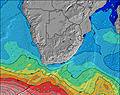 | |||||||||||||
Wave Height (m) Direction Period (s) | W 10 | W 9 | WSW 17 | SW 16 | SW 14 | SW 13 | SW 13 | SW 12 | SW 11 | SW 10 | SSW 10 | SW 14 | SW 13 | WSW 12 | SW 12 | SW 11 | SW 11 | SSW 11 | SW 11 | SW 15 | SW 15 |
Wave Graph | |||||||||||||||||||||
156 | 132 | 963 | 3040 | 3558 | 2381 | 1671 | 1249 | 897 | 677 | 261 | 224 | 1110 | 1607 | 1444 | 1226 | 952 | 973 | 777 | 2899 | 7372 | |
Wind (km/h) | |||||||||||||||||||||
Wind State on-shore cross-onshore cross-shore cross-offshore off-shore glassy | on | cross-on | on | glassy | glassy | glassy | cross-off | off | off | cross-off | glassy | glassy | cross | glassy | cross-on | cross | off | cross-off | cross | glassy | on |
High Tide | 3:27PM1.56m | 3:42AM1.56m | 4:12PM1.61m | 4:28AM1.54m | 4:55PM1.63m | 5:12AM1.48m | 5:37PM1.59m | 5:55AM1.39m | 6:19PM1.52m | 6:38AM1.28m | 7:01PM1.42m | 7:23AM1.17m | 7:45PM1.31m | 8:15AM1.07m | |||||||
Low Tide | 9:38PM0.10m | 9:58AM-0.00m | 10:25PM0.08m | 10:40AM0.01m | 11:11PM0.09m | 11:20AM0.07m | 11:55PM0.15m | 12:00PM0.16m | 00:39AM0.23m | 12:39PM0.27m | 1:24AM0.33m | 1:21PM0.39m | 2:14AM0.43m | ||||||||
— | — | 7:48 | — | — | 7:48 | — | — | 7:48 | — | — | 7:47 | — | — | 7:47 | — | — | 7:46 | — | — | 7:46 | |
5:53 | — | — | 5:54 | — | — | 5:55 | — | — | 5:55 | — | — | 5:57 | — | — | 5:57 | — | — | 5:58 | — | 5:59 | |
mm | — | — | — | — | — | — | — | — | — | — | — | — | — | — | — | — | 2 | — | — | — | — |
Temp °C | 14 | 14 | 14 | 16 | 15 | 15 | 17 | 15 | 16 | 19 | 19 | 17 | 18 | 16 | 16 | 16 | 15 | 14 | 15 | 13 | 12 |
Feels °C | 12 | 13 | 13 | 15 | 16 | 16 | 16 | 14 | 15 | 18 | 18 | 17 | 17 | 16 | 16 | 14 | 14 | 13 | 14 | 12 | 11 |
Swell 1 Height (m) Direction Period (s) | W 10 | W 9 | WSW 17 | SW 16 | SW 14 | SW 13 | SW 13 | SW 12 | SW 11 | SW 10 | SSW 10 | S 11 | SW 13 | WSW 12 | SW 12 | SW 11 | SW 11 | SSW 11 | SW 11 | SW 15 | SW 15 |
156 | 132 | 963 | 3040 | 3558 | 2381 | 1671 | 1249 | 897 | 677 | 261 | 191 | 1110 | 1607 | 1444 | 1226 | 952 | 973 | 777 | 2899 | 7372 | |
Swell 2 Height (m) Direction Period (s) | SW 13 | SW 18 | WSW 9 | W 9 | — | — | — | — | — | — | WSW 10 | WSW 9 | S 11 | S 10 | W 11 | W 10 | W 10 | W 10 | W 9 | W 9 | — |
56 | 108 | 135 | 106 | — | — | — | — | — | — | 135 | 88 | 146 | 53 | 119 | 106 | 94 | 66 | 60 | 40 | — | |
Swell 3 Height (m) Direction Period (s) | S 9 | SW 12 | SW 11 | — | — | — | — | — | — | — | S 13 | SW 14 | — | — | S 10 | S 10 | S 10 | SW 16 | — | WSW 12 | — |
24 | 52 | 59 | — | — | — | — | — | — | — | 51 | 224 | — | — | 19 | 8 | 7 | 10 | — | 14 | — | |
Wind waves Height (m) Direction Period (s) | NW 2 | — | — | — | — | — | — | — | — | — | — | — | — | — | — | — | — | — | — | — | — |
1 | — | — | — | — | — | — | — | — | — | — | — | — | — | — | — | — | — | — | — | — | |
Nearest Offshore or Glassy | |||||||||||||||||||||
Distance (km) | 4 | 2 | 4 | 0 | 0 | 0 | 0 | 0 | 0 | 0 | 0 | 0 | 6 | 0 | 10 | 34 | 0 | 0 | 14 | 0 | 29 |
Best forecast wave conditions in Cape Town | |||||||||||||||||||||
Best forecast wave conditions in South Africa | |||||||||||||||||||||
Header Global | |||||||||||||||||||||
- Map Icons:
 Break
Break Live Wave Height (m)
 Live Wind Speed (km/h)
 Surf Rating (10 Max)
 Ocean Swells (m)
- Wind Speed (km/h)


FREE! Surf-Forecast.com widget for your website
The surf report / weather widget below is available to embed on third party websites free of charge and provides a summary of our Kamer Van surf forecast. Simply grab the html code snippet that we provide and paste it into your own site. You can choose your preferred language and metric/imperial units for the surf forecast feed to suit users of your site. Click here to get the code.
Information about the Kamer Van Surf forecast
The above surf forecast table for Kamer Van provides essential information for determining whether the surfing conditions will be good over the next 16 days. A general guide to surfing at Kamer Van can be found by selecting the local surf guide option on the grey menu. Our Kamer Van surf forecast is unique since it includes wave energy (power) that defines the real feel of the surf rather than just the height or the period. If you surf the same spot (Kamer Van) regularly then make a mental note of the wave energy from the surf forecast table each time you go. Very soon you may start to choose your surf days based on the wave energy alone combined with our forecast of favourable offshore wind conditions. Our star ratings will help here and of course you will also find the usual wave height and period predictions on our surf forecasts as well as a full break down of the swell components under our advanced users option (to reveal that, click the little Einstein character under the tide times).
Further information to help with frequently asked questions about our surf forecast for Kamer Van may be found under the help tab on the top menu and also by moving your mouse over the question marks on the surf forecast table itself. Please always bear in mind that the forecast is for near-shore open water and local factors at each surf break influence the actual breaking wave height, such as the beach / reef profile, water depths offshore and shelter.
Kamer Van is 8 km (5 miles) from the very large city of Robben Island. If you plan a holiday in Cape Town, look for hotels and other accommodation in Robben Island. Robben Island has rooms for a wide range of budgets as well as cheap car hire and transport links.
 Nearest