

Surf Forecasts:

How big are the waves at Glenfield today (20 Jun):
- Afternoon surf: Afternoon surf (20 Jun, local time) - 4ft (1.2m), 14s period with SW swell.
- Evening surf: Evening surf (20 Jun, local time) - 3.5ft (1.1m), 14s period with SW swell.
The current surf forecast for Glenfield at 11PM is: 1.1m 14s primary swell from a Southwest direction and 0.3m 18s secondary swell from a Southwest direction (forecast issued at 07:00pm June 20). The wind direction is predicted to be offshore and the swell rating is 3.
| Time (AWST) & Date | Wave Height | Wave Period |
|---|---|---|
| Morning (20 Jun) | - | - |
| Afternoon (20 Jun) | 4ft (1.2m) | 14s |
| Evening (20 Jun) | 3.5ft (1.1m) | 14s |
Table - waves today at Glenfield. (Swell directed towards the surf break)
Updates in hr min s Forecast update imminent
Short Range ForecastMostly dry. Warm (max 21°C on Sun afternoon, min 15°C on Tue morning). Wind will be generally light. | ||||||||||||||||||||||||
Sat 20 | Sunday 21 | Monday 22 | Tue 23 | |||||||||||||||||||||
5 PM | 8 PM | 11 PM | 2 AM | 5 AM | 8 AM | 11 AM | 2 PM | 5 PM | 8 PM | 11 PM | 2 AM | 5 AM | 8 AM | 11 AM | 2 PM | 5 PM | 8 PM | 11 PM | 2 AM | 5 AM | 8 AM | 11 AM | 2 PM | |
Swell Height Map |  |  | 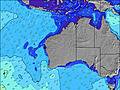 |  |  | 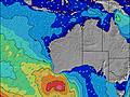 |  |  | 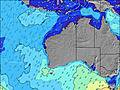 | |||||||||||||||
Wave Height (m) Direction Period (s) | SW 14 | SW 14 | SW 14 | SW 16 | SW 16 | SW 16 | SW 16 | SW 15 | SW 15 | SW 15 | SW 15 | SW 15 | SW 15 | SW 15 | SW 15 | SW 14 | SW 14 | SW 15 | SW 16 | SW 15 | SW 14 | SW 14 | SW 14 | SW 14 |
Wave Graph | ||||||||||||||||||||||||
581 | 492 | 485 | 720 | 739 | 729 | 711 | 693 | 675 | 724 | 714 | 695 | 695 | 773 | 940 | 928 | 833 | 1034 | 1164 | 1028 | 899 | 886 | 874 | 769 | |
Wind (km/h) | ||||||||||||||||||||||||
Wind State on-shore cross-onshore cross-shore cross-offshore off-shore glassy | glassy | off | off | off | off | off | off | cross-off | glassy | off | off | off | off | off | cross-off | cross-off | cross-off | off | off | off | off | off | off | cross-off |
High Tide | 4:36AM0.44m | 9:44AM0.44m | 4:49AM0.51m | 5:13AM0.57m | ||||||||||||||||||||
Low Tide | 8:16PM0.20m | 6:58AM0.42m | 7:53PM0.23m | 7:46PM0.23m | ||||||||||||||||||||
— | — | — | — | 7:13 | — | — | — | — | — | — | — | 7:13 | — | — | — | — | — | — | — | 7:13 | — | — | — | |
5:31 | — | — | — | — | — | — | — | 5:31 | — | — | — | — | — | — | — | 5:31 | — | — | — | — | — | — | 5:32 | |
mm | — | — | — | — | — | — | — | — | — | — | — | — | — | — | — | — | — | — | — | — | — | — | — | — |
Temp °C | 21 | 20 | 19 | 18 | 18 | 17 | 18 | 20 | 21 | 20 | 19 | 18 | 17 | 17 | 19 | 21 | 20 | 19 | 17 | 17 | 16 | 15 | 18 | 20 |
Feels °C | 19 | 17 | 15 | 14 | 15 | 13 | 15 | 16 | 19 | 16 | 15 | 15 | 14 | 13 | 15 | 19 | 17 | 15 | 13 | 13 | 12 | 11 | 14 | 16 |
Swell 1 Height (m) Direction Period (s) | SW 14 | SW 14 | SW 14 | SW 16 | SW 16 | SW 16 | SW 16 | SW 15 | SW 15 | SW 15 | SW 15 | SW 15 | SW 15 | SW 15 | SW 15 | SW 14 | SW 14 | SW 15 | SW 16 | SW 15 | SW 14 | SW 14 | SW 14 | SW 14 |
581 | 492 | 485 | 720 | 739 | 729 | 711 | 693 | 675 | 724 | 714 | 695 | 695 | 773 | 940 | 928 | 833 | 1034 | 1164 | 1028 | 899 | 886 | 874 | 769 | |
Swell 2 Height (m) Direction Period (s) | — | SW 18 | SW 18 | SW 16 | — | — | — | — | — | — | — | — | — | — | — | — | — | — | SW 16 | — | — | — | — | — |
— | 51 | 51 | 264 | — | — | — | — | — | — | — | — | — | — | — | — | — | — | 366 | — | — | — | — | — | |
Swell 3 Height (m) Direction Period (s) | — | — | — | — | — | — | — | — | — | — | — | — | — | — | — | — | — | — | — | — | — | — | — | — |
— | — | — | — | — | — | — | — | — | — | — | — | — | — | — | — | — | — | — | — | — | — | — | — | |
Wind waves Height (m) Direction Period (s) | — | — | — | — | — | — | — | — | — | — | — | — | — | — | — | — | — | — | — | — | ESE 3 | E 3 | — | — |
— | — | — | — | — | — | — | — | — | — | — | — | — | — | — | — | — | — | — | — | 3 | 3 | — | — | |
Nearest Offshore or Glassy | ||||||||||||||||||||||||
Distance (km) | 0 | 0 | 0 | 0 | 0 | 0 | 0 | 0 | 0 | 0 | 0 | 0 | 0 | 0 | 0 | 0 | 0 | 0 | 0 | 0 | 0 | 0 | 0 | 2 |
Best forecast wave conditions in North West WA | ||||||||||||||||||||||||
Best forecast wave conditions in Australia | ||||||||||||||||||||||||
Header Global | ||||||||||||||||||||||||
- Map Icons:
 Break
Break Live Wave Height (m)
 Live Wind Speed (km/h)
 Surf Rating (10 Max)
 Ocean Swells (m)
- Wind Speed (km/h)


FREE! Surf-Forecast.com widget for your website
The surf report / weather widget below is available to embed on third party websites free of charge and provides a summary of our Glenfield surf forecast. Simply grab the html code snippet that we provide and paste it into your own site. You can choose your preferred language and metric/imperial units for the surf forecast feed to suit users of your site. Click here to get the code.
 Nearest