

Surf Forecasts:

Watermans surf forecast from 3 Aug 2026:
- Best quality surf: Saturday 8 Aug, 11PM (local time) - 11ft (3.5m), 16s period, WSW swell with cross-offshore winds.
- Most powerful swell: Saturday 8 Aug, 8PM (local time) - 11ft (3.5m), 16s period, WSW swell with 6,803 kJ wave energy.
- Next surfable swell (1★+): Wednesday 5 Aug, 8AM (local time) - 7ft (2.2m), 16s period with WSW swell.
Best Forecast Surf Conditions for Watermans this week:
The surf forecast for Watermans over the next 16 days: The first swell (rated 1 star or higher) is forecast to arrive on Wednesday (Aug 05) at 8AM. The primary swell is predicted to be 2.2m and 16s period. The wind is predicted to be glassy as the swell arrives.
The most powerful waves expected at Watermans in the next 16 days are 3.5m 16s and forecast to arrive on Saturday (Aug 08) at 8PM. Winds are predicted to be cross-offshore at the time the swell arrives.
| Wave Type | Time (AWST) & Date | Wave Height & Period |
|---|---|---|
| Next good surf (1 star+) | 8AM (Wed 5th Aug) | 7ft (2.2m) 16s |
| Best Surf | 11PM (Sat 8th Aug) | 11ft (3.5m) 16s |
| Most Powerful | 8PM (Sat 8th Aug) | 11ft (3.5m) 16s |
Table - best surf conditions forecast for Watermans over the next 16 days.
The Lowdown
Alright, this is Rusty, and I’m looking at the next couple of weeks for Watermans, a reef break that’s a bit of a beginner’s spot but can get seriously good when the swell lines up. The water’s running a bit colder than normal for this time of year, coming in at 64°F, so a touch nippy—about a degree and a half chillier than average.
The first real action kicks off on Monday, August 3rd. Early morning there’s a solid 5 ft swell from the WSW, with a very long 14-second period, and the wind is a clean cross-off from the NNE at 9 mph. It’s producing a nice moderate wave energy (864) and the conditions are clean. It’s a good start, but not the standout.
Monday afternoon things get messy. The wind swings NW and gets cross-on, the swell drops a little, and the wave quality goes south. The next couple of days are hit-and-miss with building swell but poor wind—Tuesday sees a 7 ft to 8 ft WSW swell but it’s cross-on and choppy, so not worth paddling out for.
The first real standout is Wednesday morning, August 5th. The wind goes glassy, dead calm from the NNE at just 3 mph, and we’ve got a pumping 8 ft WSW swell with a 16-second period. The combined energy jumps to 3278, which is moderate-to-strong. This is prime for experienced surfers—it’s powerful, clean, and the reef will handle that long-period groundswell beautifully. Expect long lines and easy paddling between sets. Just be mindful that at 8 ft, this is expert territory.
Thursday the 6th doubles down: Wednesday’s afternoon shows a 10 ft WSW swell with 16-second period and offshore wind, but Thursday morning is a total gem—absolute glass, zero wind, 10 ft swell, 16-second period, and a massive 4295 energy. This is big, clean, and powerful. Again, for experienced surfers only. The reef will be producing some proper waves.
Saturday the 8th brings a 12 ft swell but the winds are messy, so it’s a bit of a gamble. However, the afternoon has a huge 12060 combined energy reading—very strong. If the wind plays nice, it could be epic, but the cross-shore wind might chop it up.
Looking further out, the second week has some serious potential. The standout of the whole forecast is Tuesday, August 11th. Morning session sees a 15 ft WSW swell with a 17-second period, clean cross-off wind from the SE at 12 mph, and an enormous 12740 energy. This is big, heavy, and for experts only. The reef will be handling it, but it’s going to be a beast. The afternoon holds the same size but with cross-shore wind, so morning is the window.
Wednesday the 12th is also a beauty: 10 ft WSW swell, offshore wind from the E at 6 mph, and 5176 energy. Clean and powerful. Then there’s a drop-off in size toward the end of the week, but the 16th of August (Sunday) brings another 12 ft to 10 ft pulse with offshore winds, especially the afternoon with a 5295 energy reading—that’s a solid session.
Overall, there’s a gap of nothing worth mentioning before the 3rd, and then plenty of action. The best of the best is the 11th, with the 5th and 6th being close runners-up. Crowds are often at Watermans, so expect company on the good days.
Stay stoked,
Rusty
Short Range ForecastLight rain (total 8mm), mostly falling on Mon night. Very mild (max 19°C on Mon afternoon, min 13°C on Mon morning). Winds decreasing (fresh winds from the WNW on Mon night, calm by Wed morning). | Days 4-6 Weather SummaryLight rain (total 5mm), mostly falling on Fri night. Very mild (max 17°C on Fri afternoon, min 11°C on Sat night). Winds increasing (calm on Thu morning, fresh winds from the SW by Fri night). | ||||||||||||||||||||
Monday 3 | Tuesday 4 | Wednesday 5 | Thursday 6 | Friday 7 | Saturday 8 | Sunday 9 | |||||||||||||||
AM | PM | Night | AM | PM | Night | AM | PM | Night | AM | PM | Night | AM | PM | Night | AM | PM | Night | AM | PM | Night | |
Swell Height Map |  |  |  | 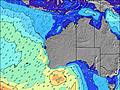 | 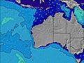 | 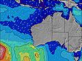 | 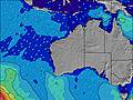 | ||||||||||||||
Wave Height (m) Direction Period (s) | WSW 14 | WSW 15 | WSW 16 | WSW 19 | WSW 17 | WSW 16 | WSW 16 | WSW 16 | WSW 16 | WSW 16 | WSW 16 | WSW 16 | WSW 15 | WSW 15 | WSW 15 | WSW 15 | WSW 16 | WSW 16 | WSW 16 | WSW 16 | WSW 15 |
Wave Graph | |||||||||||||||||||||
862 | 740 | 649 | 2938 | 3393 | 2583 | 3278 | 5065 | 4919 | 4295 | 3614 | 2786 | 3116 | 3522 | 4760 | 5472 | 6553 | 6144 | 4267 | 3287 | 2169 | |
Wind (km/h) | |||||||||||||||||||||
Wind State on-shore cross-onshore cross-shore cross-offshore off-shore glassy | cross-off | cross-on | on | cross-on | cross-on | on | glassy | on | cross-off | glassy | cross-on | cross-on | cross-on | cross-on | cross-on | cross-off | cross | off | cross | on | on |
High Tide | 10:45AM0.45m | 1:28AM0.46m | 10:36AM0.37m | 2:02AM0.52m | 2:55AM0.57m | 4:04AM0.62m | 5:16AM0.67m | 6:21AM0.71m | |||||||||||||
Low Tide | 6:08PM0.20m | 7:11AM0.33m | 6:03PM0.21m | 5:09PM0.21m | 2:55PM0.14m | 3:06PM0.06m | 3:35PM-0.01m | 4:10PM-0.04m | |||||||||||||
7:03 | — | — | 7:03 | — | — | 7:03 | — | — | 7:01 | — | — | 7:01 | — | — | 7:00 | — | — | 6:58 | — | — | |
— | 5:42 | — | — | 5:42 | — | — | 5:43 | — | — | 5:44 | — | — | 5:44 | — | — | 5:45 | — | — | 5:45 | — | |
mm | — | — | 7 | 1 | — | — | — | — | — | — | — | — | — | — | 4 | 1 | — | — | — | — | 2 |
Temp °C | 17 | 19 | 18 | 17 | 17 | 16 | 16 | 17 | 16 | 15 | 16 | 16 | 16 | 17 | 16 | 13 | 14 | 14 | 12 | 14 | 16 |
Feels °C | 13 | 15 | 14 | 15 | 13 | 13 | 15 | 15 | 15 | 14 | 13 | 15 | 12 | 12 | 10 | 7 | 8 | 9 | 9 | 11 | 14 |
Swell 1 Height (m) Direction Period (s) | WSW 14 | WSW 15 | WSW 16 | WSW 19 | WSW 17 | WSW 16 | WSW 16 | WSW 16 | WSW 16 | WSW 16 | WSW 16 | WSW 16 | WSW 15 | — | — | WSW 15 | WSW 16 | WSW 16 | WSW 16 | WSW 16 | WSW 15 |
862 | 740 | 649 | 2938 | 3393 | 2583 | 3278 | 5065 | 4919 | 4295 | 3614 | 2786 | 3116 | — | — | 5472 | 6553 | 6144 | 4267 | 3287 | 2169 | |
Swell 2 Height (m) Direction Period (s) | — | — | WSW 21 | W 6 | W 6 | — | — | — | — | — | — | — | — | — | — | — | — | NW 12 | NW 11 | WSW 21 | WSW 19 |
— | — | 302 | 74 | 26 | — | — | — | — | — | — | — | — | — | — | — | — | 6 | 5 | 578 | 590 | |
Swell 3 Height (m) Direction Period (s) | — | — | — | — | — | — | — | — | — | — | — | — | — | — | — | — | — | — | — | NW 11 | NW 11 |
— | — | — | — | — | — | — | — | — | — | — | — | — | — | — | — | — | — | — | 5 | 5 | |
Wind waves Height (m) Direction Period (s) | N 3 | NW 2 | W 6 | — | — | — | — | — | — | — | — | — | — | WSW 15 | WSW 15 | — | WSW 16 | — | — | — | — |
2 | 2 | 89 | — | — | — | — | — | — | — | — | — | — | 3522 | 4760 | — | 5507 | — | — | — | — | |
Nearest Offshore or Glassy | |||||||||||||||||||||
Distance (km) | 0 | 282 | 327 | 678 | 412 | 285 | 0 | 200 | 0 | 0 | 373 | 63 | 367 | 611 | 1999 | 163 | 163 | 0 | 4 | 296 | 105 |
Best forecast wave conditions in Perth City Coast | |||||||||||||||||||||
Best forecast wave conditions in Australia | |||||||||||||||||||||
Header Global | |||||||||||||||||||||
- Map Icons:
 Break
Break Live Wave Height (m)
 Live Wind Speed (km/h)
 Surf Rating (10 Max)
 Ocean Swells (m)
- Wind Speed (km/h)
Latest Updates


FREE! Surf-Forecast.com widget for your website
The surf report / weather widget below is available to embed on third party websites free of charge and provides a summary of our Watermans surf forecast. Simply grab the html code snippet that we provide and paste it into your own site. You can choose your preferred language and metric/imperial units for the surf forecast feed to suit users of your site. Click here to get the code.
Information about the Watermans Surf forecast
The above surf forecast table for Watermans provides essential information for determining whether the surfing conditions will be good over the next 16 days. A general guide to surfing at Watermans can be found by selecting the local surf guide option on the grey menu. Our Watermans surf forecast is unique since it includes wave energy (power) that defines the real feel of the surf rather than just the height or the period. If you surf the same spot (Watermans) regularly then make a mental note of the wave energy from the surf forecast table each time you go. Very soon you may start to choose your surf days based on the wave energy alone combined with our forecast of favourable offshore wind conditions. Our star ratings will help here and of course you will also find the usual wave height and period predictions on our surf forecasts as well as a full break down of the swell components under our advanced users option (to reveal that, click the little Einstein character under the tide times).
Further information to help with frequently asked questions about our surf forecast for Watermans may be found under the help tab on the top menu and also by moving your mouse over the question marks on the surf forecast table itself. Please always bear in mind that the forecast is for near-shore open water and local factors at each surf break influence the actual breaking wave height, such as the beach / reef profile, water depths offshore and shelter.
Are you planning a holiday in Perth City Coast? If you are looking for accommodation near Watermans, camping, hotels and holiday cottages in Perth City Coast, consider staying in Perth which is 17 km (11 miles) away. Other places in and around Perth City Coast where you can find information about places to rent, and car hire include Fremantle which is 25 km (16 miles) away, Canning Vale, Gosnells and Kwinana.
 Nearest