

Surf Forecasts:

Freeport Pier surf forecast from 2 Aug 2026:
- Most powerful swell: Thursday 6 Aug, 7PM (local time) - 3ft (0.9m), 7s period, SSE swell with 78 kJ wave energy.
Best Forecast Surf Conditions for Freeport Pier this week:
The most powerful waves expected at Freeport Pier in the next 16 days are 0.9m 7s and forecast to arrive on Thursday (Aug 06) at 7PM. Winds are predicted to be onshore at the time the swell arrives. The largest open ocean swell (not directed at the beach) is 0.3m 3s period and expected on Sunday (Aug 02) at 7AM.
| Wave Type | Time (CDT) & Date | Wave Height & Period |
|---|---|---|
| Next good surf (1 star+) | - | - |
| Best Surf | - | - |
| Most Powerful | 7PM (Thu 6th Aug) | 3ft (0.9m) 7s |
Table - best surf conditions forecast for Freeport Pier over the next 16 days.
The Lowdown
Alright folks, Rusty here. Let’s have a look at the next couple of weeks around Freeport Pier.
To be straight with you, this is a tough one. The entire 16-day window is a real struggle. We’ve got a long stretch of tiny, weak swell and mostly poor surf conditions. The waves are consistently small, barely reaching 1 ft to 3 ft, with short periods around 4 to 6 seconds – that’s pure windswell, not a lick of groundswell in sight. The combined wave energy is weak, sitting between 14 and 66 for most of the run, so there’s just no punch.
The first week is a write-off. We start on Sunday, August 2nd, with a 2 ft S swell and a 5-second period, giving weak energy of 24. The wind is offshore from the WNW in the morning, which keeps it clean, but the waves are just too small and weak to get excited about. Sunday afternoon gets worse with a cross-onshore, leaving it choppy. Monday, August 3rd, is even smaller – 1 ft SSW swell at 4 seconds – and while the morning is clean with a light WSW breeze, you’d be struggling to catch anything worthwhile. The whole week through to August 9th is the same story: tiny swell, poor surf, and mostly cross-onshore winds that chop things up. Thursday morning, August 6th, there’s a risk of thunderstorms, but the surf is still poor.
The second week doesn’t offer much hope either. Monday, August 10th, nudges up to 3 ft of SE swell at 6 seconds, the highest we see, with energy hitting 66 – still weak. The wind is a gentle cross-onshore, so it’s clean-ish but not really surfable. The rest of the week from August 11th to the 17th stays small, with heights dropping back to 1 ft to 3 ft, periods at 4 to 6 seconds, and energy mostly in the teens and twenties. Winds are cross-onshore or onshore, keeping things messy. Saturday, August 15th, and Sunday, August 16th, offer a little light cross-shore breeze in the mornings, but the swell is just too feeble.
There is no standout session here. The best of a bad lot is probably Monday, August 10th, morning, when the swell hits 3 ft from the SE with a 6-second period, and the wind is a gentle cross-onshore. That’s the biggest wave we get, but it’s still a poor surf condition. For a beginner, it might be a paddle, but it’s not worth the drive for anyone else.
The water temperature is about average for this time of year, so no surprises there.
Honestly, this stretch looks more interesting for a kite session than a surf, given the small, onshore windswell. We’ve got a big gap of poor surf from start to finish. The good news is that Freeport Pier is fairly consistent, so this blank run is a bit unusual – it tends not to stay this flat for long. Forecasts can change, so keep an eye out, but right now, I’d say save your energy.
Rusty.
Short Range ForecastLight rain (total 8mm), mostly falling on Sat night. Warm (max 32°C on Sun morning, min 27°C on Sat night). Wind will be generally light. | Days 4-6 Weather SummaryLight rain (total 2mm), mostly falling on Thu morning. Warm (max 30°C on Wed morning, min 28°C on Tue night). Wind will be generally light. | ||||||||||||||||||||
Sunday 2 | Monday 3 | Tuesday 4 | Wednesday 5 | Thursday 6 | Friday 7 | Saturday 8 | |||||||||||||||
AM | PM | Night | AM | PM | Night | AM | PM | Night | AM | PM | Night | AM | PM | Night | AM | PM | Night | AM | PM | Night | |
Swell Height Map | 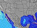 | 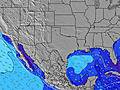 | 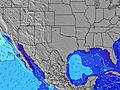 | 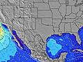 | 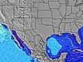 | 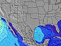 | 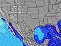 | ||||||||||||||
Wave Height (m) Direction Period (s) | S 5 | S 5 | S 5 | SE 6 | S 4 | S 4 | S 5 | S 5 | SSE 4 | S 5 | SSE 5 | SSE 4 | SE 6 | SSE 6 | SE 6 | SE 6 | SE 6 | SE 6 | SE 6 | SE 6 | SE 6 |
Wave Graph | |||||||||||||||||||||
18 | 25 | 11 | 6 | 10 | 16 | 16 | 16 | 17 | 15 | 14 | 24 | 25 | 40 | 56 | 32 | 35 | 47 | 32 | 33 | 36 | |
Wind (km/h) | |||||||||||||||||||||
Wind State on-shore cross-onshore cross-shore cross-offshore off-shore glassy | off | cross-on | cross | cross-off | cross-on | cross-on | cross-on | cross-on | cross-on | cross-on | on | on | cross-on | on | on | on | cross-on | on | on | on | on |
High Tide | 7:14AM0.57m | 6:38PM0.52m | 7:11AM0.55m | 8:24PM0.53m | 7:00AM0.54m | 10:26PM0.57m | 6:31AM0.55m | 00:28AM0.64m | 1:56AM0.71m | 3:00AM0.76m | 3:53AM0.79m | ||||||||||
Low Tide | 1:14PM0.41m | 00:49AM0.35m | 1:43PM0.34m | 1:43AM0.44m | 2:21PM0.26m | 3:06AM0.52m | 3:08PM0.19m | 4:03PM0.12m | 5:04PM0.06m | 6:08PM0.01m | |||||||||||
6:41 | — | — | 6:43 | — | — | 6:43 | — | — | 6:43 | — | — | 6:45 | — | — | 6:45 | — | — | 6:46 | — | — | |
— | 8:12 | — | — | 8:10 | — | — | 8:09 | — | — | 8:09 | — | — | 8:08 | — | — | 8:07 | — | — | 8:07 | — | |
mm | — | — | 2 | — | — | — | — | — | — | — | — | — | 2 | — | — | — | — | — | — | — | 5 |
Temp °C | 32 | 32 | 29 | 31 | 31 | 29 | 30 | 30 | 28 | 30 | 30 | 28 | 30 | 30 | 29 | 30 | 30 | 28 | 30 | 30 | 28 |
Feels °C | 34 | 33 | 30 | 33 | 32 | 31 | 32 | 32 | 30 | 32 | 31 | 29 | 32 | 32 | 31 | 32 | 31 | 29 | 31 | 30 | 29 |
Swell 1 Height (m) Direction Period (s) | S 5 | S 5 | SE 6 | SSW 4 | ESE 9 | SE 9 | S 5 | SE 9 | SE 8 | S 5 | SE 8 | — | SE 6 | — | — | SE 6 | — | SE 8 | SE 6 | — | ESE 8 |
18 | 25 | 6 | 6 | 8 | 3 | 16 | 3 | 3 | 15 | 3 | — | 25 | — | — | 32 | — | 3 | 32 | — | 6 | |
Swell 2 Height (m) Direction Period (s) | SE 9 | SE 9 | SE 10 | SE 6 | SSE 5 | — | SE 9 | ESE 9 | — | SE 6 | SE 8 | — | S 5 | — | — | ESE 8 | — | — | — | — | — |
3 | 3 | 4 | 5 | 3 | — | 3 | 7 | — | 1 | 2 | — | 8 | — | — | 7 | — | — | — | — | — | |
Swell 3 Height (m) Direction Period (s) | SE 9 | S 11 | — | SE 9 | SE 5 | — | — | — | — | SE 8 | SE 8 | — | SE 10 | — | — | S 8 | — | — | — | — | — |
3 | 2 | — | 3 | 4 | — | — | — | — | 3 | 2 | — | 4 | — | — | 1 | — | — | — | — | — | |
Wind waves Height (m) Direction Period (s) | WNW 2 | S 5 | S 5 | — | S 4 | S 4 | — | S 5 | SSE 4 | — | SSE 5 | SSE 4 | — | SSE 6 | SE 6 | — | SE 6 | SE 6 | — | SE 6 | SE 6 |
1 | 19 | 11 | — | 10 | 16 | — | 16 | 17 | — | 14 | 24 | — | 40 | 56 | — | 35 | 47 | — | 33 | 36 | |
Nearest Offshore or Glassy | |||||||||||||||||||||
Distance (km) | 12 | 1275 | 755 | 1254 | 1372 | 1254 | 1259 | 1363 | 1254 | 1259 | 1358 | 1254 | 1259 | 1360 | 1254 | 1259 | 1272 | 1254 | 1259 | 1276 | 1254 |
Best forecast wave conditions in Texas | |||||||||||||||||||||
Best forecast wave conditions in United States | |||||||||||||||||||||
Header Global | |||||||||||||||||||||
- Map Icons:
 Break
Break Live Wave Height (m)
 Live Wind Speed (km/h)
 Surf Rating (10 Max)
 Ocean Swells (m)
- Wind Speed (km/h)
Latest Updates


FREE! Surf-Forecast.com widget for your website
The surf report / weather widget below is available to embed on third party websites free of charge and provides a summary of our Freeport Pier surf forecast. Simply grab the html code snippet that we provide and paste it into your own site. You can choose your preferred language and metric/imperial units for the surf forecast feed to suit users of your site. Click here to get the code.
Information about the Freeport Pier Surf forecast
The above surf forecast table for Freeport Pier provides essential information for determining whether the surfing conditions will be good over the next 16 days. A general guide to surfing at Freeport Pier can be found by selecting the local surf guide option on the grey menu. Our Freeport Pier surf forecast is unique since it includes wave energy (power) that defines the real feel of the surf rather than just the height or the period. If you surf the same spot (Freeport Pier) regularly then make a mental note of the wave energy from the surf forecast table each time you go. Very soon you may start to choose your surf days based on the wave energy alone combined with our forecast of favourable offshore wind conditions. Our star ratings will help here and of course you will also find the usual wave height and period predictions on our surf forecasts as well as a full break down of the swell components under our advanced users option (to reveal that, click the little Einstein character under the tide times).
Further information to help with frequently asked questions about our surf forecast for Freeport Pier may be found under the help tab on the top menu and also by moving your mouse over the question marks on the surf forecast table itself. Please always bear in mind that the forecast is for near-shore open water and local factors at each surf break influence the actual breaking wave height, such as the beach / reef profile, water depths offshore and shelter.
Freeport Pier is 19 km (12 miles) from Lake Jackson. If you plan a vacation in Texas, look for hotels and other accommodation in Lake Jackson. Lake Jackson has rooms for a wide range of budgets as well as car hire and transport links.
 Nearest