

Surf Forecasts:

El Caño de la Culata surf forecast from 3 Aug 2026:
- Most powerful swell: Wednesday 5 Aug, 8PM (local time) - 3.5ft (1.0m), 5s period, WSW swell with 42 kJ wave energy.
Best Forecast Surf Conditions for El Caño de la Culata this week:
The most powerful waves expected at El Caño de la Culata in the next 16 days are 1.0m 5s and forecast to arrive on Wednesday (Aug 05) at 8PM. Winds are predicted to be cross-onshore at the time the swell arrives. The largest open ocean swell (not directed at the beach) is 0.7m 4s period and expected on Sunday (Aug 09) at 5AM.
| Wave Type | Time (CEST) & Date | Wave Height & Period |
|---|---|---|
| Next good surf (1 star+) | - | - |
| Best Surf | - | - |
| Most Powerful | 8PM (Wed 5th Aug) | 3.5ft (1.0m) 5s |
Table - best surf conditions forecast for El Caño de la Culata over the next 16 days.
The Lowdown
Alright folks, Rusty here. Let’s have a look at what’s on the cards for the next 16 days. I’ll be straight with you – it’s a grim run. The models are showing a whole lot of nothing for a very long time. We’re looking at a solid 16-day stretch, but the first real chance of a wave doesn’t show up until a few days in, and even then, it’s a struggle.
The first hint of anything rideable is on Monday the 4th of August. Even then, it’s barely a ripple. The morning session at El Caño de la Culata is clean with a light cross-offshore breeze from the NW at 12 mph, but the swell is tiny at 1 ft from the WNW with a period of just 3 seconds. The combined energy is a measly 2 (2), so it’s basically a lake. The wind is nice, but there’s no wave to work with. The afternoon gets a bit more energy with a 3 ft swell from the WSW, but the wind swings onshore and the combined energy only hits 16 (16). It’s a no-go.
The pattern repeats all week. We get clean mornings with cross-offshore winds, but the swell is flat or so small it’s not worth paddling out for. The afternoons are consistently ruined by strong onshore winds and choppy, lumpy conditions. The best you can hope for is a dribble of 0.7 ft to 1 ft on the clean morning windows, but the period is always short, around 3 to 4 seconds. The combined energy stays in the 2 to 30 range the whole time – incredibly weak.
The water temperature is sitting at 71°F, which is about average for this time of year, so that’s one thing you don’t have to worry about if you’re just floating around.
Honestly, looking through the whole 16 days, there isn’t a single standout. There’s no swell over 5 ft, no long period, nothing. The biggest swell we see is a 3 ft on the afternoon of Wednesday the 5th of August, but it’s useless with the onshore wind. The setup is so weak and wind-affected that it’s more interesting for a kite surfer than a paddle surfer if the wind picks up enough.
It’s a pretty blank run for the area, but that’s the way it goes sometimes. Forecasts can change, so keep an eye on it, but for now, don’t bother waxing up.
Rusty.
Short Range ForecastMostly dry. Warm (max 30°C on Wed afternoon, min 20°C on Tue morning). Mainly fresh winds. | Days 4-6 Weather SummaryMostly dry. Warm (max 35°C on Sat afternoon, min 19°C on Thu morning). Wind will be generally light. | ||||||||||||||||||||
Monday 3 | Tuesday 4 | Wednesday 5 | Thursday 6 | Friday 7 | Saturday 8 | Sunday 9 | |||||||||||||||
AM | PM | Night | AM | PM | Night | AM | PM | Night | AM | PM | Night | AM | PM | Night | AM | PM | Night | AM | PM | Night | |
Swell Height Map |  |  |  | 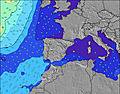 | 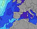 | 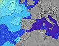 | 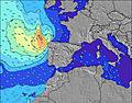 | ||||||||||||||
Wave Height (m) Direction Period (s) | WNW 3 | WSW 3 | W 5 | WNW 3 | WSW 4 | WNW 5 | WSW 4 | WSW 4 | W 5 | NNW 4 | WSW 3 | W 4 | W 4 | WSW 2 | W 4 | W 4 | WSW 3 | W 5 | NW 4 | W 4 | W 5 |
Wave Graph | |||||||||||||||||||||
2 | 7 | 22 | 2 | 16 | 29 | 2 | 30 | 0 | 0 | 9 | 0 | 0 | 1 | 0 | 0 | 3 | 0 | 0 | 9 | 21 | |
Wind (km/h) | |||||||||||||||||||||
Wind State on-shore cross-onshore cross-shore cross-offshore off-shore glassy | cross-off | on | cross-off | cross-off | cross-on | cross-off | cross-off | cross-on | cross-off | cross-off | cross-on | cross-off | cross-off | on | cross-off | cross-off | cross-on | cross-off | cross-off | cross-on | cross-off |
High Tide | 7:07PM2.75m | 7:32AM2.53m | 7:49PM2.61m | 8:18AM2.43m | 8:41PM2.45m | 9:16AM2.33m | 9:48PM2.30m | 10:30AM2.27m | 11:13PM2.23m | 11:54AM2.32m | 00:40AM2.30m | 1:11PM2.50m | 1:52AM2.47m | ||||||||
Low Tide | 12:46PM0.41m | 1:15AM0.39m | 1:26PM0.52m | 1:57AM0.51m | 2:15PM0.64m | 2:49AM0.66m | 3:19PM0.77m | 3:58AM0.80m | 4:44PM0.83m | 5:26AM0.84m | 6:19PM0.74m | 6:51AM0.74m | 7:36PM0.54m | ||||||||
7:33 | — | — | 7:33 | — | — | 7:35 | — | — | 7:35 | — | — | 7:37 | — | — | 7:37 | — | — | 7:39 | — | — | |
— | — | 9:34 | — | — | 9:32 | — | — | 9:31 | — | — | 9:30 | — | — | 9:30 | — | — | 9:29 | — | — | 9:27 | |
mm | — | — | — | — | — | — | — | — | — | — | — | — | — | — | — | — | — | — | — | — | — |
Temp °C | 25 | 27 | 26 | 24 | 27 | 27 | 25 | 30 | 30 | 25 | 33 | 33 | 27 | 33 | 33 | 29 | 35 | 35 | 28 | 35 | 33 |
Feels °C | 23 | 24 | 23 | 22 | 25 | 22 | 23 | 28 | 26 | 21 | 31 | 28 | 25 | 31 | 29 | 26 | 33 | 30 | 24 | 32 | 28 |
Swell 1 Height (m) Direction Period (s) | W 8 | W 10 | W 9 | W 9 | W 9 | W 8 | WSW 4 | — | W 5 | W 6 | W 10 | W 4 | W 4 | W 9 | W 4 | W 4 | W 8 | W 5 | W 8 | — | W 7 |
5 | 2 | 2 | 6 | 6 | 6 | 2 | — | 17 | 3 | 7 | 8 | 3 | 1 | 2 | 1 | 1 | 15 | 1 | — | 4 | |
Swell 2 Height (m) Direction Period (s) | W 10 | — | W 7 | W 9 | — | — | W 8 | — | W 8 | W 4 | W 10 | W 8 | W 9 | — | W 5 | W 8 | — | W 8 | W 8 | — | — |
2 | — | 1 | 2 | — | — | 5 | — | 1 | 1 | 2 | 1 | 1 | — | 1 | 1 | — | 1 | 1 | — | — | |
Swell 3 Height (m) Direction Period (s) | — | — | — | — | — | — | — | — | — | W 5 | — | — | NW 4 | — | SE 5 | — | — | — | — | — | — |
— | — | — | — | — | — | — | — | — | 2 | — | — | 1 | — | 1 | — | — | — | — | — | — | |
Wind waves Height (m) Direction Period (s) | WNW 3 | WSW 3 | W 5 | WNW 3 | WSW 4 | WNW 5 | NNW 3 | WSW 4 | NNW 4 | NNW 4 | WSW 3 | NNW 3 | NNW 4 | WSW 2 | — | NNW 3 | WSW 3 | NW 3 | NW 4 | W 4 | W 5 |
2 | 7 | 22 | 2 | 16 | 29 | 5 | 30 | 8 | 5 | 9 | 7 | 1 | 1 | — | 1 | 3 | 3 | 6 | 9 | 21 | |
Nearest Offshore or Glassy | |||||||||||||||||||||
Distance (km) | 93 | 369 | 247 | 160 | 103 | 95 | 162 | 162 | 119 | 189 | 93 | 103 | 103 | 189 | 672 | 84 | 181 | 146 | 81 | 181 | 626 |
Best forecast wave conditions in Andalucia | |||||||||||||||||||||
Best forecast wave conditions in Spain (Europe) | |||||||||||||||||||||
Header Global | |||||||||||||||||||||
- Map Icons:
 Break
Break Live Wave Height (m)
 Live Wind Speed (km/h)
 Surf Rating (10 Max)
 Ocean Swells (m)
- Wind Speed (km/h)
Latest Updates


FREE! Surf-Forecast.com widget for your website
The surf report / weather widget below is available to embed on third party websites free of charge and provides a summary of our El Caño de la Culata surf forecast. Simply grab the html code snippet that we provide and paste it into your own site. You can choose your preferred language and metric/imperial units for the surf forecast feed to suit users of your site. Click here to get the code.
Information about the El Caño de la Culata Surf forecast
The above surf forecast table for El Caño de la Culata provides essential information for determining whether the surfing conditions will be good over the next 16 days. A general guide to surfing at El Caño de la Culata can be found by selecting the local surf guide option on the grey menu. Our El Caño de la Culata surf forecast is unique since it includes wave energy (power) that defines the real feel of the surf rather than just the height or the period. If you surf the same spot (El Caño de la Culata) regularly then make a mental note of the wave energy from the surf forecast table each time you go. Very soon you may start to choose your surf days based on the wave energy alone combined with our forecast of favourable offshore wind conditions. Our star ratings will help here and of course you will also find the usual wave height and period predictions on our surf forecasts as well as a full break down of the swell components under our advanced users option (to reveal that, click the little Einstein character under the tide times).
Further information to help with frequently asked questions about our surf forecast for El Caño de la Culata may be found under the help tab on the top menu and also by moving your mouse over the question marks on the surf forecast table itself. Please always bear in mind that the forecast is for near-shore open water and local factors at each surf break influence the actual breaking wave height, such as the beach / reef profile, water depths offshore and shelter.
El Caño de la Culata is 7 km (4 miles) from Aljaraque. If you plan a holiday in Andalucia, look for hotels and other accommodation in Aljaraque. Aljaraque has rooms for a wide range of budgets as well as car hire and transport links.
 Nearest