

Surf Forecasts:

Devonport Rivermouth surf forecast from 3 Aug 2026:
- Best quality surf: Monday 10 Aug, 1AM (local time) - 11ft (3.5m), 8s period, NW swell with cross-offshore winds.
- Most powerful swell: Sunday 9 Aug, 1PM (local time) - 11ft (3.5m), 9s period, NNW swell with 2,145 kJ wave energy.
- Next surfable swell (1★+): Monday 3 Aug, 10PM (local time) - 3.5ft (1.1m), 7s period with NW swell.
Best Forecast Surf Conditions for Devonport Rivermouth this week:
The surf forecast for Devonport Rivermouth over the next 16 days: The first swell (rated 1 star or higher) is forecast to arrive on Monday (Aug 03) at 10PM. The primary swell is predicted to be 1.1m and 7s period with a secondary swell of 0.2m and 15s. The wind is predicted to be cross-offshore as the swell arrives.
The most powerful waves expected at Devonport Rivermouth in the next 16 days are 3.5m 9s and forecast to arrive on Sunday (Aug 09) at 1PM. Winds are predicted to be cross-onshore at the time the swell arrives. The largest open ocean swell (not directed at the beach) is 0.9m 4s period and expected on Thursday (Aug 06) at 4PM.
| Wave Type | Time (AEST) & Date | Wave Height & Period |
|---|---|---|
| Next good surf (1 star+) | 10PM (Mon 3rd Aug) | 3.5ft (1.1m) 7s |
| Best Surf | 1AM (Mon 10th Aug) | 11ft (3.5m) 8s |
| Most Powerful | 1PM (Sun 9th Aug) | 11ft (3.5m) 9s |
Table - best surf conditions forecast for Devonport Rivermouth over the next 16 days.
The Lowdown
Alright, Rusty here. Let’s have a look at what’s on offer for Devonport Rivermouth over the next couple of weeks.
Right up front, I gotta be straight with you – this is a lean stretch. For a point/river setup that takes a good NW swell, we’re looking at a whole lot of “poor surf conditions” with almost nothing worth paddling out for. There is a tiny blip around Monday, August 10th, but don’t get your hopes up just yet.
Let’s run through it. The first recommendation doesn’t come until Monday, August 10th. That’s a solid seven-day gap with no real surf on offer from now. Early on, we’ve got small, short-period junk and onshore winds. Tuesday the 4th has glassy conditions, but the swell is only 1 foot from the NW with a period of 11 seconds. Too small to bother with, and combined wave energy is just 38 – that’s weak. Later that week, Friday the 7th morning, the water temp is 55°, about normal for this time of year, but again, nothing doing swell-wise.
Now, Monday, August 10th, that’s the one day that gets a mention. The morning brings a 10-foot NW swell with a period of 9 seconds and a clean, cross-off wind from the WSW at 12 mph. Combined energy is a hefty 1375, so there’s real power in the water. On the one hand, that’s a solid size, but it’s a short-period swell, so it’ll be lumpy and a bit sectiony on the bank. At 10 feet, it’s expert-only territory – too big for beginners. The afternoon drops to 8 feet from the WNW, still with clean cross-off wind. It’s classified as marginal, but that’s your best shot in the whole 16 days. It’s a stand-out mostly because everything else is junk.
After that, it gets small and messy again. Tuesday the 11th has some clean morning conditions but the swell drops to 2 feet with a long 16-second period – too small to ride. The rest of the week into the second week is all tiny waves, 1 foot or 2 feet, with clean winds but no energy. The combined swell values dip below 100 most days. Thursday the 13th has 3 feet NW swell at 16 seconds, but energy is still moderate at 379, and it’s just not enough.
The standout if you have to pick one is unequivocally Monday, August 10th. That’s the only day with real size and clean wind. But mark my words: that 10-foot short-period swell with a cross-off wind can make for a wild, bumpy ride. You’ll need to know the river mouth well, and crowds are *sometimes* a thing here, so don’t expect it empty. The direction (NW) matches exactly what this break likes, and that counts for something.
I’d say keep an eye on the forecasts after this – it tends not to stay this quiet forever, but right now, for Devonport Rivermouth, we’re mostly staring at flat days. Winds are inconsistent, energy levels are low, and the only real chance is that one window. Don’t sell the farm for it, but if you’re desperate for a wave, that’s your shot.
Rusty.
Short Range ForecastLight rain (total 6mm), mostly falling on Mon morning. Very mild (max 11°C on Mon morning, min 6°C on Mon night). Wind will be generally light. | Days 4-6 Weather SummaryModerate rain (total 16mm), heaviest on Sat night. Very mild (max 13°C on Thu morning, min 3°C on Thu night). Winds increasing (calm on Fri morning, fresh winds from the N by Sat night). | ||||||||||||||||||||
Monday 3 | Tuesday 4 | Wednesday 5 | Thursday 6 | Friday 7 | Saturday 8 | Sunday 9 | |||||||||||||||
AM | PM | Night | AM | PM | Night | AM | PM | Night | AM | PM | Night | AM | PM | Night | AM | PM | Night | AM | PM | Night | |
Swell Height Map |  |  |  | 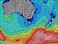 | 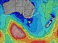 | 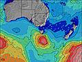 | 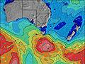 | ||||||||||||||
Wave Height (m) Direction Period (s) | NW 6 | NW 7 | NW 6 | NW 11 | NW 12 | NNW 5 | NW 11 | N 19 | NW 5 | NW 16 | N 20 | NW 6 | NW 18 | NW 15 | NW 17 | NW 16 | NW 16 | N 5 | NNW 8 | NNW 9 | NW 8 |
Wave Graph | |||||||||||||||||||||
230 | 198 | 66 | 20 | 21 | 8 | 5 | 8 | 12 | 10 | 9 | 38 | 52 | 35 | 45 | 41 | 39 | 77 | 1929 | 2048 | 1513 | |
Wind (km/h) | |||||||||||||||||||||
Wind State on-shore cross-onshore cross-shore cross-offshore off-shore glassy | cross | cross | cross-off | glassy | cross-on | cross-off | glassy | cross | off | cross-off | cross | cross-off | glassy | cross-on | cross-off | on | cross-on | on | on | cross-on | cross-off |
High Tide | 2:43PM3.05m | 2:58AM2.99m | 3:25PM3.11m | 3:50AM3.05m | 4:08PM3.18m | 4:43AM3.11m | 4:54PM3.24m | 5:37AM3.15m | 5:43PM3.30m | 6:34AM3.18m | 6:35PM3.32m | 7:33AM3.18m | 7:30PM3.31m | ||||||||
Low Tide | 8:59PM1.02m | 9:15AM0.91m | 9:45PM0.89m | 10:02AM0.93m | 10:32PM0.75m | 10:50AM0.96m | 11:21PM0.63m | 11:39AM1.00m | 00:11AM0.54m | 12:30PM1.04m | 1:05AM0.48m | 1:25PM1.09m | 2:01AM0.46m | ||||||||
7:20 | — | — | 7:18 | — | — | 7:18 | — | — | 7:16 | — | — | 7:16 | — | — | 7:15 | — | — | 7:13 | — | — | |
— | 5:21 | — | — | 5:22 | — | — | 5:22 | — | — | 5:23 | — | — | 5:23 | — | — | 5:24 | — | — | 5:25 | — | |
mm | 4 | 2 | — | — | — | — | — | — | — | — | 2 | — | — | — | — | 1 | 2 | 11 | 17 | 15 | 2 |
Temp °C | 11 | 9 | 8 | 11 | 11 | 8 | 11 | 11 | 7 | 13 | 11 | 9 | 9 | 10 | 9 | 12 | 12 | 12 | 10 | 11 | 11 |
Feels °C | 7 | 4 | 5 | 9 | 9 | 5 | 8 | 8 | 4 | 8 | 8 | 5 | 6 | 7 | 7 | 9 | 9 | 7 | 4 | 5 | 8 |
Swell 1 Height (m) Direction Period (s) | NNW 18 | NNW 16 | NW 6 | NNW 5 | NW 5 | NNW 5 | N 4 | NW 15 | NW 5 | NW 16 | NW 16 | NW 6 | NW 5 | NW 15 | NW 17 | NW 16 | NNW 4 | NNW 15 | — | NNW 9 | NE 7 |
30 | 25 | 66 | 11 | 7 | 8 | 2 | 8 | 6 | 10 | 9 | 38 | 12 | 34 | 45 | 41 | 3 | 21 | — | 1556 | 7 | |
Swell 2 Height (m) Direction Period (s) | NE 6 | — | NW 14 | NW 11 | NW 12 | NW 11 | NW 5 | N 19 | NW 13 | W 12 | N 20 | NW 19 | NW 18 | NNW 19 | NW 4 | — | NW 16 | — | — | — | — |
2 | — | 32 | 20 | 21 | 4 | 1 | 7 | 7 | 3 | 8 | 14 | 52 | 35 | 2 | — | 39 | — | — | — | — | |
Swell 3 Height (m) Direction Period (s) | — | — | NE 7 | NW 14 | NE 6 | — | NW 11 | W 11 | NW 18 | — | — | NW 11 | NW 10 | W 9 | — | — | — | — | — | — | — |
— | — | 2 | 7 | 2 | — | 5 | 2 | 12 | — | — | 5 | 4 | 2 | — | — | — | — | — | — | — | |
Wind waves Height (m) Direction Period (s) | NW 6 | NW 7 | — | — | — | — | — | NW 2 | — | WNW 5 | WNW 4 | — | — | WNW 4 | — | — | N 4 | N 5 | NNW 8 | NNW 9 | NW 8 |
230 | 198 | — | — | — | — | — | 1 | — | 27 | 25 | — | — | 7 | — | — | 3 | 77 | 1929 | 2048 | 1513 | |
Nearest Offshore or Glassy | |||||||||||||||||||||
Distance (km) | 184 | 180 | 0 | 131 | 131 | 131 | 131 | 184 | 131 | 178 | 178 | 184 | 131 | 211 | 131 | 186 | 184 | 180 | 391 | 350 | 50 |
Best forecast wave conditions in North Coast of Tasmania | |||||||||||||||||||||
Best forecast wave conditions in Australia | |||||||||||||||||||||
Header Global | |||||||||||||||||||||
- Map Icons:
 Break
Break Live Wave Height (m)
 Live Wind Speed (km/h)
 Surf Rating (10 Max)
 Ocean Swells (m)
- Wind Speed (km/h)
Latest Updates


FREE! Surf-Forecast.com widget for your website
The surf report / weather widget below is available to embed on third party websites free of charge and provides a summary of our Devonport Rivermouth surf forecast. Simply grab the html code snippet that we provide and paste it into your own site. You can choose your preferred language and metric/imperial units for the surf forecast feed to suit users of your site. Click here to get the code.
Information about the Devonport Rivermouth Surf forecast
The above surf forecast table for Devonport Rivermouth provides essential information for determining whether the surfing conditions will be good over the next 16 days. A general guide to surfing at Devonport Rivermouth can be found by selecting the local surf guide option on the grey menu. Our Devonport Rivermouth surf forecast is unique since it includes wave energy (power) that defines the real feel of the surf rather than just the height or the period. If you surf the same spot (Devonport Rivermouth) regularly then make a mental note of the wave energy from the surf forecast table each time you go. Very soon you may start to choose your surf days based on the wave energy alone combined with our forecast of favourable offshore wind conditions. Our star ratings will help here and of course you will also find the usual wave height and period predictions on our surf forecasts as well as a full break down of the swell components under our advanced users option (to reveal that, click the little Einstein character under the tide times).
Further information to help with frequently asked questions about our surf forecast for Devonport Rivermouth may be found under the help tab on the top menu and also by moving your mouse over the question marks on the surf forecast table itself. Please always bear in mind that the forecast is for near-shore open water and local factors at each surf break influence the actual breaking wave height, such as the beach / reef profile, water depths offshore and shelter.
Devonport Rivermouth is 5 km (3 miles) from Devonport. If you plan a holiday in North Coast of Tasmania, look for hotels and other accommodation in Devonport. Devonport has rooms for a wide range of budgets as well as car hire and transport links.
 Nearest