

Surf Forecasts:

Dania South Beach surf forecast from 3 Aug 2026:
- Most powerful swell: Friday 7 Aug, 8AM (local time) - 4.5ft (1.4m), 6s period, E swell with 117 kJ wave energy.
Best Forecast Surf Conditions for Dania South Beach this week:
The most powerful waves expected at Dania South Beach in the next 16 days are 1.4m 6s and forecast to arrive on Friday (Aug 07) at 8AM. Winds are predicted to be onshore at the time the swell arrives. The largest open ocean swell (not directed at the beach) is 0.2m 2s period and expected on Tuesday (Aug 04) at 2AM.
| Wave Type | Time (EDT) & Date | Wave Height & Period |
|---|---|---|
| Next good surf (1 star+) | - | - |
| Best Surf | - | - |
| Most Powerful | 8AM (Fri 7th Aug) | 4.5ft (1.4m) 6s |
Table - best surf conditions forecast for Dania South Beach over the next 16 days.
The Lowdown
Alright folks, Rusty here. Let’s be straight with you – this 16-day window for the Dania South Beach area is a tough one. We’re looking at a long stretch of small, weak, and messy conditions. Don’t get your hopes up for anything epic.
The pattern right out of the gate is flat and poor. The first few days, from Monday the 3rd through to the end of the first week, are a write-off. We’re talking tiny swell that barely registers, with onshore and cross-onshore winds messing up what little bump there is. The combined energy is weak, sitting in the low double digits (14 on Monday), and that’s the story for a while. There’s a gap of several days here with zero recommendations. It’s just not happening.
The only real, and I mean *only*, standout in this whole forecast comes on the morning of Tuesday the 18th. That’s over two weeks away, so treat it as a promising but uncertain long-range hope. The winds are forecast to swing light cross-offshore from the southwest, which could clean things up. But the swell is tiny – a mere 0.7 ft from the east, with a period of 8 seconds. The combined energy is a pathetic 12. It’s not a wave you’d drive for, but if the wind holds, it might be the one clean, glassy-looking moment in an otherwise flat spell.
For the rest of the time, expect a lot of small, onshore slop. The water temperature is a warm 86°F which is about normal for this time of year, but that’s the only thing that’s normal. Honestly, the setup here looks more interesting for a kite surfer than a paddle surfer for most of this period. The swell is too small and the wind is too strong and onshore.
Don’t stress too much, though. Dania South Beach is inconsistent at the best of times, so a blank run like this isn’t unusual. Forecasts can change, but for now, keep the board in the bag.
Rusty.
Short Range ForecastHeavy rain (total 34mm), heaviest during Mon night. Warm (max 31°C on Mon afternoon, min 24°C on Mon night). Winds decreasing (fresh winds from the W on Mon night, calm by Tue night). | Days 4-6 Weather SummaryHeavy rain (total 25mm), heaviest during Fri morning. Warm (max 30°C on Thu afternoon, min 28°C on Thu night). Wind will be generally light. | ||||||||||||||||||||
Monday 3 | Tuesday 4 | Wednesday 5 | Thursday 6 | Friday 7 | Saturday 8 | Sunday 9 | |||||||||||||||
AM | PM | Night | AM | PM | Night | AM | PM | Night | AM | PM | Night | AM | PM | Night | AM | PM | Night | AM | PM | Night | |
Swell Height Map |  |  |  | 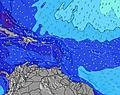 | 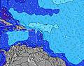 | 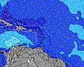 | 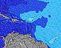 | ||||||||||||||
Wave Height (m) Direction Period (s) | E 8 | SE 3 | E 8 | E 8 | E 8 | E 8 | ESE 4 | ESE 4 | E 4 | E 5 | E 5 | E 5 | E 6 | ESE 5 | E 5 | ESE 5 | E 5 | E 5 | E 5 | E 5 | ESE 4 |
Wave Graph | |||||||||||||||||||||
5 | 9 | 10 | 10 | 10 | 10 | 9 | 14 | 16 | 46 | 40 | 59 | 101 | 81 | 71 | 78 | 34 | 59 | 48 | 11 | 31 | |
Wind (km/h) | |||||||||||||||||||||
Wind State on-shore cross-onshore cross-shore cross-offshore off-shore glassy | cross | cross-on | cross-on | cross | cross-on | cross-on | cross-on | on | on | on | on | on | on | on | cross-on | cross-on | on | on | on | on | cross-on |
High Tide | 12:00PM0.82m | 00:09AM0.77m | 12:46PM0.83m | 00:54AM0.75m | 1:38PM0.82m | 1:46AM0.73m | 2:39PM0.82m | 2:49AM0.71m | 3:48PM0.82m | 4:01AM0.72m | 4:59PM0.85m | 5:15AM0.75m | 6:05PM0.88m | ||||||||
Low Tide | 6:04PM0.08m | 6:22AM-0.02m | 6:56PM0.11m | 7:14AM-0.01m | 7:55PM0.14m | 8:13AM-0.01m | 8:58PM0.15m | 9:17AM-0.01m | 10:05PM0.15m | 10:24AM-0.02m | 11:14PM0.13m | 11:32AM-0.05m | 00:19AM0.09m | ||||||||
6:47 | — | — | 6:47 | — | — | 6:48 | — | — | 6:48 | — | — | 6:48 | — | — | 6:48 | — | — | 6:50 | — | — | |
— | 8:05 | — | — | 8:05 | — | — | 8:04 | — | — | 8:02 | — | — | 8:02 | — | — | 8:01 | — | — | 8:00 | — | |
mm | — | — | 25 | — | — | 6 | — | 1 | 2 | 1 | 3 | 5 | 5 | 2 | 7 | 1 | 1 | — | 2 | 2 | — |
Temp °C | 29 | 31 | 28 | 29 | 31 | 30 | 29 | 30 | 29 | 29 | 30 | 29 | 29 | 30 | 29 | 29 | 30 | 29 | 29 | 30 | 29 |
Feels °C | 32 | 33 | 30 | 32 | 33 | 32 | 31 | 31 | 30 | 30 | 30 | 29 | 30 | 32 | 31 | 31 | 31 | 31 | 31 | 32 | 30 |
Swell 1 Height (m) Direction Period (s) | E 4 | NE 8 | E 8 | E 8 | E 8 | E 8 | E 7 | NE 8 | SSE 5 | SSE 5 | SE 5 | SSE 5 | — | NE 8 | NE 8 | NE 9 | SSE 5 | SSE 5 | NNE 8 | SSE 5 | NE 8 |
3 | 2 | 10 | 10 | 10 | 10 | 4 | 2 | 4 | 2 | 5 | 3 | — | 10 | 11 | 12 | 23 | 5 | 7 | 9 | 3 | |
Swell 2 Height (m) Direction Period (s) | E 8 | NE 8 | NNW 2 | NE 8 | NE 8 | NE 8 | NE 8 | E 7 | E 8 | — | — | N 10 | — | NNE 8 | — | E 8 | E 8 | NE 9 | E 7 | NE 5 | E 7 |
5 | 2 | 1 | 2 | 2 | 2 | 2 | 4 | 1 | — | — | 2 | — | 7 | — | 5 | 11 | 12 | 9 | 3 | 1 | |
Swell 3 Height (m) Direction Period (s) | NE 8 | NE 8 | SSE 3 | — | — | — | — | — | — | — | — | — | — | — | — | — | NE 9 | — | NNE 4 | E 7 | — |
3 | 2 | 1 | — | — | — | — | — | — | — | — | — | — | — | — | — | 12 | — | 2 | 9 | — | |
Wind waves Height (m) Direction Period (s) | SSE 4 | SE 3 | — | SSE 3 | SE 3 | SSE 3 | ESE 4 | ESE 4 | E 4 | E 5 | E 5 | E 5 | E 6 | ESE 5 | E 5 | ESE 5 | E 5 | E 5 | E 5 | E 5 | ESE 4 |
3 | 9 | — | 2 | 2 | 1 | 9 | 14 | 16 | 46 | 40 | 59 | 101 | 81 | 71 | 78 | 34 | 59 | 48 | 11 | 31 | |
Nearest Offshore or Glassy | |||||||||||||||||||||
Distance (km) | 420 | 473 | 420 | 206 | 206 | 420 | 420 | 1194 | 1169 | 913 | 1634 | 892 | 1110 | 340 | 896 | 816 | 1268 | 373 | 373 | 1490 | 332 |
Best forecast wave conditions in South Florida | |||||||||||||||||||||
Best forecast wave conditions in United States | |||||||||||||||||||||
Header Global | |||||||||||||||||||||
- Map Icons:
 Break
Break Live Wave Height (m)
 Live Wind Speed (km/h)
 Surf Rating (10 Max)
 Ocean Swells (m)
- Wind Speed (km/h)
Latest Updates


FREE! Surf-Forecast.com widget for your website
The surf report / weather widget below is available to embed on third party websites free of charge and provides a summary of our Dania South Beach surf forecast. Simply grab the html code snippet that we provide and paste it into your own site. You can choose your preferred language and metric/imperial units for the surf forecast feed to suit users of your site. Click here to get the code.
Information about the Dania South Beach Surf forecast
The above surf forecast table for Dania South Beach provides essential information for determining whether the surfing conditions will be good over the next 16 days. A general guide to surfing at Dania South Beach can be found by selecting the local surf guide option on the grey menu. Our Dania South Beach surf forecast is unique since it includes wave energy (power) that defines the real feel of the surf rather than just the height or the period. If you surf the same spot (Dania South Beach) regularly then make a mental note of the wave energy from the surf forecast table each time you go. Very soon you may start to choose your surf days based on the wave energy alone combined with our forecast of favourable offshore wind conditions. Our star ratings will help here and of course you will also find the usual wave height and period predictions on our surf forecasts as well as a full break down of the swell components under our advanced users option (to reveal that, click the little Einstein character under the tide times).
Further information to help with frequently asked questions about our surf forecast for Dania South Beach may be found under the help tab on the top menu and also by moving your mouse over the question marks on the surf forecast table itself. Please always bear in mind that the forecast is for near-shore open water and local factors at each surf break influence the actual breaking wave height, such as the beach / reef profile, water depths offshore and shelter.
Are you planning a vacation in South Florida? If you are looking for accommodation near Dania South Beach, camping, hotels and condos and appartments in South Florida, consider staying in Dania Beach which is 4 km (2 miles) away. Other places in and around South Florida where you can find information about places to rent, and car hire include Port Everglades which is 5 km (3 miles) away, Hollywood, Fort Lauderdale and Sunrise.
 Nearest