

Surf Forecasts:

South Beach (Miami) surf forecast from 1 Aug 2026:
- Most powerful swell: Thursday 6 Aug, 2PM (local time) - 3ft (0.9m), 5s period, ESE swell with 35 kJ wave energy.
Best Forecast Surf Conditions for South Beach (Miami) this week:
The most powerful waves expected at South Beach (Miami) in the next 16 days are 0.9m 5s and forecast to arrive on Thursday (Aug 06) at 2PM. Winds are predicted to be onshore at the time the swell arrives. The largest open ocean swell (not directed at the beach) is 0.5m 4s period and expected on Sunday (Aug 02) at 8PM.
| Wave Type | Time (EDT) & Date | Wave Height & Period |
|---|---|---|
| Next good surf (1 star+) | - | - |
| Best Surf | - | - |
| Most Powerful | 2PM (Thu 6th Aug) | 3ft (0.9m) 5s |
Table - best surf conditions forecast for South Beach (Miami) over the next 16 days.
The Lowdown
Alright, Rusty here. Let’s be straight with you about the local surf scene over the next couple of weeks. Honestly, it’s a tough stretch ahead, no two ways about it. We’re looking at a long, drawn-out period where the surf isn’t really offering anything worthwhile for paddling.
Right now and for the next several days, don’t get your hopes up. The predominant story is tiny, weak waves with messy winds. We’ll see a small bump in size around the morning of the 10th of August, where the swell picks up to about 4ft from the SE. The wave energy jumps into the moderate range (103), but the wind stays cross-onshore from the ESE at 12 mph, making it choppy and poor quality. It’s more of a kite-surfing vibe than a clean paddle session.
The rest of the run is just more of the same. Small heights, often under 3ft, with short-period swell (around 4 to 6 seconds) that just doesn’t have any punch. The wind is almost always onshore or cross-onshore, which ruins any chance of a clean face. Combined wave energy barely ever breaks into triple digits, staying weak.
In short, there isn’t a single standout session or break to recommend in this 16-day window. The best you could hope for is a slightly bigger, though still messy, day around the 10th. It’s a pretty blank run, which happens in this area with this sheltered exposure. The forecasts might shift, but as it stands, keep the board in the car and wait for a better opportunity.
Rusty.
Short Range ForecastHeavy rain (total 45mm), heaviest during Sat night. Warm (max 31°C on Sat afternoon, min 25°C on Sat night). Mainly fresh winds. | Days 5-7 Weather SummaryModerate rain (total 16mm), heaviest on Thu afternoon. Warm (max 30°C on Tue afternoon, min 26°C on Tue night). Wind will be generally light. | |||||||||||||||||||
Sat 1 | Sunday 2 | Monday 3 | Tuesday 4 | Wednesday 5 | Thursday 6 | Friday 7 | ||||||||||||||
PM | Night | AM | PM | Night | AM | PM | Night | AM | PM | Night | AM | PM | Night | AM | PM | Night | AM | PM | Night | |
Swell Height Map | 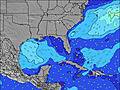 | 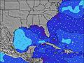 | 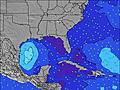 | 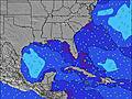 | 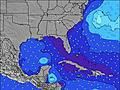 | 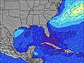 | 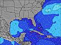 | |||||||||||||
Wave Height (m) Direction Period (s) | S 3 | E 8 | SSE 4 | SSE 4 | SE 4 | SSE 4 | SSE 4 | SSE 4 | E 8 | SE 4 | NE 3 | ESE 4 | ESE 5 | E 5 | E 4 | ENE 4 | ENE 4 | E 4 | NE 8 | NE 8 |
Wave Graph | ||||||||||||||||||||
3 | 1 | 5 | 9 | 10 | 6 | 4 | 3 | 2 | 3 | 2 | 22 | 25 | 34 | 23 | 19 | 13 | 10 | 10 | 18 | |
Wind (km/h) | ||||||||||||||||||||
Wind State on-shore cross-onshore cross-shore cross-offshore off-shore glassy | cross | cross | cross | cross | on | cross | cross | on | cross | cross-on | on | cross-on | on | on | on | on | on | on | on | cross-on |
High Tide | 11:04PM0.80m | 11:26AM0.78m | 11:41PM0.79m | 12:11PM0.78m | 00:21AM0.77m | 1:01PM0.77m | 1:07AM0.76m | 1:58PM0.76m | 2:01AM0.74m | 3:02PM0.75m | 3:04AM0.73m | 4:11PM0.77m | 4:13AM0.74m | |||||||
Low Tide | 4:53PM0.01m | 5:15AM0.01m | 5:33PM0.04m | 5:56AM0.00m | 6:16PM0.08m | 6:40AM-0.00m | 7:05PM0.11m | 7:31AM-0.00m | 8:01PM0.15m | 8:30AM-0.00m | 9:05PM0.17m | 9:35AM-0.00m | 10:15PM0.17m | |||||||
— | — | 6:47 | — | — | 6:47 | — | — | 6:48 | — | — | 6:48 | — | — | 6:48 | — | — | 6:48 | — | — | |
8:06 | — | — | 8:06 | — | — | 8:05 | — | — | 8:04 | — | — | 8:04 | — | — | 8:02 | — | — | 8:01 | — | |
mm | 4 | 21 | 6 | — | 5 | — | 1 | 8 | — | — | 3 | 1 | 1 | 1 | 1 | 6 | 1 | 2 | 1 | 2 |
Temp °C | 31 | 29 | 29 | 30 | 28 | 30 | 30 | 30 | 30 | 30 | 29 | 29 | 29 | 29 | 29 | 29 | 29 | 29 | 29 | 29 |
Feels °C | 33 | 31 | 31 | 32 | 29 | 32 | 31 | 32 | 33 | 33 | 29 | 30 | 30 | 30 | 30 | 30 | 29 | 30 | 31 | 30 |
Swell 1 Height (m) Direction Period (s) | E 9 | ESE 3 | E 8 | — | — | — | E 5 | E 8 | E 8 | E 8 | SSE 4 | E 7 | E 7 | SSE 5 | SSE 5 | SSE 5 | SSE 5 | NE 8 | SE 4 | NE 8 |
1 | 1 | 1 | — | — | — | 1 | 1 | 1 | 1 | 3 | 1 | 1 | 9 | 9 | 9 | 2 | 3 | 4 | 18 | |
Swell 2 Height (m) Direction Period (s) | NE 9 | — | NE 8 | E 8 | E 8 | E 8 | E 8 | NE 8 | NE 8 | — | E 8 | N 8 | N 8 | — | N 8 | E 7 | E 7 | E 7 | NE 8 | E 8 |
3 | — | 3 | 1 | 1 | 1 | 1 | 2 | 2 | — | 1 | 1 | 1 | — | 1 | 1 | 1 | 1 | 10 | 5 | |
Swell 3 Height (m) Direction Period (s) | — | E 8 | E 5 | NE 8 | NE 8 | N 8 | NE 8 | E 8 | — | NE 8 | NE 8 | — | N 8 | — | — | — | N 8 | E 7 | NNE 5 | — |
— | 1 | 1 | 3 | 3 | 1 | 2 | 1 | — | 2 | 2 | — | 1 | — | — | — | 1 | 1 | 2 | — | |
Wind waves Height (m) Direction Period (s) | S 3 | S 3 | SSE 4 | SSE 4 | SE 4 | SSE 4 | SSE 4 | SSE 4 | SSE 4 | SE 4 | NE 3 | ESE 4 | ESE 5 | E 5 | E 4 | ENE 4 | ENE 4 | E 4 | E 4 | E 4 |
2 | 1 | 5 | 9 | 10 | 6 | 4 | 3 | 1 | 3 | 2 | 22 | 25 | 34 | 23 | 19 | 13 | 10 | 1 | 9 | |
Nearest Offshore or Glassy | ||||||||||||||||||||
Distance (km) | 316 | 1166 | 239 | 1537 | 237 | 699 | 381 | 237 | 237 | 1206 | 329 | 363 | 1562 | 1147 | 938 | 1631 | 1147 | 859 | 599 | 848 |
Best forecast wave conditions in South Florida | ||||||||||||||||||||
Best forecast wave conditions in United States | ||||||||||||||||||||
Header Global | ||||||||||||||||||||
- Map Icons:
 Break
Break Live Wave Height (m)
 Live Wind Speed (km/h)
 Surf Rating (10 Max)
 Ocean Swells (m)
- Wind Speed (km/h)
Latest Updates


FREE! Surf-Forecast.com widget for your website
The surf report / weather widget below is available to embed on third party websites free of charge and provides a summary of our South Beach (Miami) surf forecast. Simply grab the html code snippet that we provide and paste it into your own site. You can choose your preferred language and metric/imperial units for the surf forecast feed to suit users of your site. Click here to get the code.
Information about the South Beach (Miami) Surf forecast
The above surf forecast table for South Beach (Miami) provides essential information for determining whether the surfing conditions will be good over the next 16 days. A general guide to surfing at South Beach (Miami) can be found by selecting the local surf guide option on the grey menu. Our South Beach (Miami) surf forecast is unique since it includes wave energy (power) that defines the real feel of the surf rather than just the height or the period. If you surf the same spot (South Beach (Miami)) regularly then make a mental note of the wave energy from the surf forecast table each time you go. Very soon you may start to choose your surf days based on the wave energy alone combined with our forecast of favourable offshore wind conditions. Our star ratings will help here and of course you will also find the usual wave height and period predictions on our surf forecasts as well as a full break down of the swell components under our advanced users option (to reveal that, click the little Einstein character under the tide times).
Further information to help with frequently asked questions about our surf forecast for South Beach (Miami) may be found under the help tab on the top menu and also by moving your mouse over the question marks on the surf forecast table itself. Please always bear in mind that the forecast is for near-shore open water and local factors at each surf break influence the actual breaking wave height, such as the beach / reef profile, water depths offshore and shelter.
South Beach (Miami) is 2 km (1 miles) from Miami Beach. If you plan a vacation in South Florida, look for hotels and other accommodation in Miami Beach. Miami Beach has rooms for a wide range of budgets as well as car hire and transport links.
 Nearest