

Surf Forecasts:

Sao Pedro surf forecast from 15 Jul 2026:
- Best quality surf: Thursday 16 Jul, 12AM (local time) - 3ft (0.9m), 10s period, SE swell with cross-offshore winds.
- Most powerful swell: Thursday 16 Jul, 6AM (local time) - 3.5ft (1.1m), 10s period, SE swell with 260 kJ wave energy.
- Next surfable swell (1★+): Thursday 16 Jul, 12AM (local time) - 3ft (0.9m), 10s period with SE swell.
Best Forecast Surf Conditions for Sao Pedro this week:
The surf forecast for Sao Pedro over the next 16 days: The first swell (rated 1 star or higher) is forecast to arrive on Thursday (Jul 16) at 12AM. The primary swell is predicted to be 0.9m and 10s period with a secondary swell of 0.9m and 6s. Another secondary swell of 1.3m and 6s is also forecast. The wind is predicted to be cross-offshore as the swell arrives.
The most powerful waves expected at Sao Pedro in the next 16 days are 1.1m 10s and forecast to arrive on Thursday (Jul 16) at 6AM. Winds are predicted to be cross-offshore at the time the swell arrives. The largest open ocean swell (not directed at the beach) is 0.4m 3s period and expected on Monday (Jul 20) at 3AM.
| Wave Type | Time (-03) & Date | Wave Height & Period |
|---|---|---|
| Next good surf (1 star+) | 12AM (Thu 16th Jul) | 3ft (0.9m) 10s |
| Best Surf | 12AM (Thu 16th Jul) | 3ft (0.9m) 10s |
| Most Powerful | 6AM (Thu 16th Jul) | 3.5ft (1.1m) 10s |
Table - best surf conditions forecast for Sao Pedro over the next 16 days.
The Lowdown
Alright folks, Rusty here. Let’s talk about what’s happening at São Pedro.
Right off the bat, we’ve got a bit of a slow start. The first few days are looking pretty ordinary, with small, weak swell and not much to get excited about. The water temp is sitting at 68°F, which is about average for this time of year, so no dramas there.
Wednesday the 15th onwards is a bit of a write-off to be honest. Swell is tiny, mostly under 3 ft, and the energy is low. The wind is okay but the waves just aren't there. We’ve got a real dry spell until the 26th of July, with hardly any decent surf on offer. The combined swell energy drops right down to double digits by the 20th, barely a ripple.
Now, hold onto your board, because the 26th of July is where it starts to turn. Sunday morning, we’ve got a clean 4 ft SSE swell at 10 seconds, with glassy conditions – that’s a real good sign. The energy is picking up nicely.
But the real standout, the one you’ve been waiting for, is the 28th of July. Tuesday morning sees a beautiful 5 ft SSE groundswell, with a very long period of 14 seconds and glassy, offshore wind. The combined energy is a solid 897, which is strong. This is proper, clean, powerful surf. The wind is light and offshore, so it’ll be smooth as silk. This is the pick of the entire forecast. Tuesday afternoon will also be excellent with 4 ft and glassy conditions.
The 29th hangs in there with solid 4 to 4 ft sets and clean conditions, and the 27th is also a good shout with glassy conditions and 4 ft swell. All in all, the wait is worth it. The last week of the month is where the magic happens.
Later, Rusty.
Short Range ForecastMostly dry. Warm (max 27°C on Fri afternoon, min 16°C on Wed night). Wind will be generally light. | Days 5-7 Weather SummaryMostly dry. Warm (max 32°C on Mon afternoon, min 19°C on Sat night). Wind will be generally light. | ||||||||||||||||||||
Wed 15 | Thursday 16 | Friday 17 | Saturday 18 | Sunday 19 | Monday 20 | Tuesday 21 | |||||||||||||||
PM | Night | AM | PM | Night | AM | PM | Night | AM | PM | Night | AM | PM | Night | AM | PM | Night | AM | PM | Night | AM | |
Swell Height Map |  |  |  |  |  |  | 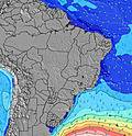 | 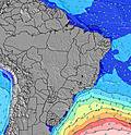 | |||||||||||||
Wave Height (m) Direction Period (s) | SE 10 | SE 10 | SE 10 | SE 10 | ESE 11 | ESE 10 | ESE 10 | ESE 7 | ESE 9 | ESE 8 | ESE 8 | ESE 8 | ESE 8 | ESE 8 | ESE 8 | ESE 8 | ESE 8 | ESE 8 | ESE 8 | E 8 | ESE 8 |
Wave Graph | |||||||||||||||||||||
261 | 148 | 226 | 200 | 204 | 161 | 122 | 41 | 103 | 113 | 72 | 62 | 53 | 68 | 37 | 37 | 33 | 11 | 35 | 30 | 20 | |
Wind (km/h) | |||||||||||||||||||||
Wind State on-shore cross-onshore cross-shore cross-offshore off-shore glassy | on | cross-off | cross-off | on | cross-off | cross-off | cross-on | cross-off | cross-off | cross-on | cross-off | cross-off | cross-on | cross-off | cross-off | cross | cross-off | cross-off | cross-on | cross-off | cross-off |
High Tide | 3:56PM1.18m | 3:16AM1.15m | 4:24PM1.12m | 3:51AM1.19m | 4:50PM1.06m | 4:27AM1.18m | 5:16PM1.00m | 5:04AM1.14m | 5:43PM0.95m | 5:44AM1.06m | 6:12PM0.91m | 6:30AM0.96m | 6:46PM0.85m | 7:31AM0.85m | |||||||
Low Tide | 10:21PM0.46m | 10:26AM-0.00m | 10:45PM0.49m | 11:01AM0.07m | 11:04PM0.49m | 11:34AM0.17m | 11:22PM0.48m | 12:05PM0.29m | 11:45PM0.47m | 12:40PM0.41m | 00:27AM0.48m | 1:32PM0.52m | 1:51AM0.49m | ||||||||
— | — | 6:46 | — | — | 6:46 | — | — | 6:46 | — | — | 6:45 | — | — | 6:45 | — | — | 6:45 | — | — | 6:43 | |
5:34 | — | — | 5:34 | — | — | 5:35 | — | — | 5:35 | — | — | 5:36 | — | — | 5:36 | — | — | 5:36 | — | 5:37 | |
mm | — | — | — | — | — | — | — | — | — | — | — | — | — | — | — | — | — | — | — | — | — |
Temp °C | 21 | 18 | 24 | 23 | 20 | 26 | 27 | 22 | 27 | 29 | 23 | 28 | 29 | 25 | 30 | 32 | 25 | 31 | 31 | 25 | 32 |
Feels °C | 20 | 18 | 24 | 23 | 19 | 25 | 25 | 20 | 25 | 27 | 21 | 26 | 27 | 23 | 28 | 30 | 23 | 30 | 29 | 23 | 29 |
Swell 1 Height (m) Direction Period (s) | SE 10 | ESE 6 | SE 10 | SE 10 | ESE 11 | ESE 10 | ESE 10 | ESE 7 | ESE 9 | ESE 8 | ESE 8 | ESE 8 | ESE 8 | ESE 8 | ESE 8 | ESE 8 | ESE 8 | ESE 8 | ESE 8 | E 8 | ESE 8 |
261 | 48 | 226 | 200 | 204 | 161 | 122 | 41 | 103 | 50 | 72 | 62 | 53 | 68 | 37 | 37 | 33 | 11 | 35 | 30 | 20 | |
Swell 2 Height (m) Direction Period (s) | S 11 | SE 10 | S 13 | S 13 | SE 11 | S 13 | S 18 | SE 10 | S 15 | SE 10 | S 18 | S 15 | S 15 | S 13 | S 12 | S 12 | S 11 | ESE 5 | S 10 | S 10 | S 10 |
2 | 148 | 4 | 3 | 137 | 3 | 6 | 37 | 4 | 16 | 6 | 5 | 17 | 14 | 3 | 3 | 2 | 5 | 2 | 2 | 8 | |
Swell 3 Height (m) Direction Period (s) | — | S 14 | S 9 | S 13 | S 13 | S 20 | S 12 | S 16 | S 11 | S 14 | S 13 | S 12 | S 9 | — | — | — | — | S 11 | — | S 12 | NNE 3 |
— | 4 | 2 | 3 | 3 | 7 | 3 | 5 | 3 | 4 | 3 | 3 | 2 | — | — | — | — | 2 | — | 3 | 1 | |
Wind waves Height (m) Direction Period (s) | E 5 | E 6 | — | — | E 7 | — | ESE 8 | — | — | ESE 8 | N 2 | N 3 | — | N 2 | N 2 | NNE 3 | — | NNW 2 | — | — | — |
52 | 108 | — | — | 104 | — | 96 | — | — | 113 | 1 | 1 | — | 1 | 1 | 1 | — | 1 | — | — | — | |
Nearest Offshore or Glassy | |||||||||||||||||||||
Distance (km) | 11 | 0 | 0 | 7 | 0 | 0 | 19 | 0 | 0 | 12 | 0 | 0 | 19 | 0 | 0 | 7 | 7 | 16 | 41 | 7 | 41 |
Best forecast wave conditions in São Paulo | |||||||||||||||||||||
Best forecast wave conditions in Brazil | |||||||||||||||||||||
Header Global | |||||||||||||||||||||
- Map Icons:
 Break
Break Live Wave Height (m)
 Live Wind Speed (km/h)
 Surf Rating (10 Max)
 Ocean Swells (m)
- Wind Speed (km/h)


FREE! Surf-Forecast.com widget for your website
The surf report / weather widget below is available to embed on third party websites free of charge and provides a summary of our Sao Pedro surf forecast. Simply grab the html code snippet that we provide and paste it into your own site. You can choose your preferred language and metric/imperial units for the surf forecast feed to suit users of your site. Click here to get the code.
Information about the Sao Pedro Surf forecast
The above surf forecast table for Sao Pedro provides essential information for determining whether the surfing conditions will be good over the next 16 days. A general guide to surfing at Sao Pedro can be found by selecting the local surf guide option on the grey menu. Our Sao Pedro surf forecast is unique since it includes wave energy (power) that defines the real feel of the surf rather than just the height or the period. If you surf the same spot (Sao Pedro) regularly then make a mental note of the wave energy from the surf forecast table each time you go. Very soon you may start to choose your surf days based on the wave energy alone combined with our forecast of favourable offshore wind conditions. Our star ratings will help here and of course you will also find the usual wave height and period predictions on our surf forecasts as well as a full break down of the swell components under our advanced users option (to reveal that, click the little Einstein character under the tide times).
Further information to help with frequently asked questions about our surf forecast for Sao Pedro may be found under the help tab on the top menu and also by moving your mouse over the question marks on the surf forecast table itself. Please always bear in mind that the forecast is for near-shore open water and local factors at each surf break influence the actual breaking wave height, such as the beach / reef profile, water depths offshore and shelter.
Sao Pedro is 5 km (3 miles) from the city of Bertioga. If you plan a holiday in São Paulo, look for hotels and other accommodation in Bertioga. Bertioga has rooms for a wide range of budgets as well as car hire and transport links.
 Nearest