

Surf Forecasts:

Riviera Shorebreak surf forecast from 3 Aug 2026:
- Best quality surf: Friday 7 Aug, 5PM (local time) - 3ft (0.9m), 17s period, SW swell with glassy winds.
- Most powerful swell: Saturday 8 Aug, 11AM (local time) - 3.5ft (1.0m), 16s period, SW swell with 496 kJ wave energy.
- Next surfable swell (1★+): Sunday 2 Aug, 11PM (local time) - 2ft (0.6m), 13s period with SW swell.
Best Forecast Surf Conditions for Riviera Shorebreak this week:
The surf forecast for Riviera Shorebreak over the next 16 days: The first swell (rated 1 star or higher) is forecast to arrive on Sunday (Aug 02) at 11PM. The primary swell is predicted to be 0.6m and 13s period with a secondary swell of 0.5m and 6s. The wind is predicted to be offshore as the swell arrives.
The most powerful waves expected at Riviera Shorebreak in the next 16 days are 1.0m 16s and forecast to arrive on Saturday (Aug 08) at 11AM. Winds are predicted to be cross-onshore at the time the swell arrives.
| Wave Type | Time (MST) & Date | Wave Height & Period |
|---|---|---|
| Next good surf (1 star+) | 11PM (Sun 2nd Aug) | 2ft (0.6m) 13s |
| Best Surf | 5PM (Fri 7th Aug) | 3ft (0.9m) 17s |
| Most Powerful | 11AM (Sat 8th Aug) | 3.5ft (1.0m) 16s |
Table - best surf conditions forecast for Riviera Shorebreak over the next 16 days.
The Lowdown
Alright, let me tell you how it's shaping up for Riviera Shorebreak.
Right off the bat, I gotta be straight with you – it’s pretty grim out there. We’ve got a long dry spell ahead. Most of the next week and a half looks like a write-off. The one little glimmer we get is on Friday, August 7th. The afternoon there is glassy, dead calm, with 3ft of SW swell pushing in at a long 17 seconds. The wave energy is strong, and the conditions are set to be very good. That’s your one standout. But, this spot is a rare bird, it rarely breaks, so you need to be ready to move on it. The water's sitting at 89°, which is a touch warmer than normal for this time of year.
Before that, and after it, it’s mostly onshore, cross-onshore, or just plain poor surf conditions. There's a window on Saturday, August 8th, with glassy wind again in the afternoon and 3ft, 16-second SW swell, but it’s a marginal call. Then on Sunday, August 16th, the morning looks glassy again with 3ft, 15-second SW swell and good conditions, but again, that's a long way out and it's a fickle wave.
For the size we're seeing, mostly under 3ft, it's fine for most folks, but the lack of consistency and the wind being wrong 90% of the time is the real killer. Given the exposed beach setup and the strong winds that pop up, this stretch is going to be more interesting for the kite crew than us paddle surfers on most days.
Stay hopeful, though. Forecasts can flip.
Rusty
Short Range ForecastModerate rain (total 19mm), heaviest on Sun night. Warm (max 31°C on Sun afternoon, min 24°C on Sun night). Wind will be generally light. | Days 5-7 Weather SummaryLight rain (total 3mm), mostly falling on Thu night. Warm (max 30°C on Wed afternoon, min 26°C on Thu night). Wind will be generally light. | |||||||||||||||||||
Sun 2 | Monday 3 | Tuesday 4 | Wednesday 5 | Thursday 6 | Friday 7 | Saturday 8 | ||||||||||||||
PM | Night | AM | PM | Night | AM | PM | Night | AM | PM | Night | AM | PM | Night | AM | PM | Night | AM | PM | Night | |
Swell Height Map |  |  |  | 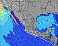 | 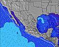 | 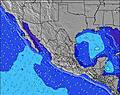 | 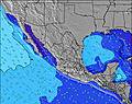 | |||||||||||||
Wave Height (m) Direction Period (s) | SW 13 | SW 13 | SSW 13 | SSW 13 | SW 16 | SW 16 | SSW 12 | SW 15 | SW 14 | SW 14 | SW 14 | SW 13 | SW 18 | SW 19 | SW 18 | SW 17 | SW 16 | SW 16 | SW 16 | SW 15 |
Wave Graph | ||||||||||||||||||||
142 | 138 | 111 | 114 | 73 | 88 | 99 | 75 | 103 | 73 | 70 | 183 | 159 | 278 | 249 | 439 | 310 | 496 | 353 | 309 | |
Wind (km/h) | ||||||||||||||||||||
Wind State on-shore cross-onshore cross-shore cross-offshore off-shore glassy | glassy | off | cross-on | on | cross | cross-on | on | glassy | on | cross-on | glassy | on | on | cross-off | cross-on | glassy | cross-off | cross-on | glassy | cross-off |
High Tide | 10:29PM1.41m | 11:13AM1.51m | 11:15PM1.24m | 11:44AM1.51m | 00:21AM1.06m | 12:26PM1.50m | 3:16AM0.93m | 1:33PM1.47m | 3:15PM1.48m | 7:46AM1.21m | 4:49PM1.56m | |||||||||
Low Tide | 4:40PM0.65m | 4:43AM0.49m | 5:29PM0.65m | 5:04AM0.63m | 6:34PM0.65m | 5:23AM0.78m | 8:18PM0.63m | 5:08AM0.93m | 10:34PM0.50m | 11:51PM0.32m | 11:00AM1.14m | 00:42AM0.15m | ||||||||
— | — | 5:37 | — | — | 5:37 | — | — | 5:37 | — | — | 5:37 | — | — | 5:37 | — | — | 5:39 | — | — | |
6:46 | — | — | 6:46 | — | — | 6:45 | — | — | 6:45 | — | — | 6:45 | — | — | 6:44 | — | — | 6:44 | — | |
mm | 1 | 9 | — | — | 6 | 3 | — | — | — | — | — | — | — | 2 | — | 1 | — | — | 1 | 1 |
Temp °C | 31 | 26 | 30 | 30 | 29 | 30 | 30 | 28 | 30 | 30 | 28 | 29 | 30 | 28 | 30 | 30 | 28 | 30 | 30 | 28 |
Feels °C | 34 | 29 | 33 | 33 | 35 | 34 | 33 | 32 | 34 | 33 | 31 | 33 | 33 | 32 | 34 | 33 | 33 | 34 | 33 | 33 |
Swell 1 Height (m) Direction Period (s) | SW 13 | SW 13 | SSW 13 | SSW 13 | SW 12 | SW 16 | SSW 12 | SW 12 | SW 14 | SW 14 | SW 14 | SW 13 | SW 13 | SW 13 | SW 13 | SW 17 | SW 16 | SW 16 | SW 16 | SW 15 |
142 | 138 | 111 | 114 | 73 | 88 | 99 | 50 | 103 | 73 | 70 | 183 | 109 | 175 | 164 | 439 | 310 | 496 | 353 | 309 | |
Swell 2 Height (m) Direction Period (s) | WSW 6 | WSW 5 | SW 16 | SW 16 | SW 16 | SW 12 | SW 15 | SW 15 | S 9 | SW 11 | SW 11 | SW 20 | SW 10 | SW 19 | SW 18 | SW 12 | SW 12 | SW 12 | SW 12 | SW 11 |
12 | 9 | 67 | 66 | 66 | 39 | 56 | 75 | 13 | 19 | 32 | 60 | 48 | 278 | 249 | 151 | 116 | 69 | 114 | 43 | |
Swell 3 Height (m) Direction Period (s) | WSW 8 | SW 18 | WSW 7 | SW 6 | WSW 5 | SW 12 | S 11 | WSW 4 | SSW 12 | S 8 | S 9 | W 4 | SW 18 | SSW 8 | S 13 | S 12 | S 12 | SSW 8 | SW 23 | SSW 8 |
13 | 49 | 10 | 8 | 5 | 22 | 2 | 4 | 14 | 12 | 14 | 1 | 159 | 20 | 3 | 3 | 3 | 13 | 21 | 13 | |
Wind waves Height (m) Direction Period (s) | — | — | — | — | — | — | WSW 5 | — | — | WSW 4 | — | — | W 2 | — | — | SW 9 | — | — | — | — |
— | — | — | — | — | — | 4 | — | — | 3 | — | — | 1 | — | — | 39 | — | — | — | — | |
Nearest Offshore or Glassy | ||||||||||||||||||||
Distance (km) | 0 | 0 | 135 | 340 | 10 | 135 | 581 | 0 | 135 | 305 | 0 | 135 | 305 | 0 | 135 | 0 | 0 | 135 | 0 | 0 |
Best forecast wave conditions in Sinaloa | ||||||||||||||||||||
Best forecast wave conditions in Mexico | ||||||||||||||||||||
Header Global | ||||||||||||||||||||
- Map Icons:
 Break
Break Live Wave Height (m)
 Live Wind Speed (km/h)
 Surf Rating (10 Max)
 Ocean Swells (m)
- Wind Speed (km/h)
Latest Updates


FREE! Surf-Forecast.com widget for your website
The surf report / weather widget below is available to embed on third party websites free of charge and provides a summary of our Riviera Shorebreak surf forecast. Simply grab the html code snippet that we provide and paste it into your own site. You can choose your preferred language and metric/imperial units for the surf forecast feed to suit users of your site. Click here to get the code.
Information about the Riviera Shorebreak Surf forecast
The above surf forecast table for Riviera Shorebreak provides essential information for determining whether the surfing conditions will be good over the next 16 days. A general guide to surfing at Riviera Shorebreak can be found by selecting the local surf guide option on the grey menu. Our Riviera Shorebreak surf forecast is unique since it includes wave energy (power) that defines the real feel of the surf rather than just the height or the period. If you surf the same spot (Riviera Shorebreak) regularly then make a mental note of the wave energy from the surf forecast table each time you go. Very soon you may start to choose your surf days based on the wave energy alone combined with our forecast of favourable offshore wind conditions. Our star ratings will help here and of course you will also find the usual wave height and period predictions on our surf forecasts as well as a full break down of the swell components under our advanced users option (to reveal that, click the little Einstein character under the tide times).
Further information to help with frequently asked questions about our surf forecast for Riviera Shorebreak may be found under the help tab on the top menu and also by moving your mouse over the question marks on the surf forecast table itself. Please always bear in mind that the forecast is for near-shore open water and local factors at each surf break influence the actual breaking wave height, such as the beach / reef profile, water depths offshore and shelter.
Are you planning a holiday in Sinaloa? If you are looking for accommodation near Riviera Shorebreak, camping, hotels and holiday cottages in Sinaloa, consider staying in Mazatlan which is 20 km (12 miles) away. Alternatively, find information about places to stay and car hire in Escuinapa de Hidalgo which is 91 km (57 miles) away
 Nearest