

Surf Forecasts:

Portao surf forecast from 16 Jul 2026:
- Most powerful swell: Sunday 19 Jul, 12PM (local time) - 5.5ft (1.7m), 7s period, E swell with 270 kJ wave energy.
Best Forecast Surf Conditions for Portao this week:
The most powerful waves expected at Portao in the next 16 days are 1.7m 7s and forecast to arrive on Sunday (Jul 19) at 12PM. Winds are predicted to be cross-offshore at the time the swell arrives. The largest open ocean swell (not directed at the beach) is 1.6m 6s period and expected on Thursday (Jul 16) at 6AM.
| Wave Type | Time (-03) & Date | Wave Height & Period |
|---|---|---|
| Next good surf (1 star+) | - | - |
| Best Surf | - | - |
| Most Powerful | 12PM (Sun 19th Jul) | 5.5ft (1.7m) 7s |
Table - best surf conditions forecast for Portao over the next 16 days.
The Lowdown
Alright, Rusty here. Let’s have a look at what’s on the cards for Portao over the next couple of weeks.
To be straight with you, this is a pretty grim stretch. The entire 16-day run is basically a write-off. There’s no proper surf window to get excited about. The waves are small, the wind is mostly cross or cross-off, and the quality just isn’t there. The first real chance of anything even slightly rideable doesn’t show up until Friday the 24th, and even then it’s a marginal call.
Let’s break it down. From now through to the 24th, the swell is generally weak. On Wednesday the 15th, we’re looking at a weak 4ft easterly swell with a short period of 5 seconds and a combined energy of just 100 – that’s barely a bump. The wind is a cross-shore 12 mph, creating a cross-chop that’s messy. It’s not surfable.
Thursday the 16th and Friday the 17th are even smaller. Thursday morning has a tiny 1ft NNE swell with a period of 8 seconds, but the wind is cross-off at 16 mph, so it’s clean. Still, it’s ankle-deep. The energy is only 21. Friday morning is a joke – 0.7ft from the north, 10-second period, but still only 14 energy. Afternoons pick up a little to 5ft – 5ft, but the period is 6-7 seconds, so it’s all windswell chop. Not worth paddling out.
This pattern of small, short-period, cross-shore slop continues all the way through to the 24th. The combined energy hovers between 100 and 275, which is weak to moderate, but the swell quality is poor. The 19th and 20th have some 5ft – 6ft east swell, but with a 7-second period and cross winds, it’s just a messy, crumbly wave.
The only glimmer of hope is on Friday the 24th, in the morning. The swell picks up to 6ft from the east, with a 7-second period and a combined energy of 275. The wind is a gentle 9 mph cross-off from the southeast, which keeps it clean. The data says it’s “marginal surf forecast or questionable tide conditions,” so it’s a long shot. That’s the only thing even close to a recommendation. But for a beginner, 6ft might be a bit much, and the short period means it’ll be a bit lumpy. It’s a maybe, not a go.
After that, it trails off quickly. The 25th to the 30th sees the swell drop back to 3ft – 4ft, with periods of 5-6 seconds and energy dropping from 152 down to 50. The wind stays cross or cross-off, but it’s just too small to do anything with.
The water temperature is around 82°F, which is pretty normal for this time of year – the anomaly is 1°F, so nothing unusual there.
Honestly, Portao is a reef/pier setup that’s very consistent, but this forecast is a dead zone. We’ve got a solid 10-day gap with no recommendable surf, and then just a single marginal morning. It’s one of those blank runs that happens. Forecasts can change, but right now, leave the board at home. If you’re a kite surfer, the 5ft – 6ft afternoons with cross-shore wind might be more interesting, but for paddling, it’s a no-go.
Rusty.
Short Range ForecastModerate rain (total 11mm), heaviest on Wed night. Warm (max 28°C on Thu morning, min 23°C on Wed night). Wind will be generally light. | Days 5-7 Weather SummaryModerate rain (total 14mm), heaviest on Mon night. Warm (max 28°C on Sun afternoon, min 23°C on Sat night). Wind will be generally light. | ||||||||||||||||||||
Wed 15 | Thursday 16 | Friday 17 | Saturday 18 | Sunday 19 | Monday 20 | Tuesday 21 | |||||||||||||||
PM | Night | AM | PM | Night | AM | PM | Night | AM | PM | Night | AM | PM | Night | AM | PM | Night | AM | PM | Night | AM | |
Swell Height Map |  |  |  |  |  |  | 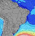 | 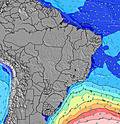 | |||||||||||||
Wave Height (m) Direction Period (s) | E 5 | E 6 | NNE 8 | E 7 | E 6 | N 10 | E 6 | E 6 | ENE 6 | E 7 | E 7 | E 7 | E 7 | E 6 | E 7 | E 6 | E 6 | E 6 | E 6 | E 6 | E 6 |
Wave Graph | |||||||||||||||||||||
52 | 169 | 13 | 229 | 193 | 7 | 184 | 149 | 127 | 176 | 222 | 262 | 233 | 219 | 196 | 176 | 188 | 161 | 128 | 130 | 136 | |
Wind (km/h) | |||||||||||||||||||||
Wind State on-shore cross-onshore cross-shore cross-offshore off-shore glassy | cross | cross | cross-off | cross | cross-off | cross-off | cross | cross-off | cross-off | cross | cross-off | cross-off | cross | cross | cross-off | cross | cross | cross-off | cross | cross | cross-off |
High Tide | 5:52PM2.37m | 6:06AM2.52m | 6:36PM2.38m | 6:52AM2.49m | 7:18PM2.37m | 7:36AM2.42m | 8:00PM2.32m | 8:20AM2.33m | 8:42PM2.26m | 9:04AM2.21m | 9:26PM2.18m | 9:52AM2.09m | 10:13PM2.09m | 10:44AM1.98m | |||||||
Low Tide | 11:51PM0.20m | 12:21PM0.07m | 00:37AM0.19m | 1:04PM0.12m | 1:21AM0.21m | 1:46PM0.19m | 2:04AM0.26m | 2:28PM0.29m | 2:49AM0.34m | 3:10PM0.40m | 3:36AM0.42m | 3:56PM0.52m | 4:27AM0.51m | ||||||||
— | — | 5:41 | — | — | 5:41 | — | — | 5:41 | — | — | 5:41 | — | — | 5:41 | — | — | 5:41 | — | — | 5:41 | |
5:37 | — | — | 5:37 | — | — | 5:37 | — | — | 5:37 | — | — | 5:37 | — | — | 5:37 | — | — | 5:37 | — | 5:37 | |
mm | — | 3 | — | 1 | 4 | — | — | 3 | — | 2 | 3 | — | — | 3 | — | — | 5 | 1 | 1 | 11 | 6 |
Temp °C | 27 | 26 | 28 | 27 | 26 | 27 | 27 | 27 | 28 | 27 | 26 | 27 | 28 | 26 | 27 | 27 | 26 | 27 | 27 | 26 | 27 |
Feels °C | 27 | 26 | 26 | 26 | 26 | 25 | 27 | 26 | 27 | 27 | 26 | 25 | 27 | 25 | 25 | 26 | 26 | 26 | 26 | 27 | 27 |
Swell 1 Height (m) Direction Period (s) | NNE 8 | NNE 8 | NNE 8 | N 10 | N 10 | N 10 | N 9 | N 9 | ENE 6 | N 9 | — | N 8 | N 11 | N 11 | N 8 | N 8 | N 9 | NNE 9 | NNE 9 | NNE 8 | NNE 8 |
27 | 25 | 13 | 8 | 8 | 7 | 7 | 6 | 127 | 1 | — | 5 | 2 | 2 | 1 | 1 | 6 | 16 | 16 | 14 | 23 | |
Swell 2 Height (m) Direction Period (s) | N 11 | N 11 | N 10 | N 10 | N 10 | N 10 | N 9 | N 9 | N 9 | N 10 | — | N 11 | N 11 | N 8 | N 10 | N 10 | — | N 9 | N 9 | — | — |
21 | 21 | 8 | 18 | 8 | 7 | 7 | 6 | 1 | 2 | — | 2 | 2 | 1 | 2 | 2 | — | 2 | 2 | — | — | |
Swell 3 Height (m) Direction Period (s) | — | — | — | — | — | — | — | — | — | — | — | N 11 | — | N 11 | — | — | — | — | — | — | — |
— | — | — | — | — | — | — | — | — | — | — | 2 | — | 2 | — | — | — | — | — | — | — | |
Wind waves Height (m) Direction Period (s) | E 5 | E 6 | ESE 7 | E 7 | E 6 | ESE 7 | E 6 | E 6 | SE 5 | E 7 | E 7 | E 7 | E 7 | E 6 | E 7 | E 6 | E 6 | E 6 | E 6 | E 6 | E 6 |
52 | 169 | 206 | 229 | 193 | 175 | 184 | 149 | 23 | 176 | 222 | 262 | 233 | 219 | 196 | 176 | 188 | 161 | 128 | 130 | 136 | |
Nearest Offshore or Glassy | |||||||||||||||||||||
Distance (km) | 1856 | 1775 | 1775 | 1775 | 1793 | 1775 | 2182 | 1793 | 1775 | 1775 | 1775 | 1775 | 1775 | 1775 | 1686 | 1775 | 1173 | 1173 | 1775 | 936 | 1175 |
Best forecast wave conditions in Ceará | |||||||||||||||||||||
Best forecast wave conditions in Brazil | |||||||||||||||||||||
Header Global | |||||||||||||||||||||
- Map Icons:
 Break
Break Live Wave Height (m)
 Live Wind Speed (km/h)
 Surf Rating (10 Max)
 Ocean Swells (m)
- Wind Speed (km/h)


FREE! Surf-Forecast.com widget for your website
The surf report / weather widget below is available to embed on third party websites free of charge and provides a summary of our Portao surf forecast. Simply grab the html code snippet that we provide and paste it into your own site. You can choose your preferred language and metric/imperial units for the surf forecast feed to suit users of your site. Click here to get the code.
Information about the Portao Surf forecast
The above surf forecast table for Portao provides essential information for determining whether the surfing conditions will be good over the next 16 days. A general guide to surfing at Portao can be found by selecting the local surf guide option on the grey menu. Our Portao surf forecast is unique since it includes wave energy (power) that defines the real feel of the surf rather than just the height or the period. If you surf the same spot (Portao) regularly then make a mental note of the wave energy from the surf forecast table each time you go. Very soon you may start to choose your surf days based on the wave energy alone combined with our forecast of favourable offshore wind conditions. Our star ratings will help here and of course you will also find the usual wave height and period predictions on our surf forecasts as well as a full break down of the swell components under our advanced users option (to reveal that, click the little Einstein character under the tide times).
Further information to help with frequently asked questions about our surf forecast for Portao may be found under the help tab on the top menu and also by moving your mouse over the question marks on the surf forecast table itself. Please always bear in mind that the forecast is for near-shore open water and local factors at each surf break influence the actual breaking wave height, such as the beach / reef profile, water depths offshore and shelter.
Portao is 8 km (5 miles) from Fortaleza. If you plan a holiday in Ceará, look for hotels and other accommodation in Fortaleza. Fortaleza has rooms for a wide range of budgets as well as car hire and transport links.
 Nearest