

Surf Forecasts:

Leca surf forecast from 2 Aug 2026:
- Best quality surf: Monday 3 Aug, 1AM (local time) - 2ft (0.6m), 9s period, W swell with glassy winds.
- Most powerful swell: Wednesday 5 Aug, 4PM (local time) - 3.5ft (1.1m), 8s period, NW swell with 176 kJ wave energy.
- Next surfable swell (1★+): Monday 3 Aug, 1AM (local time) - 2ft (0.6m), 9s period with W swell.
Best Forecast Surf Conditions for Leca this week:
The surf forecast for Leca over the next 16 days: The first swell (rated 1 star or higher) is forecast to arrive on Monday (Aug 03) at 1AM. The primary swell is predicted to be 0.6m and 9s period with a secondary swell of 0.2m and 7s. The wind is predicted to be glassy as the swell arrives.
The most powerful waves expected at Leca in the next 16 days are 1.1m 8s and forecast to arrive on Wednesday (Aug 05) at 4PM. Winds are predicted to be cross-onshore at the time the swell arrives.
| Wave Type | Time (WEST) & Date | Wave Height & Period |
|---|---|---|
| Next good surf (1 star+) | 1AM (Mon 3rd Aug) | 2ft (0.6m) 9s |
| Best Surf | 1AM (Mon 3rd Aug) | 2ft (0.6m) 9s |
| Most Powerful | 4PM (Wed 5th Aug) | 3.5ft (1.1m) 8s |
Table - best surf conditions forecast for Leca over the next 16 days.
The Lowdown
G’day, Rusty here. Look, I’ll be straight with you – this forecast window for Leca is a long, tough stretch. We’ve got a 16-day run from August 2nd, but we’re looking at a whole lot of nothing for the first full week. The swell is tiny, the wind is messy, and the "poor surf conditions" tag sticks like glue from the Sunday afternoon of the 2nd right through until the morning of Sunday the 9th. That’s a solid eight days of barely a ripple worth paddling for.
The first sign of a pulse comes on the morning of Sunday the 9th. There’s a tiny 2ft west-northwest swell, and it’s glassy as a mirror on the water. The water temp is sitting at 66°, which is about average for this time of year. But the wave energy is a weak 56, and the break is "inconsistent," so you’ll be scratching for a ride. The winds are light and variable, but it’s a beginner spot, so the total lack of push is a problem. That window is a "surfable waves but very ordinary" scenario, and that’s the best we get for a while.
After that, it’s back to the same old story – cross-on winds, tiny swell, and those "poor surf conditions" labels. The morning of Wednesday the 12th offers another glassy moment with a 2ft west swell, but again, the energy is a weak 73. It’s just not enough to get excited about.
The real shift doesn’t happen until the very end of the run. If you’re patient, Sunday the 16th afternoon starts to show something. The swell jumps to 5ft from the northwest (8 seconds), with a strong 300 combined energy. The wind is onshore, which is a bummer, but the size is there. The morning of Monday the 17th is still marginal, but by Monday afternoon we’re looking at 7ft northwest swell and a beefy 589 energy. That’s the standout of the whole period. It’s legitimate size, but at 7ft, it’s too big for beginners and strictly for those with experience. The period is only 8 seconds, so it’s a short-period wind swell, not a clean groundswell, and the cross-on wind will keep it lumpy. It’s a raw, powerful, messy setup, but it’s the only real surf on offer.
So, to sum it up: nearly two weeks of flatness, then a raw, expert-only pulse on the 17th. If you’re a beginner, don’t hold your breath. If you’re seasoned, keep an eye on Monday the 17th afternoon, but don’t expect perfection.
Rusty.
Short Range ForecastMostly dry. Warm (max 21°C on Mon morning, min 18°C on Sun night). Wind will be generally light. | Days 5-7 Weather SummaryMostly dry. Warm (max 20°C on Thu afternoon, min 17°C on Wed night). Winds decreasing (fresh winds from the NW on Wed afternoon, calm by Thu night). | |||||||||||||||||||
Sun 2 | Monday 3 | Tuesday 4 | Wednesday 5 | Thursday 6 | Friday 7 | Saturday 8 | ||||||||||||||
PM | Night | AM | PM | Night | AM | PM | Night | AM | PM | Night | AM | PM | Night | AM | PM | Night | AM | PM | Night | |
Swell Height Map |  |  |  |  | 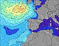 | 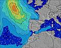 | 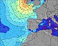 | |||||||||||||
Wave Height (m) Direction Period (s) | W 10 | W 9 | W 9 | W 8 | W 8 | W 9 | W 8 | W 8 | W 8 | NW 8 | NW 9 | W 10 | NW 9 | NW 7 | NW 7 | NW 7 | NW 7 | NW 8 | NW 5 | NW 8 |
Wave Graph | ||||||||||||||||||||
45 | 58 | 76 | 161 | 110 | 95 | 86 | 65 | 43 | 176 | 41 | 49 | 112 | 77 | 54 | 45 | 59 | 14 | 10 | 69 | |
Wind (km/h) | ||||||||||||||||||||
Wind State on-shore cross-onshore cross-shore cross-offshore off-shore glassy | on | glassy | cross | cross-on | cross | cross | on | cross | cross-on | cross-on | cross-off | cross-on | cross-on | cross | cross-on | cross-on | cross-on | on | cross-on | glassy |
High Tide | 6:19PM2.69m | 7:11AM2.51m | 7:38PM2.75m | 8:23AM2.68m | 8:45PM2.91m | 9:21AM2.92m | 9:41PM3.12m | 10:10AM3.18m | 10:31PM3.31m | 10:54AM3.42m | 11:16PM3.47m | 11:37AM3.61m | 00:00AM3.55m | |||||||
Low Tide | 00:48AM1.42m | 1:08PM1.48m | 2:05AM1.30m | 2:26PM1.32m | 3:06AM1.10m | 3:27PM1.08m | 3:56AM0.88m | 4:18PM0.82m | 4:41AM0.68m | 5:05PM0.59m | 5:24AM0.53m | 5:49PM0.42m | ||||||||
— | — | 6:31 | — | — | 6:31 | — | — | 6:33 | — | — | 6:33 | — | — | 6:35 | — | — | 6:35 | — | — | |
8:51 | — | — | 8:49 | — | — | 8:47 | — | — | 8:46 | — | — | 8:45 | — | — | 8:45 | — | — | 8:43 | — | |
mm | — | — | — | — | — | — | — | — | — | — | — | — | — | — | — | — | — | — | — | — |
Temp °C | 20 | 19 | 21 | 21 | 20 | 21 | 21 | 20 | 19 | 19 | 18 | 19 | 20 | 19 | 20 | 20 | 19 | 19 | 19 | 19 |
Feels °C | 19 | 20 | 20 | 21 | 22 | 21 | 21 | 21 | 19 | 15 | 16 | 17 | 17 | 19 | 21 | 18 | 19 | 20 | 17 | 21 |
Swell 1 Height (m) Direction Period (s) | W 10 | W 9 | W 9 | W 8 | W 8 | W 9 | W 8 | W 8 | W 8 | WNW 10 | NW 6 | NW 6 | WNW 10 | NW 7 | NW 7 | W 9 | NW 7 | NW 5 | W 9 | NW 8 |
45 | 58 | 76 | 161 | 110 | 95 | 86 | 65 | 43 | 19 | 39 | 21 | 31 | 77 | 54 | 15 | 59 | 9 | 6 | 69 | |
Swell 2 Height (m) Direction Period (s) | NW 7 | WNW 7 | NW 7 | N 8 | N 8 | NW 11 | NW 11 | NW 10 | NW 8 | SW 12 | W 7 | W 10 | SW 12 | WNW 9 | W 9 | W 6 | W 9 | W 6 | W 6 | W 8 |
2 | 5 | 2 | 1 | 1 | 4 | 5 | 17 | 25 | 6 | 21 | 49 | 6 | 17 | 27 | 3 | 14 | 6 | 2 | 6 | |
Swell 3 Height (m) Direction Period (s) | — | — | W 15 | — | — | W 13 | W 13 | W 13 | WNW 10 | W 12 | NW 9 | NW 9 | — | NNW 9 | — | — | — | NW 8 | NW 10 | W 5 |
— | — | 4 | — | — | 3 | 3 | 3 | 20 | 3 | 41 | 38 | — | 8 | — | — | — | 14 | 4 | 2 | |
Wind waves Height (m) Direction Period (s) | NW 4 | — | SSW 2 | — | — | — | — | — | — | NW 8 | — | — | NW 9 | — | — | NW 7 | — | — | NW 5 | — |
4 | — | 1 | — | — | — | — | — | — | 176 | — | — | 112 | — | — | 45 | — | — | 10 | — | |
Nearest Offshore or Glassy | ||||||||||||||||||||
Distance (km) | 161 | 0 | 1 | 161 | 1 | 1 | 156 | 19 | 57 | 156 | 0 | 57 | 244 | 13 | 13 | 243 | 19 | 19 | 244 | 0 |
Best forecast wave conditions in Douro and Minho | ||||||||||||||||||||
Best forecast wave conditions in Portugal | ||||||||||||||||||||
Header Global | ||||||||||||||||||||
- Map Icons:
 Break
Break Live Wave Height (m)
 Live Wind Speed (km/h)
 Surf Rating (10 Max)
 Ocean Swells (m)
- Wind Speed (km/h)
Latest Updates


FREE! Surf-Forecast.com widget for your website
The surf report / weather widget below is available to embed on third party websites free of charge and provides a summary of our Leca surf forecast. Simply grab the html code snippet that we provide and paste it into your own site. You can choose your preferred language and metric/imperial units for the surf forecast feed to suit users of your site. Click here to get the code.
Information about the Leca Surf forecast
The above surf forecast table for Leca provides essential information for determining whether the surfing conditions will be good over the next 16 days. A general guide to surfing at Leca can be found by selecting the local surf guide option on the grey menu. Our Leca surf forecast is unique since it includes wave energy (power) that defines the real feel of the surf rather than just the height or the period. If you surf the same spot (Leca) regularly then make a mental note of the wave energy from the surf forecast table each time you go. Very soon you may start to choose your surf days based on the wave energy alone combined with our forecast of favourable offshore wind conditions. Our star ratings will help here and of course you will also find the usual wave height and period predictions on our surf forecasts as well as a full break down of the swell components under our advanced users option (to reveal that, click the little Einstein character under the tide times).
Further information to help with frequently asked questions about our surf forecast for Leca may be found under the help tab on the top menu and also by moving your mouse over the question marks on the surf forecast table itself. Please always bear in mind that the forecast is for near-shore open water and local factors at each surf break influence the actual breaking wave height, such as the beach / reef profile, water depths offshore and shelter.
Leca is 1 km (1 miles) from Matosinhos. If you plan a holiday in Douro and Minho, look for hotels and other accommodation in Matosinhos. Matosinhos has rooms for a wide range of budgets as well as car hire and transport links.
 Nearest