

Surf Forecasts:

Horace Caldwell Pier surf forecast from 3 Aug 2026:
- Most powerful swell: Friday 7 Aug, 7PM (local time) - 3.5ft (1.0m), 6s period, SE swell with 72 kJ wave energy.
Best Forecast Surf Conditions for Horace Caldwell Pier this week:
The most powerful waves expected at Horace Caldwell Pier in the next 16 days are 1.0m 6s and forecast to arrive on Friday (Aug 07) at 7PM. Winds are predicted to be onshore at the time the swell arrives.
| Wave Type | Time (CDT) & Date | Wave Height & Period |
|---|---|---|
| Next good surf (1 star+) | - | - |
| Best Surf | - | - |
| Most Powerful | 7PM (Fri 7th Aug) | 3.5ft (1.0m) 6s |
Table - best surf conditions forecast for Horace Caldwell Pier over the next 16 days.
The Lowdown
Alright, folks, Rusty here. Let’s look at Horace Caldwell Pier. The water’s sitting at about 84°, which is right around average for this time of year. Nothing weird there.
But we’ve got a long dry spell ahead. Starting now, there’s nothing to get excited about. The first few days are tiny, weak, and blown out. Monday the 3rd of August, we’re looking at a tiny 2ft SSE swell with a short period of 5 seconds. The combined energy is a weak 30. Wind is cross-on from the south at 6 mph, and it’s just messy. It doesn’t get much better through the week, with afternoon onshore winds picking up to 12-15 mph. The swell stays small, usually 3ft to 3ft, with period stuck at 5-6 seconds and energy struggling to hit triple digits. It’s all poor surf conditions.
There’s a glimmer on Thursday the 13th of August – the swell finally bumps up a bit. The morning shows a 4ft swell from the SE, period 6 seconds, and the combined energy hits 102 – that’s moderate energy. Still, the wind is cross-on from the south at 12 mph, making it choppy. It’s not clean, and it’s not a standout. The afternoon has 4ft at 6 seconds, energy 116, but it’s onshore. This is the best on offer, but it’s honestly not much. The following days, the 14th and 15th, hold similar 4ft swells, but the wind remains a problem. It’s never glassy, never offshore.
After that, the swell fades back down to 2ft for the rest of the window. The whole 16 days is a flat, choppy mess. There are no standout sessions. If you’re really desperate, the morning of the 13th is your best bet, but keep your expectations low. Crowds are "sometimes" an issue here, but with conditions this poor, you’ll probably have the place to yourself. For the most part, this setup looks more interesting for a kite surfer than a paddle surfer, given the onshore wind and small, weak swell.
Rusty.
Short Range ForecastMostly dry. Warm (max 29°C on Mon afternoon, min 27°C on Mon night). Mainly fresh winds. | Days 4-6 Weather SummaryLight rain (total 5mm), mostly falling on Sat night. Warm (max 29°C on Thu morning, min 28°C on Thu night). Winds decreasing (fresh winds from the SE on Thu afternoon, light winds from the SE by Fri night). | ||||||||||||||||||||
Monday 3 | Tuesday 4 | Wednesday 5 | Thursday 6 | Friday 7 | Saturday 8 | Sunday 9 | |||||||||||||||
AM | PM | Night | AM | PM | Night | AM | PM | Night | AM | PM | Night | AM | PM | Night | AM | PM | Night | AM | PM | Night | |
Swell Height Map |  |  |  | 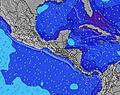 | 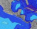 |  | 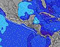 | ||||||||||||||
Wave Height (m) Direction Period (s) | SSE 5 | SE 5 | SSE 5 | SSE 5 | SSE 5 | SSE 5 | SE 5 | SE 5 | SE 6 | SE 6 | SE 6 | SE 6 | SE 6 | SE 6 | SE 6 | SE 5 | ESE 6 | ESE 6 | ESE 6 | ESE 6 | SE 5 |
Wave Graph | |||||||||||||||||||||
15 | 11 | 33 | 33 | 34 | 44 | 41 | 42 | 50 | 50 | 43 | 67 | 56 | 62 | 50 | 32 | 39 | 53 | 37 | 40 | 31 | |
Wind (km/h) | |||||||||||||||||||||
Wind State on-shore cross-onshore cross-shore cross-offshore off-shore glassy | cross-on | on | cross-on | on | on | on | cross-on | on | on | cross-on | on | on | cross-on | cross-on | on | cross-on | on | on | cross-on | on | cross-on |
High Tide | 6:49PM0.37m | 6:48AM0.38m | 8:29PM0.38m | 6:33AM0.40m | 11:23PM0.43m | 6:20AM0.44m | 00:47AM0.49m | 6:45AM0.48m | 1:58AM0.54m | 7:22AM0.52m | 3:01AM0.56m | 8:15AM0.54m | 3:54AM0.57m | ||||||||
Low Tide | 12:26PM0.21m | 00:20AM0.23m | 1:28PM0.12m | 1:05AM0.32m | 2:32PM0.04m | 1:55AM0.41m | 3:38PM-0.03m | 5:00AM0.47m | 4:44PM-0.10m | 6:13AM0.51m | 5:48PM-0.15m | 7:10AM0.53m | 6:49PM-0.18m | ||||||||
6:50 | — | — | 6:52 | — | — | 6:52 | — | — | 6:52 | — | — | 6:54 | — | — | 6:54 | — | — | 6:54 | — | — | |
— | 8:15 | — | — | 8:15 | — | — | 8:15 | — | — | 8:14 | — | — | 8:13 | — | — | 8:12 | — | — | 8:10 | — | |
mm | — | — | — | — | — | — | — | — | — | — | — | — | 2 | — | — | — | — | 3 | — | — | — |
Temp °C | 28 | 29 | 28 | 29 | 29 | 28 | 28 | 29 | 28 | 29 | 29 | 29 | 28 | 29 | 28 | 28 | 29 | 28 | 28 | 29 | 28 |
Feels °C | 32 | 30 | 28 | 31 | 30 | 29 | 31 | 31 | 29 | 32 | 32 | 30 | 31 | 31 | 29 | 31 | 30 | 29 | 31 | 31 | 29 |
Swell 1 Height (m) Direction Period (s) | SSE 5 | ESE 9 | ESE 9 | SSE 5 | ESE 9 | SE 8 | E 8 | E 8 | — | SE 6 | — | — | SE 6 | — | SE 9 | SE 5 | SE 9 | — | ESE 6 | ESE 6 | — |
15 | 8 | 8 | 33 | 8 | 3 | 1 | 1 | — | 31 | — | — | 56 | — | 3 | 32 | 3 | — | 37 | 40 | — | |
Swell 2 Height (m) Direction Period (s) | ESE 10 | — | — | ESE 9 | — | — | — | — | — | — | — | — | ESE 6 | — | — | SE 9 | SE 7 | — | — | — | — |
9 | — | — | 8 | — | — | — | — | — | — | — | — | 34 | — | — | 3 | 2 | — | — | — | — | |
Swell 3 Height (m) Direction Period (s) | — | — | — | — | — | — | — | — | — | — | — | — | — | — | — | — | — | — | — | — | — |
— | — | — | — | — | — | — | — | — | — | — | — | — | — | — | — | — | — | — | — | — | |
Wind waves Height (m) Direction Period (s) | SSW 4 | SE 5 | SSE 5 | S 5 | SSE 5 | SSE 5 | SE 5 | SE 5 | SE 6 | SE 6 | SE 6 | SE 6 | SSE 6 | SE 6 | SE 6 | — | ESE 6 | ESE 6 | — | — | SE 5 |
6 | 11 | 33 | 18 | 34 | 44 | 41 | 42 | 50 | 50 | 43 | 67 | 42 | 62 | 50 | — | 39 | 53 | — | — | 31 | |
Nearest Offshore or Glassy | |||||||||||||||||||||
Distance (km) | 1060 | 1332 | 1055 | 1060 | 1162 | 1055 | 1060 | 1177 | 1055 | 1060 | 1160 | 1055 | 1060 | 1076 | 1055 | 1060 | 1160 | 1068 | 1060 | 1160 | 1055 |
Best forecast wave conditions in Texas | |||||||||||||||||||||
Best forecast wave conditions in United States | |||||||||||||||||||||
Header Global | |||||||||||||||||||||
- Map Icons:
 Break
Break Live Wave Height (m)
 Live Wind Speed (km/h)
 Surf Rating (10 Max)
 Ocean Swells (m)
- Wind Speed (km/h)
Latest Updates


FREE! Surf-Forecast.com widget for your website
The surf report / weather widget below is available to embed on third party websites free of charge and provides a summary of our Horace Caldwell Pier surf forecast. Simply grab the html code snippet that we provide and paste it into your own site. You can choose your preferred language and metric/imperial units for the surf forecast feed to suit users of your site. Click here to get the code.
Information about the Horace Caldwell Pier Surf forecast
The above surf forecast table for Horace Caldwell Pier provides essential information for determining whether the surfing conditions will be good over the next 16 days. A general guide to surfing at Horace Caldwell Pier can be found by selecting the local surf guide option on the grey menu. Our Horace Caldwell Pier surf forecast is unique since it includes wave energy (power) that defines the real feel of the surf rather than just the height or the period. If you surf the same spot (Horace Caldwell Pier) regularly then make a mental note of the wave energy from the surf forecast table each time you go. Very soon you may start to choose your surf days based on the wave energy alone combined with our forecast of favourable offshore wind conditions. Our star ratings will help here and of course you will also find the usual wave height and period predictions on our surf forecasts as well as a full break down of the swell components under our advanced users option (to reveal that, click the little Einstein character under the tide times).
Further information to help with frequently asked questions about our surf forecast for Horace Caldwell Pier may be found under the help tab on the top menu and also by moving your mouse over the question marks on the surf forecast table itself. Please always bear in mind that the forecast is for near-shore open water and local factors at each surf break influence the actual breaking wave height, such as the beach / reef profile, water depths offshore and shelter.
Horace Caldwell Pier is 22 km (14 miles) from Rockport - Arkansas County. If you plan a vacation in Texas, look for hotels and other accommodation in Rockport - Arkansas County. Rockport - Arkansas County has rooms for a wide range of budgets as well as car hire and transport links.
 Nearest