

Surf Forecasts:

Short Range ForecastHeavy rain (total 26mm), heaviest during Mon night. Warm (max 31°C on Tue morning, min 27°C on Tue night). Winds increasing (light winds from the NE on Mon night, near gales from the NNW by Thu afternoon). | ||||||||||||||||||
Mon 3 | Tuesday 4 | Wednesday 5 | ||||||||||||||||
6 PM | 9 PM | 12 AM | 3 AM | 6 AM | 9 AM | 12 PM | 3 PM | 6 PM | 9 PM | 12 AM | 3 AM | 6 AM | 9 AM | 12 PM | 3 PM | 6 PM | 9 PM | |
Swell Height Map |  |  | 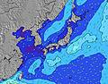 |  |  | 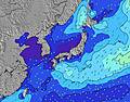 |  | |||||||||||
Wave Height (m) Direction Period (s) | ESE 16 | ESE 16 | E 16 | E 16 | E 17 | E 18 | E 17 | E 17 | E 18 | E 18 | E 17 | E 17 | E 16 | E 17 | E 17 | E 18 | E 18 | E 18 |
Wave Graph | ||||||||||||||||||
0 | 0 | 0 | 507 | 724 | 733 | 861 | 1009 | 1183 | 1375 | 1543 | 1311 | 1372 | 1663 | 1929 | 2174 | 2973 | 4247 | |
Wind (km/h) | ||||||||||||||||||
Wind State on-shore cross-onshore cross-shore cross-offshore off-shore glassy | cross-off | cross-off | cross-off | cross-off | cross-off | off | cross-off | off | off | off | off | off | off | cross-off | cross-off | cross-off | cross-off | cross-off |
High Tide | 10:15PM2.05m | 10:30AM1.94m | 10:49PM2.01m | 11:26AM1.80m | ||||||||||||||
Low Tide | 4:00PM0.51m | 4:26AM0.63m | 4:37PM0.68m | 5:16AM0.63m | 5:17PM0.88m | |||||||||||||
— | — | — | 5:54 | — | — | — | — | — | — | — | 5:54 | — | — | — | — | — | — | |
7:15 | — | — | — | — | — | — | — | 7:14 | — | — | — | — | — | — | — | 7:13 | — | |
mm | — | — | 1 | 4 | 1 | 2 | — | 2 | 1 | 1 | 1 | — | — | 1 | — | 1 | 1 | — |
Temp °C | 30 | 29 | 29 | 28 | 28 | 29 | 31 | 30 | 30 | 28 | 28 | 28 | 27 | 29 | 31 | 30 | 29 | 29 |
Feels °C | 32 | 32 | 32 | 31 | 32 | 32 | 34 | 33 | 33 | 31 | 31 | 31 | 30 | 31 | 33 | 31 | 30 | 31 |
Swell 1 Height (m) Direction Period (s) | ESE 16 | ESE 16 | E 16 | E 16 | E 17 | E 18 | E 17 | E 17 | E 18 | E 18 | E 17 | E 17 | E 16 | E 17 | E 17 | E 18 | E 18 | E 18 |
432 | 416 | 516 | 507 | 724 | 733 | 861 | 1009 | 1183 | 1375 | 1543 | 1311 | 1372 | 1663 | 1929 | 2174 | 2973 | 4247 | |
Swell 2 Height (m) Direction Period (s) | S 7 | S 7 | SW 7 | S 8 | S 8 | N 5 | N 5 | S 8 | S 8 | — | — | S 8 | S 8 | S 8 | S 8 | S 7 | S 7 | — |
1 | 1 | 2 | 1 | 5 | 12 | 12 | 6 | 5 | — | — | 5 | 5 | 5 | 4 | 4 | 4 | — | |
Swell 3 Height (m) Direction Period (s) | SW 7 | SW 7 | SE 8 | SW 7 | SW 7 | S 8 | S 8 | — | — | — | — | — | — | — | SE 13 | SSW 7 | SSW 7 | — |
2 | 2 | 11 | 2 | 2 | 5 | 6 | — | — | — | — | — | — | — | 7 | 5 | 5 | — | |
Wind waves Height (m) Direction Period (s) | NNE 3 | N 3 | N 4 | N 4 | N 5 | — | — | NNE 5 | NNE 5 | NNE 5 | NNE 5 | NE 5 | NE 5 | NE 5 | NNE 6 | NNE 4 | NNE 5 | NNE 6 |
3 | 6 | 11 | 13 | 15 | — | — | 13 | 15 | 14 | 13 | 25 | 34 | 40 | 55 | 42 | 64 | 90 | |
Nearest Offshore or Glassy | ||||||||||||||||||
Distance (km) | 656 | 623 | 37 | 0 | 0 | 0 | 0 | 0 | 0 | 0 | 0 | 0 | 0 | 32 | 793 | 793 | 793 | 609 |
Best forecast wave conditions in Okinawa | ||||||||||||||||||
Best forecast wave conditions in Japan | ||||||||||||||||||
Header Global | ||||||||||||||||||
- Map Icons:
 Break
Break Live Wave Height (m)
 Live Wind Speed (km/h)
 Surf Rating (10 Max)
 Ocean Swells (m)
- Wind Speed (km/h)
Latest Updates


FREE! Surf-Forecast.com widget for your website
The surf report / weather widget below is available to embed on third party websites free of charge and provides a summary of our Hawaiians surf forecast. Simply grab the html code snippet that we provide and paste it into your own site. You can choose your preferred language and metric/imperial units for the surf forecast feed to suit users of your site. Click here to get the code.
 Nearest