

Surf Forecasts:

El Muelle surf forecast from 3 Aug 2026:
- Most powerful swell: Saturday 8 Aug, 10AM (local time) - 5ft (1.6m), 8s period, N swell with 339 kJ wave energy.
Best Forecast Surf Conditions for El Muelle this week:
The most powerful waves expected at El Muelle in the next 16 days are 1.6m 8s and forecast to arrive on Saturday (Aug 08) at 10AM. Winds are predicted to be onshore at the time the swell arrives.
| Wave Type | Time (WEST) & Date | Wave Height & Period |
|---|---|---|
| Next good surf (1 star+) | - | - |
| Best Surf | - | - |
| Most Powerful | 10AM (Sat 8th Aug) | 5ft (1.6m) 8s |
Table - best surf conditions forecast for El Muelle over the next 16 days.
The Lowdown
Alright folks, Rusty here. Let's have a look at what's cookin' for El Muelle over the next couple of weeks.
Well, I gotta be straight with you – it’s a tough stretch ahead. Looking at the whole picture, the wind is just gonna be a constant pain. We’ve got a solid run of northerly winds that are either onshore or cross-onshore for the entire 16-day window, and the surf itself is never really clean. It’s a pretty bleak run, to be honest.
Starting from Monday the 3rd of August, we’ve got small, weak swell rolling in. We’re talking 3 ft from the north with a short, weak period of 6 seconds. The combined wave energy is weak too, around 108. Add in a moderate onshore breeze, and it’s just poor surf conditions. That sets the tone for the whole week. Tuesday and Wednesday are the same story – swell bumps up a touch to 4 ft on Wednesday morning, but the wind is still cross-onshore and choppy, making it a no-go. Thursday through to the weekend sees the swell building a bit, hitting 5 ft by Saturday the 8th, with the energy climbing into the moderate range (362). But that wind just doesn't let up – it’s onshore and fresh all day. The water temp is sitting at 73°, which is about normal for the time of year, not that it’ll make the choppy conditions any more fun.
We head into the second week, and honestly, it’s more of the same. The wind stays relentless from the north, with speeds of 12-19 mph. The swell holds in the 3 ft to 4 ft range for a lot of the week, with wave energy sometimes dropping back under 100. There’s a little pulse of energy on Saturday the 15th, with 5 ft swell and the energy jumping up to a strong 566, but again, it’s blown out by onshore winds. The pattern is just broken. For a reef and point break like El Muelle, that northerly wind direction isn't doing us any favors – it’s not the clean offshore that spot needs to shine.
Honestly, there are no standouts here. Not a single morning or afternoon in the entire 16-day window gets a decent rating. The wind is constantly on it, and the swell never really organises into something that would make up for it. This is a blank run, plain and simple. For an area like this, when the wind sets in from the north for that long, it’s a normal part of the season. You just have to wait for it to switch.
Keep your chin up, though. Forecasts can change, and it never stays poor forever.
Rusty.
Short Range ForecastMostly dry. Warm (max 26°C on Tue afternoon, min 21°C on Mon night). Wind will be generally light. | Days 4-6 Weather SummaryMostly dry. Warm (max 23°C on Thu morning, min 20°C on Thu night). Mainly fresh winds. | ||||||||||||||||||||
Monday 3 | Tuesday 4 | Wednesday 5 | Thursday 6 | Friday 7 | Saturday 8 | Sunday 9 | |||||||||||||||
AM | PM | Night | AM | PM | Night | AM | PM | Night | AM | PM | Night | AM | PM | Night | AM | PM | Night | AM | PM | Night | |
Swell Height Map |  |  |  | 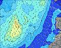 | 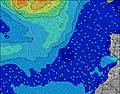 | 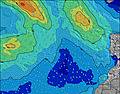 | 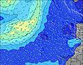 | ||||||||||||||
Wave Height (m) Direction Period (s) | N 6 | N 6 | NNE 6 | N 6 | N 7 | NNE 6 | NNE 7 | ENE 8 | NNE 6 | NNE 6 | N 6 | N 9 | N 8 | N 8 | N 8 | N 8 | N 8 | N 8 | N 8 | N 8 | N 7 |
Wave Graph | |||||||||||||||||||||
48 | 47 | 48 | 53 | 56 | 72 | 132 | 55 | 77 | 123 | 91 | 304 | 247 | 291 | 321 | 339 | 298 | 234 | 207 | 142 | 106 | |
Wind (km/h) | |||||||||||||||||||||
Wind State on-shore cross-onshore cross-shore cross-offshore off-shore glassy | on | cross-on | cross-on | on | on | cross-on | cross-on | cross-on | cross-on | on | on | on | on | on | on | on | on | on | on | on | on |
High Tide | 5:13PM2.24m | 5:39AM2.04m | 5:54PM2.12m | 6:25AM1.95m | 6:46PM1.97m | 7:24AM1.86m | 7:54PM1.84m | 8:41AM1.80m | 9:24PM1.77m | 10:10AM1.85m | 10:54PM1.83m | 11:27AM2.01m | 00:06AM1.98m | ||||||||
Low Tide | 10:56AM0.35m | 11:26PM0.31m | 11:36AM0.44m | 00:08AM0.42m | 12:26PM0.55m | 1:00AM0.54m | 1:30PM0.65m | 2:11AM0.65m | 2:57PM0.70m | 3:40AM0.68m | 4:33PM0.62m | 5:05AM0.60m | 5:51PM0.44m | ||||||||
7:16 | — | — | 7:18 | — | — | 7:18 | — | — | 7:18 | — | — | 7:18 | — | — | 7:20 | — | — | 7:20 | — | — | |
— | 8:45 | — | — | 8:44 | — | — | 8:44 | — | — | 8:43 | — | — | 8:42 | — | — | 8:40 | — | — | 8:39 | — | |
mm | — | — | — | — | — | — | — | — | — | — | — | — | — | — | — | — | — | — | — | — | — |
Temp °C | 24 | 25 | 22 | 25 | 26 | 22 | 24 | 24 | 22 | 23 | 23 | 21 | 22 | 23 | 21 | 23 | 23 | 21 | 22 | 23 | 21 |
Feels °C | 23 | 24 | 21 | 24 | 25 | 21 | 23 | 22 | 21 | 21 | 21 | 19 | 20 | 21 | 19 | 22 | 22 | 20 | 21 | 21 | 20 |
Swell 1 Height (m) Direction Period (s) | WNW 9 | WNW 9 | WNW 9 | WNW 9 | ENE 7 | NW 8 | NW 8 | ENE 8 | WNW 10 | N 10 | ENE 8 | WNW 9 | WNW 9 | NW 9 | NW 9 | WNW 9 | WNW 8 | WNW 8 | WNW 8 | WNW 8 | WNW 8 |
32 | 32 | 34 | 32 | 30 | 35 | 16 | 54 | 40 | 51 | 59 | 34 | 32 | 21 | 20 | 15 | 14 | 13 | 13 | 13 | 11 | |
Swell 2 Height (m) Direction Period (s) | NE 7 | ENE 7 | N 9 | ENE 7 | WNW 9 | N 8 | WNW 10 | WNW 11 | NNW 11 | WNW 10 | N 10 | WNW 9 | WNW 9 | WNW 9 | WNW 9 | WNW 9 | WNW 9 | WNW 8 | WNW 8 | WNW 8 | N 12 |
14 | 21 | 13 | 19 | 30 | 1 | 20 | 44 | 24 | 38 | 47 | 17 | 16 | 16 | 8 | 8 | 7 | 7 | 6 | 6 | 3 | |
Swell 3 Height (m) Direction Period (s) | N 9 | N 9 | — | N 8 | NW 11 | — | N 11 | N 11 | N 11 | — | WNW 10 | — | — | — | — | — | — | N 11 | N 8 | — | W 12 |
14 | 14 | — | 1 | 5 | — | 2 | 2 | 2 | — | 37 | — | — | — | — | — | — | 2 | 1 | — | 3 | |
Wind waves Height (m) Direction Period (s) | N 6 | N 6 | NNE 6 | N 6 | N 7 | NNE 6 | NNE 7 | N 6 | NNE 6 | NNE 6 | N 6 | N 9 | N 8 | N 8 | N 8 | N 8 | N 8 | N 8 | N 8 | N 8 | N 7 |
48 | 47 | 48 | 53 | 56 | 72 | 132 | 55 | 77 | 123 | 91 | 304 | 247 | 291 | 321 | 339 | 298 | 234 | 207 | 142 | 106 | |
Nearest Offshore or Glassy | |||||||||||||||||||||
Distance (km) | 13 | 13 | 13 | 241 | 13 | 223 | 223 | 290 | 223 | 223 | 223 | 223 | 223 | 223 | 291 | 446 | 290 | 227 | 223 | 223 | 223 |
Best forecast wave conditions in Fuerteventura | |||||||||||||||||||||
Best forecast wave conditions in Spain (Africa) | |||||||||||||||||||||
Header Global | |||||||||||||||||||||
- Map Icons:
 Break
Break Live Wave Height (m)
 Live Wind Speed (km/h)
 Surf Rating (10 Max)
 Ocean Swells (m)
- Wind Speed (km/h)
Latest Updates


FREE! Surf-Forecast.com widget for your website
The surf report / weather widget below is available to embed on third party websites free of charge and provides a summary of our El Muelle surf forecast. Simply grab the html code snippet that we provide and paste it into your own site. You can choose your preferred language and metric/imperial units for the surf forecast feed to suit users of your site. Click here to get the code.
Information about the El Muelle Surf forecast
The above surf forecast table for El Muelle provides essential information for determining whether the surfing conditions will be good over the next 16 days. A general guide to surfing at El Muelle can be found by selecting the local surf guide option on the grey menu. Our El Muelle surf forecast is unique since it includes wave energy (power) that defines the real feel of the surf rather than just the height or the period. If you surf the same spot (El Muelle) regularly then make a mental note of the wave energy from the surf forecast table each time you go. Very soon you may start to choose your surf days based on the wave energy alone combined with our forecast of favourable offshore wind conditions. Our star ratings will help here and of course you will also find the usual wave height and period predictions on our surf forecasts as well as a full break down of the swell components under our advanced users option (to reveal that, click the little Einstein character under the tide times).
Further information to help with frequently asked questions about our surf forecast for El Muelle may be found under the help tab on the top menu and also by moving your mouse over the question marks on the surf forecast table itself. Please always bear in mind that the forecast is for near-shore open water and local factors at each surf break influence the actual breaking wave height, such as the beach / reef profile, water depths offshore and shelter.
Are you planning a holiday in Fuerteventura? If you are looking for accommodation near El Muelle, camping, hotels and holiday cottages in Fuerteventura, consider staying in La Oliva which is 16 km (10 miles) away. Other places in and around Fuerteventura where you can find information about places to rent, and car hire include Puerto del Rosario which is 27 km (17 miles) away, Puerto del Carmen, Tias and Lanzarote.
 Nearest